We've moved! For NASA Distributed Active Archive Center information, please follow @NASAEarthData. For National Snow and Ice Data Center news, follow @NSIDC.
We've moved! For NASA Distributed Active Archive Center information and data news, please follow @NASAEarthData. For National Snow and Ice Data Center news, please follow
@NSIDC.
We're moving - this Twitter account will be shutdown soon. For NASA Distributed Active Archive Center information and data news, please follow @NASAEarthData. For National Snow and Ice Data Center news, please follow @NSIDC.
Attention data users and scientists: we need your help! We are building a new NSIDC website and could use your feedback. Take this short user feedback study (it only takes a few minutes) to test our new navigation (we will be so grateful!): https://t.co/XDZPtGCvkT.
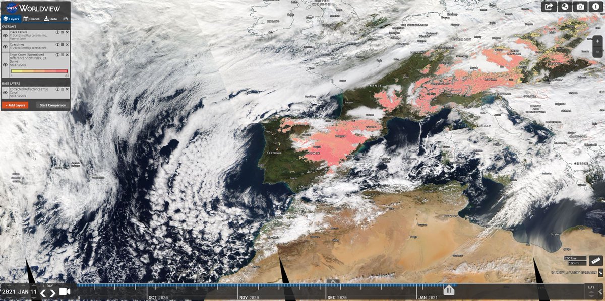
This NASA Worldview image (https://t.co/7HGuSSHQDO) shows snow cover using data acquired by the Moderate Resolution Imaging Spectroradiometer (MODIS) on board the Aqua satellite. These data are managed and stored at the NSIDC DAAC and can be found here: https://t.co/x6syZQeznA.
Madrid was brought to a standstill this week as Storm Filomena dropped 1.5 feet of snow on the city. This is the heaviest snowfall Madrid has seen in 50 years (@nytimes: https://t.co/En0ukAq7RG). This @nasa Worldview image shows snow cover on the day of the storm (1/11).
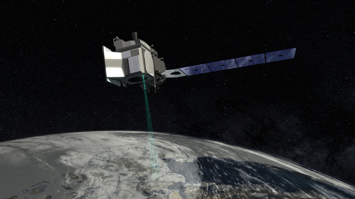
In less than 2 years, researchers have downloaded #ICESat2 data files *10 million* times from our partners @NSIDCDAAC, accessing precise height measurements of our planet and its polar regions: https://t.co/ojiojMYKxZ
Downloads of @NASAEarthData ICESat-2 data files at the NSIDC DAAC have hit 10 million! This milestone represents the wide acceptance and use of ICESat-2 #data by the research community, with nearly 3,000 scientists accessing the data thus far. https://t.co/AQISerFcDS
In 2018, @NASAEarthData launched ICESat-2 to help scientists investigate why & how much the frozen parts of our planet are changing due to #climatechange. This week, downloads of data files from the satellite hit 10 million at the NSIDC DAAC. Learn more: https://t.co/AQISerFcDS.
What NASA #EOSDIS datasets were released last week? Find new #snow water equivalent and snow depth #data over the conterminous US at #NSIDCDAAC, and new Stratospheric and Mesospheric Sounder products at #GESDISC to name a few! Learn more: https://t.co/yoFCtZnMv2, #OpenScience
Overview video on OpenAltimetry by @NASA PODAAC and @NSIDCDAAC for #AGU20 Fall Meeting Workshop: "Working with Cloud-Based NASA Earth Observations Data and Tools" - https://t.co/zpR4QMfkS1 #AGU2020#ICESat2
The @nasa Worldview image, which shows A68a moving toward South Georgia, uses AMSR2 sea ice concentration data from the NSIDC DAAC. AMSR2 is an instrument aboard @JAXA_en GCOM-W1 and it measures weak microwave emissions from Earth's surface & atmosphere. https://t.co/LfDpcSoiZQ
The world's largest iceberg, A68a, is getting ever closer to the island of South Georgia. As of the weekend, it was ~130 miles off the coast (@npr: https://t.co/cM8VgZY5x8). This @nasa Worldview image shows the iceberg moving toward South Georgia on 12/9. https://t.co/cD8s0vhLAP
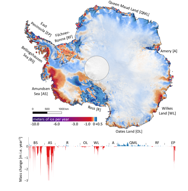
People from 92 different countries have downloaded more than 9 million ICESat-2 data files from @NSIDC. Scientists have used the data in more than 50 scientific papers – including one that showed Greenland and Antarctica’s ice sheets lost 318 gigatons per year from 2003-2019.
As of today, #ICESat2 has been orbiting Earth for 810 days, & its laser instrument has pulsed more than 643 BILLION times to collect height measurements. @NASA_Earth scientists are providing a mission update at #AGU20 today
(Spoiler alert: It’s healthy & meeting requirements!)
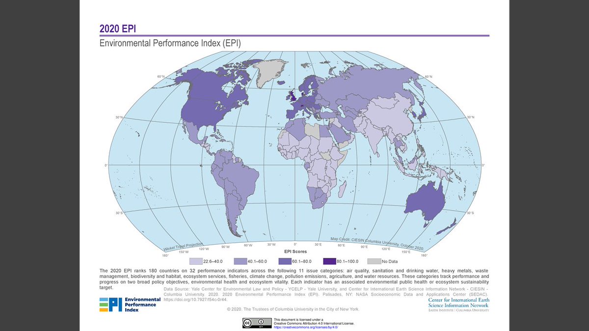
What new NASA EOSDIS Earth science datasets were released last week? Find new ICESat-2 daily and monthly data at #NSIDCDAAC, new ACT-America data at #ORNLDAAC, the new Environmental Performance Index 2020 dataset at NASA’s #SEDAC and more. https://t.co/i3hvJyugb3
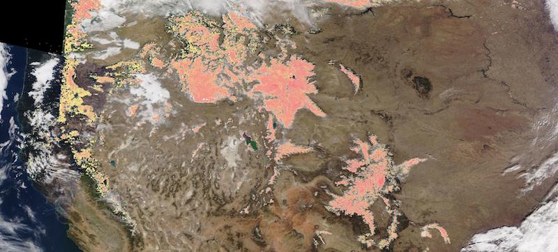
#NASAWorldview Image of the Week: Snow in the American Rockies, as observed by NASA's Terra MODIS instrument on 11/29/20. The true color corrected reflectance image is overlaid with the Snow Cover (Normalized Difference Snow Index (NDSI))layer. https://t.co/TM5Gcn4lyN
Hurricane Iota is the strongest storm to hit Nicaragua in the country’s history, according to the Nicaraguan government. More at @cnn: https://t.co/QJzJvkwUDL.
Hurricane Iota strengthened to Category 5 as it approached Central America. This @NASAEarthdata website image, provided by the NSIDC DAAC, displays surface precipitation in mm/hour. Data are from the AMSR-E/AMSR2 products (https://t.co/tVT3iQamTw). https://t.co/tWyBj642pB
Glacial lakes have grown rapidly since 1990 due to #climatechange (@nature: https://t.co/TPPvJxZZpd) & 220M people could be impacted by glacial lake outburst floods in the Himalayan region (@MSN: https://t.co/yQXhkrTX6G). Glacial lakes data set @NSIDCDAAC: https://t.co/B85J1ylp3j
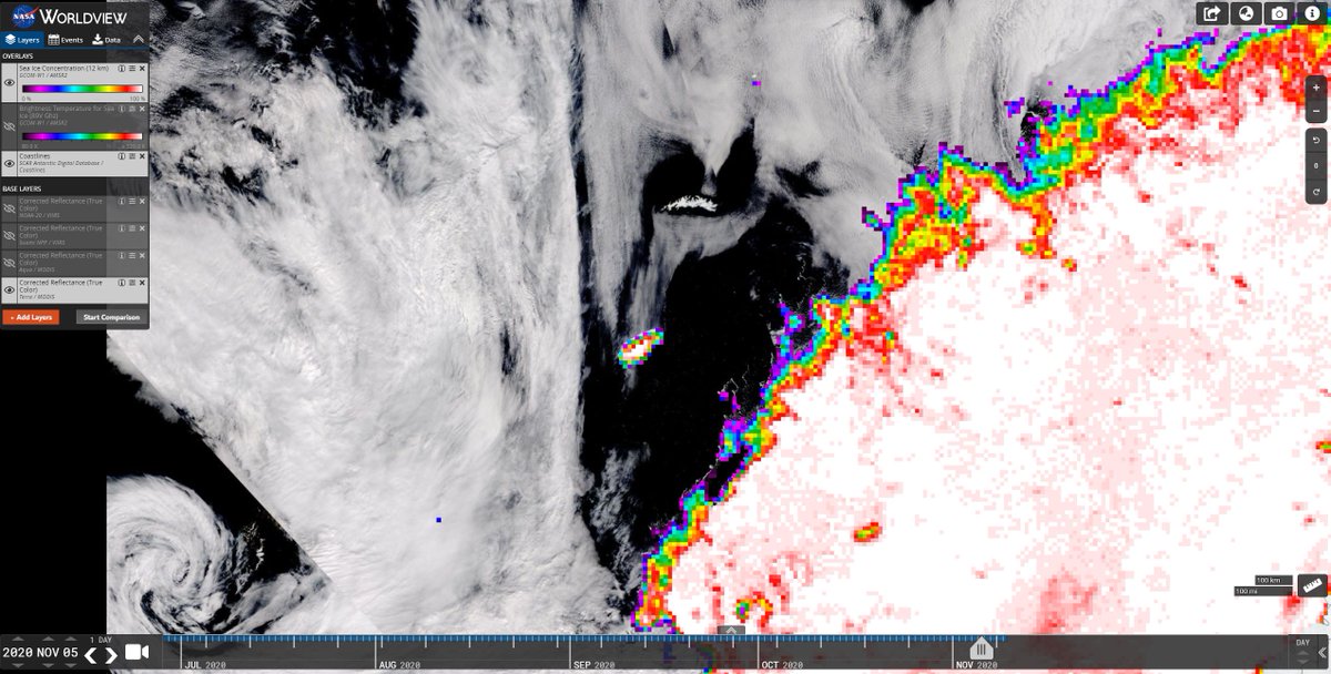
This @NASAEarthdata Worldview image, based on NSIDC DAAC AMSR2 data (Sea ice concentration: https://t.co/hpgNjzAnmt & brightness temp for sea ice https://t.co/Yp6b9ZpoBf) shows the iceberg & its proximity to South Georgia on November 5. NASA Worldview: https://t.co/8sVIInY193
#Iceberg A68a, which broke off the #Antarctic Peninsula in 2017 and is the size of Delaware, is heading toward the island of South Georgia. If it grounds there, it could disrupt wildlife (like seals and penguins) and threaten the economy. @BBCScienceNews: https://t.co/wYKiVfncgg