OUTFLOW #onstorm || A Time Lapse Film
Feat. Ontario storms from the past 4 years of chasing
I'd like to dedicate this vid to @ReedTimmerAccu & @ONwxchaser for inspiring me with their incredible passion for storms
Hope u enjoy! #onwx
FULL VID ▶️ https://t.co/jWe2h3TLBn
_
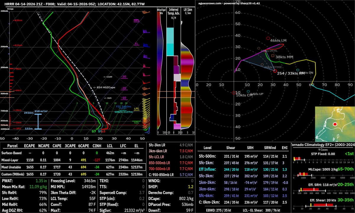
Rather strong low level shear in SW ON today. Good chance a storm or two will develop weak rotation.
Limiting factors:
- marginally unstable 0-2km layer
- SR winds are too strong for the expected updraft width unless a storm interaction or boundary helps out?
Main line of storms arrives in SW ON after midnight.
Primary Risk: Rain
Secondary: Hail & Wind
Env supports sct svr hail but messy storm mode should suppress the risk
Gusty winds are possible but low lvl stability should keep gusts sub-svr
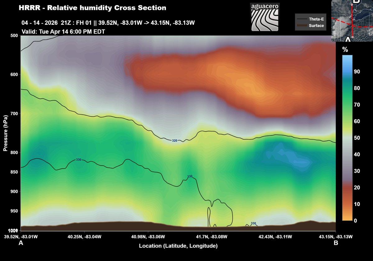
Models suggest a nominal difference in low level stability between MI (left) and SW ON (right). Therefore the gust front bears watching for winds/rotation as it nears SW ON.
Overall risk remains on the low end as the line weakens
Models suggest a nominal difference in low level stability between MI (left) and SW ON (right). Therefore the gust front bears watching for winds/rotation as it nears SW ON.
Overall risk remains on the low end as the line weakens
@stormwx1 My concern is another wave of instability is on the way that could spark a new cluster of cells merging into the apex. That could cause hailers in Lambton and Middlesex Co
Scattered storms are not expected along the lifting boundary in SW ON this evening until the MCS arrives. The EML is more robust north of the ongoing cluster in Indiana which should inhibit development.
Conditional severe risk this aftn.
Env may support small hail, but bias toward tor risk east of hwy 400.
However, adequate storms are unlikely because low LCLs beneath hostile mid levels and strong LL shear will snub convection.
Likely outcome: Clouds and isolated showers