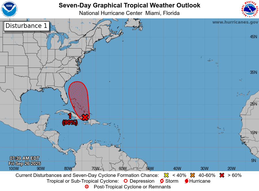
8 am EDT - Showers and thunderstorms continue to show signs of organization in association with a tropical wave #94L located near Hispaniola and eastern Cuba. This low is expected to become a tropical depression near the central and northwest Bahamas over the weekend.
Heavy rains are likely to spread across the Bahamas and eastern Cuba during the next day or two. While there remains considerable uncertainty in the long-range track and intensity of the system, there is a significant risk of wind, rainfall, and storm surge
impacts for a portion of the southeast U.S. coast early next week.
2 weather items to keep on your "Radar". First, a few storms may become strong enough to produce damaging winds on Thursday. Second, there are 2 tropical systems, and 1 has the potential to impact our area later in the week. Keep abreast of the latest forecasts. #ncwx#scwx#gawx
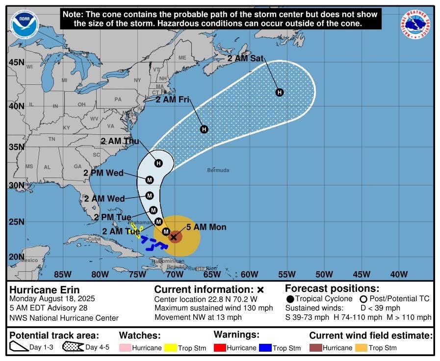
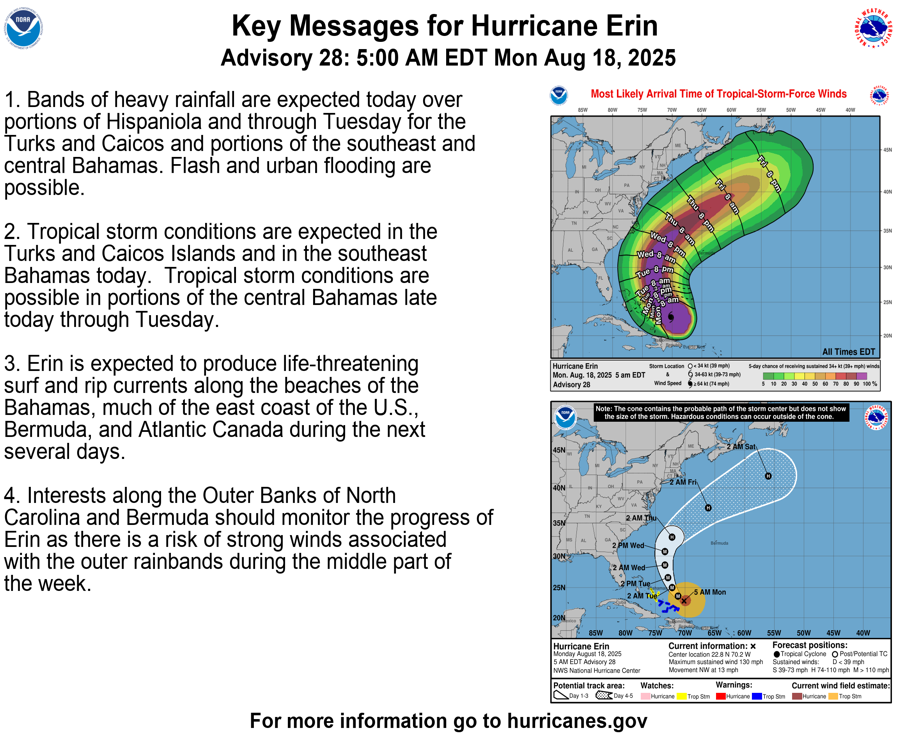
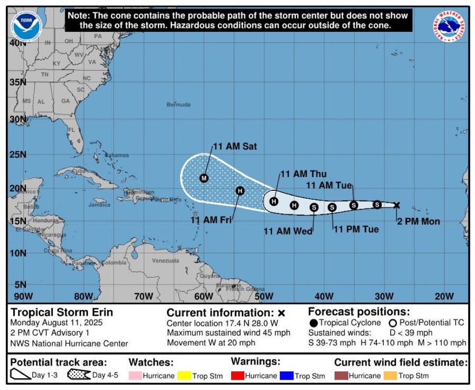
Hurricane Erin remains out in the Atlantic, bringing high surf, dangerous rip currents, beach erosion, and possible coastal flooding at high tide along South Carolina’s coast.
Learn more about rip current safety: https://t.co/pAtWAp6dMu
Emergency Management personnel are continually monitoring Tropical storm ERIN for any updates to it projected path and will pass along updates as they come it.
Locally heavy rainfall will continue this morning, tapering off to showers this PM. Isolated flash flooding is possible, mainly southeast of I-85. Otherwise, the unseasonably cool air remains locked in, with high temps 10-15 degrees below normal expected for much of the area.
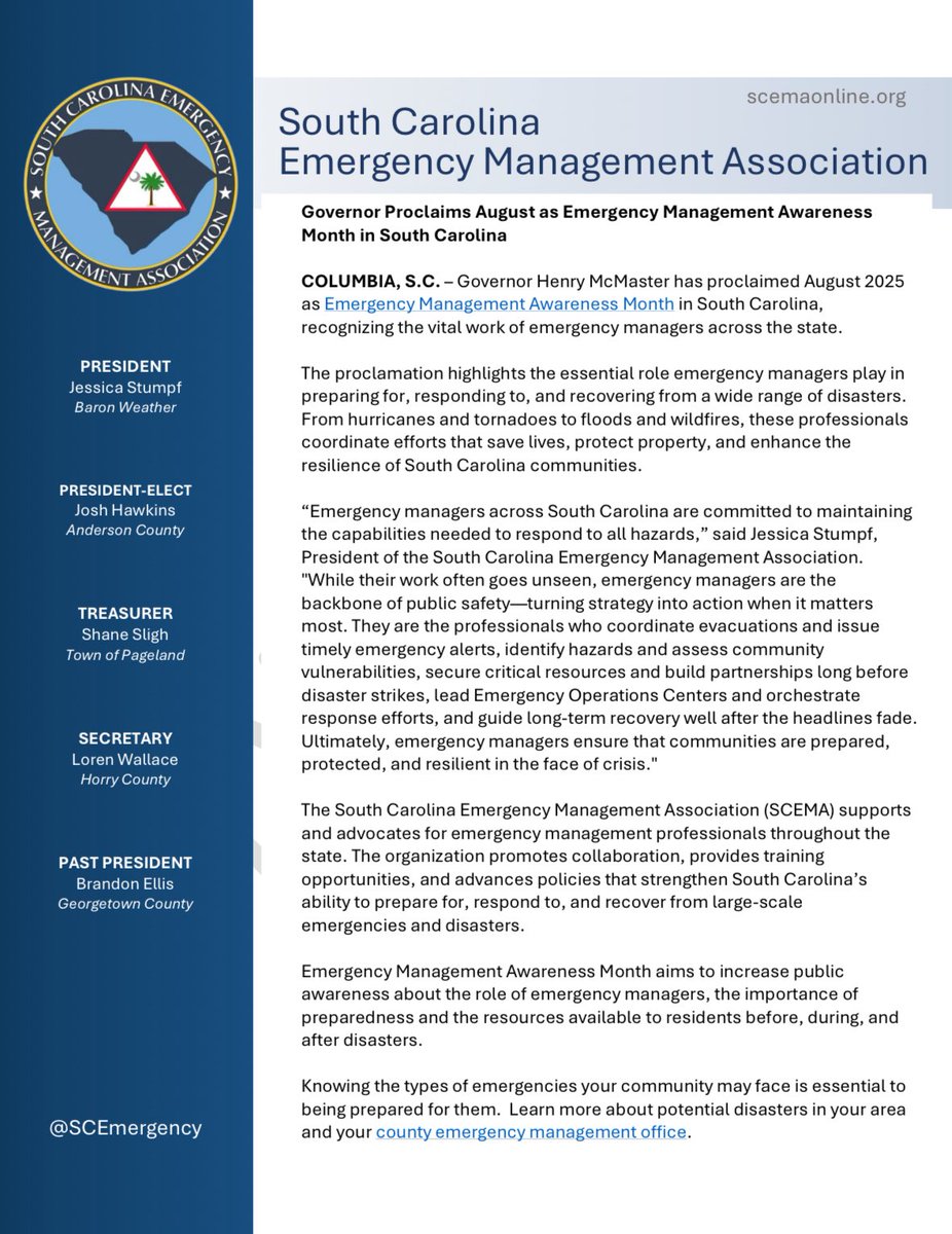
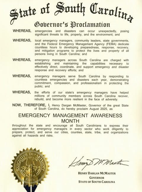
Governor @henrymcmaster has proclaimed August 2025 as Emergency Management Awareness Month in South Carolina. This recognizes the vital work of emergency managers who help communities prepare for, respond to, and recover from disasters. #EMAwarenessMonth
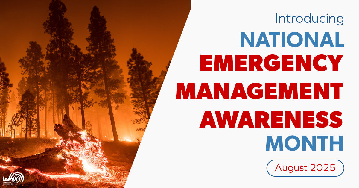
Introducing the @IAEM National Emergency Management Awareness Month! 🦺⚠️
Throughout the month, #TeamIEM is joining to highlight #EmergencyManagement & the professionals dedicated to preparing, protecting, & strengthening their communities. 💪
🔗 https://t.co/ulbMigbkjE
Crews are out assisting residents with emergencies during the storm. Please stay at home, road conditions are impassible in many areas due to trees and power lines down.
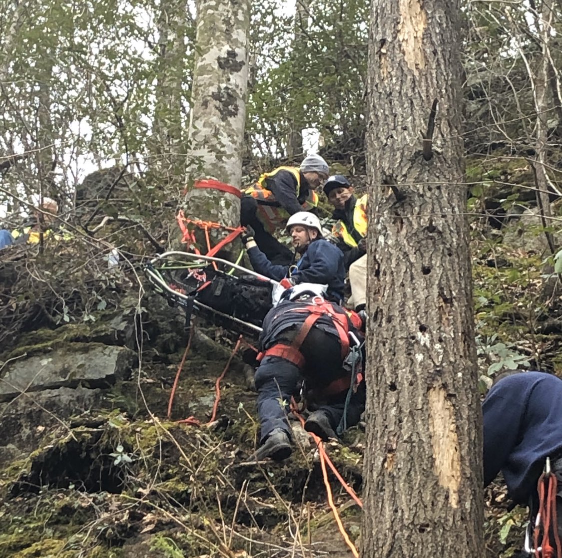
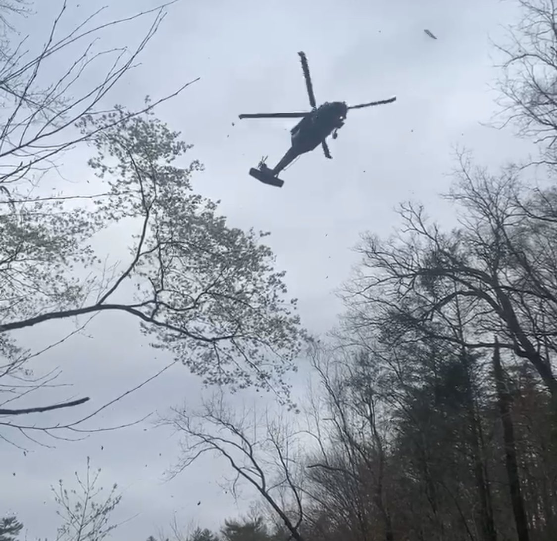
Just before 4am on Sun, Mar 22, 2020 crews responded to rescue a woman who fell 75ft from the top of Laurel Fork Falls near Lake Jocassee. Steep terrain prevented crews from extricating the patient by ground, so assistance from #SCHART was requested. @SCStateFire@SCNationalGuard
Never a good time for a fire but the cold, rain and traffic made it worse this morning. FF’s from Liberty, Easley and Central responded to a fire on Hwy 178.
The couple in the home escaped without any injuries but it’s important to have working smoke detectors in every bedroom.
Another great response on the Greater 123 Corridor today for acrylic acid leaking from an 18-wheeler. Great relationships among first responders and public private partnerships through the Local Emergency Planning Commission (LEPC) made this incident a huge success.
#hazmat#G1C
Three years ago today, we responded to a Wildland Fire on Pinnacle Mountain. Little did we all know, we wouldn’t leave until 28 days later.
The 2016 Pinnacle Mountain Fire response tested capabilities of not only Pickens County but many surrounding counties and state agencies.
Thank you @JasonWISTV and @wis10 for covering the anniversary of the 2016 Pinnacle Mountain Fire. We’ve come a long way since this incident and the wildland fire trailer is a great example of relationships. #teamwork@SCStateFM
Overturned 18 wheeler - Hwy 123 into Easley from Greenville is closed. Hwy 153 onto 123 towards Easley is also closed. Fuel and oil leak controlled by HazMat crews. No injuries.