Jaw-dropping satellite and radar imagery of Super Typhoon Bavi as it barrels toward the southern portion of the Mariana Islands, including Guam. Notice on radar the abundance of tornadic supercells in the western semicircle of the storm...this is quite unusual for a Northern Hemisphere tropical cyclone, as they're usually found in the eastern semicircle.
Like yesterday, scattered thunderstorms will form across North Alabama this afternoon. Some could be strong to severe with strong winds and hail… but many places won’t see a drop of rain.
Here is a plot of the total tornadoes by state as of 3 pm July 1. The numbers were obtained by the quality controlled tornado tracks in the Damage Assessment Toolkit database. #ILwx#tornadoes
EAST TO WEST: Many were asking about the thunderstorm motion across North Alabama yesterday.
Normally storms across Alabama move in a general motion from west to east. But, yesterday, storms were going “backwards”… from east to west.
This is actually fairly common in summer. The storms are simply following the clockwise circulation of the upper high centered north of the state, which represents the center of the “heat dome”.
10:45am 6-29-26: Intense supercell-turned-bow echo moving across South Dakota and now Minnesota this morning. It has produced multiple tornadoes and wind gusts over 130 mph, yielding widespread damage. As of this post, this complex is showing no signs of slowing down.
April 27, 2011:
The climax of the Super Outbreak ravaged the Southeast US and several other states. An astonishing 15 tornadoes were violent (EF4+), the strongest of which were four EF5s in Alabama and Mississippi. Over 300 people were killed and 2700+ were injured.
#wxhistory
April 25–28, 2011 Super Outbreak – Day 1!
One of the worst #tornado outbreaks on record began on this day in 2011.
368 tornadoes.
224 in just 24 hours.
4 EF5s.
324 lives lost. Over 3,100 injured. $12B in damage.
We’ve built an overview with links to our in-depth stories—including April 25 in Arkansas.
https://t.co/xsj5Ez8yBP
#tornadohistory #OTD
Pretty decent ensemble agreement 7 days out for severe weather potential across the Deep South. Would not be surprised to see SPC Outlooks in the next day or two for Monday the 27th.
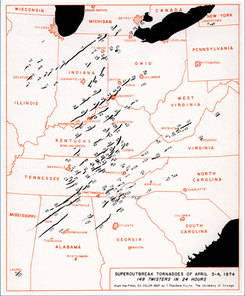
ON THIS DATE IN 1974: The “Super Outbreak” was underway, the most violent tornado outbreak ever recorded, with 30 violent (F4 or F5 rated) tornadoes confirmed.
From April 3–4, there were 149 tornadoes confirmed in 13 U.S. states and the Canadian province of Ontario. In the United States, the tornadoes struck Illinois, Indiana, Michigan, Ohio, Kentucky, Tennessee, Alabama, Mississippi, Georgia, North Carolina, Virginia, West Virginia, and New York.
A total of 335 people lost their life, and over 6,000 were injured that horrible night.
In Alabama, 86 were killed, and just under 1,000 were injured. The most violent tornado tore through Guin, in Marion County, where 23 lives were lost. It is considered to be one of the most violent ever recorded in the nation.
Other communities hard hit included Jasper, Cullman, Tanner, Harvest, Hazel Green, and Huntsville.
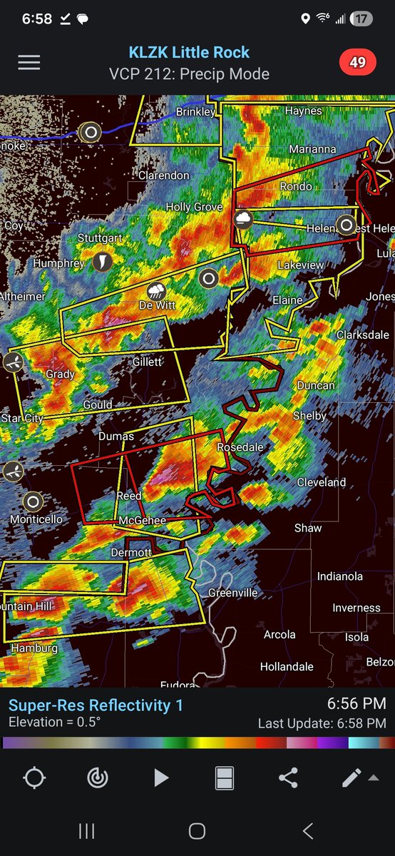
Mostly "mushy" convection so far with sporadic wind and brief tornadoes in the MS Delta
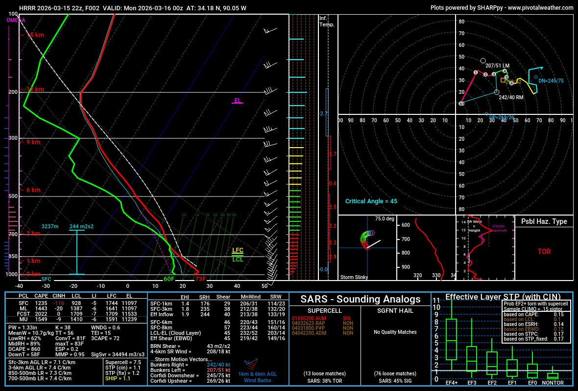
Proximity soundings show strong shear, but very little of it above 1 km, where most of these high-based updrafts are based. Thus, large proportion of sub-severe storms.
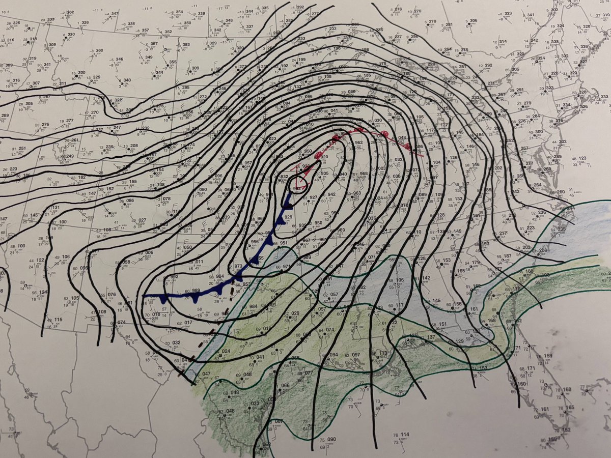
Here at the Storm Prediction Center, we dig deep into the data to do the best possible analysis of the storm threat. Even in 2026, this sometimes involves putting pencil to paper to do hand surface analysis. This is what the morning map looks like today.
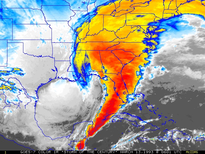
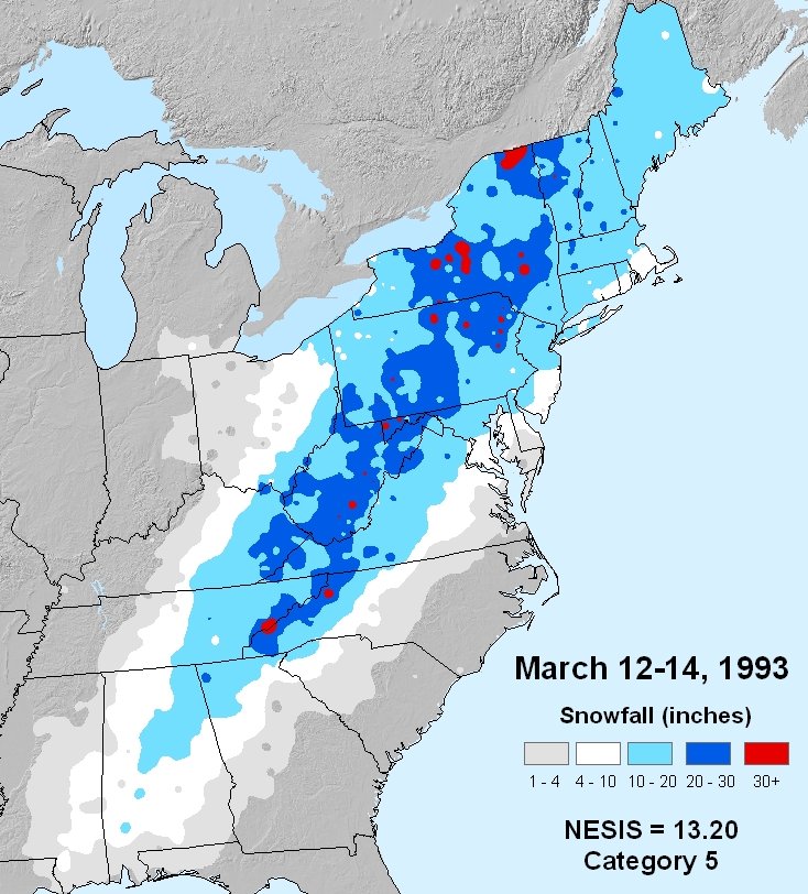
March 12-14, 1993:
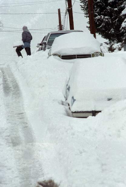
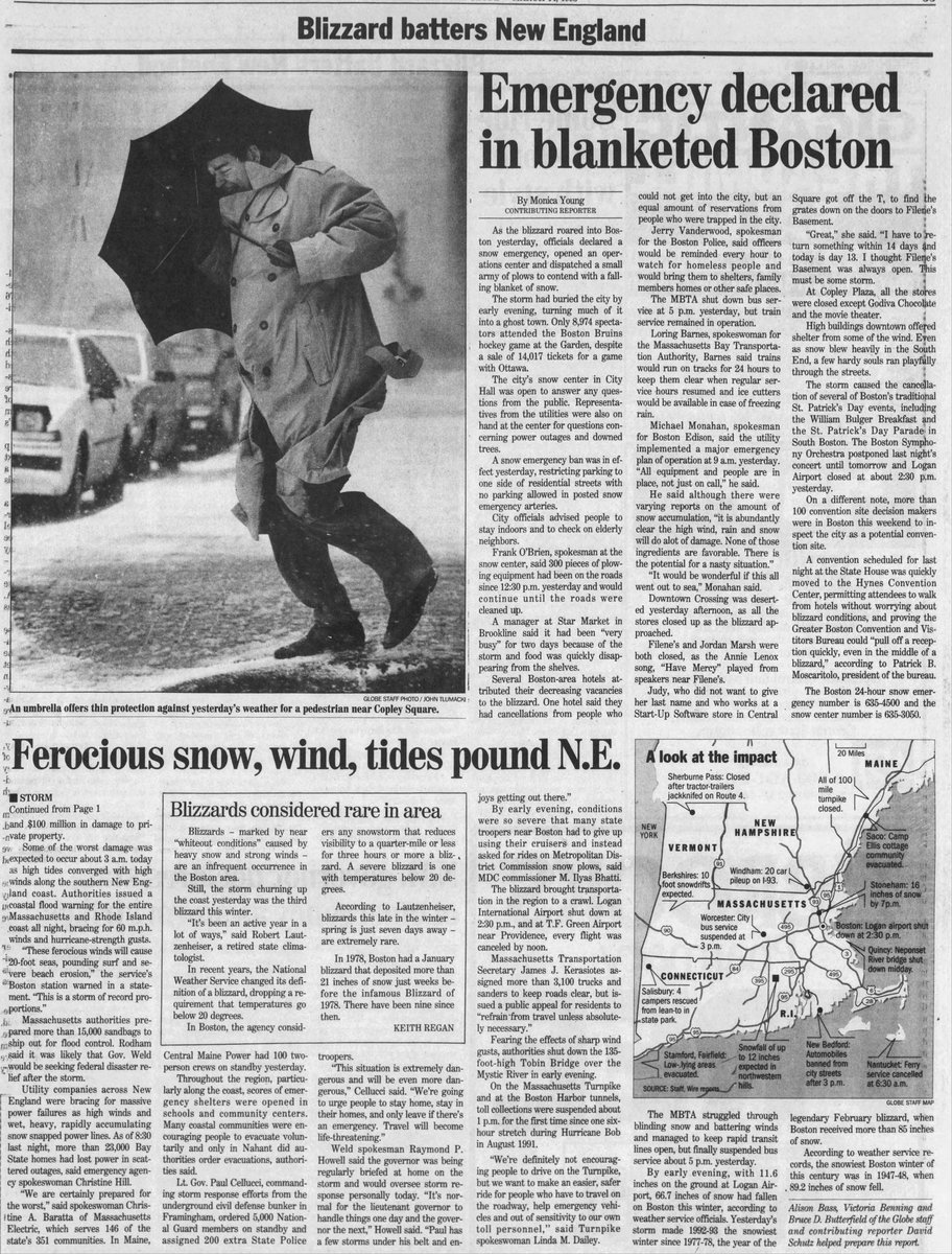
The "Storm of the Century" slammed the Eastern United States. The dynamic and immense extratropical cyclone brought a wide range of impacts, the most notable of which was blizzard conditions and huge snow totals from New England to the Carolinas.
#wxhistory
@weatherinNC@NickCMNWX19 Moisture quality is going to matter a lot on Sunday. That's some very dry air that probably gets mixed down to the surface when the low-level jet kicks in during the evening.
The Union City, MI preliminary EF-3 tornado with max wind speeds of 160 mph is the earliest EF-3+ tornado on record in the calendar year for Michigan. It is also the strongest tornado to occur in Michigan since an F4 struck Kalamazoo and Eaton Counties on April 2, 1977.
It's official...the proposed changes to the Storm Prediction Center outlooks have gone into effect! Today's Day 1 outlook doesn't include any of the new CIG levels, but we can at least marvel at the beautiful, clean look of the new graphics. I'm sure we'll see CIG hatching added to some of the outlooks over the next few days.
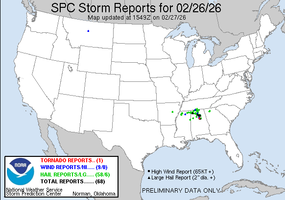
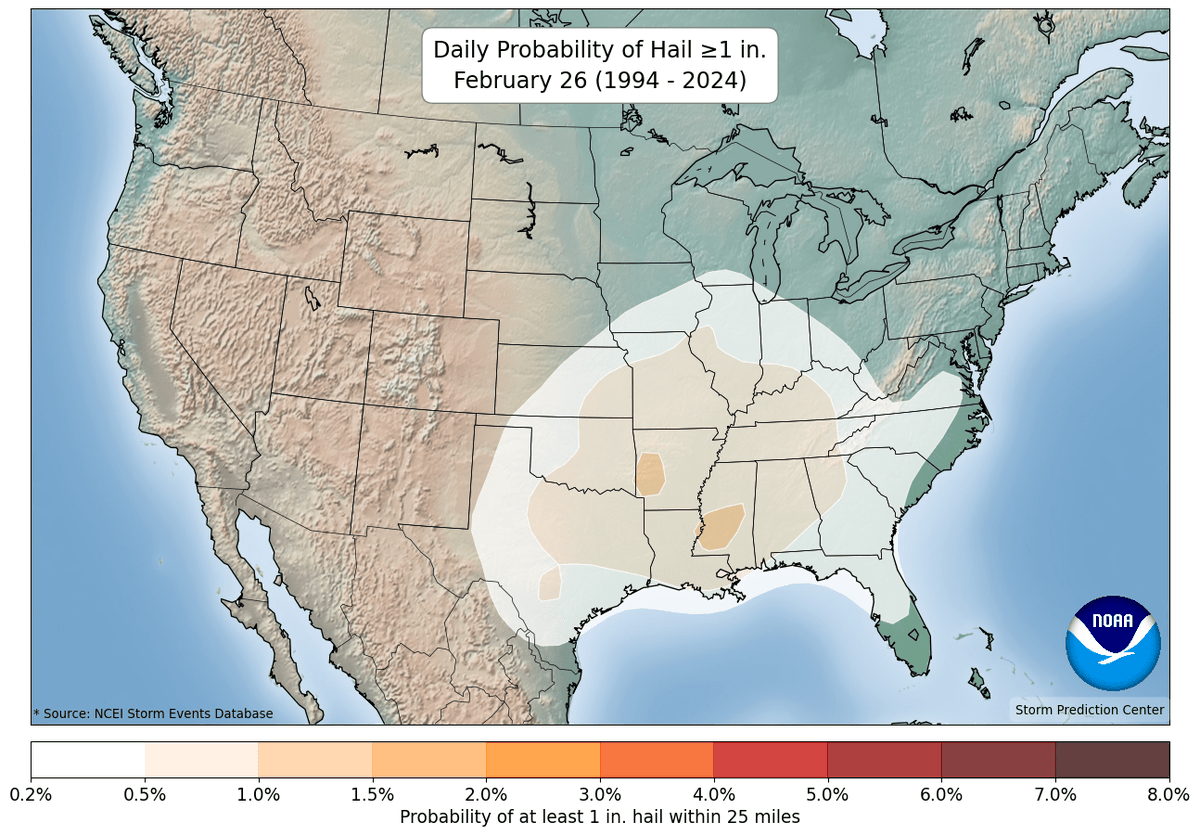
Well, yesterday featured a localized hail outbreak across parts of the Deep South, perhaps even a tornado in the Trussville, AL area.
Even some significant hail reports mixed in as well.
Climatologically, severe hail is by no means unheard of across the Mid/Deep-South in late February, but hail climatology generally peaks in late April-early May.
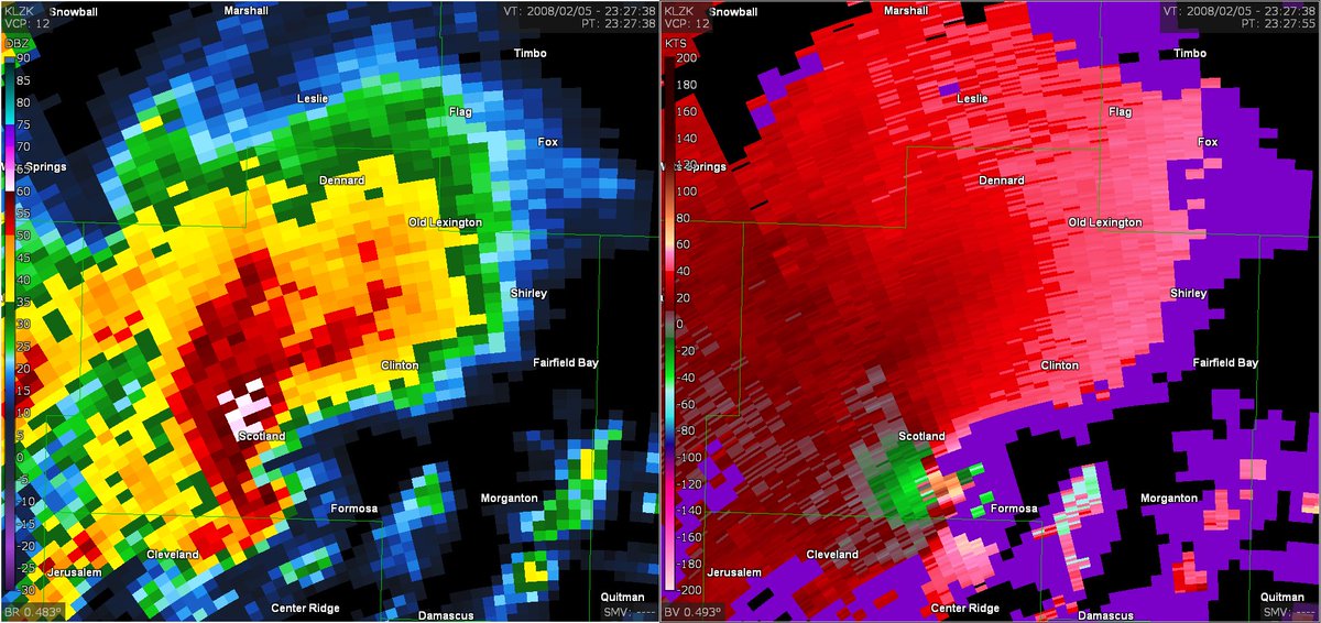
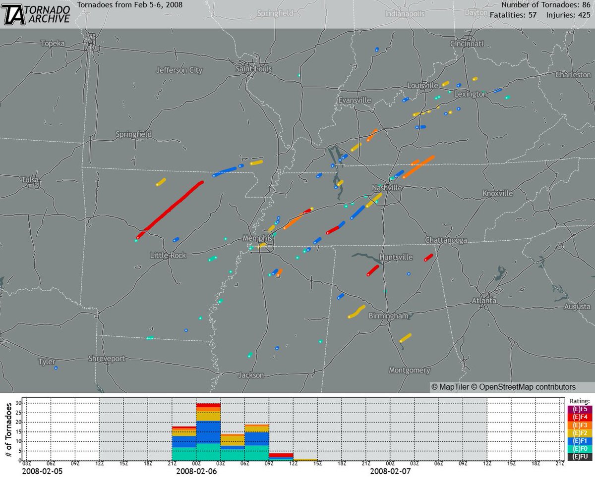
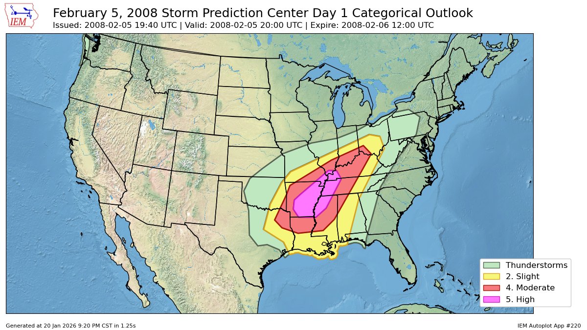
February 5-6, 2008:
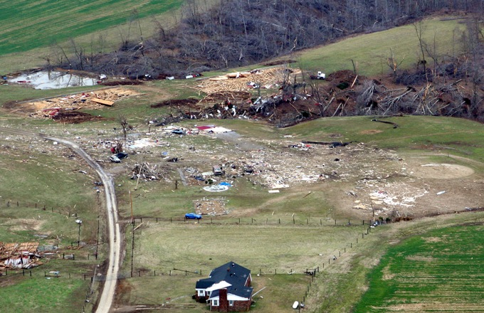
A substantial outbreak during Super Tuesday spawned 86 tornadoes throughout much of the South and lower Ohio Valley. 27 tornadoes were significant (EF2+), five of which reached EF4 intensity. 57 people were killed and more than 400 were injured.
#wxhistory
This one was a doozy, and will be remembered for a long time. Sadly the fatalities are over 5 now from this storm. The sleet line was a tricky forecast for sure. Major ice storm from Louisiana to middle Tennessee. Indianapolis got over 11" of snow -- biggest snowstorm since 2014. 15 states got 12"+ of snow.
Been watching @spann at Alabama Weather Network all day for the winter weather coverage in North Alabama. Fantastic and well done!
https://t.co/hT7JQWszFf