The hottest day of the heat wave is expected today with heat indices climbing to 105 to 110 degrees. An Excessive Heat Warning is in effect for all of northern IL, while a heat advisory is in effect for for much of northwestern Indiana. #ILwx#INwx
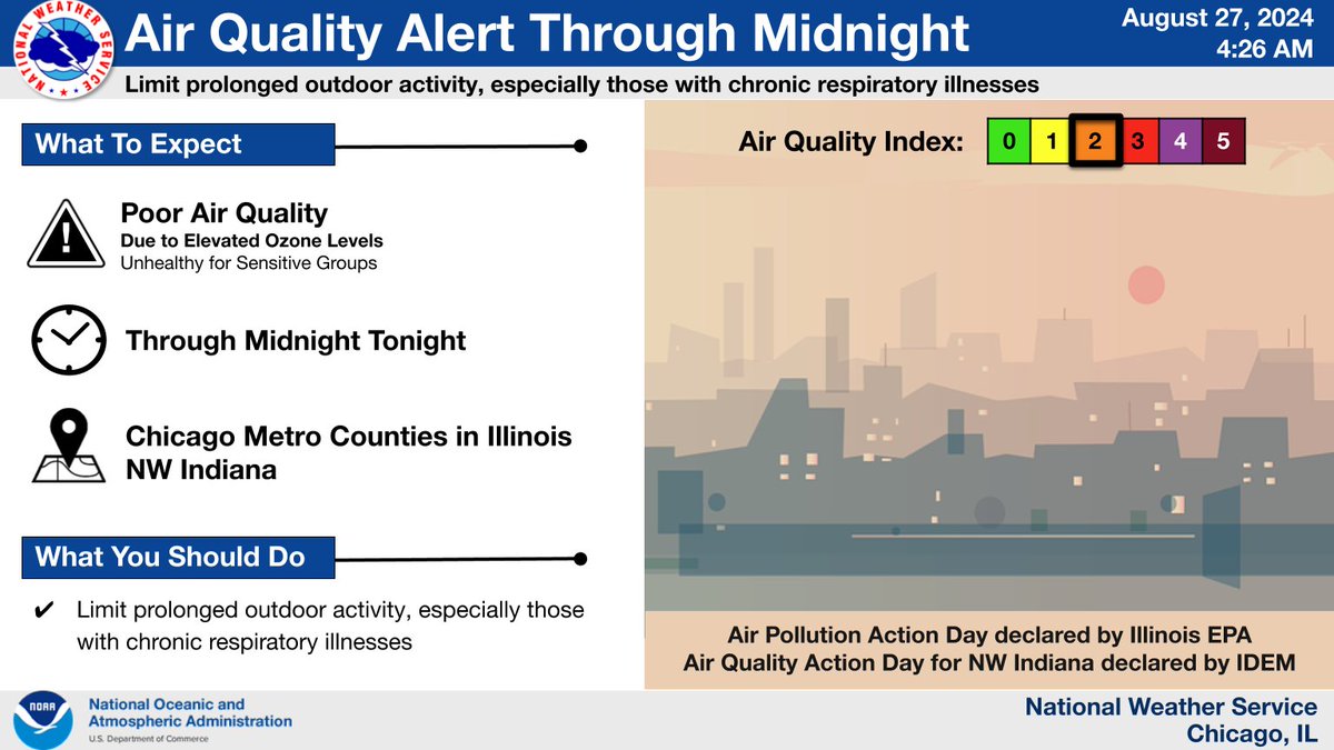
An Air Quality Alerts continue through midnight tonight for northeast Illinois and northwest Indiana. Air quality is expected to be at unhealthy levels for sensitive groups. Limit prolonged outdoor activity, especially those with chronic respiratory illnesses. #ILwx#INwx
📷Temperatures are expected to heat up again today. Several agencies throughout DuPage County serve as Cooling Centers📷. Availability may change at some locations, so call ahead to verify space. An extensive list can be found online at https://t.co/VR9Z1uQrwM.
#CoolingCenters
With the hot temperatures this week, don't forget about heat impacts to pets. Animals can die of heatstroke within 15 minutes, and cracking the car windows doesn’t help. NEVER leave your pets in parked vehicles. https://t.co/HUFM5Bmmtw #ILwx#INwx
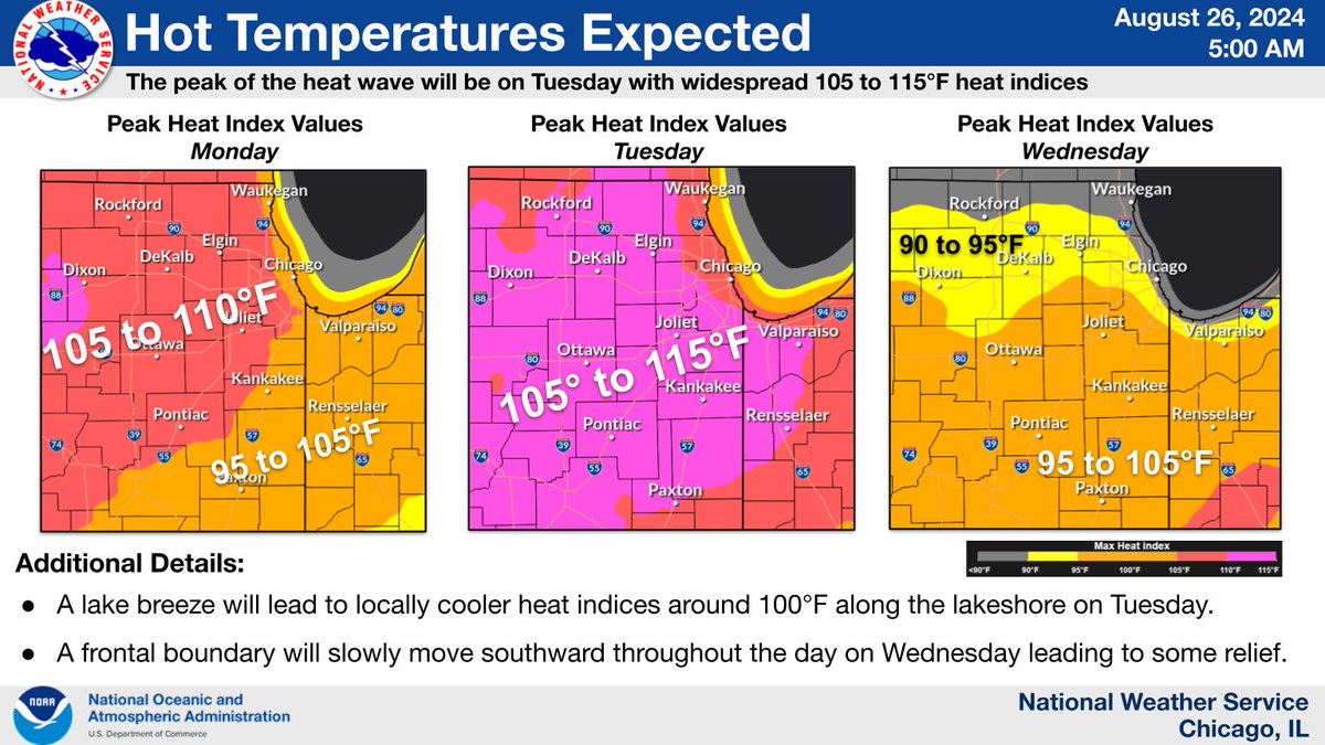
A heat wave continues to build today and peak on Tuesday with gradual easing on Wednesday. Consider altering your outdoor plans including school sports practices. This is the hottest air that we’ve experienced so far this summer. #ILwx#INwx
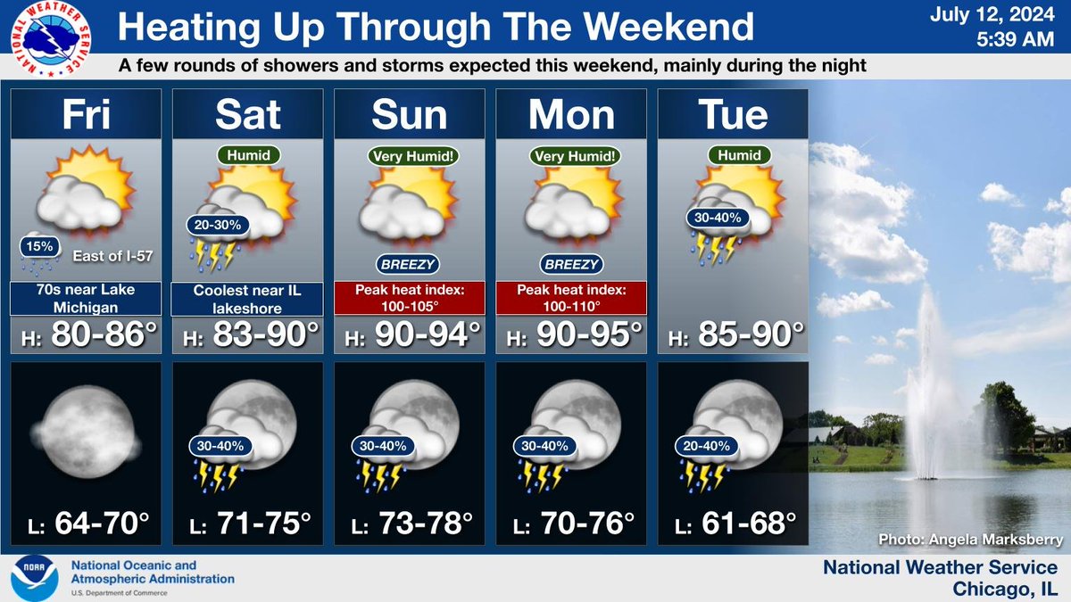
Today will be a pleasant, warm summer day across the area. Conditions get hotter this weekend with oppressive or even dangerous heat expected on Sunday and Monday. Additionally, we find a few chances for rain and storms through the weekend, primarily during the nighttime.
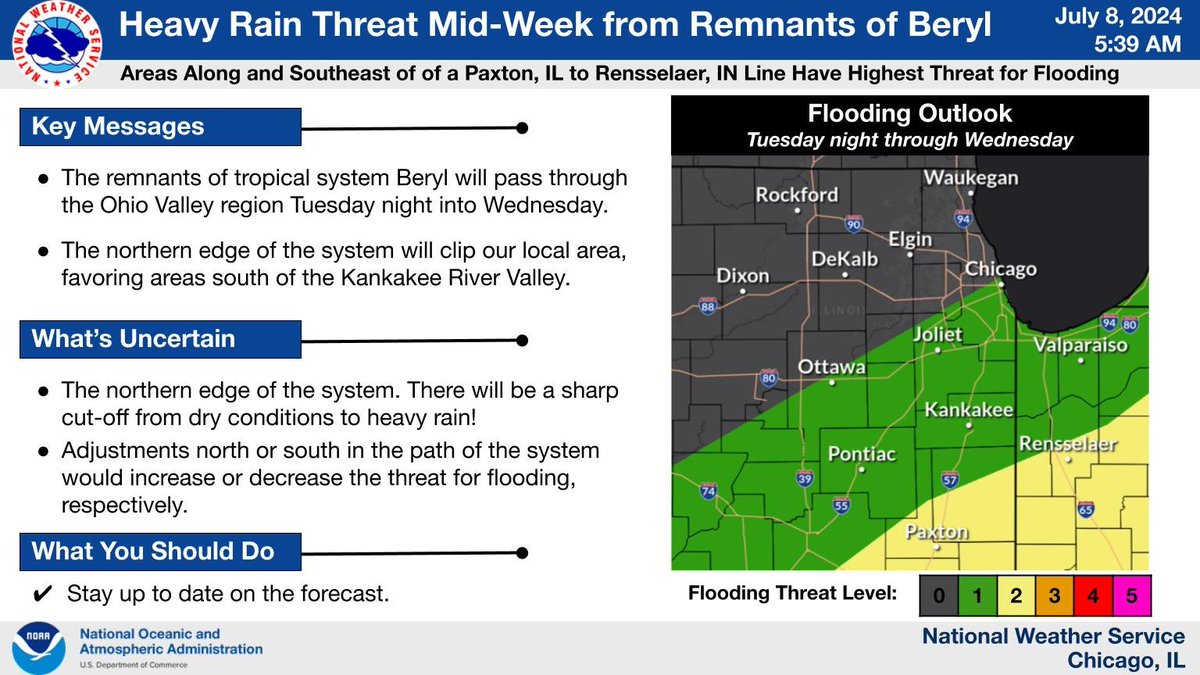
The remnants of tropical system Beryl will shift through the Ohio Valley region Tuesday night into Wednesday and graze our area. Stay up to date on the forecast! #ILwx#INwx
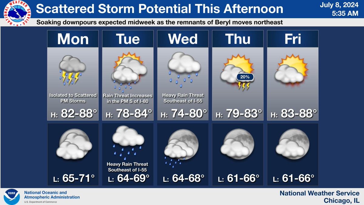
Scattered storms are possible once again this PM. The remnants of the tropical system Beryl will move northeastward into the Ohio Valley Tuesday night into Wednesday providing the chances for heavy rain, especially for areas south of the Kankakee River Valley. #ILwx#INwx
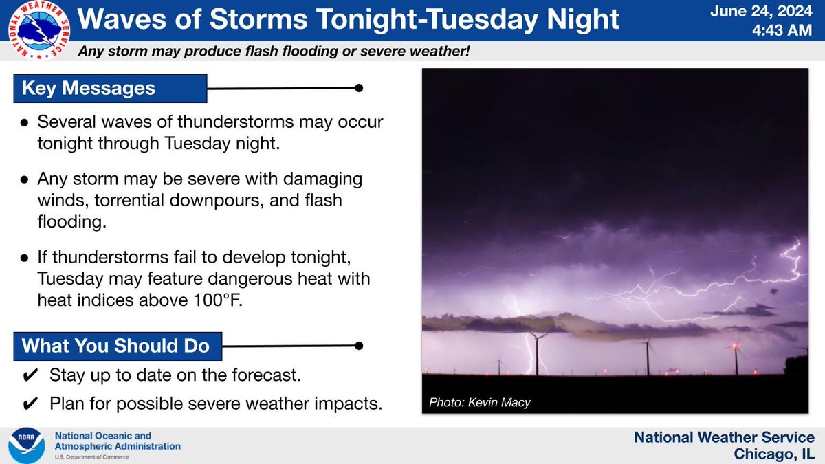
Waves of storms may parade through the region tonight through Tuesday night. With building heat and humidity levels, any storm may be severe with damaging winds and torrential downpours. Stay up to date on the forecast, and have multiple ways to receive warnings! #ILwx#INwx
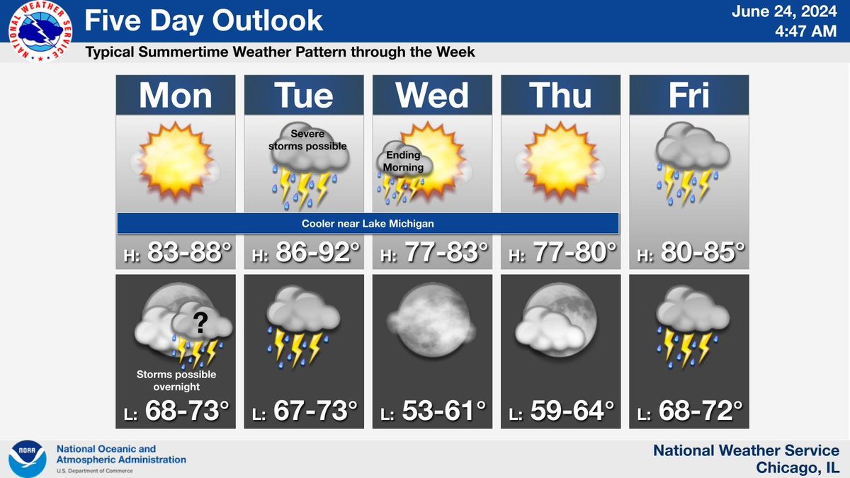
Seasonable summertime weather is expected through the week, with periods of showers and thunderstorms late tonight into early Wednesday morning and again Friday.
During heat waves, check on your friends, family, and neighbors daily. Extreme heat can be hazardous for everyone, especially for older adults.
Find #SummerReady tips for everyone at https://t.co/kcV8doo2hr!
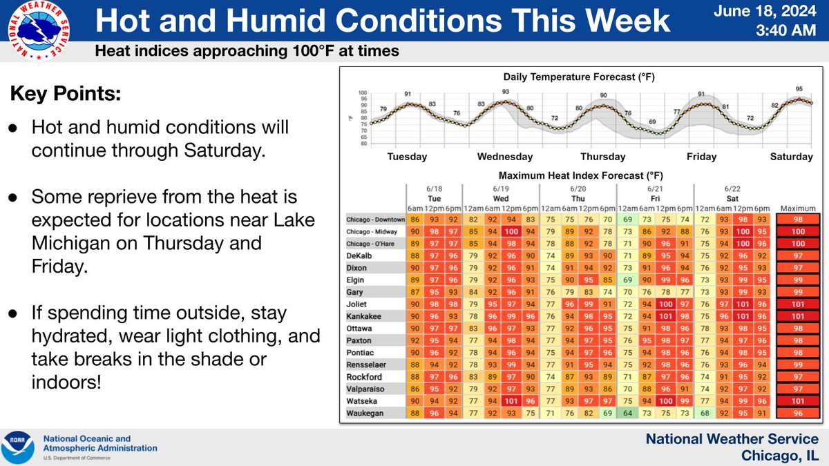
Hot and humid conditions will continue through Saturday, though areas near Lake Michigan should see some reprieve from the heat on Thursday and Friday. Periodic chances for showers and storms also remain through the next several days. #ilwx#inwx
Stay cool even when it's hot outside. Several agencies throughout DuPage County serve as Cooling Centers. Availability may change at some sites, so call ahead to verify space. An extensive list can be found online at https://t.co/VR9Z1uQrwM.
#CoolingCenters#Team211#211DuPage
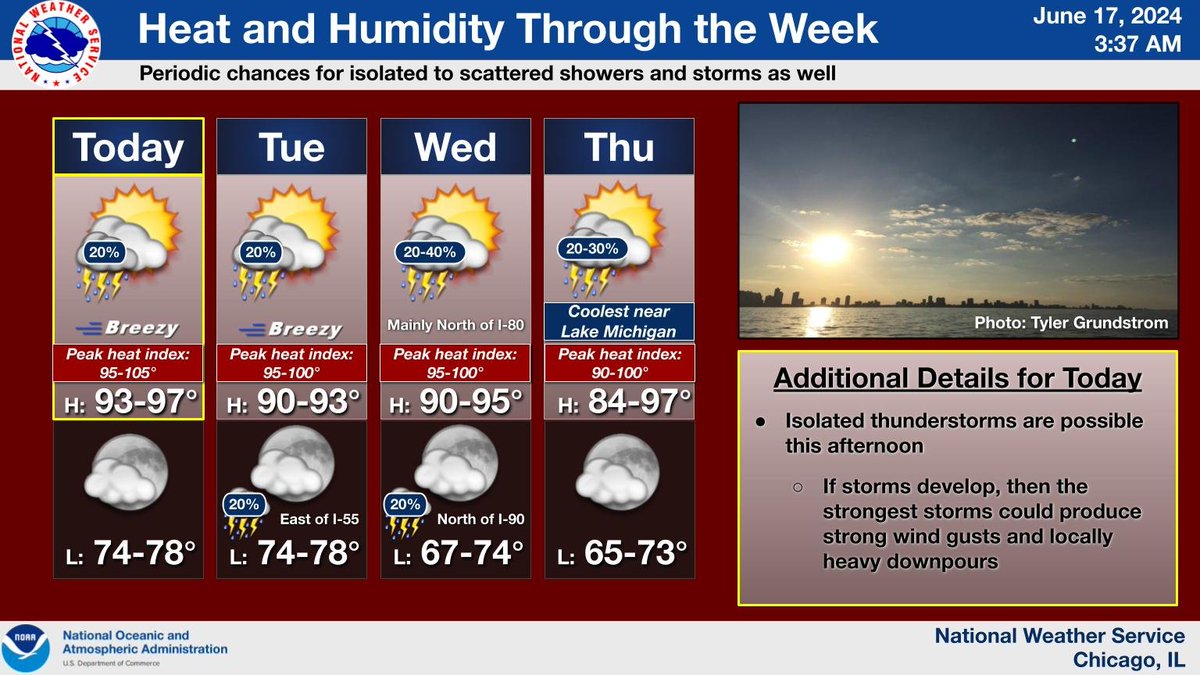
Hot and humid conditions are expected each day this week. If spending time outside, stay hydrated, wear light clothing, and take breaks in the shade or indoors! #ilwx#inwx
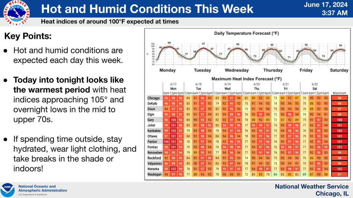
Hot and muggy conditions will continue this week with peak heat indices approaching and even exceeding 100 degrees at times. Periodic chances for showers and storms are also expected over the next few days, but most hours should be dry. #ilwx#inwx
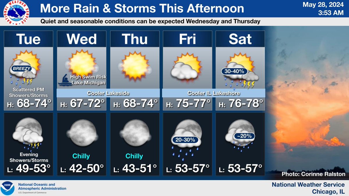
Scattered showers and thunderstorms can be expected this afternoon into this evening. A few stronger storms with gusty winds or small hail will be possible. Conditions will then quiet down for a couple of days with temperatures warming into the weekend. #ILwx#INwx
With the threat for severe thunderstorms late into the night tonight, make sure you have multiple ways to receive warnings, including at least a couple that will wake you up if needed. DO NOT rely on outdoor sirens to alert you indoors, especially while you’re asleep! #ILwx#INwx
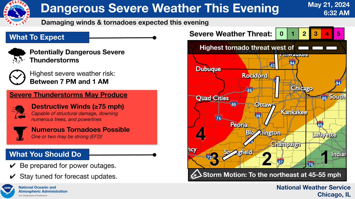
An outbreak of dangerous severe thunderstorms capable of producing tornadoes and widespread damaging winds is expected this evening. Make sure you have multiple ways to receive severe weather warnings and review your severe weather safety plans! #ILwx#INwx
An initial round of storms across far northeast IL will continue produce small hail and gusty winds into early afternoon. Farther SW, we continue to closely monitor for the development of additional severe storms into early afternoon.