Nos coparon el estadio siendo locales, alentaron todo el partido, ahora nos ganan. Es una de las derrotas más humillantes en la gloriosa historia de San Marino. 🇸🇲
Es intolerable esta derrota, tienen que renunciar todos.
Terrain impacts nearly every project. Luckily, Google Earth’s measure tool just got a major upgrade. Introducing elevation profiles. https://t.co/strPGePtP1
Simply draw a line, as you always have, to instantly generate a detailed and interactive elevation profile in the inspector panel. Whether you are tackling complex route and transportation planning, conducting viewshed analysis, or mapping out logistics for heavy machinery, you can now instantly contextualize terrain dips and peaks directly on the map.
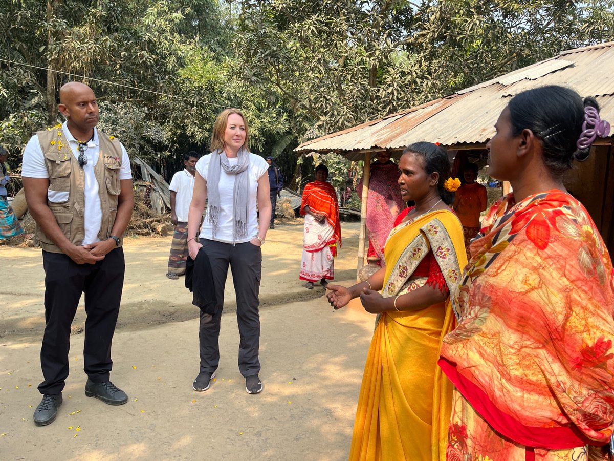
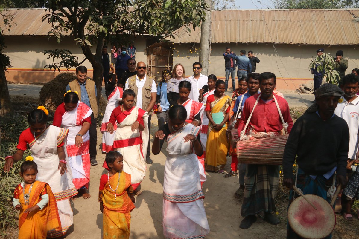
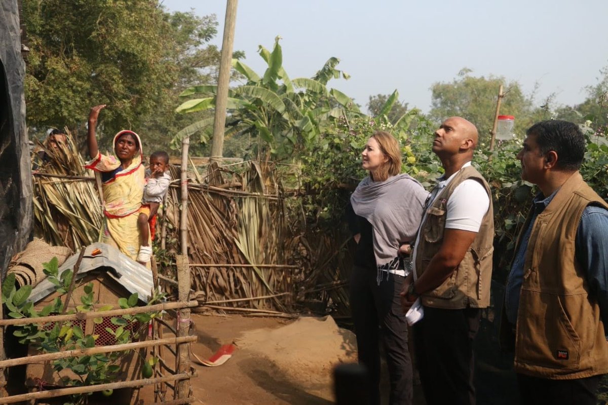
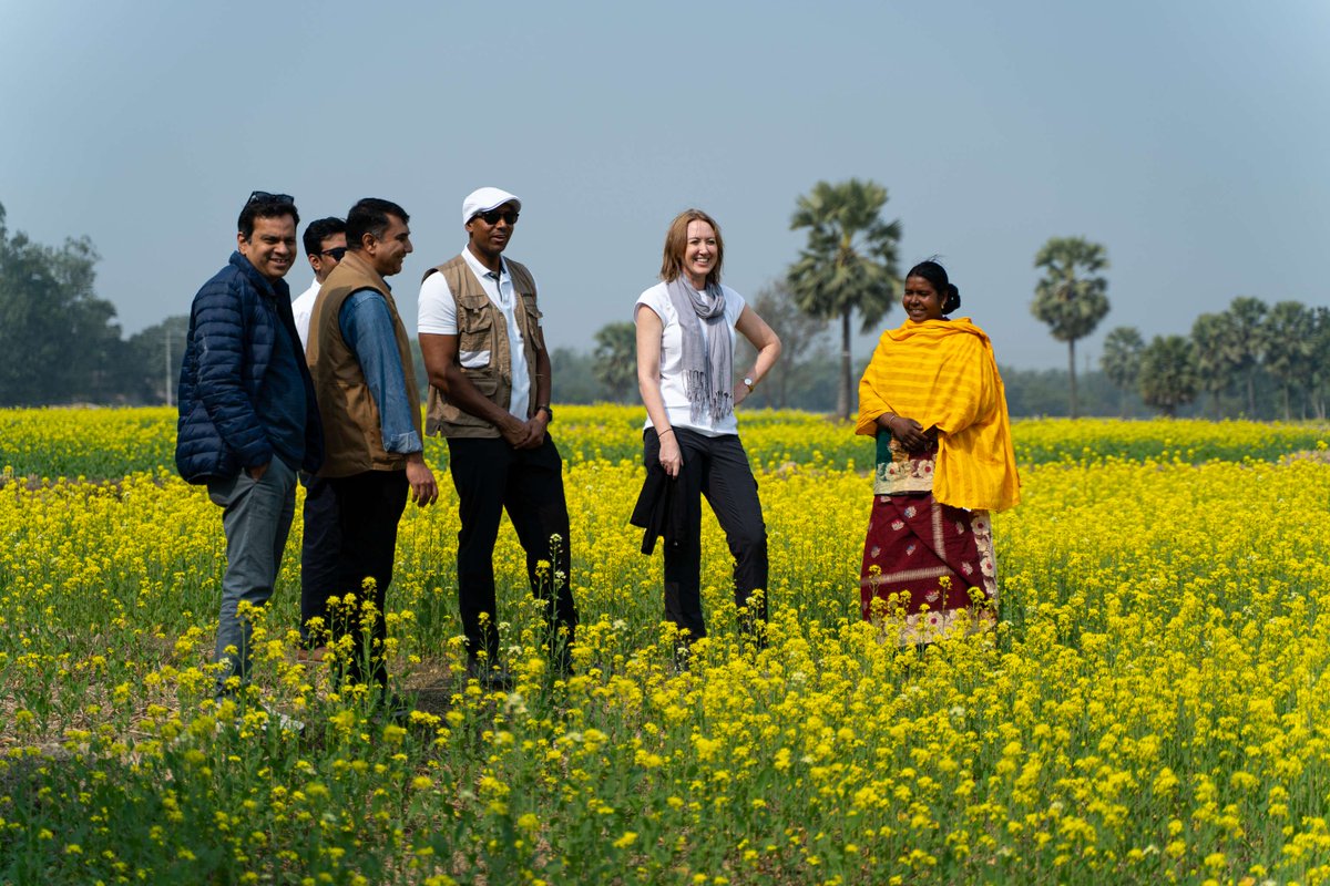
Indigenous communities in the Barind Tract face persistent poverty. In Tanore, HC Ajit Singh met Indigenous women supported through Canada’s partnership with Australia and BRAC, building agency, solving local challenges, and strengthening sustainable livelihoods for the future.
#30DayMapChallenge | Day 17 A New Tool
AI-generated “ancient style” map of Madison using #NanoBanana Pro🍌. Still has typos and shaky lines, but already far better than early AI maps. #AI is moving from pure inspiration toward practical cartographic tool. The Age of AI has begun!
Mapping US wind energy infrastructure with H3 hexagons for #30DayMapChallenge Day 25.
Turbines and their capacity are aggregated by H3 level; we apply a "fade effect" as the user zooms to reveal smaller hexagons then individual turbines.
Posting a tutorial later today!
Sometimes, it's hurting to hear, "just making a map." It's not a simple task to make spatial relations between things/parameters. Finding effective outcomes. But, what can I do? In our country, 99.99% people don't understand about the Spatial World. So, JUST LAUGH & ^-^
#GIS
📖 Just received a proof copy of my new book from Amazon! 438 pages color print. I am happy with the print quality. Better than my previous book✌️
Amazon: https://t.co/wQvVYAleMu
Book website: https://t.co/attjjMHTQo
We faced a medium strength earthquake this morning in Banglades. Can this one be a Foreshock? Please, please, experts, describe it. @USGS_Quakes@NASAEarth@USGSted
Taiwan is a gorgeous and fun country to visit. It really feels like an alternative reality version of what China could’ve been. Too much? Either way, how cool is this population density map by @researchremora?
In the shadow of the world's highest peaks, Nepal's forests weave a tapestry of resilience, where ancient evergreens cling to rugged slopes and vibrant broadleaves thrive in hidden valleys.
Behold the diverse forest types across this Himalayan gem, from cyan needle-leaved stands in the north to magenta broadleaf realms and yellow deciduous patches in the south.
Data: Copernicus Global Land Service.
Save it, share it, and tell me: which country's forests should I map next?
#cartography #gis #rstats #Nepal #forests #dataviz #geography #remotesensing #mapdesign #milosmakesmaps
@LinkedInHelp I got my new linkedin id temporary restricted. As I knew linkedin, I don't know that sending some connection within a few seconds cause issue. Please help me to get my id back.
Big thanks, @EsriTraining and @John_M_Nelson , NathanShephard, and @kennethfield for providing such impactful information. I forgot about one madam's name. It was fun and so much in-depth knowledge about #cartography.
GlobalBuildingAtlas was published today. 2.75B footprints covering the entire world. Planet Labs imagery + some fancy AI was used for some of footprints while OSM, MS and Google's footprints were used for others.