For Emergencies dial 911. This feed is not monitored regularly. Serving:Thomas, Blaine, Loup,Garfield,Wheeler,Greeley,Valley & Sherman Counties in Nebraska.
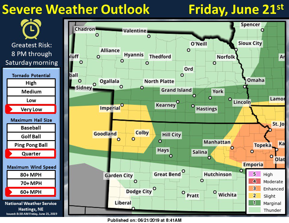
Showers and thunderstorms will be possible through the day Friday. There will be another round of potential severe weather during the afternoon and into the overnight with large hail, damaging winds, frequent lightning and heavy rain possible. #NEwx
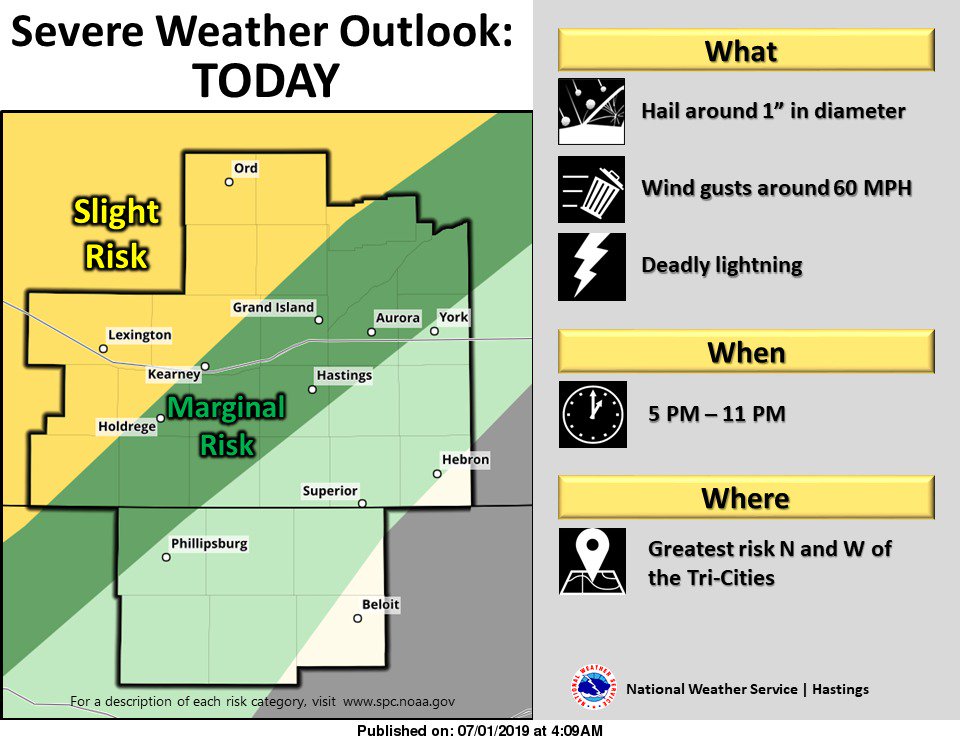
Scattered thunderstorms are likely to develop later Monday afternoon. Some may become severe with large hail, damaging winds, and frequent lightning. Be sure to have a source for weather alerts in the event a watch and/or warning is issued. #NEwx
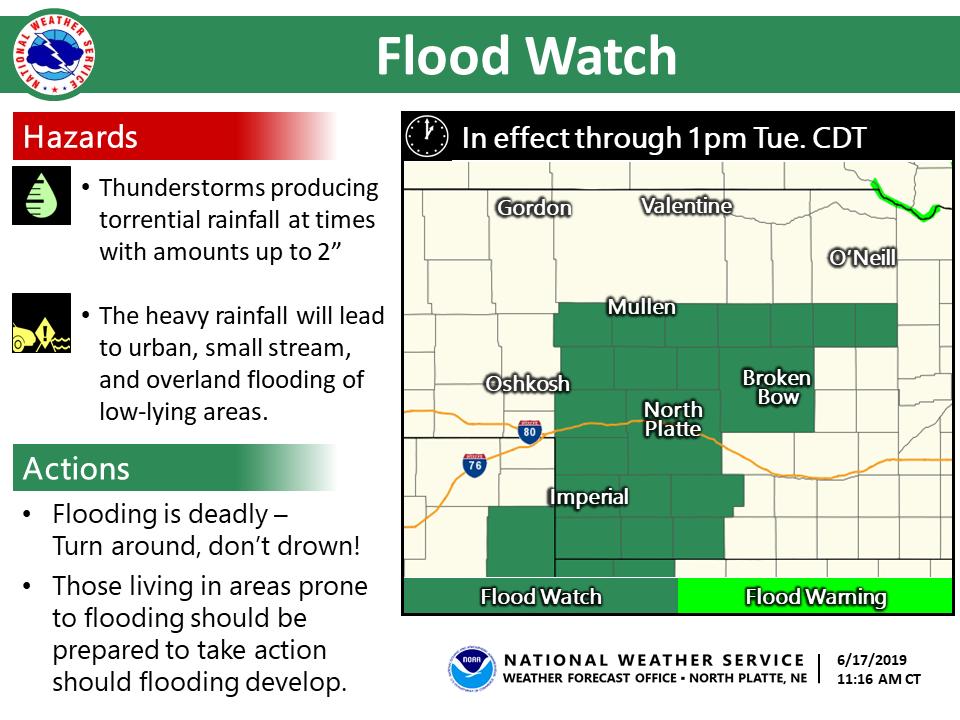
An active pattern continues through the work week, bringing the potential for strong/severe storms today & Tuesday. Large hail, damaging winds & locally heavy rainfall would be the primary hazards. Best chance for widespread precip looks to be tonight into Tues. #newx#kswx
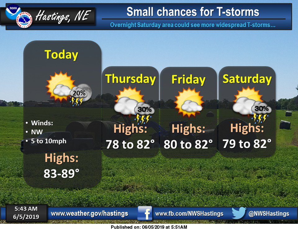
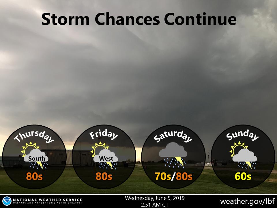
Continued scattered storms to round out the workweek. Widespread showers & storms Saturday with a cold front passage. Highs struggle to leave the 60s on Sunday #NEwx
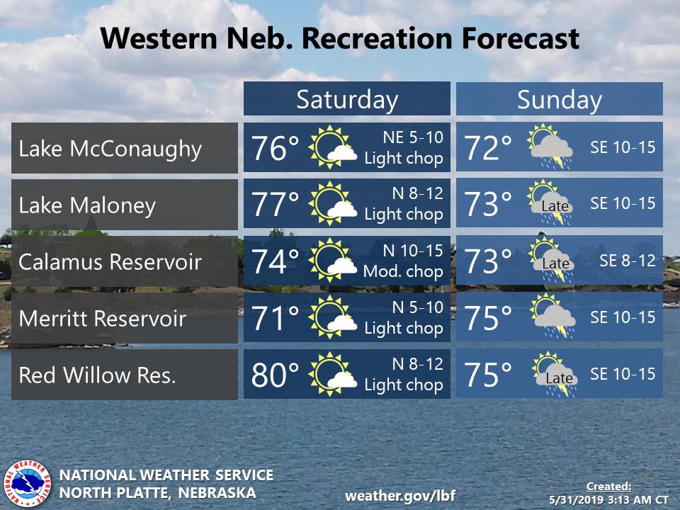
Thinking of hitting the area lakes this weekend? Mostly sunny with a light breeze for Saturday. Storm chances increase Sunday with a few on the stronger side for areas west of Hwy 83 #NEwx
We've had a few calls about the haze you may have seen in the sky today. This is smoke from the wildfires in Canada. Here is a satellite image of the smoke, as you can see it covers most of Nebraska. #NEwx
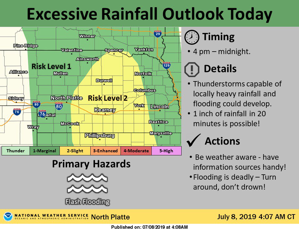
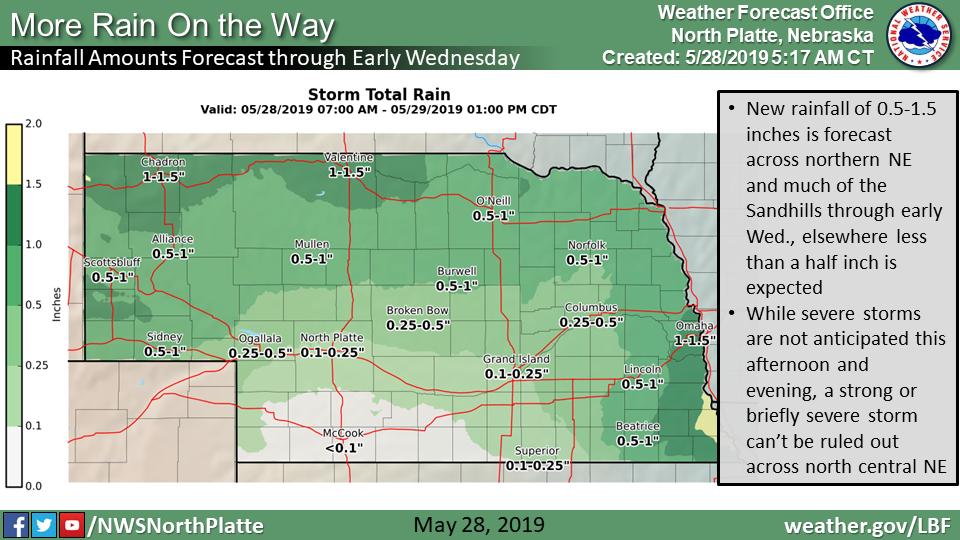
Unsettled conditions will continue through Wed. New rainfall of 0.5-1.5 inches is forecast across northern NE and much of the Sandhills through early Wed. While severe storms are not anticipated today, a strong or briefly severe storm can’t be ruled out across north central NE.
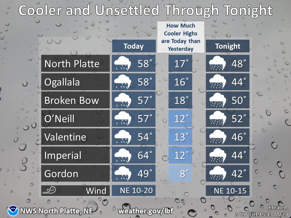
Stay dry and dress a tad warmer than yesterday. High temperatures will be largely near 10 to 20 degrees cooler than yesterday, from about 50 to the lower 60s, with modest northeast breezes. #NEwx