There been some interesting chatter with stormnet going with its highest tornado probabilities ever for an event I think it really is possible more than anytime since the SPC adopted the new system we could see the high risk issued.
I mean will we? I don't think so but we could see a cig 3 finally issued by Day 1 and even a 30% tor cig2. This is a unbelievable high end set up on hand.
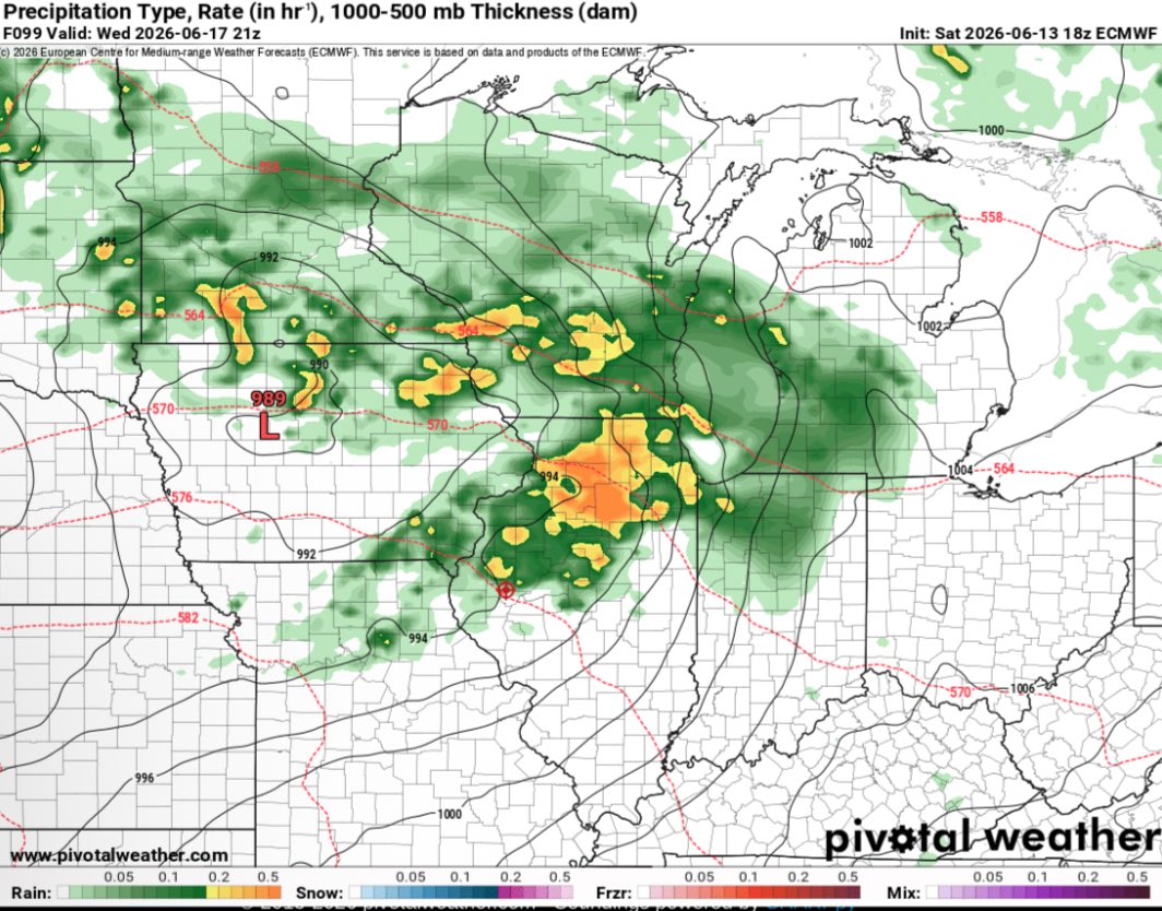
Elevated threat of tornadoes detected for Wednesday, June 17th, 2026.
See attached map for details.
This forecast initialized on Sunday morning. Follow for future forecast updates.
How are trends right now on the Euro? Getting quite a bit more concerning. 500mb and 850mb wind speeds on the rise and height falls dropping (evident of stronger system). This is just a wild scenario we are watching unfold in MID JUNE.
These hodographs have the look of a winter time mega trough but with summer thermodynamics in play, what could go wrong?
Tornado Probabilities are pretty much unchanged from previous runs with a little wobble from run to run. According to StormNet, these are the highest probabilities it's ourput at this distance so far this year. Meaning the likelihood of tornadoes are growing. According to the recent model runs, the I-80 corridor and south has the most favorable conditions on Wednesday for tornadoes, some may be strong. Across northern Illinois, we will definitely still have an all hazard risk with flooding also included. We will monitor and update as we get closer but I-80 and south into central and southern Illinois have the highest risks with this system as it looks today. #ilwx
Elevated threat of tornadoes detected for Wednesday, June 17th, 2026.
See attached map for details.
This forecast initialized on Saturday night. Follow for future forecast updates.
Elevated threat of tornadoes detected for Wednesday, June 17th, 2026.
See attached map for details.
This forecast initialized on Saturday night. Follow for future forecast updates.