@MetroRailThane loud hammering near chulha village waghbil Rd, Are we not allowed to even sleep peacefully. The Government and local authorities have no sense. Stop this work atleast in the night. @TMCaTweetAway@ThaneCityPolice@CMOMaharashtra
@MAHAVITARAN@CMDMSEDCL@MSEDCL If the meters are your property then why do you need consent from the customers or society to change to #smartmeters and under which rule cutting off power to get the consent legal. Sheer show of power by officials of @MAHAVITARAN@CMOMaharashtra
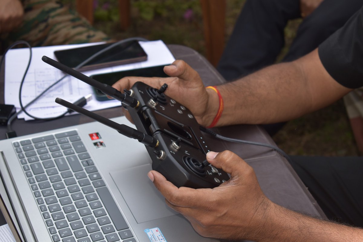
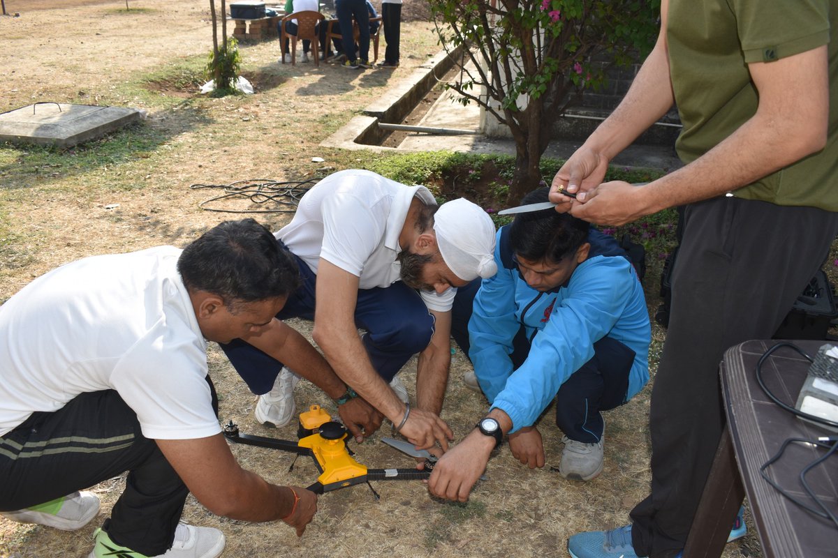
We are proud to announce our first successful supply and deployment of indigenous Survey Grade Drones by @MapmyIndia to the Indian Army.
These state-of-the-art, Made-in-India drones, equipped with advanced aerial survey and mapping technology, will be used for hands-on training at the Faculty of Geospatial Sciences (FGS), College of Military Engineering (CME) — the Centre of Expertise for Geospatial Sciences and Geo-Informatics for the Armed Forces.
Designed for high-precision surveying, terrain mapping, and aerial reconnaissance, the drones will support the Corps of Engineers with faster, safer, and more accurate data acquisition for operational and engineering applications.
The training and evaluation sessions at FGS saw active participation and valuable technical feedback, contributing to the continuous refinement of indigenous drone technologies for defence use.
We express our sincere gratitude to the Col SK Sarkar, Commander, Faculty of Geospatial Sciences, for his visionary leadership, guidance, and critical technical inputs during the training and demonstration sessions. His insights and feedback are invaluable for refining technology aligned with Army requirements. We also extend our sincere gratitude to the entire Faculty of Geospatial Sciences, as well as the leadership of CME and the Corps of Engineers, for their guidance, support, and trust.
Together, we advance towards strengthening national capabilities through indigenous geospatial and drone technologies — aligned with the vision of Atmanirbhar Bharat.
@rakeshverma1950 | @MapmyindiaVerma | @_rohanverma
#AtmanirbharBharat #IndianArmy #DefenceInnovation #Geospatial #DroneSurvey #CorpsOfEngineers #CMEPune #IndigenousTechnology #MapmyIndia
Is a circle the size that is being constructed near Hiranandani Westgate, Chulha Village on the Waghbil road really needed? A smaller one which will not cause traffic should do. Arcadia Circle faces traffic issues due to the size of circle. @waghbilforum@ThaneLive@TMCaTweetAway
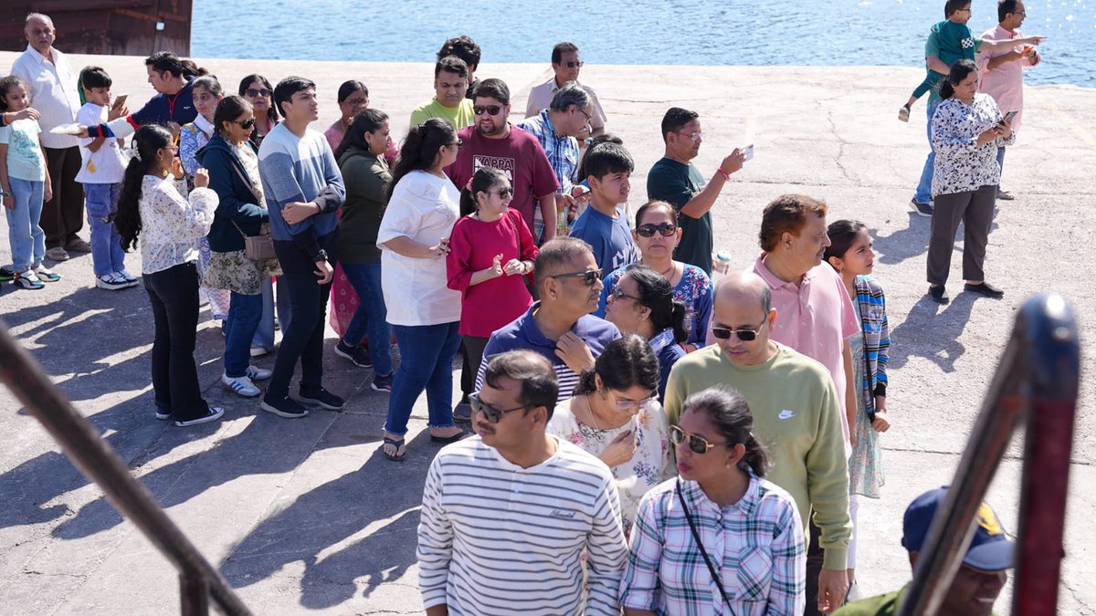
More than 400 members of the Indian diaspora visited Kaundinya at Muscat and were fascinated by her distinctive traditional construction, the remarkable maritime wisdom of ancient Indian tradefarers and the centuries-old Indo–Omani maritime connect. Through engaging interactions with the crew, visitors gained insights into the voyage, navigation techniques and the ship’s historical significance. They not only appreciated #IndianNavy’s steadfast role in defending the nation but also lauded its efforts in preserving and showcasing #India’s rich maritime culture.
#INSVKaundinya
#MaritimeLegacy #StitchedShip_India
@MinOfCultureGoI@SpokespersonMoD@Indemb_Muscat@sanjeevsanyal@indiannavy@IN_WNC@IN_HQENC@IN_HQSNC
When India were playing USA in the U-17 Women's World Cup, the USA team did a full PR show before the game, gifting footballs to a local women's academy.
Yeah, they found an academy in Bhubaneswar, a city hosting the World Cup, where kids did not have balls to play with.
Everyone was covering it like such an awesome thing, and I stood in the corner hanging my head in shame. We were hosting the World Cup, yet the image going out in the world was one of a country where football academies couldn't afford balls until the USA came and rescued them.
At some point we need to stop celebrating our shortcomings. We're not Argentina, we can't romanticize a 'Pibe de Barrio' playing in the streets. Because we don't have a Maradona or a Messi to show for it.
These kids playing with the trash ball have no avenue to become world-class players no matter how talented they are, because they were born in India. We will waste their talent.
They should stop kicking and focus on studies because maybe then they can have a decent life. Because in this country you don't even know if there will be a league next season.
We are a country of 1.5 billion that can't even qualify for Asian Cup. Kids playing with a trash ball is something we should be ashamed of. Failing to qualify for the World Cup is also something that should shame us.
And that shame should stir us into action, making sure we build the infrastructure needed to produce a decent team that can get us there decades later.
#indianfootball
Lest we miss the symbolism, the name Kaundinya comes from the ancient Hindu explorer and adventurer who sailed to southeast Asia in 1st century CE.
Kaundinya met princess Soma (Vietnamese) in a pirate battle. They fell in love, founded the Funan empire near Mekong river delta. Ancient Chinese texts mention them, how they founded cities with irrigation and flood control networks, how this nation became immensely wealthy through innovation and hard work. Thus was seeded the majestic Hindu kingdoms of Khmer and Champa.
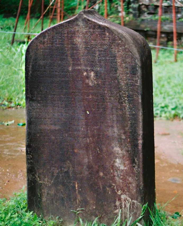
Below is the inscription stone where Kaundinya's name and story is earliest inscribed. It was found in My Son, a world heritage site in Central Vietnam. It is a mix of Sanskrit prose and verse. Transcribed, it says:
तत्र स्थापितवान् शूलं कौण्डिन्यस् तद्द्विजर्षभः । अश्वत्थाम्नो द्विजश्रेष्ठाद् द्रोणपुत्राद् अवाप्य तम् ॥
कुलासीद् भुजगेन्द्रकन्या सोमेति सा वंशकरी पृथिव्याम् । आश्रित्य भावे तिविशेषवस्तु या मानुषावासम् उवास ॥
कौण्डिन्यनाम्ना द्विजपुंगवेन कार्यार्थपत्नीत्वम् अनायि यापि । भविष्यतो ऽर्थस्य निमित्तभावे विधेर् अचिन्त्यं खलु चेष्टितं हि ॥
Transl: It was there that Kauṇḍinya, the foremost among Brāhmins, planted the spear which he had obtained from Droṇa’s son Asvatthāman. There was a daughter of the king of serpents, called Somā, who founded a family in this world. Having attained, through love, she was taken as wife by the excellent Kauṇḍinya...
Summary:
1⃣Some 2000+ years later, Kaundinya sails again!
2⃣Ancient Hindus were early explorers and innovators, something innate in the nature of human beings everywhere.
3⃣Don't fall for Indologists who gaslight and insult us with Kalapani and other myths. Ignore them with a smile. Kaundinya is the early proof that no ocean can stop you; that India cheered 1000s of Kaundinya-like explorers between 1st and 20th century. Likely even earlier when Sumerians called our ancestors Meluhhas 4000 some years ago! Explore. Experiment. Excel. Be like Kaundinya.
The Armada That Unlocked the World
A thousand years ago, an Indian emperor launched a massive naval strike not for territory, but to break a chokehold on global commerce.
If you stood on the Coromandel Coast of India in the final months of 1024 AD, looking east toward the Bay of Bengal, you would have witnessed a mobilization unlike anything the pre-modern world had ever seen. The harbor was not filled with the usual bustle of merchant dhows or fishing catamarans. Instead, it was crowded with a purpose-built armada. There were hundreds of ships, robust vessels constructed from teak and jackfruit wood, bobbing in the surf. On board were tens of thousands of soldiers, armor, supplies, and, perhaps most terrifying of all to the enemies they would soon face, fully trained war elephants.
This was not a fleet of exploration. It was a fleet of correction.
The man who commanded this force, Emperor Rajendra Chola I, was about to launch a campaign that would rewrite the rules of Asian geography. His target was not a neighboring kingdom or a land border. It was an empire of islands across the ocean, the Srivijaya Empire, which controlled the vital chokepoints of Southeast Asia. The subsequent raid of 1025 AD remains one of the most audacious naval operations in history. It was a strike that effectively birthed a medieval version of global free trade, connecting the markets of China, India, and the Arab world by force.
To understand the sheer ambition of Rajendra’s gamble, one must understand the map of the medieval world. In the 11th century, the global economy beat to the rhythm of the monsoon winds. The great maritime Silk Road stretched from the Abbasid Caliphate in Baghdad to the Song Dynasty in China. India sat squarely in the center, the golden fulcrum where Arab merchants offloaded frankincense and horses, and Chinese traders sought spices and textiles.
But there was a problem. To get from the Indian Ocean to the South China Sea, every ship had to pass through the Strait of Malacca. This narrow ribbon of water was the property of the Srivijaya Empire, a thalassocracy based in modern-day Sumatra and the Malay Peninsula. Srivijaya did not produce great goods; it produced great borders. It acted as the world’s most aggressive tollbooth.
For decades, Srivijaya had leveraged its geography to squeeze the life out of the trade routes. They demanded exorbitant transit fees. They forced merchant vessels into their ports to offload cargo at below-market rates. When captains refused, the Srivijayan navy turned to piracy, seizing ships and stifling the flow of goods. For the powerful merchant guilds of southern India, known as the "Five Hundred Lords of Ayyavole," this was an intolerable strangulation of their livelihood. (I have written about Ayyavole. It was the probably first corporation in the world. Check my thread for that.)
Diplomacy had failed. The Srivijayan kings, secure in their distant island fortresses, believed they were untouchable. No Indian power had ever projected force across the open ocean on such a scale. The Bay of Bengal was too wide, the logistics too complex, the risks too high.
Rajendra Chola decided to change the rules.
The logistics of the 1025 campaign stagger the modern imagination. Transporting a medieval army by land is difficult enough; transporting one across 1,500 miles of open ocean is a feat of engineering genius. The Chola shipbuilders adapted their vessels for the high seas, using a technique of stitching planks with coir and sealing them with pitch to withstand the ocean swell. They mastered the science of celestial navigation, using rudimentary sextants to guide this floating city across the featureless blue. (Check my thread on how Cholas perfected latitude sailing which perhaps was used later by Columbus)
The genius of the operation, however, was not just in the engineering. It was in the strategy. Srivijaya expected any attack to come from the north, filtering predictably into the Malacca Strait. Rajendra appears to have done the impossible. His fleet likely swung south, navigating the treacherous currents to penetrate the Sunda Strait.
They emerged from the ocean mist like a thunderclap.
The inscriptions at the Tanjore Temple, carved in granite to immortalize the victory, read like a litany of shock and awe. They describe the Chola forces sweeping through the archipelago with the force of a "burning fire." The attack was not a single battle but a synchronized dismantling of the Srivijayan network. Fourteen key ports were struck. The capital at Palembang was sacked. The Srivijayan king, Sangrama Vijayatunggavarman, was captured, his treasury seized, and his "Vidyadhara-torana," the jeweled war gate of his city, taken as a trophy.
The use of elephants in an amphibious assault highlights the psychological dimension of Chola warfare. For the defenders, seeing armored pachyderms storming off ships onto their beaches must have been an apocalyptic sight, a shattering of the natural order that broke their will to fight.
Yet, what happened next distinguishes Rajendra Chola from a mere conqueror. He did not occupy Srivijaya. He did not station permanent garrisons or attempt to govern the archipelago from India. Once the Srivijayan king surrendered and acknowledged Chola suzerainty, the armada sailed home.
Rajendra was not interested in empire building in the colonial sense. He was interested in market correction.
The result was immediate and profound. The Bay of Bengal became, in effect, a Chola lake. The stranglehold on the Malacca Strait was broken. For the next century, the trade route was open. Chinese chronicles from the Song Dynasty record a sudden spike in tribute missions and trade from India. Arab geographers noted the ease with which goods now flowed from the Persian Gulf to Guangzhou.
The Chola raid of 1025 was the ultimate enforcement of freedom of navigation. It ensured that the triangular trade between the Arab world, India, and China could flourish without the interference of a predatory monopoly. It allowed the merchant guilds of South India to become the first true multinational corporations, setting up trading posts that stretched from Sumatra to southern China.
In our modern era, we often view the concept of "secure sea lanes" as a 20th-century invention, a responsibility of the British Royal Navy or the U.S. Navy. But a millennium ago, a Tamil emperor understood the same fundamental truth. He recognized that a global economy relies on open doors, and he proved that a nation with the will and the technology could reach across the ocean to kick them open.
The 2,000-Year-Old Dam That Taught the World to Build
How an ancient Indian engineering marvel became the unlikely godfather of modern irrigation, from the Nile to the Mississippi.
The most important engineering school of the 19th century had no classrooms. Its curriculum was a stone dam built by a Tamil king before the fall of Rome.
In 1874, a British military engineer named Arthur Cotton wrote a sentence that should have upended the history of technology: "It was from them we learnt how to secure a foundation in a loose sand of unmeasured depth."
The "them" in question were not his colleagues at the Royal Military Academy. They were not professors at Oxford or Cambridge. They were engineers who had been dead for seventeen centuries, builders who served a Tamil king named Karikala in the second century AD, men whose names were never recorded but whose work still stands today, diverting the waters of the Kaveri River across one of the most fertile deltas on Earth.
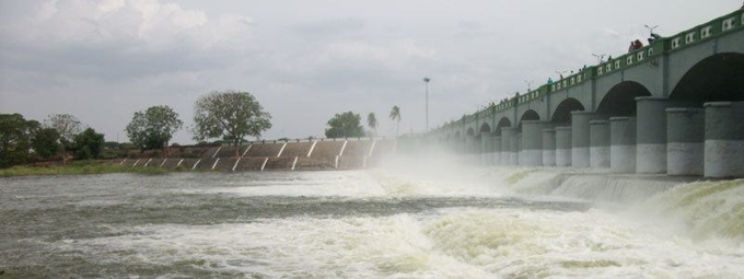
The structure Cotton was describing is the Kallanai, known to the British as the Grand Anicut. It is among the oldest dams in the world still in operation. And its influence on modern engineering is a story that has been largely forgotten, even as the dams it inspired continue to function from India to Egypt.
A Dam That Should Not Have Worked
The Kallanai presents a puzzle that still intrigues hydraulic engineers. Built around 150 CE, it spans 329 meters across the Kaveri River, standing 20 meters wide and over 5 meters high. It was constructed without mortar, without concrete, without any binding agent at all. Massive unhewn granite blocks were simply rolled into the riverbed and stacked atop one another, relying on nothing but gravity and the interlocking pressure of stone against stone.
By every principle of European engineering that Arthur Cotton had learned, this should not have worked. The riverbed was loose sand of "unmeasured depth," the kind of foundation that swallows structures whole. European engineers of the 18th and 19th centuries would have insisted on driving piles deep into bedrock, or constructing elaborate cofferdams to create dry working conditions. The Chola engineers did neither.
Instead, they did something counterintuitive: they worked with the sand rather than against it. The massive boulders, owing to their weight, settled into the sandy riverbed and created their own stable foundation. Smaller stones were layered on top. The structure was curved, with an irregular sloping crest that allowed floodwaters to skim across rather than pound against the masonry.
The result was a dam that has survived nearly two millennia of monsoons, floods, and the occasional earthquake. When the British arrived in the 18th century, it was still functioning exactly as designed, diverting water to irrigate approximately 69,000 acres of delta farmland.
The Education of Arthur Cotton
Arthur Cotton arrived in India in 1821, a young officer in the Madras Engineers. He had been trained in the European tradition, which held that engineering was a matter of imposing order on nature through brute force and superior materials. What he found in Tamil Nadu challenged everything he thought he knew.
The Kaveri delta was suffering. Years of neglect had allowed silt to accumulate in the irrigation channels. The ancient system was faltering. Cotton was assigned to restore it, and in doing so, he became a student of the Chola engineers who had built it.
Lady Hope, Cotton's daughter, later recounted a pivotal moment in her biography of her father. Cotton had been struggling with how to build a new dam on the Kollidam River, where the same loose sandy foundation that plagued European engineers awaited him. Then he studied the Kallanai:
"The most important step in his education was the lesson he learned from the builder of the Grand Anicut. It gave him, even with the slender means extended to engineers of that period, the power to control and master the greatest river of the country."
Cotton did not merely admire the ancient dam. He replicated it. His Lower Anicut, built in the 1830s across the Kollidam, was explicitly modeled on the Kallanai's design principles. He used the same approach of working with the sandy foundation rather than fighting it. He employed similar stone-stacking techniques. The dam worked.
The Madras School of Engineering
What Cotton developed from his study of the Kallanai became known, somewhat dismissively, as the "Madras Cheap School of Engineering." The name was meant as an insult by Cotton's critics in the colonial administration, who favored more expensive, European-style construction. Cotton wore it as a badge of honor.
The principles were simple: work with nature rather than against it. Use locally available materials. Minimize complexity. Maximize durability. Build small interventions that leverage natural forces rather than massive structures that attempt to overpower them.
These principles, learned from a dam built before the Roman Empire reached its zenith, would go on to shape irrigation projects across the British Empire and beyond.
After his success on the Kaveri, Cotton was assigned to the Godavari River, where he built what many consider his masterpiece: the Dowleswaram Barrage. Completed in 1852, it transformed the Godavari delta from one of the poorest regions in India to one of the most prosperous. The project cost a fraction of what European-style construction would have required and returned over 100 percent annually on its initial investment from the first year of operation.
Cotton became, in the words of his contemporaries, the "Father of Indian Irrigation." A museum in his honor stands today in Rajahmundry, Andhra Pradesh, near the barrage he built. Statues of him dot the Godavari and Kaveri deltas. The Institution of Engineers (India) has called him "the Father of the engineering profession" in the country.
But Cotton himself was clear about where his knowledge came from. He was not the teacher. He was the student.
From the Kaveri to the Nile
The influence of the Madras School did not stop at India's borders. In the late 19th century, British irrigation engineers trained in India began taking positions in Egypt, where the colonial administration was desperate to increase cotton production in the Nile delta.
Among them was William Willcocks, a polymathic engineer who had spent his formative years in India before being assigned to Egypt's Ministry of Public Works. Willcocks would go on to design the first Aswan Dam, completed in 1902, which was at the time the largest masonry dam in the world.
The intellectual lineage is clear. Willcocks learned from engineers who had learned from Cotton. Cotton had learned from the Kallanai. The principles of working with river hydrology rather than against it, of using locally available materials, of building for durability rather than monumentality, all flowed from a 2nd-century Tamil dam to a 20th-century Egyptian one.
Willcocks himself later worked in Mesopotamia, where he proposed irrigation schemes for the Tigris and Euphrates. The Madras Cheap School of Engineering, born from a colonial officer's encounter with an ancient Indian dam, had become a global methodology.
What the Kallanai Teaches
Today, the Kallanai irrigates not 69,000 acres but nearly one million. Modifications by British and later Indian engineers have expanded its capacity, but the original structure remains at its heart, still diverting floods, still channeling water to the delta, still standing after 1,900 years.
In 2021, it was designated a World Heritage Irrigation Structure by the International Commission on Irrigation and Drainage. The designation was overdue. Few structures in human history have had such an outsized influence on engineering practice across such a span of time and geography.
The dam's longevity offers a quiet rebuke to modern construction. In an era when newly built infrastructure regularly fails within decades, here is a structure approaching its second millennium of continuous operation. It was built without computer modeling, without steel reinforcement, without any of the technologies we consider essential to modern engineering. It was built by people who understood something that we, with all our advanced tools, sometimes forget: that the most durable solutions are often the simplest ones, the ones that work with natural forces rather than against them.
Arthur Cotton understood this. He learned it not from a textbook but from a dam. And through him, that lesson spread across the world, shaping irrigation projects from the Godavari to the Nile, from the principles of the Madras Cheap School to the foundations of modern hydraulic engineering.
The next time you read about a dam failure, about a reservoir silting up decades ahead of schedule, about an irrigation project that cost billions and delivered little, consider the Kallanai. Consider what a Tamil king and his unnamed engineers knew in the second century that we have apparently forgotten in the twenty-first.
Consider that the most important engineering school in modern history had no classrooms, no professors, no degrees. It had only a stone dam, standing in a river, teaching anyone humble enough to learn.
Consider how much fakeness has been passed in Indian history by the European colonizers.
When they ask them for primary source, point them to the dam which has been functioning for 2000 years which probably is mother of civil and hydraulic engineering.
Below is the picture. I have already described this elsewhere.