I like pop music, classical, country, accapella, Glee, Vampire Diaries, Twilight series. I like Darren Criss, Chris Colfer, Ash Hardell, & James Charles!!!
Storms are developing across south-central Nebraska and will track east-northeast, intensifying this evening. Initially, all severe hazards are possible, including a strong tornado. The threat will transition toward heavy rain and flash flooding overnight.
LIVE emergency update from OMAHA on the threat of an EF2+ #tornado this late afternoon and evening. Supercells should erupt by 4-6 pm likely to the west and southwest of Omaha. Any supercells that can experience the strong low-level shear will have a chance of a strong tornado or two. Storm chase mode has been activated
We have been chasing the most violent storms on earth together for over 25 years.
Now, we are bringing the ultimate intercept to the BIG SCREEN. 🌪️🎥
I am beyond excited to announce that NEVER STOP CHASING is hitting theaters nationwide on August 21!
Huge thanks to Deadline for breaking the news this morning. You can read the exclusive announcement and watch the full official trailer here: https://t.co/zwTquSOoiY
Directed by my longtime chase partner Ken Cole, this documentary takes you directly inside the bear's cage. We mastered the entire film in Dolby Vision and immersive Dolby Atmos sound so you can actually feel the roar of a massive wedge tornado right in your theater seat. This is the real deal, and I can't wait for you to experience it with us.
Check out https://t.co/ULS5vzmnew for updates and theater info!
#NeverStopChasing #StormChasing #Dominator #Tornado#Dominator #Tornado
After a relatively comfortable stretch of weather, Iowa is about to experience its hottest temperatures of the summer so far. Heat and humidity will build Saturday before peaking on Sunday, when much of the state is expected to see heat index values between 100° and 110°+. The map below shows the forecast heat index values for Sunday afternoon.
The combination of temperatures climbing into the 90s—and even topping 100° in a few locations—with dew points well into the 70s will create dangerous conditions for anyone spending extended time outdoors. Adding to the concern, overnight temperatures will only fall into the 70s, providing very little relief from the heat.
Heat headlines will likely be issued as confidence continues to increase in this heat event. We'll also be monitoring the potential for thunderstorms late Sunday into Monday as the edge of the heat dome becomes more active.
#iawx #iowa #weather
I hope you like the heat! Multiple days of extreme heat expected next week, especially in the white-dashed area. Very high dew points (boosted by corn evapotranspiration) and temperatures in the upper 80s to low 90s will push heat index values into the low 100s across a large area. This ridge should break down after the 4th of July.
We will be watching the threat of severe weather Wednesday afternoon closely. At the moment, it appears the highest severe weather probabilities will stay south and east of Iowa. But portions of southeast Iowa could still see a severe weather threat Wednesday afternoon. More updates to come!
Meteorologist @StephanieAbrams is tracking a dangerous severe weather threat across parts of the Midwest on Tuesday. Storms could bring damaging winds, large hail, and tornadoes from Iowa and Missouri to Illinois and Indiana.
Every year, I share this video of French caretakers who take sand from Omaha Beach in Normandy, and scrub them into the letters to give them the gold coloring.
They do this for all 9,386 US soldiers who died.
France also gave us this land as American soil. #MemorialDayWeekend
🌪️WORST TORNADO DAY YET🌪️
TORCON 7
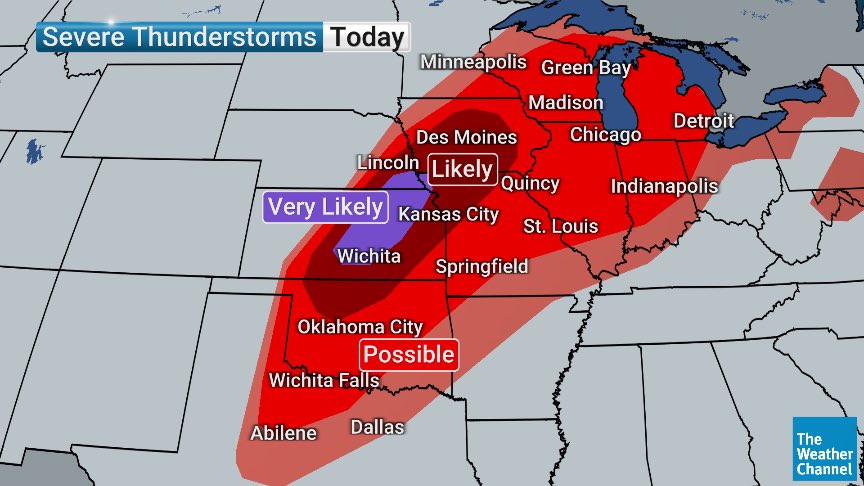
After 22 tornadoes Sunday, today is likely to be the worst tornado day of May so far. Severe storms, with tornadoes, could be seen from Michigan to Texas, with an area from near Omaha, NE to Wichita, KS at risk for long-track EF3+ tornadoes.
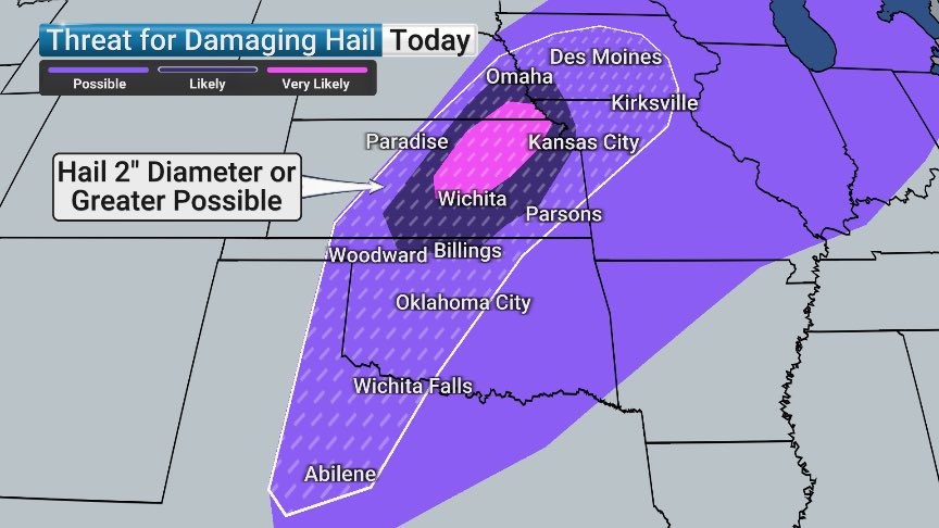
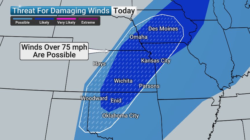
Millions of Americans are on alert for severe weather including damaging wind, large hail and possible tornadoes.
A line of storms is expected to sweep through parts of Iowa, Illinois, Missouri, Kansas, Oklahoma and Northern Texas. https://t.co/JO0g4qyCwz
A rare long-track winter storm is forecast to bring dangerous ice and heavy snow from Texas to the Mid-Atlantic this weekend. Arctic air will remain in place after the storm, keeping temperatures well below average. Monitor the forecast closely as this develops.
It was a good run, Omaha! After a mild start to winter with zero days below zero so far, the streak ends Friday! 📉
Morning Low: -6°
High Temp: 4°
Minimum Wind Chill: -26°
Remember: An Extreme Cold Watch means dangerous cold is possible. Start preparing now; check your furnace!
MAJOR WINTER STORM will slam the United States, beginning Friday, with very dangerous ice and heavy snow expected.
NOW is the time to begin preparations from Texas to the East Coast, and you should prepare now for the potential of power outages, major travel problems, and pipe bursts with extreme cold on the way.