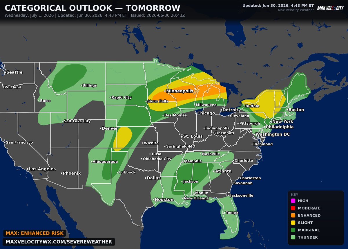
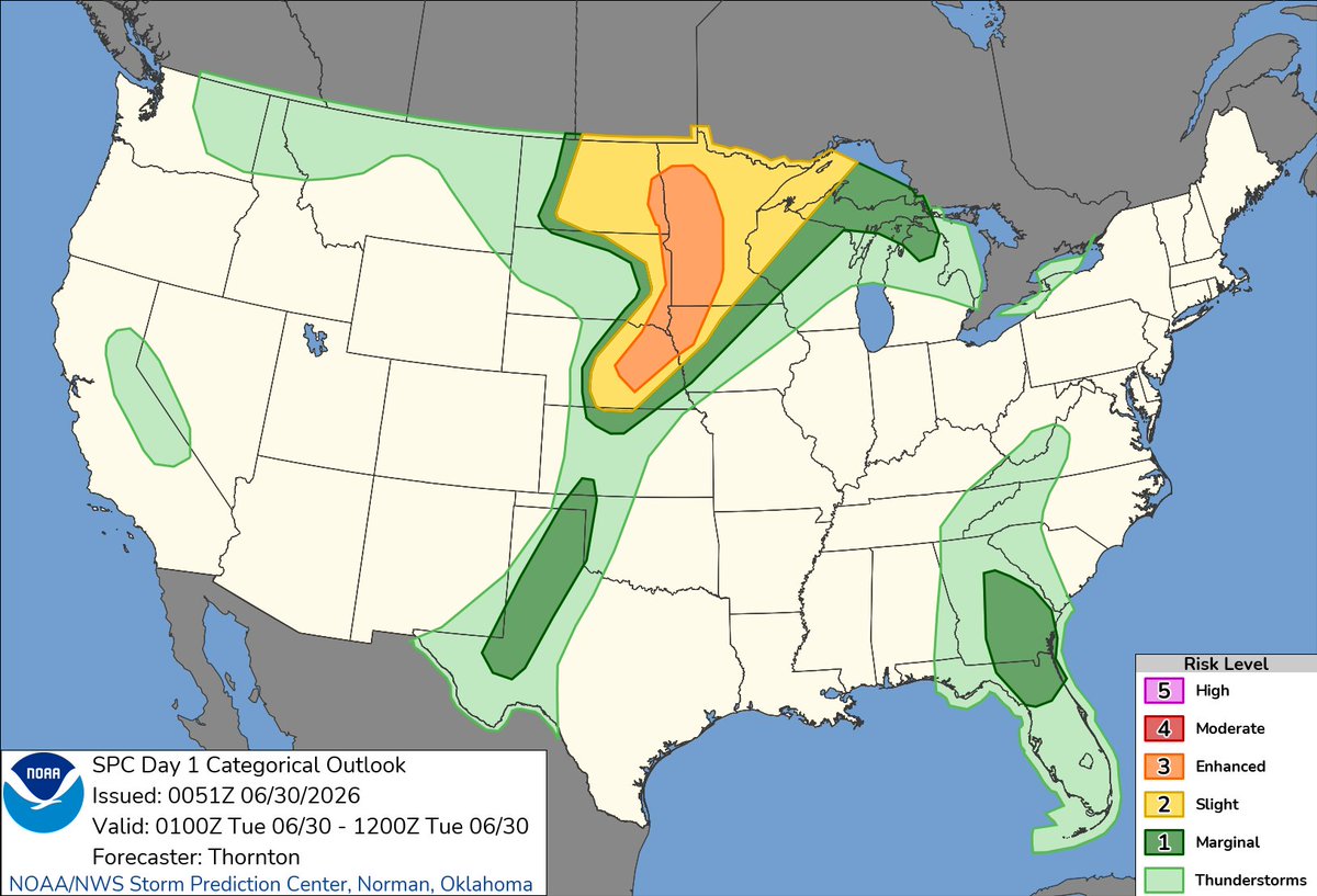
There is now a level 3 risk for tomorrow extending from southern Minnesota all the way into northern Michigan. Multiple rounds of severe thunderstorms will be possible as an upper-level shortwave trough moves through the region, triggering supercells that will be present in a moist and unstable airmass.
A mesoscale convective system (MCS) may already be moving through the region during the early morning hours in southern Minnesota. If this is the case, it would be moving east-northeast along an quasi-stationary boundary, presenting a damaging wind and large hail threat. If this is not the case, and morning activity is instead weak, it would not lessen the threat any due to Round 2.
Round 2 comes in during the afternoon with intense convection expected to fire once again over southern Minnesota. These early discrete supercells will be capable of damaging winds, large hail, and perhaps a couple of tornadoes before they eventually grow upscale into a fast-moving, bowing MCS. This MCS will carry with it wind gusts potentially up to 80mph throughout the overnight hours as it goes through Wisconsin and Michigan. It is important to have a way to receive warnings as it will likely come through at a time most would be sleeping.
Checkout this branchless lightning strike in front of the Rossburn, MB tornado. It was the only strike of lightning I saw during the entire 30 minute dance.
Sadly the warnings going off on my phone muted the sound very early into the pursuit.
The remote northwestern Ontario community of Kasabonika Lake First Nation declared a state of emergency over the weekend and began flying out its most vulnerable residents due to surrounding wildfires.
https://t.co/RVbTnb3Iva
Scattered severe thunderstorms are probable over parts of the central High Plains, with severe wind gusts (60 to 85 mph) being the primary hazard during the late afternoon and evening. Visit https://t.co/VyWINDk3xP for the latest.
A professional storm chaser doesn’t cry on social media about wasted environments, setups underperforming, and violent tornadoes not happening.
A professional storm chaser should be grateful to be in the field, being a part of the warning process, and realize that those busts were possibly someone’s home not being slabbed.
If you want to be a pro suck it up and do the grind for the process.
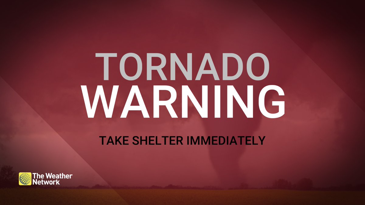
A TORNADO WARNING has been issued in Manitoba for:
- Mun. of Pembina incl. Manitou La Rivière and Snowflake
- Mun. of Louise incl. Pilot Mound and Crystal City
Take shelter immediately, if threatening weather approaches.
#MBStorm#MBwx