Field-based Sedimentologist || Seismic hazards and Surface processes || Science and Technology Research Institute for DE-Carbonization (STRIDE-C), NTU, Taiwan
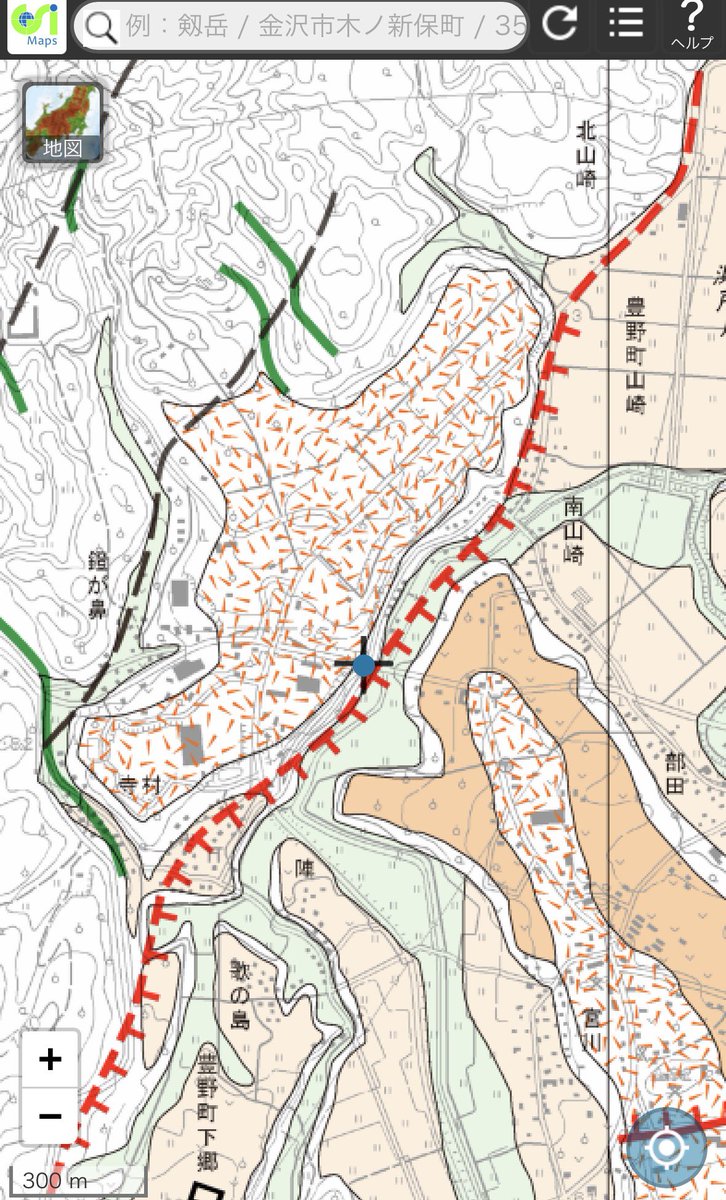
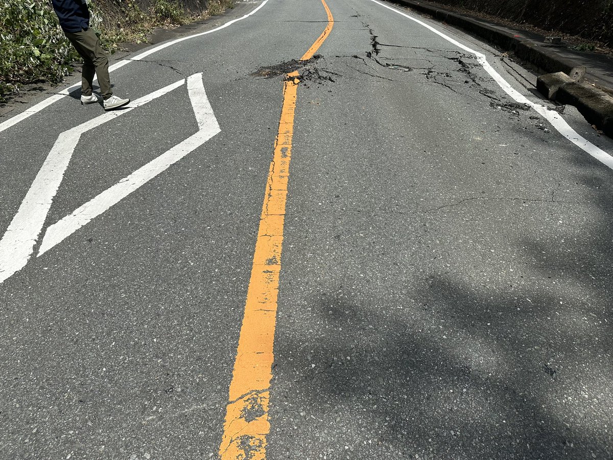
Preliminary results of InSAR and field survey for the Jan 21 M6.4 Dapu Earthquake, Taiwan. Although there are lots of building damage reported, surface deformation is not widely present. So far, limited surface rupture is only seen at the mid-south part of the Kouhsiaoli Fault.
@patton_cascadia The joint investigation team (Drs. Feng Shi and Mingjian Liang et al.) of the Sichuan Bureau, Xizang Bureau, and the Institute of Geology found that the co-seismic vertical displacement of the Dingri earthquake was as much as 3 meters.
Source from https://t.co/iLTBUSOgzA
Our paper is out!!
Fukushima, Y., Ishimura, D., Takahashi, N., Iwasa, Y., Malatesta, L.C., Takahashi, T., Tang, C., Yoshida, K., Toda, S.
Landscape changes caused by the 2024 Noto Peninsula earthquake in Japan | Science Advances https://t.co/l0UKgwrUTz
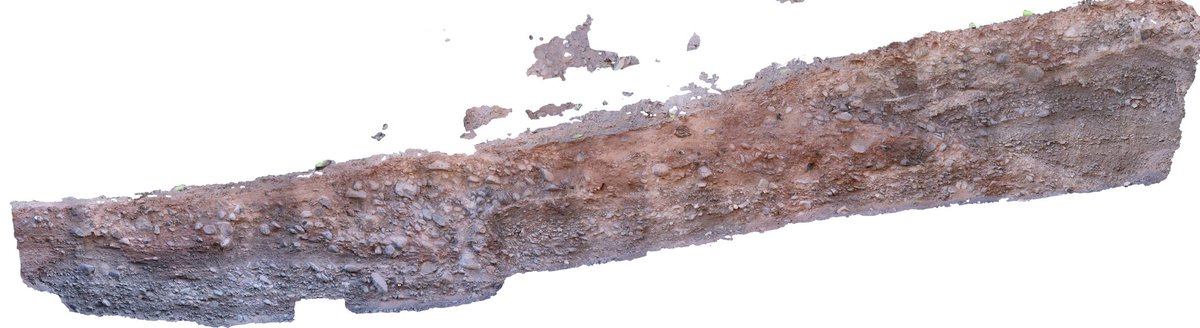
Wow that is indeed a great trench. Apart from the most recent rupture, I wonder if the ramp-like offset in the left part involves some degree of strike slip? Those tilted gravels look like slightly to moderately rotated…
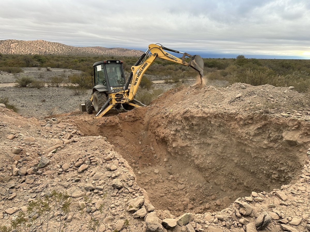
Another successful trench along the Las Chacras Fault.The 1977 M7.4 Caucete earthquake produced two shocks within 20s interval and claimed 64 lives. The fault responsible remains unknown, while Las Chacras proximity to the epicenter makes it ideal for paleoseismic investigation
A new #SRL editorial by @GFZ_Potsdam and @USC scientists argues that sea level rise driven by global warming will drive an increase in earthquakes in coastal regions, particularly where faults are already highly stressed.
https://t.co/1PQbBrCUJG
Forecasting Earthquake Ruptures from Slow Slip Evolution?
That's the heading of the @AGU_Eos Editor's highlight for @DuoLi1 and my recent @theAGU Advances paper, however, our story is not that simple ... 👇 [thread]
https://t.co/wMzNerVs2j
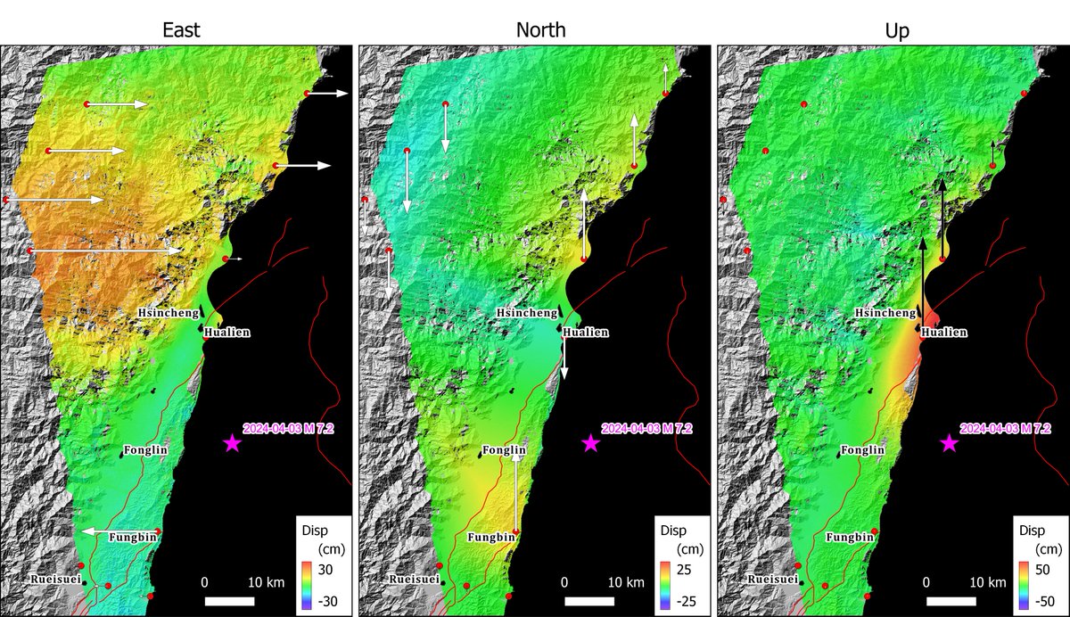
The reconstructed ground deformation field from ALOS-2 #InSAR results shows a clear vertical motion pattern along the coast near #Hualien city, after the Apr-2 #Taiwan#earthquake. This result is generated by Dr. Yunung Lin in IES, Academia Sinica.
the Automatic Sentinel-1 DInSAR coseismic Interferogram and LOS Displacement map (Ascending Pass) for the recent seismic in Taiwan with a magnitude of Mw 7.4, is available on @EPOSeu geoportal @CnrIrea@FraxInSAR@claudiodeluca@SimoneAtzori73@dott109
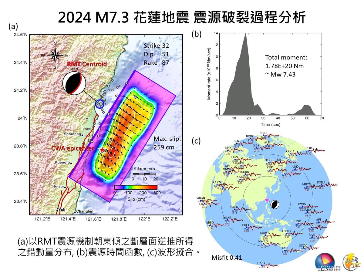
So far the west-dipping solution shows a better match on the location of the centroid and distribution of aftershocks, as well as less misfit of waveform.
I’ve been wondering whether it’s a west or east dipping fault (at least for the mainshock). Field observation, GPS, and records from gauge stations all suggest it might be a west-dipping event. Upcoming image analyses should be able to clear up this a bit.
@JudithGeology New preliminary inversion results by Dr. Shiann-Jong Lee at Academia Sinica suggest that a "west-dipping" fault may better explain the location of centroid, waveform pattern, and the distribution of aftershots.
This is exciting!
https://t.co/I8H3CUA9kb
Inversion results from Dr. Shiann-Jong Lee, Academia Sinica.
w/ east-dipping plane
(a) slip distribution & centroid
(b) time series
(c) wave form misfit
Flew into Tokyo last night to say farewell to Yoko Sensei today. When we browsed her field notes and off prints in the ceremony this morning, notifications of M7.2 EQ in Taiwan popped up. The off print we were flipping through is “Field surveys of Chichi earthquake in Taiwan”.
Sad to learn that our beloved Yoko Ota sensei is now in a better place. She is a great mentor, remarkable role model, and most importantly, a longtime friend for a lot of us.