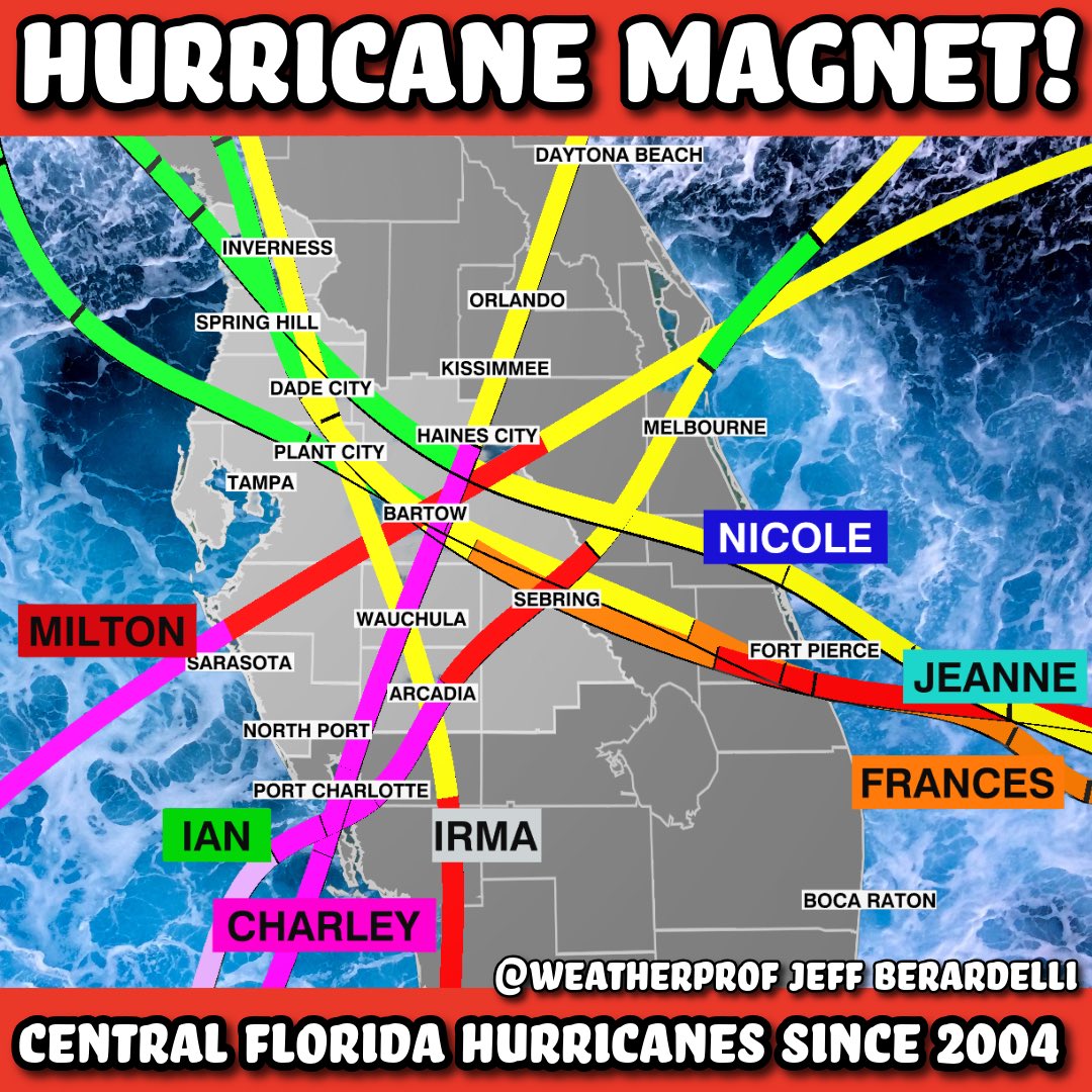
Central Florida is a Hurricane Magnet!
How many of you have experienced one of these storms? It’s remarkable - almost hard to believe - that all these storms in the past ~20 years have passed right over the same area! I did a #hurricane talk in the Davenport/ Haines City/ Kissimmee area this week and I showed this graphic. When we think about hurricanes the coast always comes to mind, but inland areas have been very hit hard! So, the lesson is: no matter where you live in #Florida you must always be prepared. Hurricane season starts in 3 days.
SAHARAN DUST 🏜️🐪 It's that time of the year again! Plumes of dust will be heading west from Africa over the next 2 weeks...some of which could head aloft into the United States. Helps to suppress tropical activity in impacted areas and can lead to an extra vibrant glow at sunrise & sunset. Here's the latest model:
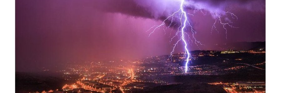
Classic example how #lightning can strike more than 7 miles from the parent thunderstorm. Bottom line. If you can hear thunder you can be struck by lightning.
📷 JoshFL over Estero Bay last night. #Florida
Great visual that shows why the Atlantic Hurricane Season is "officially" June 1st to November 30th. Out of 1,773 storms that have formed across the basin since 1851, nearly 97% have been during those months.
❄ April 2026 saw the second-lowest Arctic sea ice extent for April in the 48-year satellite record, at 4.8% below average. In the Antarctic, sea ice extent was about 10% below average, ranking 11th-lowest for April. Sea ice insights in #C3S Climate Bulletin.⬇️
#CopernicusClimate
📌LANDFALL: Category 4 Typhoon Sinlaku has directly hit the islands of Saipan and Tinian, with maximum sustained winds of 145 MPH and a core pressure of 930 MBAR. Early footage shows damaging whiteout conditions and waist-deep floodwaters are ongoing as both the inner and outer eyewalls rake across the islands.
Sinlaku is one of the strongest Typhoons to make landfall in the southernmost Mariana Islands.
The JTWC has retroactively upgraded Super Typhoon Sinlaku’s peak intensity earlier to 185 MPH (300 KPH) and 890 MBAR.
Over the darkest depths of the Pacific Ocean today, we have witnessed this storm close in on the meteorological upper echelons of cyclonic fury.
Holy cow.
What we are seeing with Typhoon Sinlaku right now is one of the most extreme satellite presentations Earth is capable of constructing.
Look at the absolute perfect symmetry of the storm’s convectively cryogenic core. You only see this with some of the planet’s most powerful cyclones, and it is reminiscent of Hurricane Melissa’s appearance last year. Just completely insane.
JUST IN: Cyclone Maila has reached Category 3 Major Hurricane-equivalent intensity, becoming the FIRST ever Cat 3+ Cyclone to either form or traverse through the Solomon Sea on record.
At least going back to the start of the satellite era, she is a completely anomalous storm for this part of the planet.
The full life of Hurricane Catarina, which made landfall 22 years ago today, from just after its subtropical transition through landfall. To this day, Catarina remains the only bonified tropical cyclone in the South Atlantic on record.
🚨⚡️A rare video of a meteorite hitting the Moon is going viral worldwide
Because the Moon has no atmosphere, meteorites don’t burn up on impact like they do on Earth
24 hours of infrared satellite imagery over the Middle East last night, showing the explosion of piercingly cold Persian Gulf supercells and their subsequent impacts in Qatar, Oman, and the United Arab Emirates.
An incredibly stormy night for this normally dry, sun-scorched region of the world.
2.5-minute #Himawari9 Infrared images showed the large eye of Category 4 Cyclone #Narelle as it approached North West Cape in Western Australia: https://t.co/HWUTSVsWDm
Cyclone Narelle is back.
With her winds rising above Category 1 strength and dual hot towers rotating around a new and larger core structure, this storm is steadily intensifying once again. A landfall in Learmonth, Australia is less than 30 hours away.
(Sat-image credit: Windy)
Cyclone #NARELLE may circumnavigate ~3/4 of Australia over the next 2 weeks. 🔄🌀
Another important call out: she’s spinning clockwise in the Southern Hemisphere!