We’ve been acquired by @Indigoag, a partner that shares our mission to help build a more sustainable global food system. We look forward to continuing to work with you and creating even more robust agricultural intelligence. Follow us @Indigoag https://t.co/llfGZjUcyp
Go behind the scenes to hear @indigoag co-founder Geoffrey von Maltzahn explain why TellusLabs is Indigo’s first acquisition. https://t.co/pcOJ1S3Igq And follow @Indigoag to learn more.
We are thrilled to announce we’ve been #acquired by @indigoag, a company that shares our global vision for helping growers more sustainably feed the planet.
Learn more:https://t.co/llfGZjUcyp
A beautiful EVI multitemporal composite image of Northern Arkansas to kick off the weekend. Red band is early season, green band is mid-season, and the blue band is late season. #RasterFriday
Somerville-based @TellusLabs makes technology to map the world’s food supply. We down with Co-Founder and CEO @david_potere to learn more about the company’s story, as well as the details behind their #AgTech solution.
https://t.co/jIWAwh4nGT
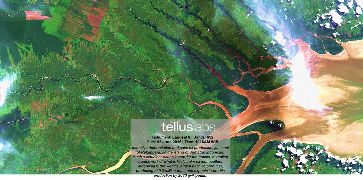
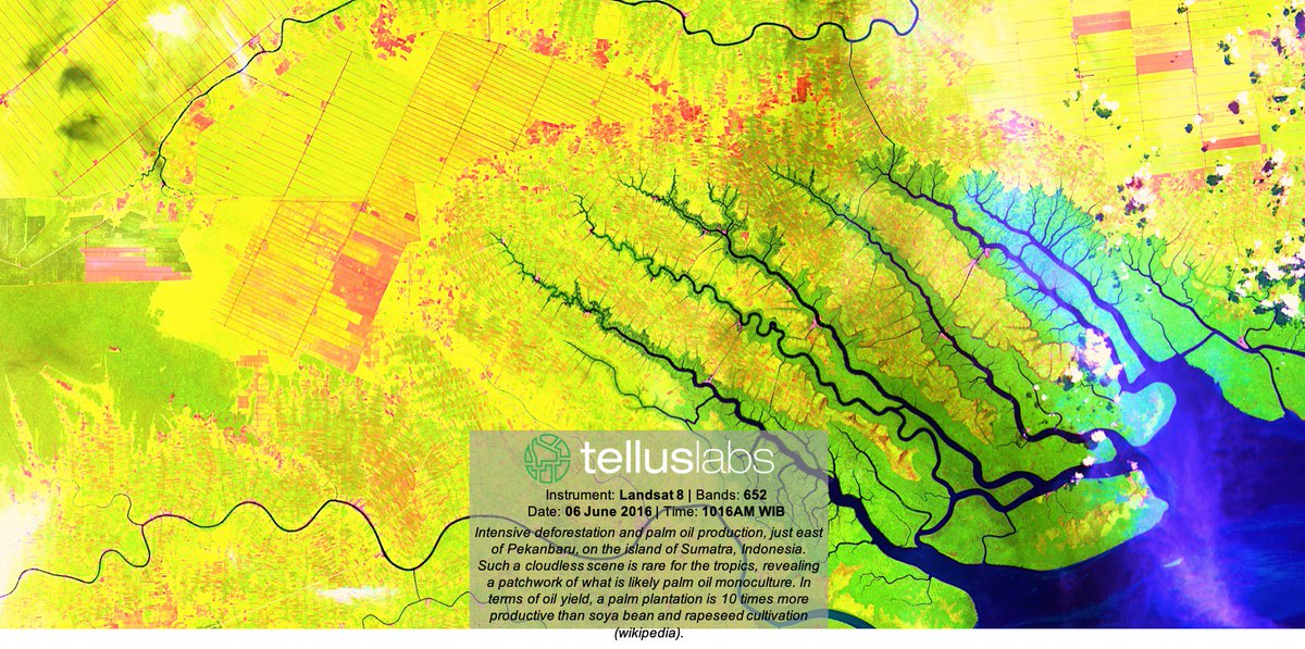
Intensive deforestation and palm oil production, just east of Pekanbaru, on the island of Sumatra, Indonesia. Created using @NASAGoddard's Landsat 8 instrument, Bands 652. View this and more in your free #Kernel account today! #RemoteSensing https://t.co/hhyptPvoLI
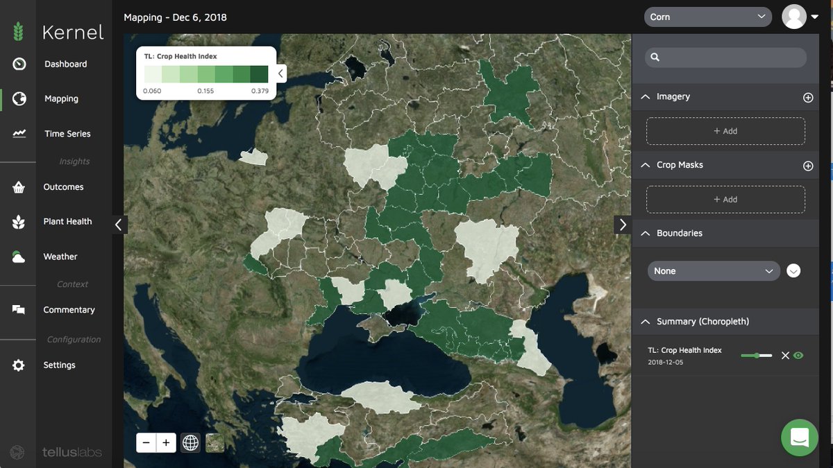
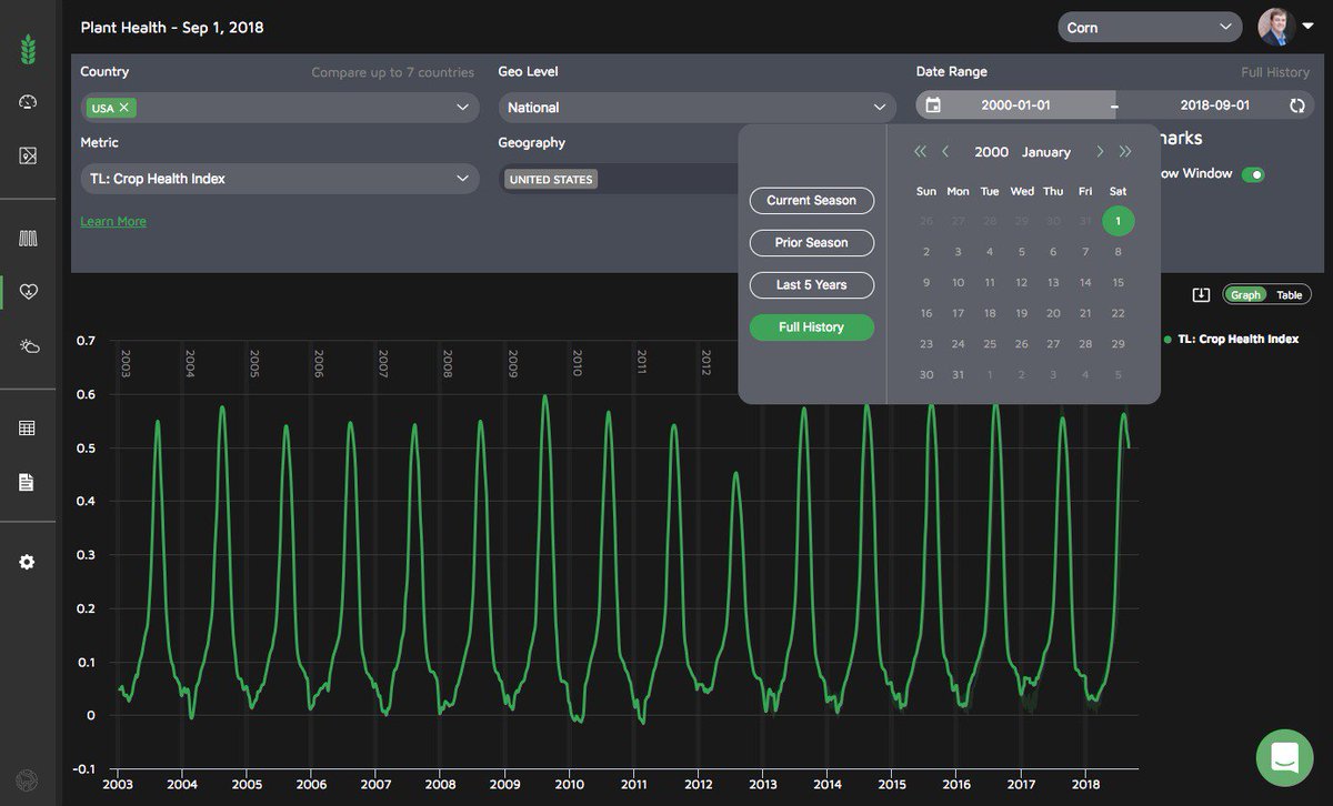
A look into the heartbeat of the U.S. corn crop through our own TellusLabs Crop Health Index. The entire 15-year history of daily insights is available via #Kernel. Sign up for your free account today! https://t.co/hhyptPvoLI
Another beautiful image taken over Lake Clark National Park (just west of Anchorage) created using @NASAGoddard's Landsat 8 instrument, bands 543. The vegetation shows through in red, while the ice and snow show as blue & white. #RasterFriday#RemoteSensing
Another beautiful image over Lake Clark National Park (just west of Anchorage) created using @nasagoddard Landsat 8, Bands 543. Vegetation shines through in red, while the surrounding… https://t.co/jCj3z4d91D
A new tool uses @NASA satellite imagery to take the predictions to a whole new level — to near-perfect, in fact...Months before harvest, @TellusLabs Kernel’s projections were all within 1% of @USDA’s actual reported yields https://t.co/KHPKuJx99C #predictiveanalysis#agdata#ag
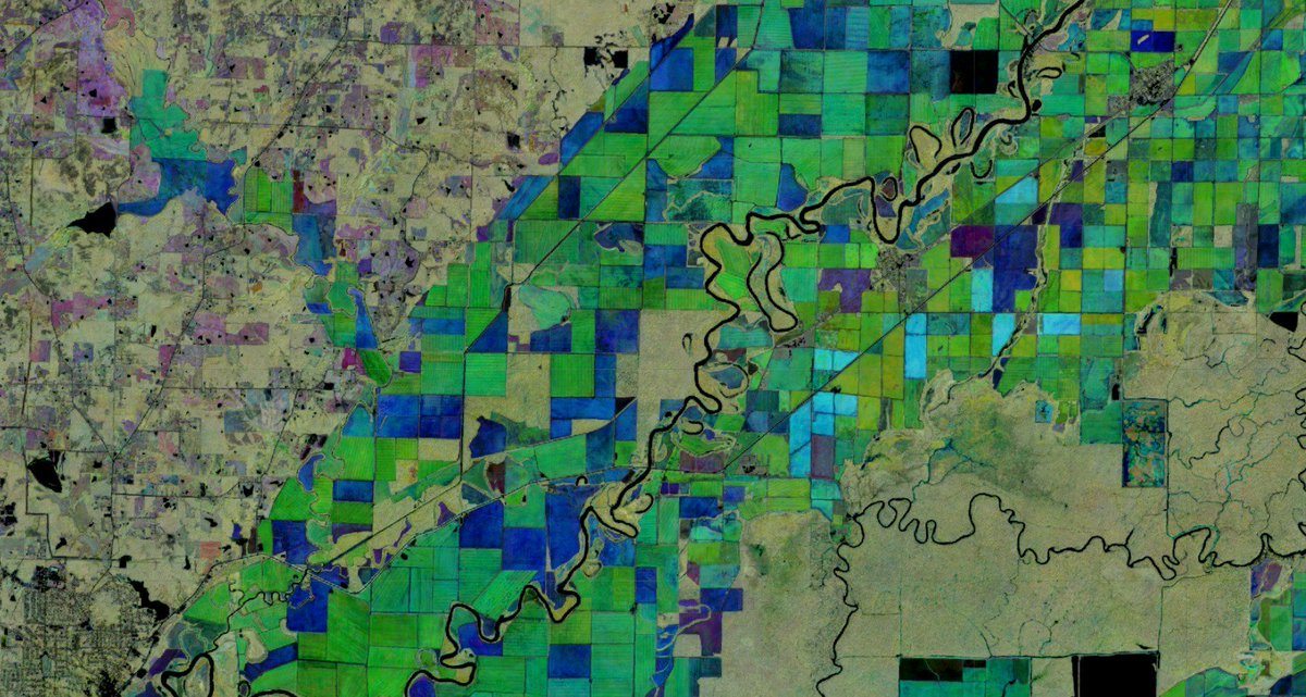
More auto-delineated field boundaries using multi temporal EVI imagery, with the last image highlighting seasonal change detection. #RemoteSensing @ Arkansas https://t.co/QMziH0W3EY
As winter slowly invades Boston, a vacation to the warm Brazilian coast starts to sound extremely enticing.
Sign up for your free two week Kernel trial today! Zero strings attached. #TryKernel https://t.co/6eBeeHYJWl