⚡Striking Cartography⚡ How can I help you? ツ Currently: Web GIS @greeninfo | Previously: Transportation, Telecom, Defense, Disaster, and Academic GIS. He/Him
@jbfja Hey! I've really been enjoying exploring visual spaces in https://t.co/rj1wrlZBAr, but it's been slowly degrading over time. Now I see lots of 500 server errors in the console. Are you still maintaining the project? Thanks!
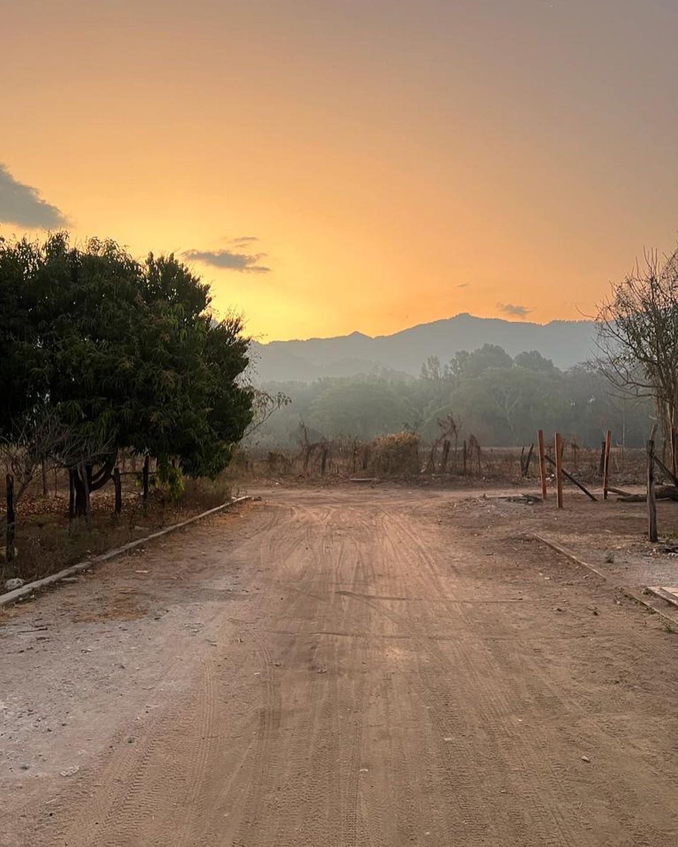
This week we are excited to announce the release of four microlots from Mexico. These coffees represent the hope and goal of establishing meaningful relationships with small farms in the country.
https://t.co/ZUvR1wH1VM
#Mexico#coffee#vermont
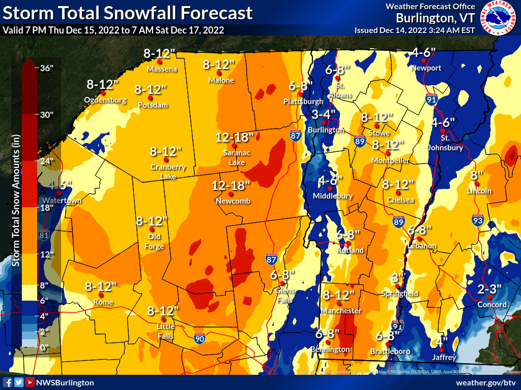
A winter storm watch has been issued for Northern New York and most of Vermont. Our initial forecast is for 4 to 16 inches of snowfall with areas of higher terrain expected to receive the highest amounts of storm total snowfall.
After years of trying to help people choose appropriate zoom levels and feature filtering for their web maps, it is a real pleasure that we don't have to ask users those questions when they upload files to Felt. I have a new blog post about how it works: https://t.co/18769pSQjr
Our castle doodling game finally has a name!
✨🏰🌿 #TinyGlade 🌿🏰 ✨
If you are longing for some cozy meadows to build in, Wishlist the game on our freshly-baked 🚂-Steam-page-💨
https://t.co/d6LIw7mDki
(sound on 🔊)
New Faculty & Staff Spotlight Alert! Get to know Assistant Professor of GIS&T and Associate Director of GIS Professional Programs, Johnathan Nelson here: https://t.co/b7nlRnTKlk
#GISPP#Spotlight#UWMadisonGIS
⛏STRIKE THE EARTH! ⛏
The legendary Dwarf Fortress by @Bay12Games is out now for Steam and https://t.co/Mzy0XrjMUa
Steam: https://t.co/tmoSSzv88W
itchio: https://t.co/HmDhqEfBvO
@steveruizok Awesome, thanks! You've made an awesome tool. It's invaluable to me as a project manager of technical tools that I have to simplify and explain to clients. Thanks for all your great work!
@steveruizok Congrats on the launch of the new version! I've got a big multi-page board in v1, and I'd like to know if I can open it in v2. Is that possible yet?
Excerpt from "Railroad Commissioners' map of the State of Vermont" ([ca. 1908]) https://t.co/LKcr3fJRE7
[See something that needs more explanation? Please read https://t.co/aeyHggP7wN]
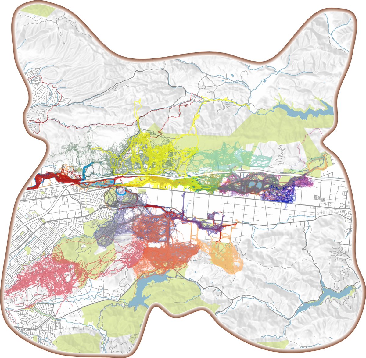
Yesterday our GIS team did a 30 minute #30DaysMapChallenge. We each chose one topic from the Challenge list and used 30 minutes to come up with a map that fit that topic! See the below for some examples...


![auto_mapic's tweet photo. Excerpt from "Railroad Commissioners' map of the State of Vermont" ([ca. 1908]) https://t.co/LKcr3fJRE7
[See something that needs more explanation? Please read https://t.co/aeyHggP7wN] https://t.co/0tNMRX7rWG](https://pbs.twimg.com/media/FiGlRO7WYAAy6ZH.jpg)