🔄ACTUALIZACIÓN SOBRE EL INVEST 96L
La circulación y estructura del Invest 96L luce muy saludable. Un aumento en el área de convección podría llevar al sistema a fortalecerse en una depresión tropical. Lo importante es que la ventana para desarrollo es de unas 36 horas adicionales. Desde el viernes comenzará a enfrentar vientos cortantes y aire seco.
Esto no cambia el panorama, los modelos continúan proyectando que pasaría cerca o sobre el noreste del Caribe entre el domingo y lunes como onda tropical.
Les daré una actualización con un video en la tarde.
Gracias,
Rubén García, Meteorólogo
#Invest #96L
The overall structure of #96L is fairly healthy, with some spiral banding and shallow convection firing even at the diurnal minimum. The biggest issue short-term is the dry/stable air just to the north that is getting pulled into the circulation, limiting the depth and coverage of the convection.
Unreal footage of glacier lake failure (most likely cause) near Nepal / China. I’ve seen many videos and from what I’ve seen it’s as bad or worse than any tsunami I’ve ever seen. Unreal.
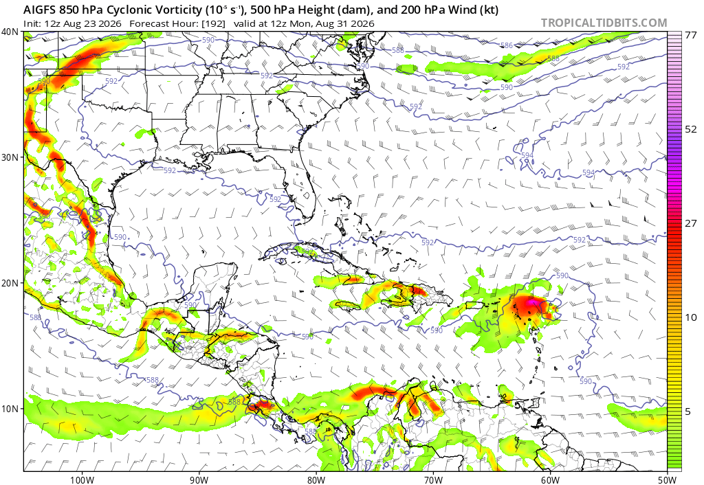
The latest 12z of the Google AI is out.
Invest 96L’s near-future forecast looks grim, but what happens after Day 5 is where we take notice.
Models, most notably the Google AI, perk up some in the Bahamas, and develop a disorganized wave as it treks west.
This is where these low-riding disorganized waves become a problem. If they don’t develop, they can survive just long enough to become a threat down the road. We’d almost rather them develop and just head straight out to sea. What the Google is depicting, we saw happen with Debby/Dorian. Ironically, this is another D-name. There is no confidence in any outcome out the moment, but this is certainly climatologically plausible.
It does hinge entirely on whether or not a wave even survives into this region of the Basin, but the environment here is much more favorable than it was a month ago.
For now, all we can do is watch, but there is no threat with this system until we know more.
Pulsing convection within 96L is doing its best to fend off all the nearby dry air. The window of lower shear is narrow and closing, so the next 48 hours seems pivotal. Tonight may be its best shot. Surface winds are already tropical storm force.
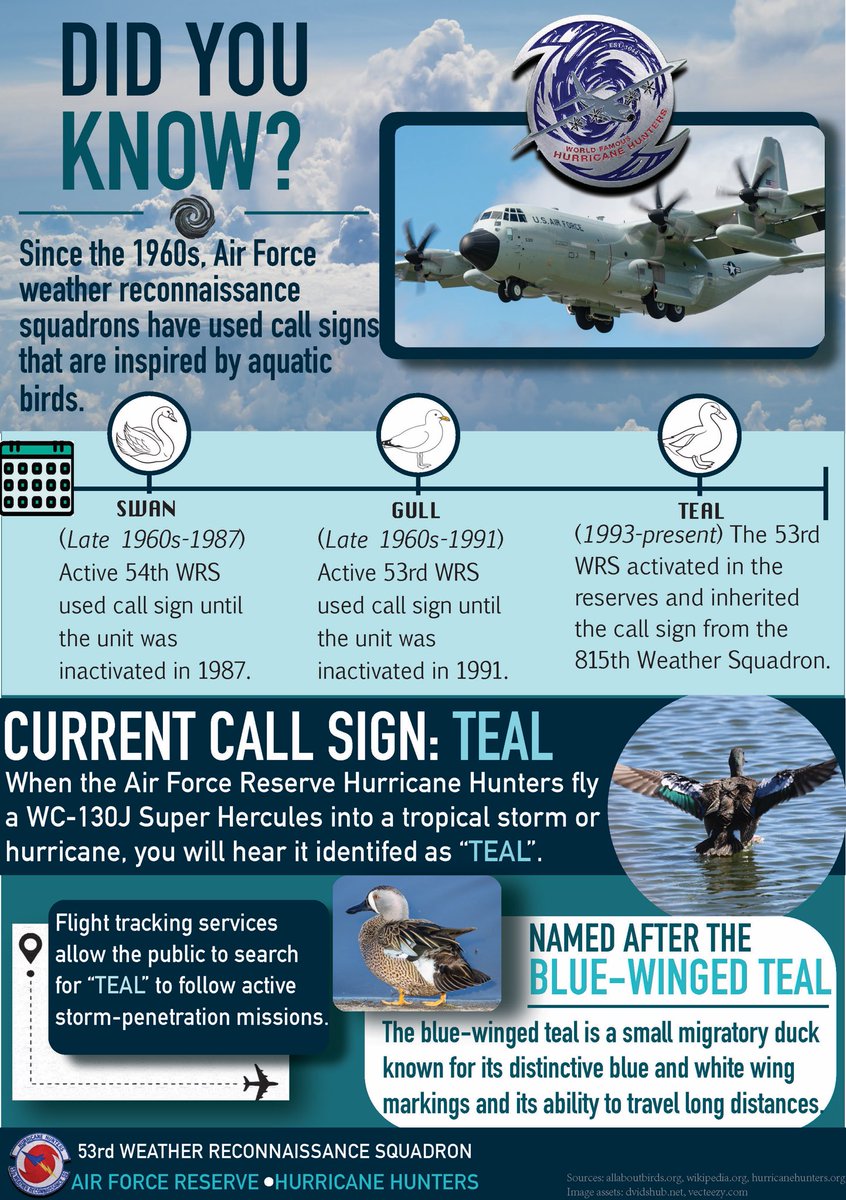
Did you know? 👀
When you see “TEAL” on a flight tracker, you’re not watching just any aircraft- you’re watching the Air Force Reserve Hurricane Hunters in action! 🌀✈️
📊Infographic by Staff Sgt. Stacey Thornburg
#WeatherReady#hurricanehunters#afrc
Substantial differences in solutions for #96L between HWRF and HAFS, despite modelling a similar short-term environment.
Both make a TC in about a day, but HWRF goes on to make a hurricane while HAFS shears it apart in a few days. I’d lean more into the latter’s solution here.
What's interesting is the AIGFS is much more muted on development, like other models, showing a weaker system limping towards the Lesser Antilles. This is a clue that the bias in MDR genesis is probably not an initialization issue (at least not primarily), but more related to the model physics.
TROPICAL UPDATE: I'm tracking 3 areas in the tropics with a chance of development. Next names are Dolly, Edouard and Fay. Here's the latest and what to know:
AREA #1: For the United States, the only to actually keep tabs on between the 3 areas. If trends continue, I expect the current odds of 30% to go up later today and also in the days ahead. Right now a handful of long range models have this curving north in the open Atlantic, but not all do. Some do bring it more west towards the United States. There's a huge spread in possibilities because 1) hasn't even formed yet and 2) it's far out into time, upwards of 10+ days. When looking at models that far out, especially over 10+ days, observe with caution. They can easily flip-flop and change. Look for consistency, especially after a center has formed and models have a more accurate take on it. Just watching for now, avoid any early online hype you may see.
AREA #2. No threat to the United States. Only impacts would be to eastern Canada, specifically Newfoundland, by late Tuesday into early Wednesday with fast-moving rain and some wind. Odds for development are currently at 20%.
AREA #3: No threat to the United States. A strong low in the Northeast Atlantic could become a subtropical or tropical storm this weekend before heading into Portugal and Spain on Monday. Regardless of development, it wil bring rain, wind and higher surf. Odds for development are currently at 20%.
I'll continue to keep you updated 24/7 with no hype, just the facts. Thanks everyone!
- Matt Devitt Weather
Une dépression est actuellement surveillée par le NHC (National Hurricane Center) au large du Portugal.
Actuellement non tropicale, elle aurait 20 % de chances de devenir une dépression hybride, avec des caractéristiques subtropicales, d’ici samedi à dimanche.
Sur les modèles, les cartes sont particulièrement impressionnantes, avec une belle rotation bien visible.
L’intensité devrait rester assez faible avec un système qui pourrait se rapprocher du Portugal en début de semaine prochaine.