Research scientist @metoffice and PhD student in the predictability of flooding from tropical cyclones @UniRdg_water | volcano and football fan | personal views
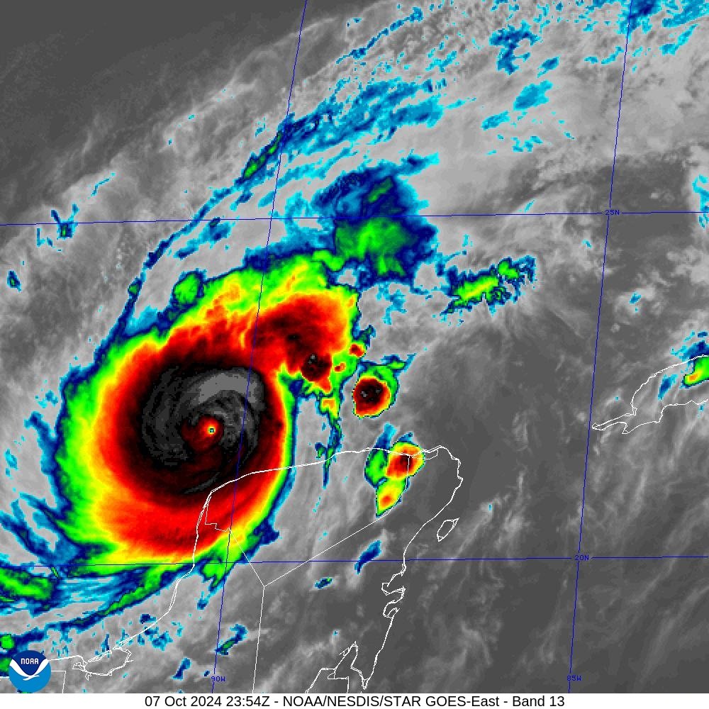
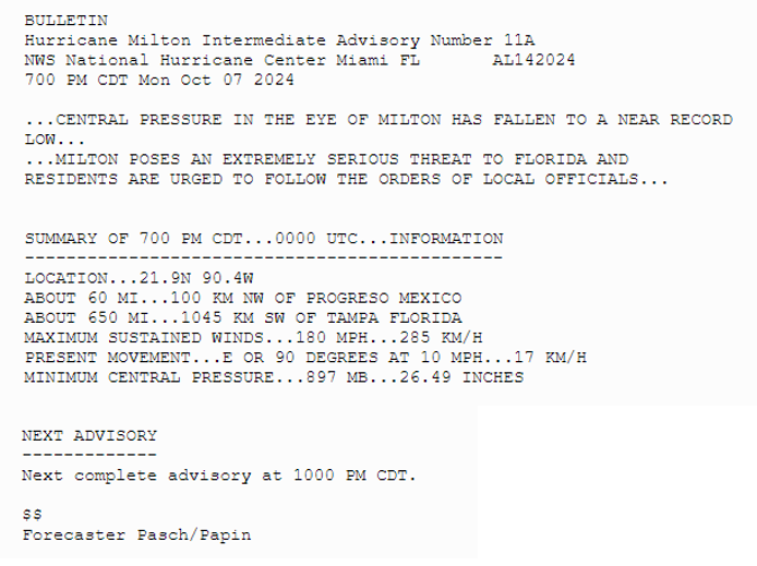
7pm CDT Oct 7th -- #Hurricane#Milton remains an extremely dangerous Category 5 hurricane with winds of 180 mph.
The minimum center pressure measured by a @NOAA_HurrHunter dropsonde was estimated at 897 mb.
Latest: https://t.co/LQEVorqXZH
Hurricane #Helene has made landfall on the Gulf coast of Florida with destructive category 4 sustained winds of 140 mph. A large storm storm surge is being experienced along the Florida coast, with heavy rain and strong winds pushing well inland into neighbouring Georgia.
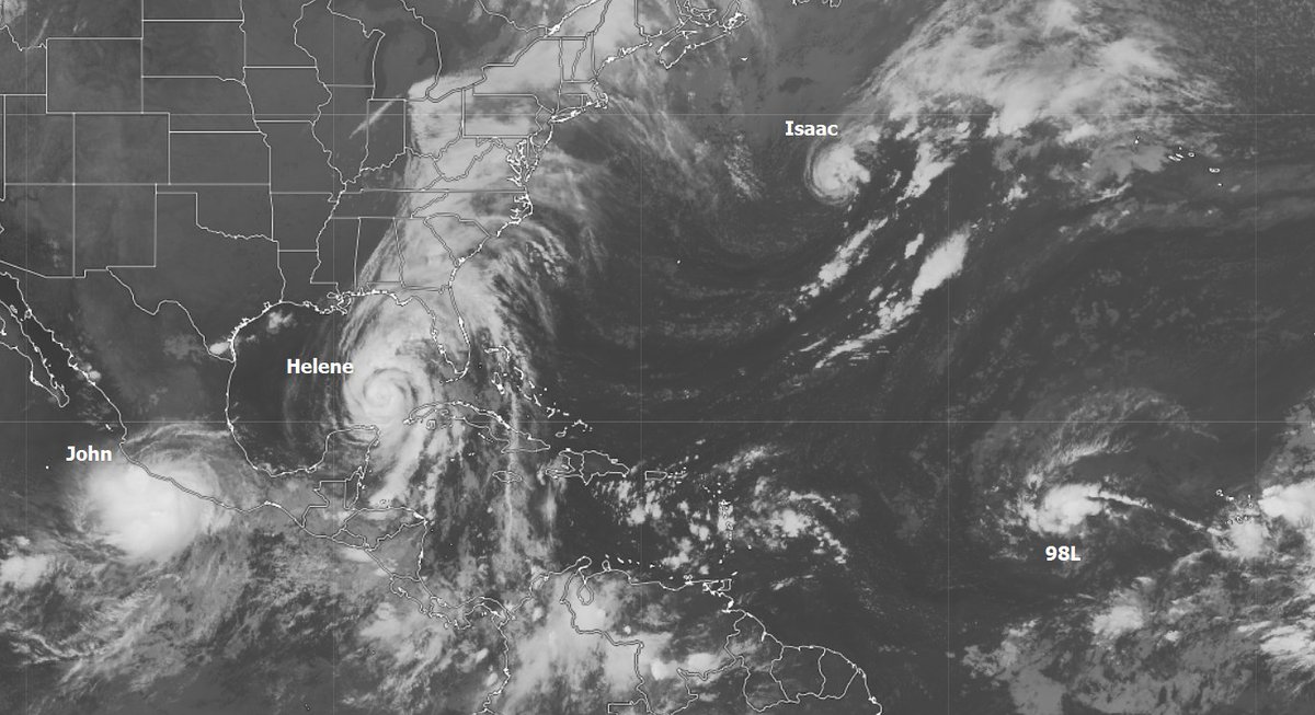
Recent view of Tropical Storm #John, close to regaining hurricane strength, Hurricane #Helene in the Gulf of Mexico, newly formed Tropical Storm #Isaac moving east in the central Atlantic and disturbance 98L with a high chance of soon becoming a tropical storm.
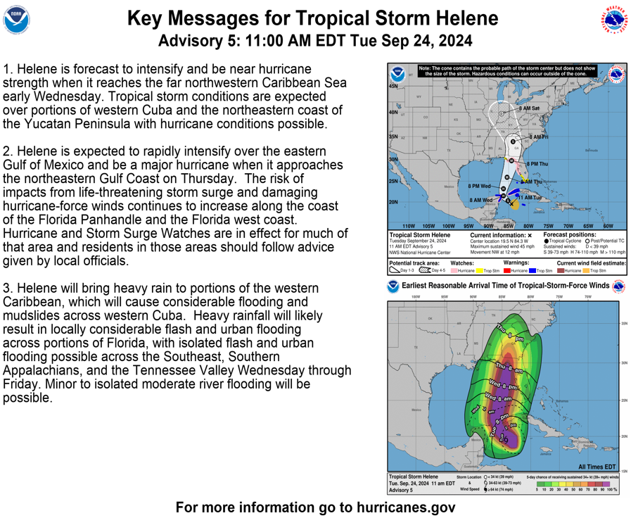
11 am EDT - Tropical Storm #Helene forms. Hurricane and Storm Surge Watches in effect for portions of Florida. Here are the Key Messages. https://t.co/tW4KeGdBFb
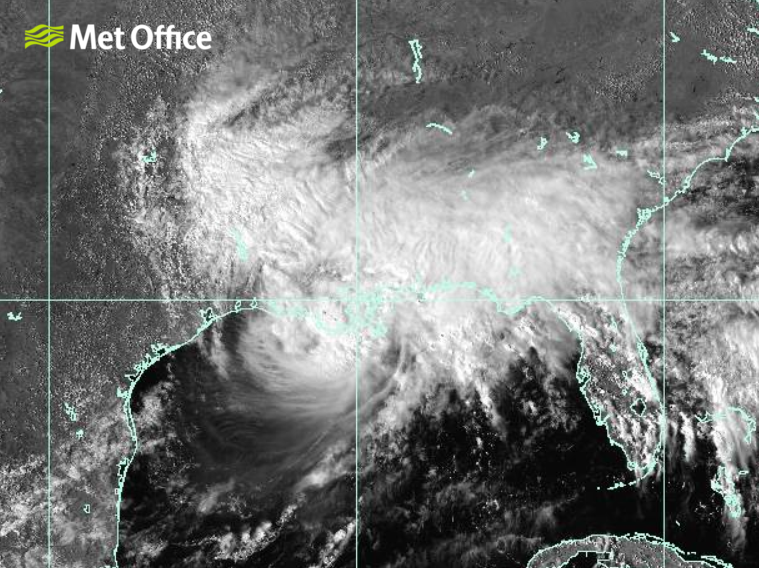
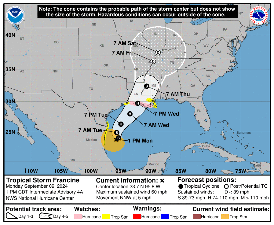
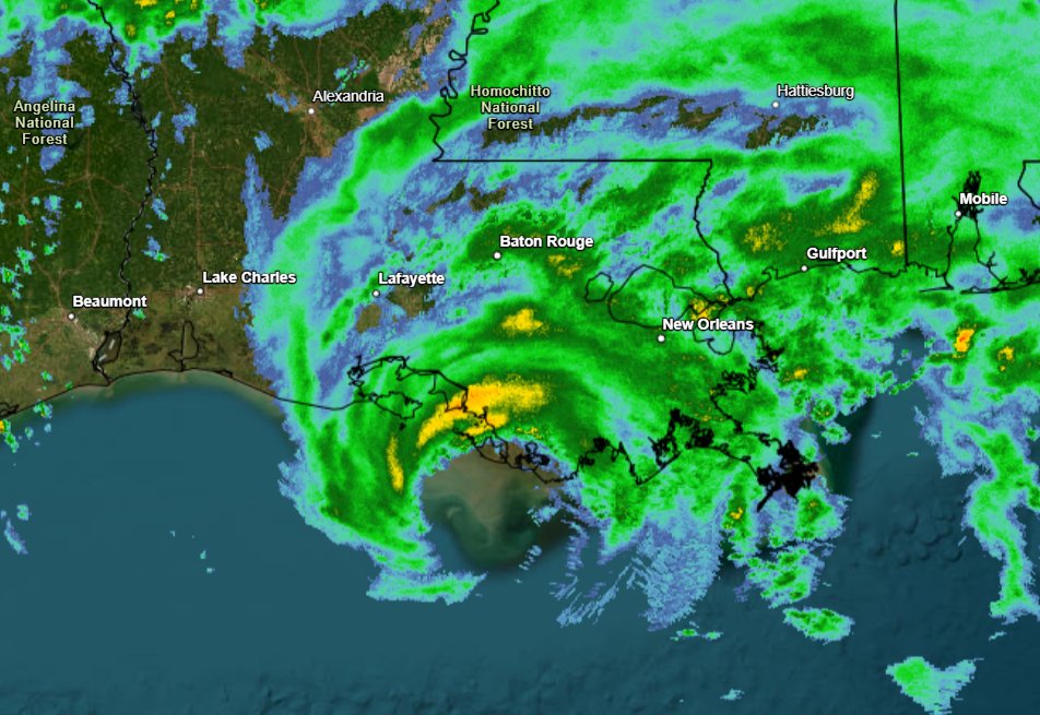
Exactly four weeks since the naming of the last Atlantic tropical storm, #Francine has formed in the Gulf of Mexico and is forecast to become a hurricane before landfall over Louisiana in the southern USA.
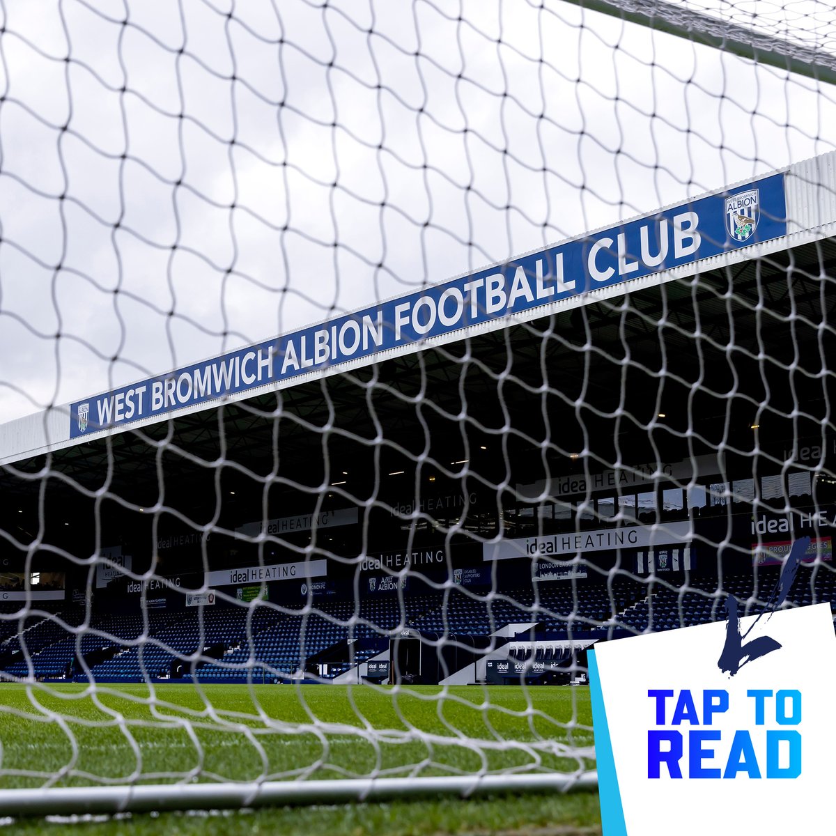
Wonderful news for my beloved Baggies. Finally free from the very real danger of us going out of existence with our current owner. Start of a new era 🇺🇸. Boing boing ⚽️🥳
Bilkul Football WBA, LLC – a company ultimately owned by Florida-based entrepreneur Shilen Patel and his father Dr Kiran C. Patel – has reached an agreement to acquire an 87.8% shareholding in West Bromwich Albion Group Limited, the parent company of West Bromwich Albion FC.
#StormHenk has been named and is forecast to bring very strong winds and heavy rain to parts of southern Britain through the day today
⚠️ Stay #WeatherAware
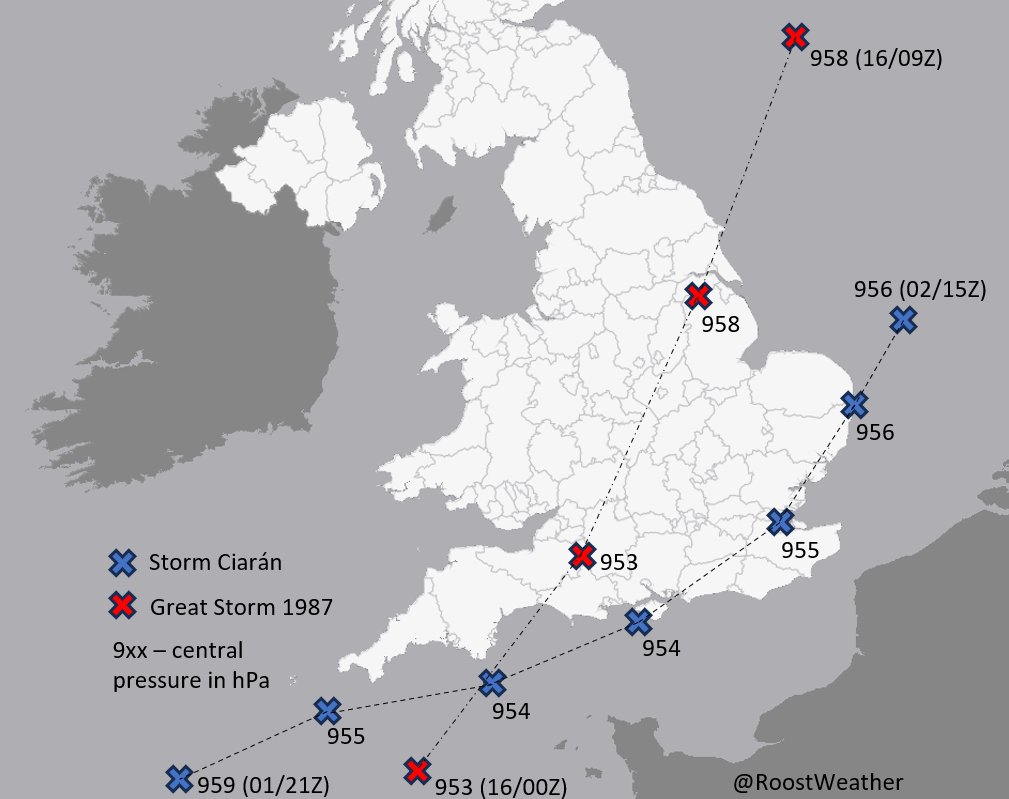
Comparison of #StormCiaran vs the 1987 "Great Storm".
Similar central pressure, but Oct 87 moved faster, had slightly stronger winds, and a more northerly track, bringing them across SE UK.
Most similar for NW #France and #Jersey (85-95kn at 5000' in Ciaran, vs 100 kn in 1987).
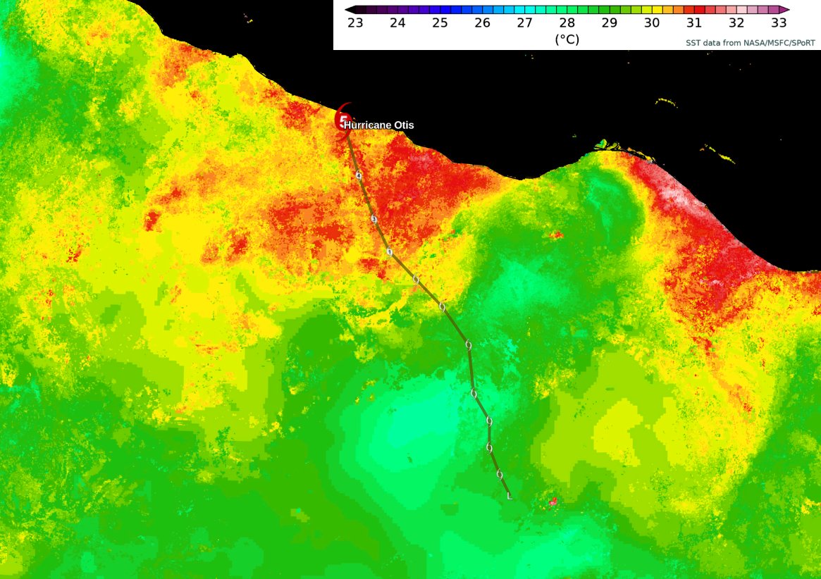
#Otis took full advantage of a warm patch of ocean last night... passing over 31°C water on its approach to #Acapulco. The extremely rapid intensification from a tropical storm to a Category 5 hurricane took place over this tiny area.
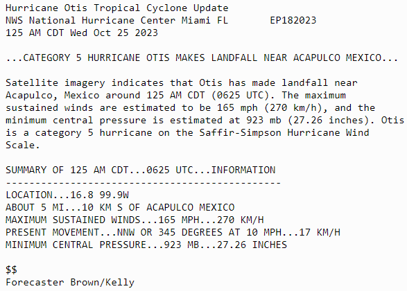
Thought long and hard about the word nightmare. But a rapidly interesting, category 5 headed towards a major city that was just a TS less than 24 hours ago. That’s a nightmare scenario as Max Mayfield used to preach 🙏
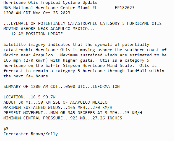
12 AM Update: Eyewall of Category 5 Hurricane #Otis moving ashore near Acapulco, Mexico. Maximum winds are estimated to be 165 mph. Otis is forecast to remain a category 5 hurricane through landfall within the next few hours
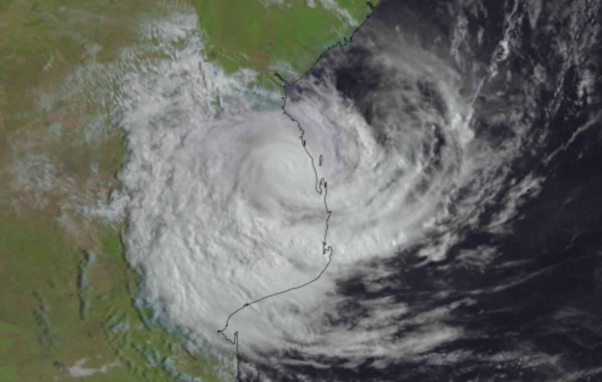
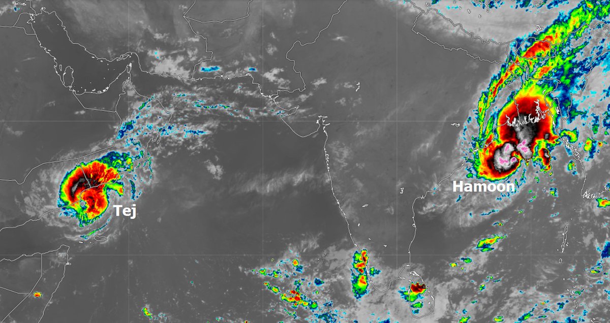
Cyclone #Tej is moving towards landfall later today over eastern Yemen. Rainfall totals of 400mm is possible in some locations over the next few days, which is several times the annual average in this usually arid region.
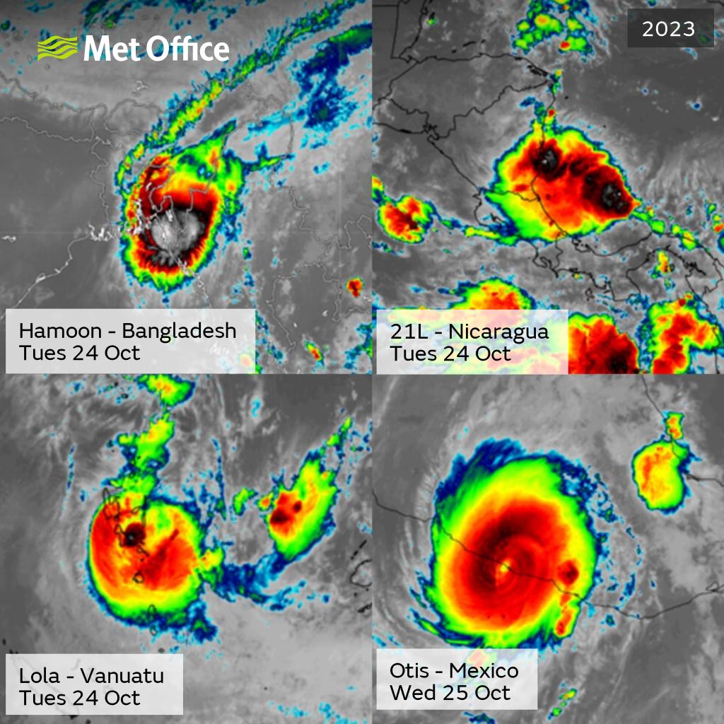
Satellite image shows Very Severe Cyclonic Storm #Tej about to make landfall over #Yemen and newly formed Cyclonic Storm #Hamoon, expected to make landfall over #Bangladesh later this week.
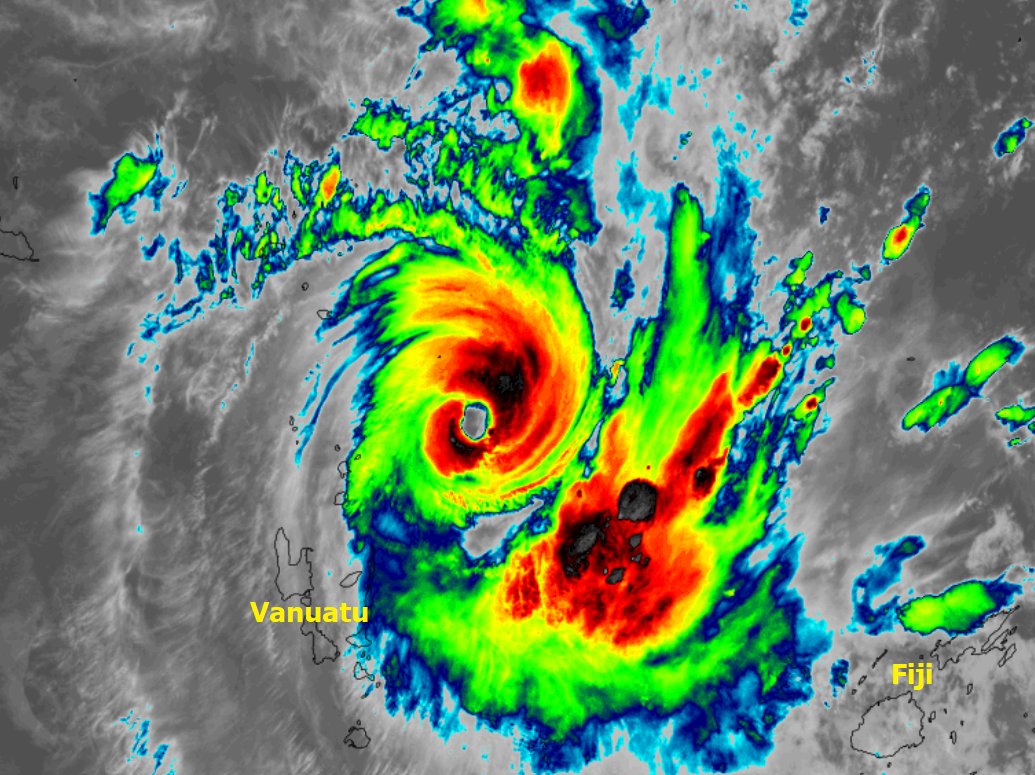
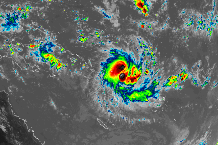
#Lola is now the strongest cyclone to develop this early in the South Pacific cyclone season for over 50 years. It is moving towards landfall over #Vanuatu tomorrow.
The Southern Hemisphere tropical cyclone season is under way with early season Tropical Storm #Lola forming in the South Pacific Ocean. It is expected to strengthen and pass close to the #SolomonIslands and #Vanuatu in the next few days.
Today, after 5 long years studying ensemble TC forecasting and early flood warning, I passed my PhD viva, and will soon be Dr Titley 🥳. Huge thanks to my wonderful supervisors @hancloke@liz_stephens and my lovely examiners @DrGVillarini @reinhardkh 🌀 #phdlife@MetOffice_Sci