LIVE from Yukon, OK with dangerous cold and several inches of snow causing big problems this Sunday on the roads! Wind chills of -10 to -20F through the night tonight with bands of snowfall continuing! Track winter alerts on the @RadarOmega_WX app
IT’S HAPPENING! Significant multi-round snow storm appears increasingly likely for a large part of Oklahoma Sunday through middle of next week, with impacts expected statewide. @ReedTimmerAccu will be all over this event, intercepting the heavy snow in OKC. #okwx
TORNADO rated EF2 from last night in Union County, Arkansas, produced by a very long track supercell that tracked through the Ozark Mountains. Tornadoes at night are especially dangerous, because they are often not visible and strike when people are asleep. @Tornadosafetx#arwx
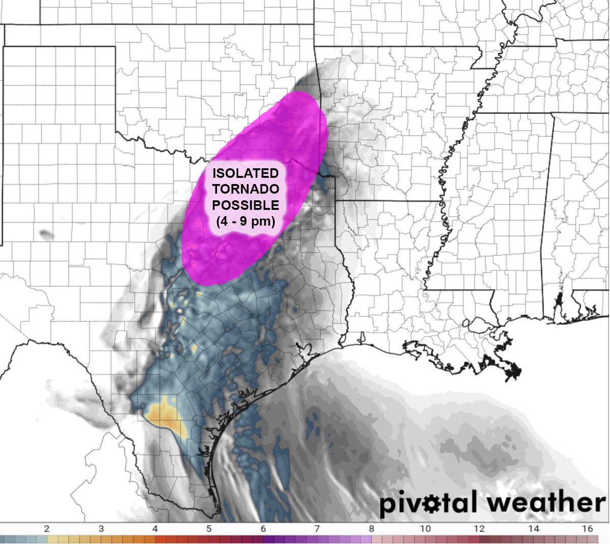
UPDATE: Isolated supercells with severe weather threat, maybe an isolated tornado, are likely this late afternoon/evening across Northwest into north-central TX, despite later arrival of upper-level system. While not as widespread, impactful severe wx still likely @Tornadosafetx
SUPERCELL and isolated #tornado threat this SUNDAY afternoon and evening from the Pecos Valley and especially into northern Mexico off the mountains. This is the beginning of a VERY ACTIVE severe weather pattern through next week from southern Plains through Dixie @Tornadosafetx
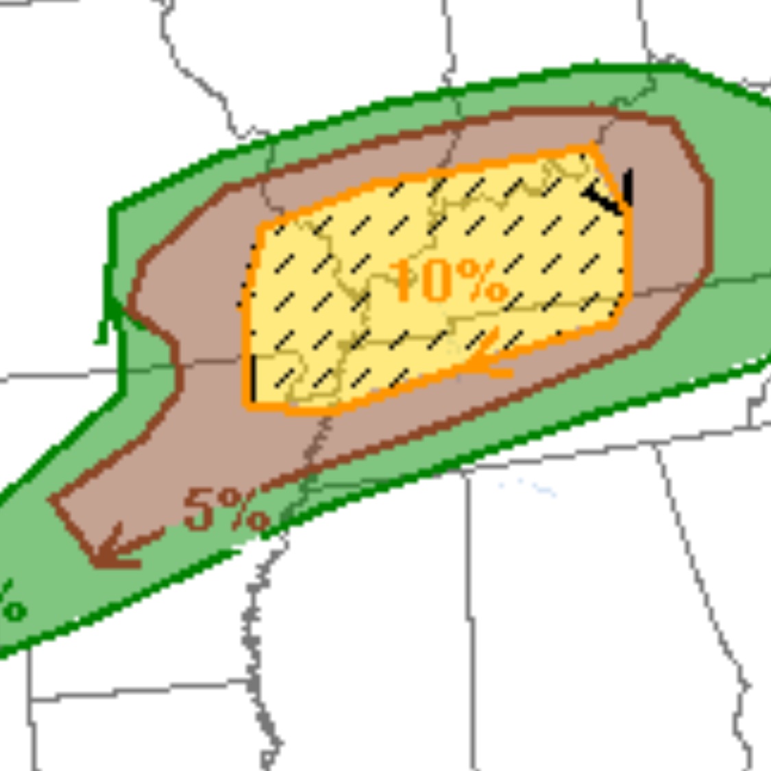
Risk of STRONG TORNADOES this afternoon and overnight is highest along warm front zone and along and just south of surface low track from southeast MO/northeast AR through kY, northwest TN into far southern IL and IN. Stay tuned to warnings and have a plan! @Tornadosafetx
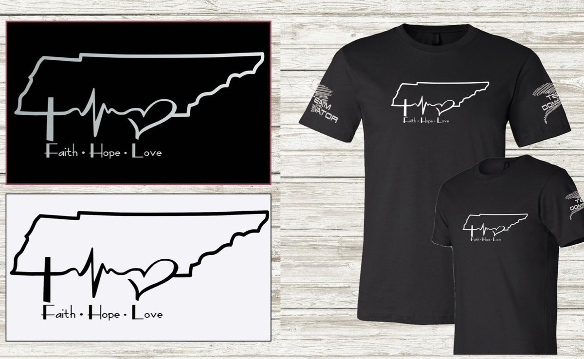
Check out these awesome tshirt designs for NASHVILLE STRONG with all proceeds in support of the #tornado recovery effort. Communities like Cookeville, TN need our help! Please SHARE!
https://t.co/NnHx9K5DPZ
NASHVILLE, TN impacted by damaging tornado late last night. Worst case scenario with strong #tornado impacting populated areas in the middle of the night. Here is a hi-res radar loop from @RadarOmega_WX @meteodon showing the long-track supercell on approach to Nashville #tnwx
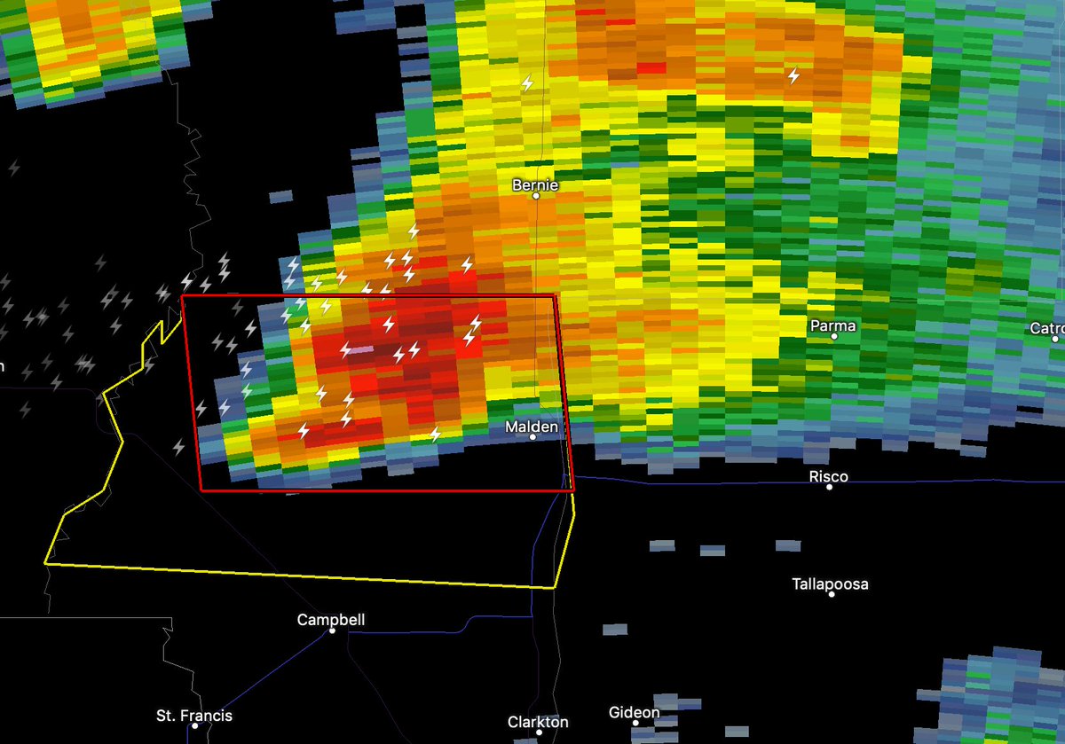
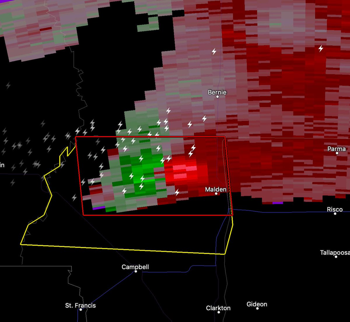
Dangerous #TORNADO warned supercell is heading toward Malden in southeastern MO any minute! This supercell is located just north of the AR border. Time is 1009 pm CST! @Tornadosafetx#mowx
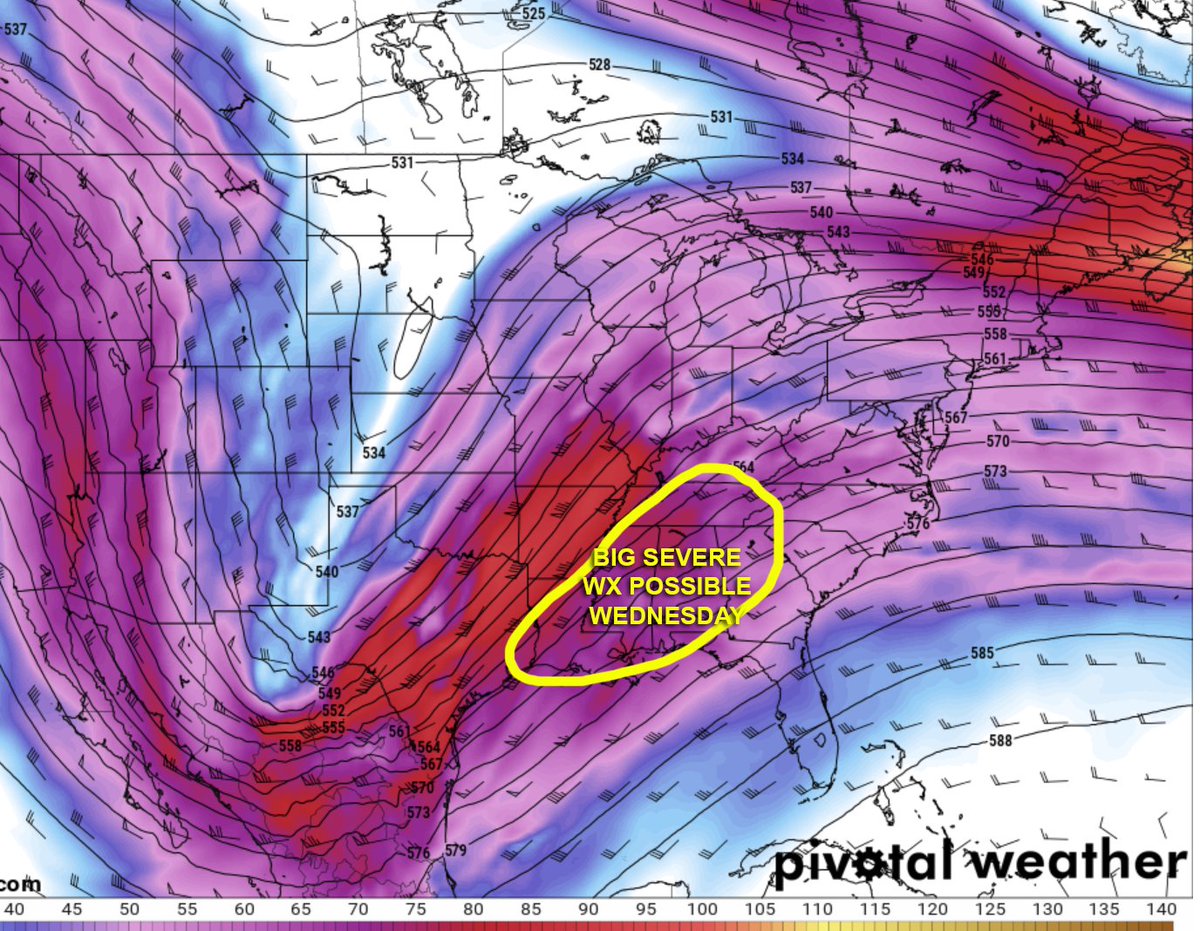
WATCHING Dixie Alley for severe weather potential the middle of next week (Wednesday, March 3, 2020) with upper-level system digging into northern Mexico before shearing out across the Deep South. Forecast model discrepencies still exist, but worth watching! @Tornadosafetx#mswx
TORNADO THREAT is greatest this afternoon (3-7 pm) across central/southern MS where a 50 knot low-level jet and modest instability axis coincide. A limiting factor for a more widespread outbreak is the relatively pinched warm sector but isolated tors expected @Tornadosafetx#mswx
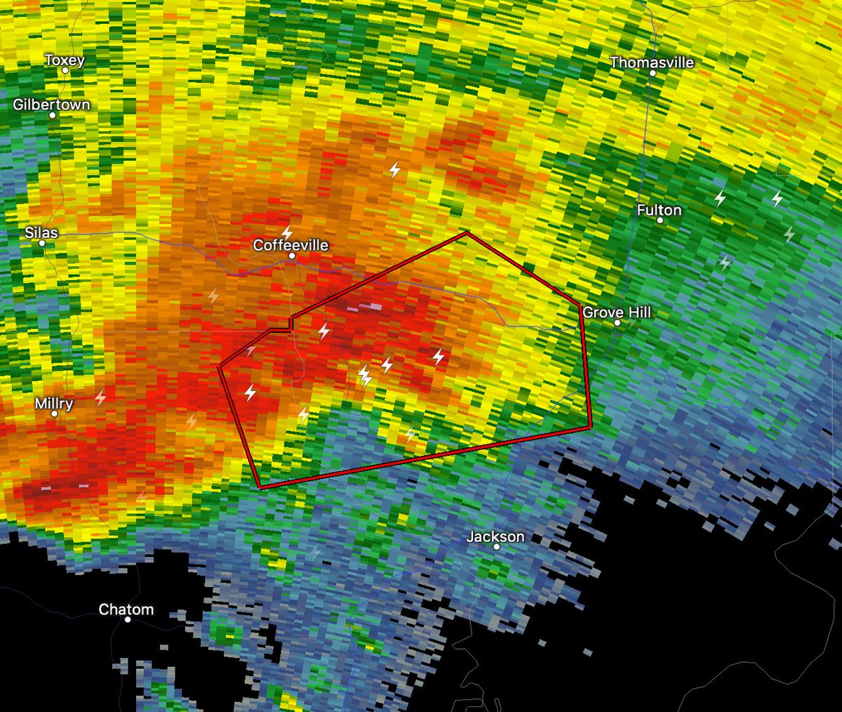
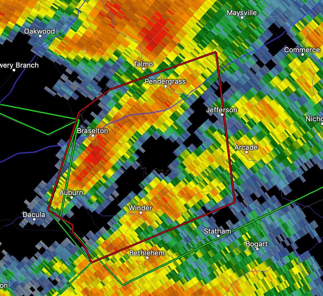
DANGEROUS high-precipitation or HP supercell with tornado warning is heading in the direction of Grove Hill, AL, with a tornado warning just to the southwest as of 7:33 pm CST! The large inflow zone (bright pink) of this couplet is a classic precursor for tornado development
NEW: Small but non-zero TORNADO POTENTIAL this evening as supercells are forecast to develop just prior to sunset even near the DFW area. The tail end of a strong LLJ could result in sufficient wind shear for isolated tornado or two. Stay tuned to watches/warnings! @Tornadosafetx
STORM CHASE MODE from Dixie Alley chase today, including long-range drone footage of a tornado warned storm north of Raleigh, MS which had a correlation drop on radar while lofting debris (tornado not visible here), aerial footage of beautiful Dixie Alley terrain @Tornadosafetx
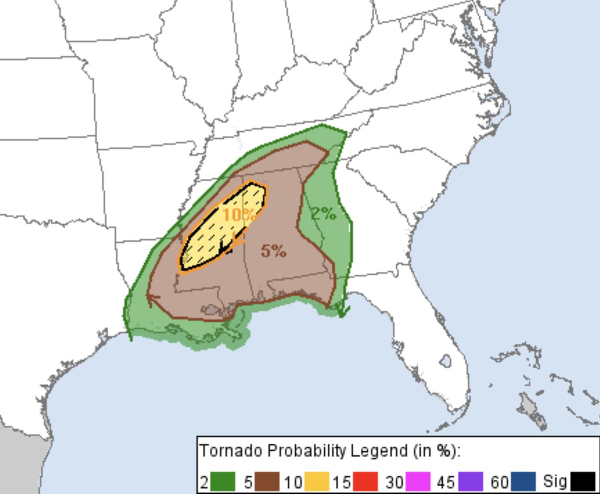
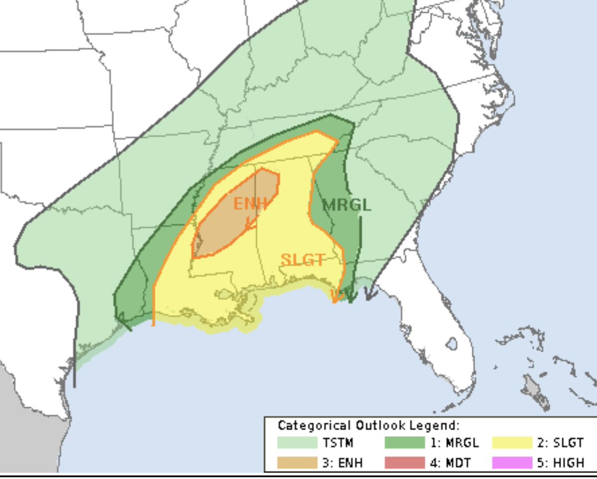
ENHANCED RISK! Storm Prediction Center has upgraded portions of central/northern MS into western AL to an enhanced risk including a hatch area for strong #tornado threat. Supercells to initiate in far eastern LA into central MS as early as 1-2 pm #mswx#lawx
UPDATE: Confidence is HIGH in a swath of heavy snow with 6-10” accumulation from Northwest TX through central OK starting tonight through early Wednesday! This snow is coming to Tornado Safe OKC HQ. Once the roads are clear come check out Dominators 1 and 2 and a new shelter!
BIG SEVERE WEATHER possible in Dixie Alley on Wednesday next week as a high-amplitude trough digs deep into northern Mexico before ejecting across central/southern U.S. Tornado threat likely as early as Tuesday night, E TX through LA, MS AL TN on Wed. Stay tuned! @Tornadosafetx
Strong-to-violent TORNADOES like this one south of Dodge City, KS on May 24, 2016 are common in Tornado Alley. The INFINITY shelter by Tornado Safe can keep your family safe when severe weather strikes. NOW is the time to prepare! Talk to our experts: 877-848-3017 @Tornadosafetx