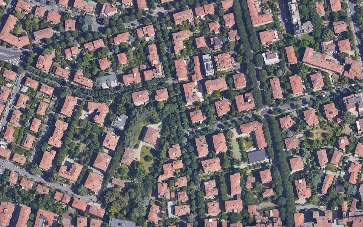
OpenStreetMap has nearly 21 million individual trees mapped all throughout the world, but that data is highly localized and unevenly mapped.
I was curious to see which countries have mapped more trees than we might expect, so decided to try comparing trees to area.
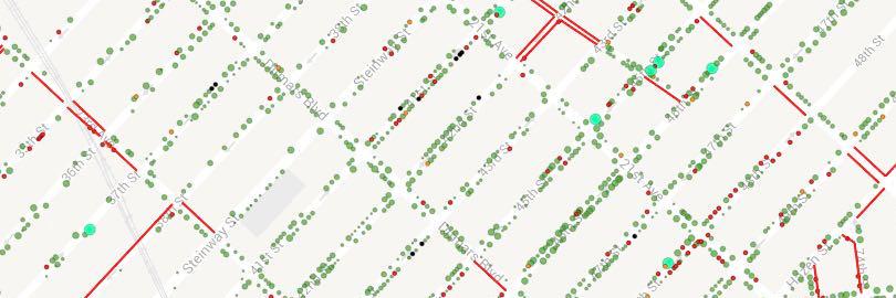
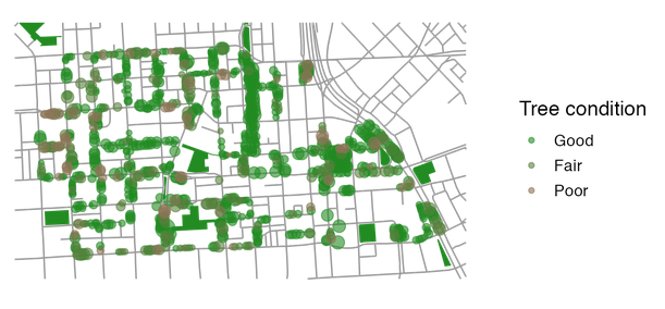
Interactive map using Deepscatter showing 680,000 street trees in New York from the tree census. https://t.co/iFK3sdfb36
This one is kind of neat technologically because it just plots an Arrow table straight in the browser.
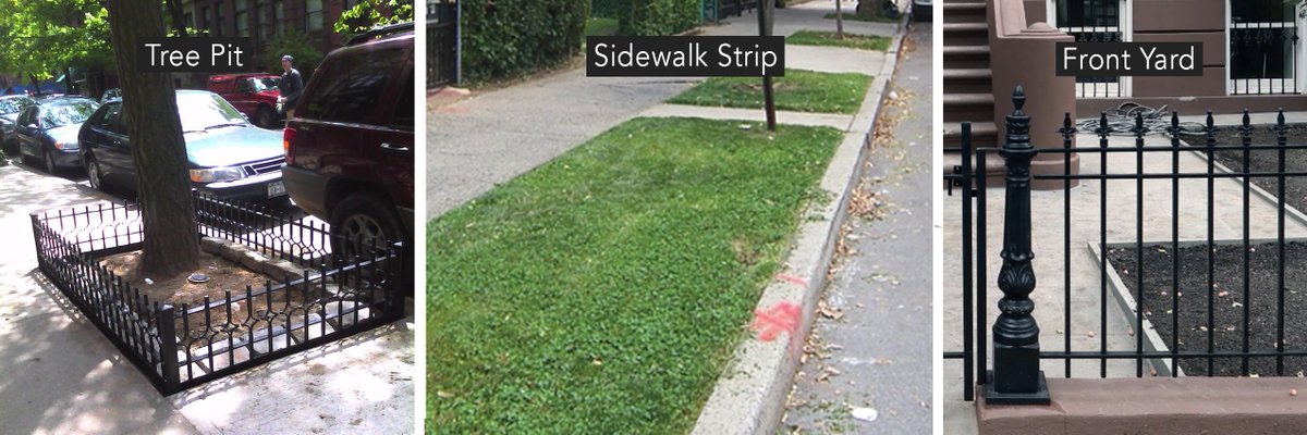
#Brooklyn! @V6A_coLab and @land_interact are looking for people who have tree pits or sidewalk strips in front of their rentals or property that they would like to re-wild for increasing biodiversity and stormwater control.
If this is you, form info → https://t.co/PP3FSertoA
Great reporting from L.A., where city officials say they spend about $1,850 to procure and plant a single street tree — half of what it costs in NYC. Then they spend another $2,500 for their crews to allegedly hand water that tree for the next five years
https://t.co/DnjguazDBD
i am so grateful for the amazing crew that came together to make this vision possible @lizbarry @LearnKnowAct @jarlathond@debsting@rcheetham
and so many more! miss y'all and that crazy ride we had heading up to launch day 🙃. Happy Arbor Day!
can datasets have bdays? 7 yrs ago on #ArborDay, together with @TreeKIT@azavea@uvmvermont's SAL, @NYCParks launched the 2015 street tree census, a citizen mapping project with 2,200+ volun-treers and 60+ community groups.
can datasets have bdays? 7 yrs ago on #ArborDay, together with @TreeKIT@azavea@uvmvermont's SAL, @NYCParks launched the 2015 street tree census, a citizen mapping project with 2,200+ volun-treers and 60+ community groups.
In the last week I've started to receive inquiries from people running tree planting programs wanting my help. I am suggesting that they shut down their programs. Here I will explain why:
This is interesting— have u heard of the “3-30-300 rule?”
3: Everyone should be able to see at least 3 trees from home
30: Cities should ensure a 30% tree canopy in all neighbourhoods
300: Everyone should have a park within 300 metres of home
Via @IUCN https://t.co/wYgpiTvIjj
Then, you can use the layer_after, parameter to add on any number of additional guides, scales, and labels (beware conflicts as you mix & match layers) that you want to combine with the data. Save the results to an object and then combine w/ streets, buildings, etc. #mapbaltimore
happy birthday Alice Walker, author of The Color Purple (1982)
“In nature, nothing is perfect, and everything is perfect. Trees can be contorted, bent in weird ways, and they’re still beautiful.”
🖤🖤🖤💚💚💚