LOOK: The eruption of the Hunga-Tonga-Hunga-Ha'apai volcano has created a spectacular shockwave, as seen from @Windycom. It managed to create powerful tsunami waves hitting the shores of #Tonga.
Mass firings have started at the National Weather Service, including people in critical roles. Cutting waste is great. Mindlessly taking a sledgehammer to a valuable organization is stupid. All the know-it-alls who said we were fabricating this threat can shut up now. Thanks.
This is devastating news. Today's reported layoffs at the NWS will impact our ability to keep Americans safe from extreme weather. These forecasters are essential frontline workers who save lives during hurricanes, tornadoes, and floods. Cutting these meteorologists isn't just short-sighted… it's dangerous.
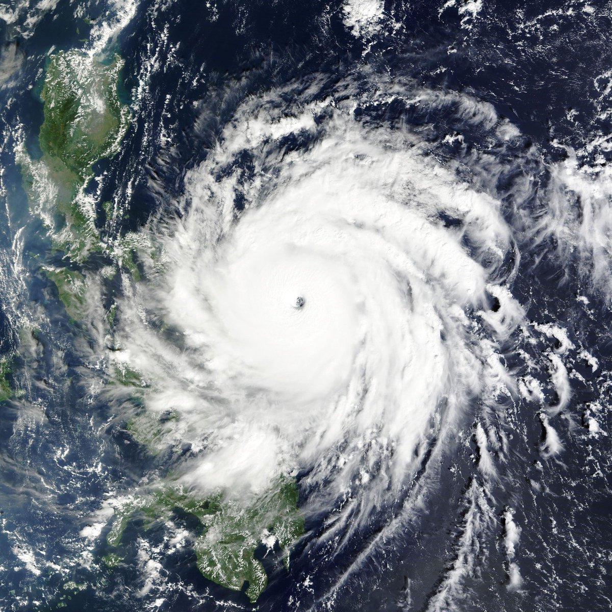
Super Typhoon MAN-YI (#PepitoPH) is set to strike the Bicol Region as a Category 5 super typhoon tonight. It currently possesses a robust structure with a stadium effect-induced eye.
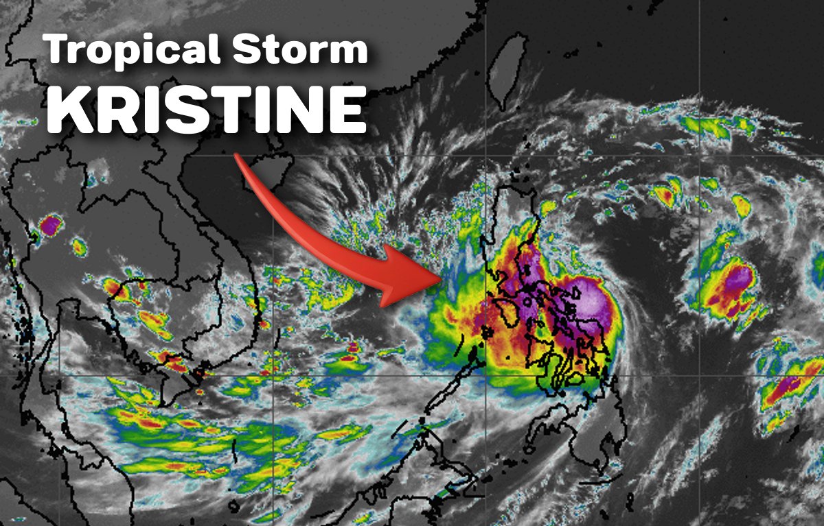
Tropical Storm #KristinePH (#Trami) is currently bringing a LOT of rainfall to much of Southern Luzon! Flooding is likely in vulnerable areas.
Kristine is expected to intensify further and may strike Central Luzon on Thursday. #WalangPasok and #RescuePH are also imminent!
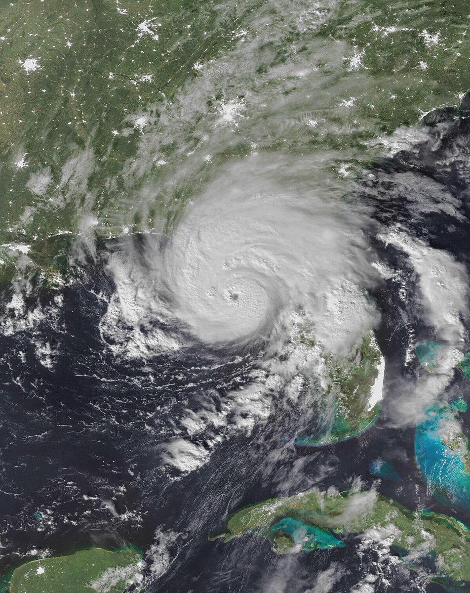
Hurricane Milton is now a Category 5 storm with winds of 180 mph, and tied as the 3rd strongest hurricane in Atlantic history.
Further strengthening is forecast, and the record for the strongest Atlantic hurricane on record could be challenged.
The International Space Station just orbited above Hurricane Milton as it is re-intensifying over the southern Gulf of Mexico.
Spectacular view from space.
In Sarasota. Calm. Raining. Cat-5 #Hurricane#MILTON continues on a steady course toward #Florida. Like a bowling ball. One thing that concerns me: it hasn't started weakening. It should—but so far it hasn't. The satellite presentation overnight remains spectacular.
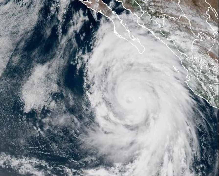
THE STRONGEST EPAC HURRICANE TO MAKE LANDFALL ⚠️
#HurricaneOtis defied expectations by rapidly intensifying into a Category 5 hurricane and later making landfall near Acapulco, Mexico. It made landfall at peak intensity with 165 mph winds and a pressure of 923 millibars.
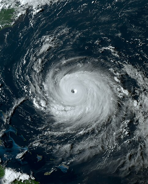
BREAKING: Hurricane #LEE intensified into a CATEGORY 5 hurricane❗
It currently has 1-minute winds of 160 mph (140 kts), and is expected to peak at 180 mph, making it potentially the strongest hurricane since Hurricane Dorian last 2019. #HurricaneLee
THE HURRICANE BEASTS OF AUGUST 🌀
As August 2023 saw a rise in tropical cyclone activity in the Atlantic and East Pacific, the month also saw four powerful hurricanes roaring across the basins: Hurricanes #Dora, #Hilary, #Franklin, and most notably, #Idalia.
CSU has issued its next two-week Atlantic #hurricane forecast and calls for the most likely chance of above-normal activity (70%) with near normal (25%) and below-normal (5%) being less likely:
https://t.co/8GimzWU672
#Franklin's central pressure is down to 926 hPa - the lowest central pressure for a #hurricane this far north (29°N) in the open Atlantic (e.g., not Gulf of Mexico) on record. Atlantic pressure records have been recorded consistently since 1979.
Meanwhile, check out this specimen near #Philippines (orange). #Typhoon#SAOLA is Cat 3 now, & it could eventually become super typhoon. Where's it going? Beats me. SAOLA may attack #Taiwan (pink)—but it's hard to know for sure. Spread in computer-model solutions is huge.
#Franklin is now a #hurricane - the second of the 2023 Atlantic hurricane season. On average, the second Atlantic hurricane actually forms today, August 26.