We're keeping an eye on Hurricane Dorian. For Central AL, there's no reason to worry at this time but certainly check @NHC_Atlantic daily for the latest Dorian-related information. We have your local 7-day forecast at https://t.co/9rRNiZCm8d -enter your city or zip.
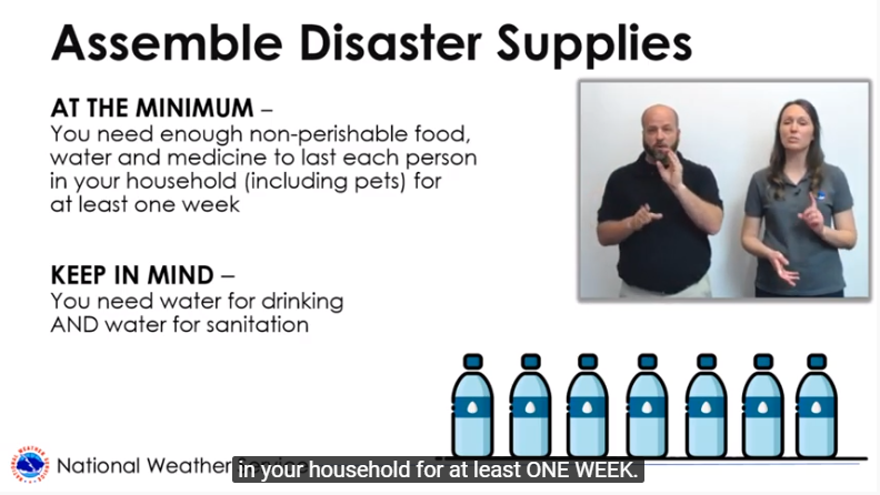
Here's a hurricane supplies video for our deaf and hard-of-hearing friends in the Florida region. If you have friends or family there, share with them to help them better prepare as Hurricane Dorian approaches 👉🏽 https://t.co/G2UhhB4IzI @NWSMiami@NWSMelbourne@NWSJacksonville
🛑 It's going to be a hot week with highs low-mid 90s & max heat index values around 100-105 each day. "Not long" is too long! DO NOT leave pets or people in vehicles! Parking in the shade or cracking the windows DOES NOT help! Temps. rise to deadly levels in minutes in the car!
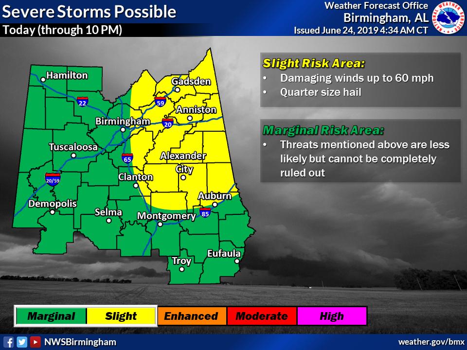
Showers & thunderstorms will approach our western counties this morning with strong winds possible. We maintain a Slight Risk of severe storms in the northeast for additional storm intensification this afternoon. Scattered rain chances continue tonight, mainly in the east. #alwx
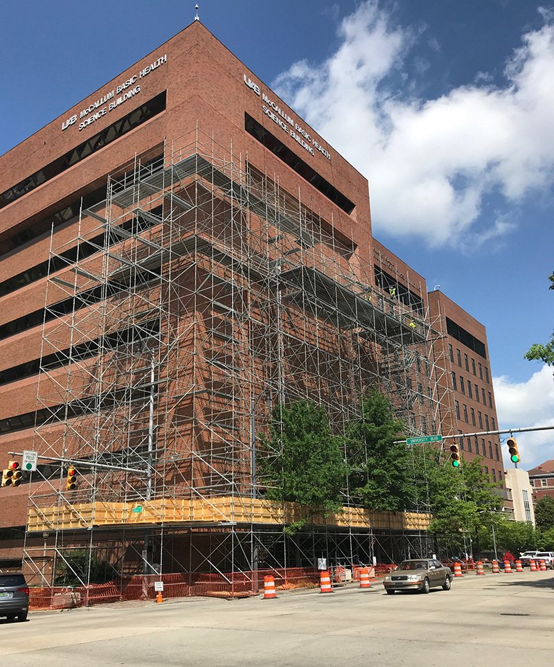
🚧Traffic lanes & sidewalks along University Boulevard and 20th Street South will be closed through Aug. 31 to ensure pedestrian and traffic safety during the renovation of McCallum Basic Health Science Building and demolition of UAB Townhouse. https://t.co/wUKMoPH25P
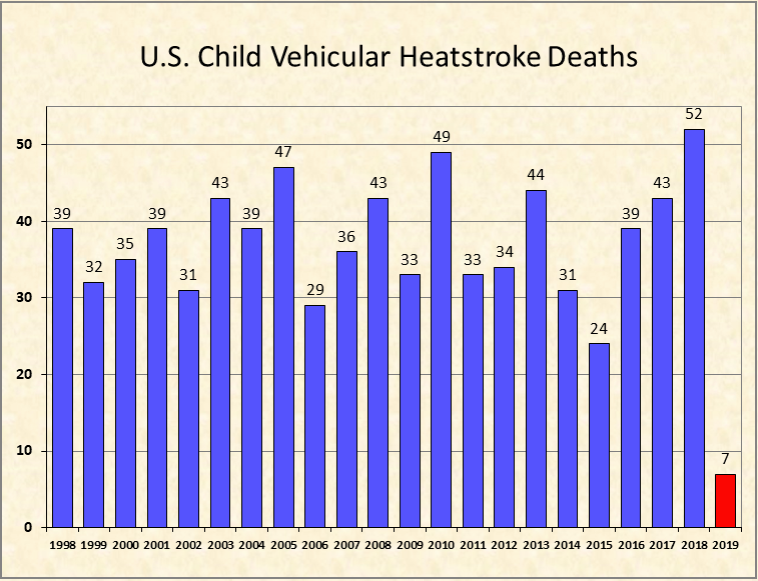
😢Sad Stat: Since 1998, 802 children have died from heatstroke after being left in vehicles…including 7 so far this year. ALL were preventable! 👀 LOOK BEFORE YOU LOCK!! #HeatSafety
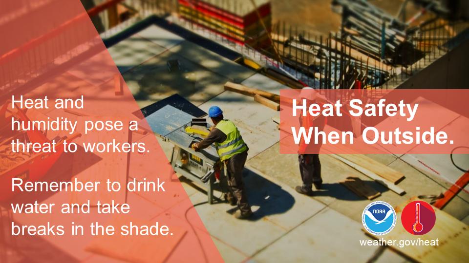
Warm weather is becoming more commonplace as we make our way through Spring. With temps expected to rise to near 90F today, remember that it will take a couple of weeks for our bodies to acclimate to the warm weather. It's best practice to take breaks if working outside! #alwx
A reminder to not forget about your pets tonight! Have their medications/food included in your safety kit. Make sure you can reach them quickly if a warning is issued, and can easily take them with you to your safe place! #alwx
⚠️Yellow shaded area: damaging straight line winds are the main threat with brief tornadoes also possible. Orange shaded area: somewhat greater overall threat of both tornadoes and damaging winds. Either area: have multiple ways to get warnings this afternoon and tonight! #alwx
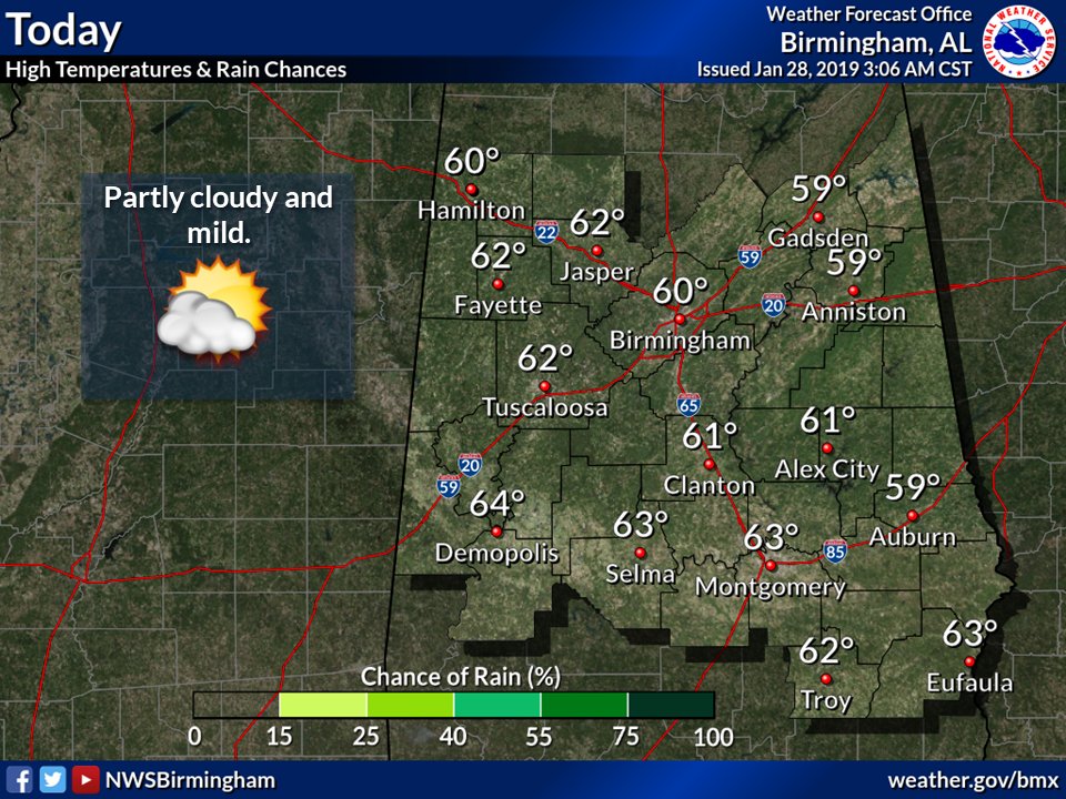
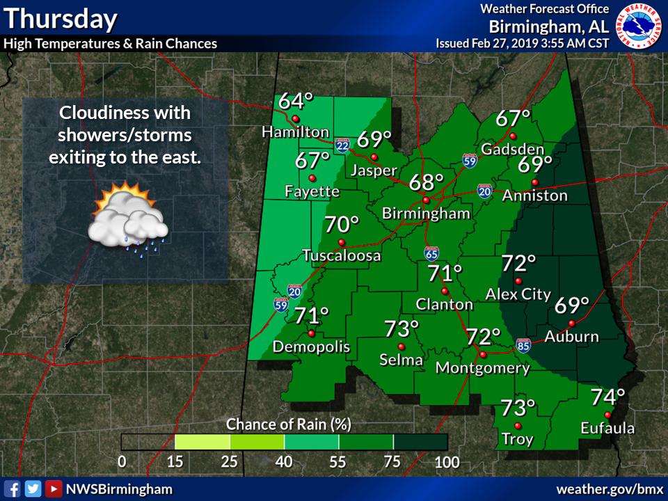
We'll have another enjoyable day with highs in the low 70s and periods of sun this afternoon. Rain showers increase this evening and exit during the day Thursday with a few rumbles of thunder possible. Lows tonight will be in the mid to upper 50s. #alwx
❄️WINTER WEATHER❄️
Our local meteorologists at the @NWSBirmingham are doing a great job churning out information, so we can keep you informed of the possible impacts Tues & Wed.
Please take a moment and read our winter weather message: https://t.co/iChXmEsxFv
#PelhamPD
With much of the country under this week's frigid 💨🥶 forecast, now is a great time to follow your local @NWS office, check winter weather supplies, and brush up on safety tips at https://t.co/Huk3zeppXj.
Expect partly cloudy skies today with highs ranging from near 60 NE to the mid 60's SW. Increasing clouds with rain showers through midnight then transitioning to snow early morning. Lows will range from mid 20's NW to upper 40's SE. Partly cloudy Monday with highs near 60.
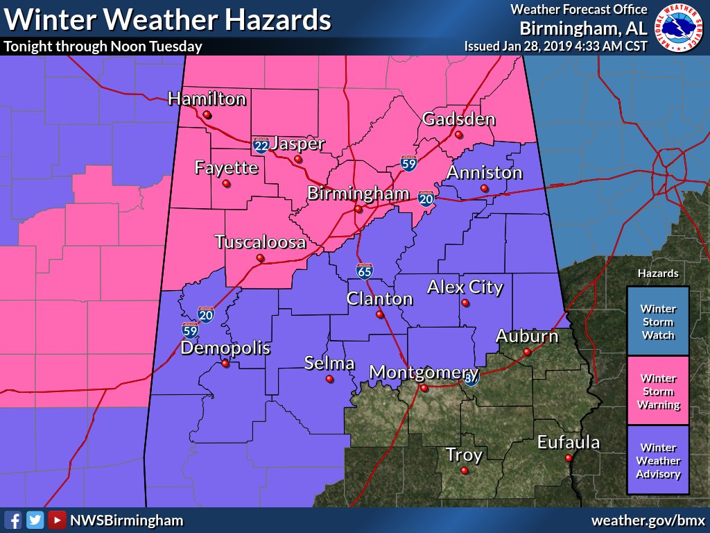
Winter Storm Warning for much of our area near and northwest of Interstate 59 late tonight through late Wednesday Morning. Winter Weather Advisory for our southwest, east-central counties tonight late tonight through late Wednesday Morning.
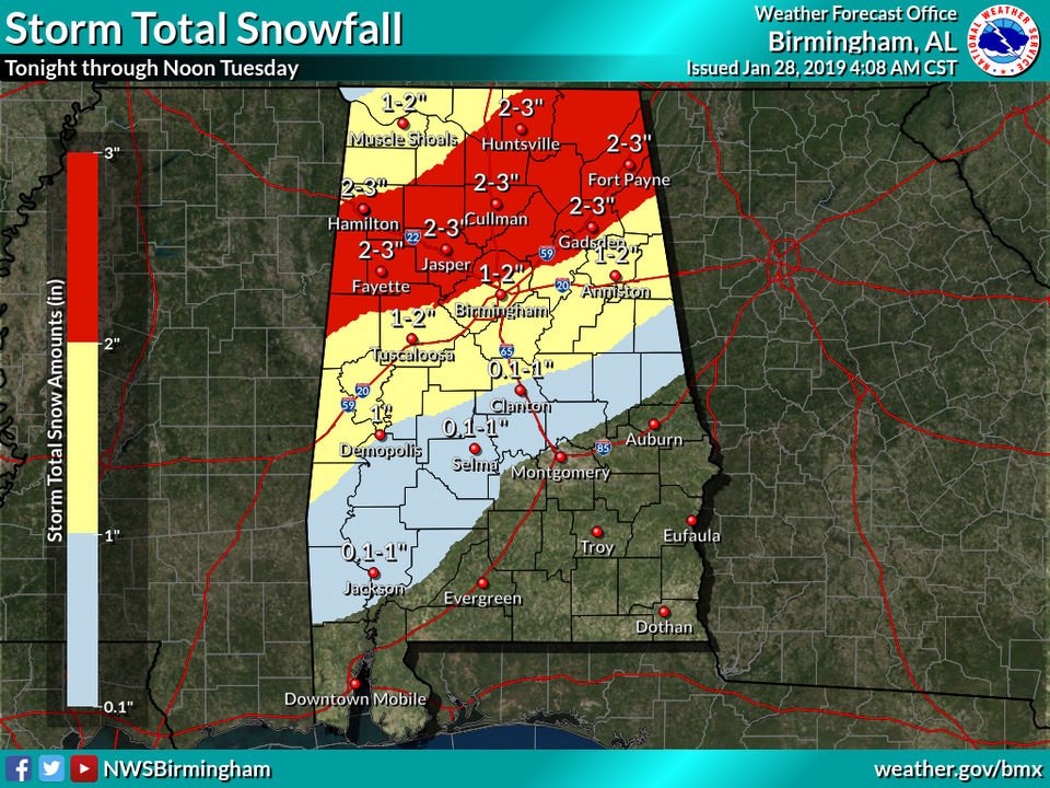
It looks like it's going to happen. It's going to snow. Starting as early as tonight.
Snow is coming: Winter storm warnings have been issued for parts of Alabama #alwx https://t.co/OWAeiss5EZ
This is a U.A.B. B-Alert TEST: Update your B-Alert profile/preferences at https://t.co/K8xubRtP2V. Visit https://t.co/pOmnn8ItEW to check your group assignment - red, yellow or green - in the event UAB closes due to inclement weather.
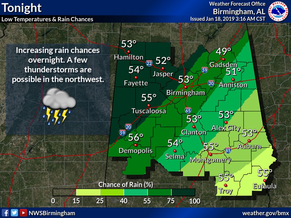
Tonight, light scattered showers will increase slowly from west to east ahead of the main line expected Saturday. Scattered strong to severe storms possible Saturday. Damaging winds and an isolated tornado are the main threat. Stay aware of the weather throughout the day! #alwx