UAS4Ecology is a research lab specialized in drone-based remote sensing for ecology.
Founder and Scientific Leader @SigneNormand, Lab Manager @UrsTreier.
Tenure Track Assistant/Associate Prof in Remote Sensing of Landscape Dynamics at Aarhus University, https://t.co/YQfWwE6lbj. Application deadline 15 Nov 23:59. Great opportunity to work with @SigneNormand & to collaborate with UAS4Ecology & @SustainScapes. https://t.co/raOZWpyYED
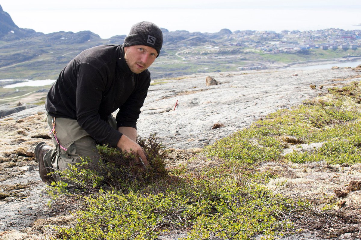
Working with #dendroecology, interested in #Arctic#shrubs and/or #RemoteSensing? Here's a nice perspective piece from my office mate & group on how to integrate these to better understand the ecology of #tundra shrubification. Way to go Candice! 🥳
🌿🛰️🌡️❄️
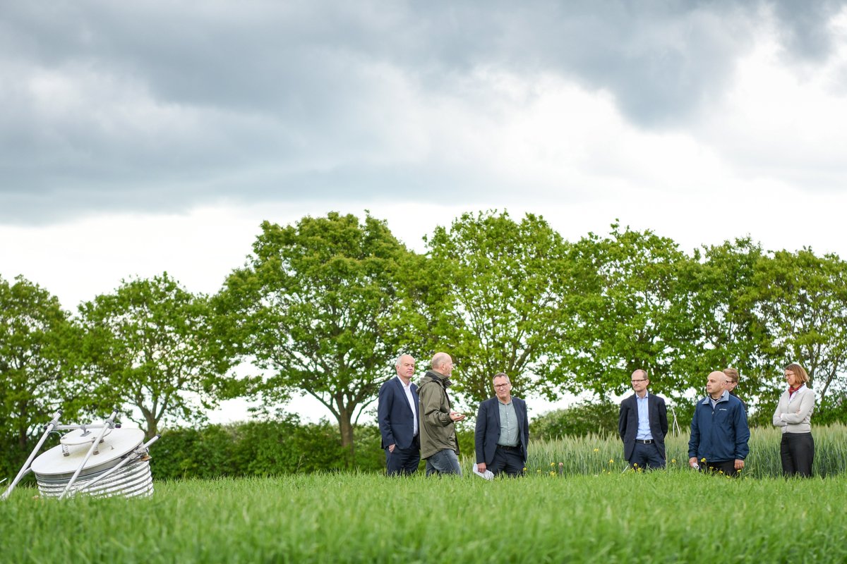
Center for Landscape Research in Sustainable Agricultural Futures #LandCRAFT officially started yesterday. UAS4Ecology Lab is happy to contribute with co-PI @SigneNormand leading the Digital Landscape Analyses and Remote Sensing of the center.
New center opens: it requires basic and detailed knowledge if we are to achieve the green transformation of agriculture.
#Pioneer Center Land-CRAFT, and aims to develop basic research-based solutions to the green transition in agriculture. #LandCRAFT
https://t.co/HdEBTfQJZ7
Congrats to UAS4Ecology Lab leader Signe Normand for being awarded the Victor Albeck Prize recognizing her work on cross-scale integration of data from cells to satellites and across time to understand vegetation dynamics under global change.
https://t.co/6fnVcuuVre
We are very happy to see this work published and hope it is of wide use for science, nature management and consultancy. Big thanks to @VegDyn Lab member Jakob for leading this!
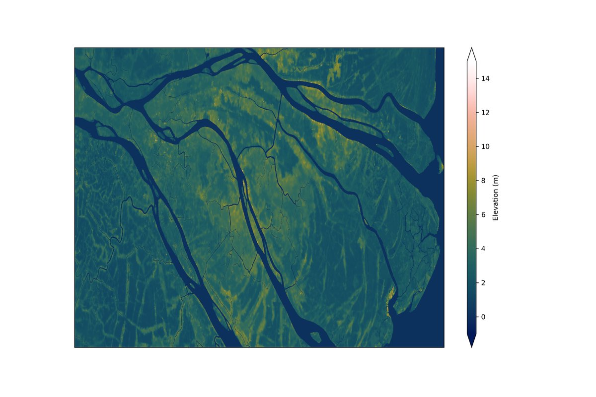
📢Announcing FABDEM - a new 30m global terrain dataset
Using machine learning, we remove building and tree artefacts from Copernicus GLO-30m DEM, to create the most accurate complete map of the Earth's terrain ever built.
Paper https://t.co/gN8mbHbLmT
Data https://t.co/2WW9tlbPbu
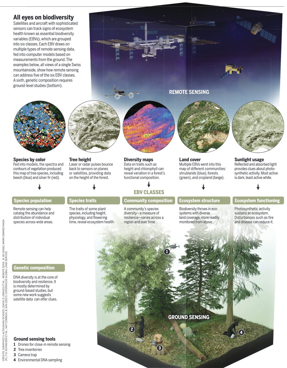
Getting the big picture of #biodiversity
Super article in @ScienceMagazine on the need to monitor biodiversity change across scales and levels of organization. Lovely focus on @CavenderG9 work. Delighted to see spotlight on @GEOBON_org framework
DOI: 10.1126/science.acx9637
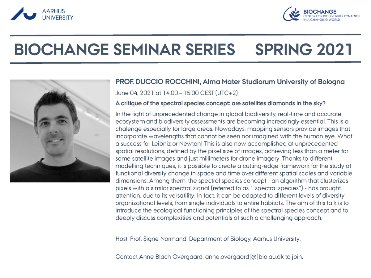
Mark the calendars! We are pleased to announce another BIOCHANGE seminar on zoom. On June 4 @ 14:00 CEST (UTC+2) @ducciorocchini will give a talk titled: 'A critique of the spectral species concept: are satellites diamonds in the sky?'. All are welcome. Host: @SigneNormand
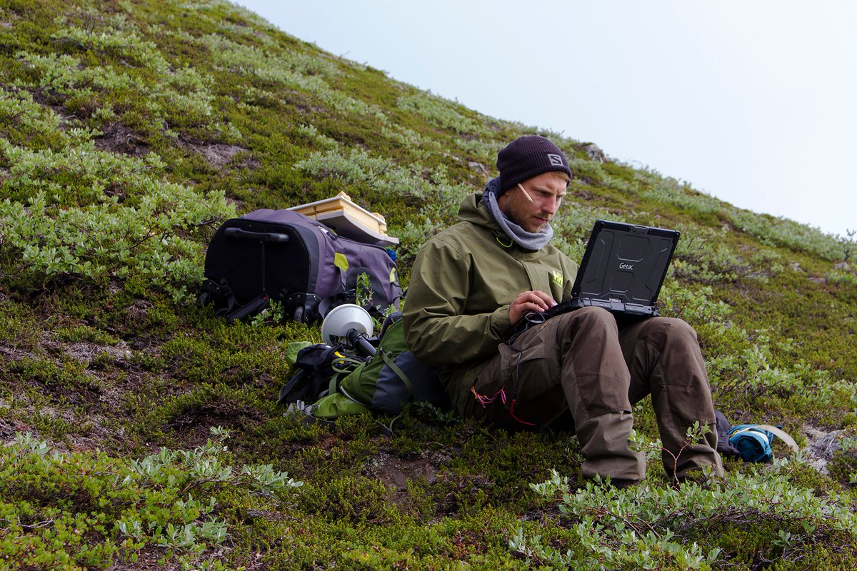
@stefanopuliti @KAnderson_RS Completely agree, terrain following would be extremely useful. When flying with our Mikrokopter, flight planning with their tool is very versatile, resulting in a simple editable text file. Free, not fancy, not much developed over time 🙂, but does the job.
I am very honoured to receive the #Eliteforsk prize. A BIG thanks to the amazing post docs, Phd students, and colleagues that I am so privileged to work with! Without you this would not have been possible! Congratulations to Eva, Gemma, Anders and Emil.
1/2: Application deadlines for our #PhD & #postdoc#positions approach - Feb 1st or soon thereafter! See #SustainScapesJobs or https://t.co/N6iGMPbXUi @AarhusUni and join our international team and our effort to finding Sustainable solutions across landScapes.
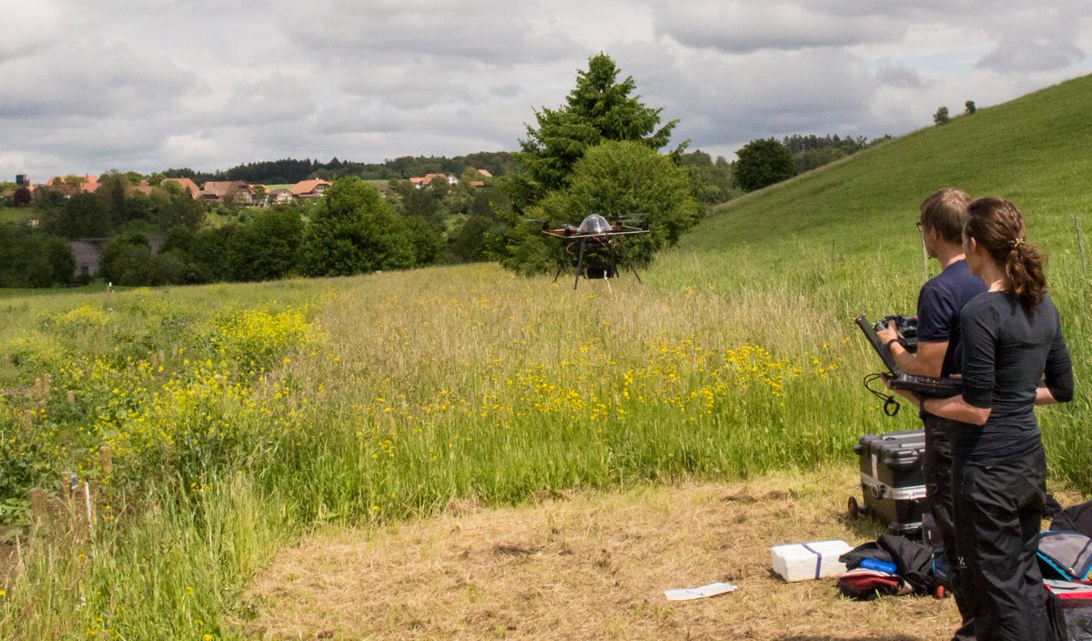
New paper led by @JamesPDuffy with @IlyaMaclean@dominic_fawcett and Robin Curtis out now - "Drones provide spatial and volumetric data to deliver new insights into microclimate modelling". https://t.co/04lzM3M07y
All of us at #BIOCHANGE congratulate @BioMadsen supervised by @SigneNormand & @UrsTreier on a well-defended PhD thesis today on his work on Drone ecology - Understanding grassland plant diversity dynamics using close-range remote sensing. Well done Bjarke! @UAS4Ecology@VegDyn
Today we have published our WWF conservation technology report on drones! Freely available here - https://t.co/bnsp0KBBBz Great collaborative effort with @KAnderson_RS, Leon DeBell, @aurelgrooves and others. Have a read to find out about drone tech...
Please RT: The @Rsc4Earth is looking for a motivated PhD-student (E13, 0.75%) in the DFG-funded project BigPlantSens, which aims at harnessing image databases (e.g. @iNaturalist) for automatic plant species identification in drone or satellite imagery. @UniLeipzig@UFZ_de