ICYMI: The draft Clean Energy Plan is available online at https://t.co/2QSyn4FPzn. The public comment period is open until September 9, 2019. Learn more: https://t.co/Z5gnnLLEW7
Productively procrastinating today and played around with the awesome #rayshader R package to make this gif of southeastern North Carolina fluctuating from a sea level decrease of 20m to an increase of 3m.
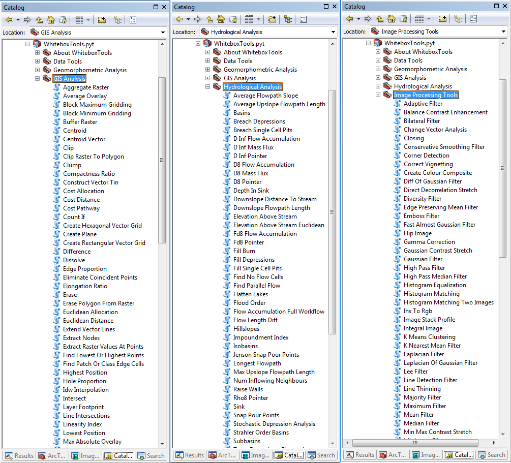
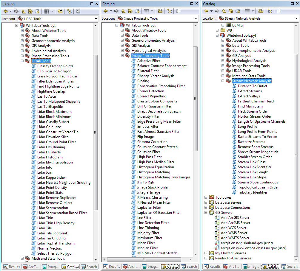
ArcGIS Toolbox for WhiteboxTools v0.1.0 released, an ArcGIS Toolbox of Prof. John Lindsay's WhiteboxTools library, which contains 400 tools for GIS analysis and geoprocessing. More on GitHub: https://t.co/afrApeDAS6 #GIS#geospatial#opensource#lidar#hydrology#remotesensing
Made a video of #HurricaneFlorence's impact on @CapeLookoutNPS using @planetlabs satellite imagery. Stunning change in the Cape and a massive amount of organic matter out of Beaufort Inlet. These barrier islands are living and breathing and major storms sure do demonstrate that.
Some worthwhile orgs to support rebuilding NC include:
The Governor’s NC Disaster Relief Fund
https://t.co/JuPSbgzkwy
Food Bank of Central & Eastern NC
https://t.co/fh11JYqkDt
United Way of NC
https://t.co/jDlSWcaikI
NC Community Foundation
https://t.co/eJDT5eCyqj
#FLORENCE
Someone asked me about river basins. Here's a map from @NCDEQ showing river basins around our area. Should river flooding become a concern during #Florence, know what river you are closest too. #ncwx
We’re now open in....
KINSTON, NC! ♨️🎉🙌
We will be hosting our Grand Opening on Saturday (2/3) from 11am-2pm and 5pm-8pm, where we will be giving away free T-shirts, koozies, lanyards, and much more! Come see us! 🎉