Honestly one of the heavier snow bands I’ve experienced, visibility easily down to abt 1/4 mile and we have roughly an inch or so in the elevated/grassy areas
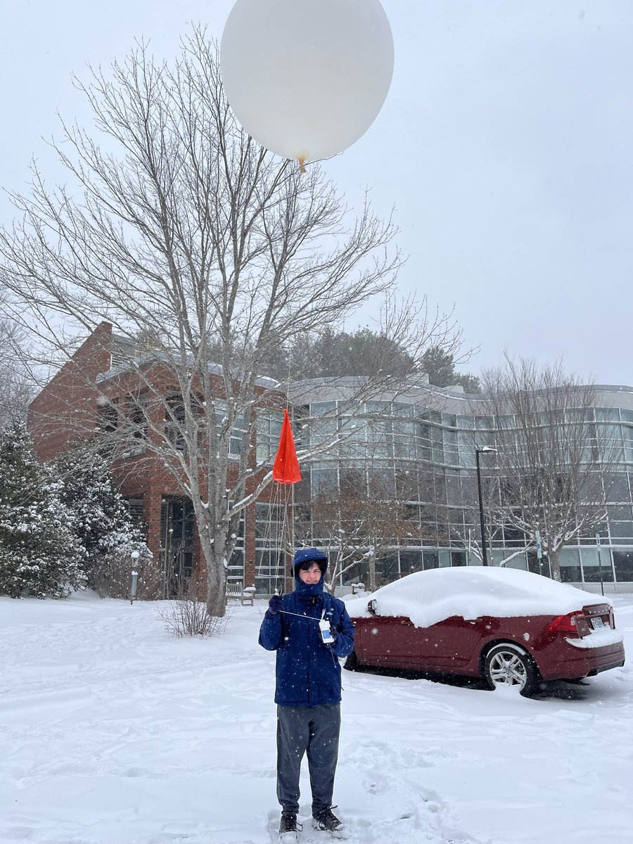
Had a great time launching weather balloons with SEMPE this past weekend. We ended up with a little over 6” of snow with some areas having nearly 18” drifts. We finished of with some good very cold NWFS which led to some very good dendrite photo taking! @NWSGSP@UNCAweather#ncwx
@NWSGSP just out of pure curiosity, how close is WNC to blizzard criteria? I know the winds will be a bit low, but duration and visibility might be there.
Light snow here in far northern wake county, picked up maybe a 0.5” during the heavier rates. If only the cold air could’ve gotten here quicker… @NWSRaleigh#ncwx
A thread of videos from today’s flight into Hurricane Melissa
In this first one we are entering from the southeast just after sunrise and the bright arc on the far northwest eye wall is the light just beginning to make it over the top from behind us.
The 12 GDM ensembles have just came out and continue to show a west trend, with the mean making landfall somewhere in western #Jamaica. Too add on, all but 2 of the members have #Melissa reaching Category 5 status. The ensemble mean is 149kt/915mb. #tropicswx
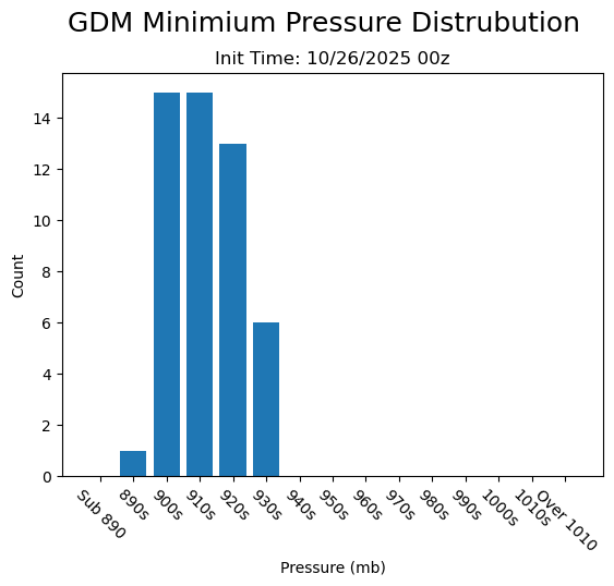
Additionally, the min pressure distribution shows the majority of the members (30/50) in the 900-919.9mb range. With all members falling below 940mb. The mean max intensity is 147kts/917mb. #tropicswx#Jamaica#wxtwitter 🌀🌀🌀
While #Melissa undergoes IR tonight/this morning, the 0z GDM ensembles came out. A fairly substantial west shift is present, likely due to the storms present WSW motion. All members still make a landfall on the island, but just west of where they were on the 18z run.
As Dr. @pppapin mentioned in his earlier discussions, now >80% of the 50 GDM ensembles (42/50 to be exact) show this becoming a Category 5 at one point or another, although given current obs, I'd say its next to a guarantee. All members still have it becoming at least a Cat 4.