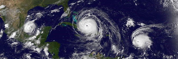
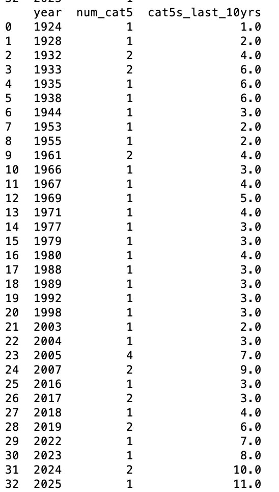
#Humberto has rapidly intensified to a CATEGORY 5 hurricane! 2024-2025 is the second pair of seasons on record to produce 2 Cat 5s each. Luckily, this one is staying mostly out to sea with some potential impacts to #Bermuda.
Erin is only the 5th Category 5 hurricane on record to form this early in the hurricane season and the only Category 5 observed outside the Gulf or Caribbean this early in the year.
With Erin, the last ten years have now seen 11 category five Atlantic hurricanes. This puts us even further ahead of 2007, which held the previous record of nine. Remarkable.
Hurricane #Erin has rapidly intensified to a Category 5 hurricane with winds of 160 mph and a pressure of 917 mb. Currently tracking further south than expected and battering the northern Leeward islands, Virgin Islands, and soon Puerto Rico with heavy rainfall.
First light is revealing just how extensive the damage is to the Tampa Bay Times office. Sections of the crane stretch across 1st Ave S. The top quarter of the building is shattered. #milton
#Hurricane#Milton has made landfall near Siesta Key, FL - the 5th US Gulf Coast hurricane landfall this year (Beryl, Debby, Francine and Helene are other 4). This ties 2005 and 2020 for 2nd most Gulf hurricane landfalls on record, trailing only 1886 (6 Gulf hurricane landfalls).
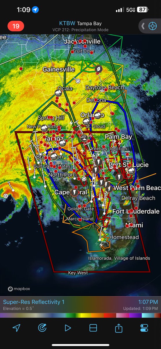
An extreme wind warning is in effect for Tampa FL, Saint Petersburg FL, Clearwater FL until 9:30 PM EDT for extremely dangerous hurricane winds. Treat these imminent extreme winds as if a tornado was approaching and move immediately to an interior room or shelter NOW!
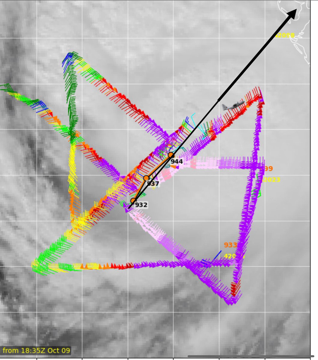
#MILTON LANDFALL TRACKING POST.
If current trajectory on average based on the last four passes from recon held up we would have a landfall near Clearwater just W of Tampa.
This would put Tampa and St Pete in the max surge zone.
Now deviations and wobble are still a factor so this doesn’t guarantee it but there’s an increasing likelihood that Tampa could receive a direct hit.
Keep following closely to monitor.
Landfall expected tonight.
#hurricanemilton #flwx #landfall #tampawx
.@FEMA has over 1k responders on the ground in FL supporting #Milton.
- 1,400 search and rescue personnel
- 7 incident management teams
- 400 ambulances
- 20 helicopters for medical requirements
- 60 high water vehicles
- 20 million meals
- 40 million liters of water
#Milton’s impact will extend over much of #Florida, with tropical-storm force winds, serious risk of flash flooding, tornadoes, and storm surge along the Gulf and Atlantic coasts. Hunker down and pay close attention to local officials for details as #Milton approaches. Stay safe!
While #Milton’s max wind speeds and fallen to 130 mph, he is growing in size and impact as he approaches #Florida. Tornado warnings are blanketing south Florida, and heavy rain and tropical storm force winds are extending over the peninsula. Now is the time to hunker down.
This @NWS map showing the hazards from #Milton is really helpful but also so so concerning. Serious, life-threatening surge, wind, rain and tornado threats over highly-populated areas... some dealing with all four.
#Milton is starting to "weaken" this morning as expected, but don’t be lulled into a false sense of security. This will be an incredibly dangerous storm for Florida, making landfall as a MAJOR (category 3-4) hurricane. Catastrophic, life-threatening surge of 10-15 FEET expected.
#Milton remains an extremely dangerous Category 4 hurricane with winds of 155 mph and a pressure of 915 mb. Expected to make landfall near Sarasota sometime late tonight or early tomorrow morning. All preparations, including evacuations, should be rushed to completion. #Florida