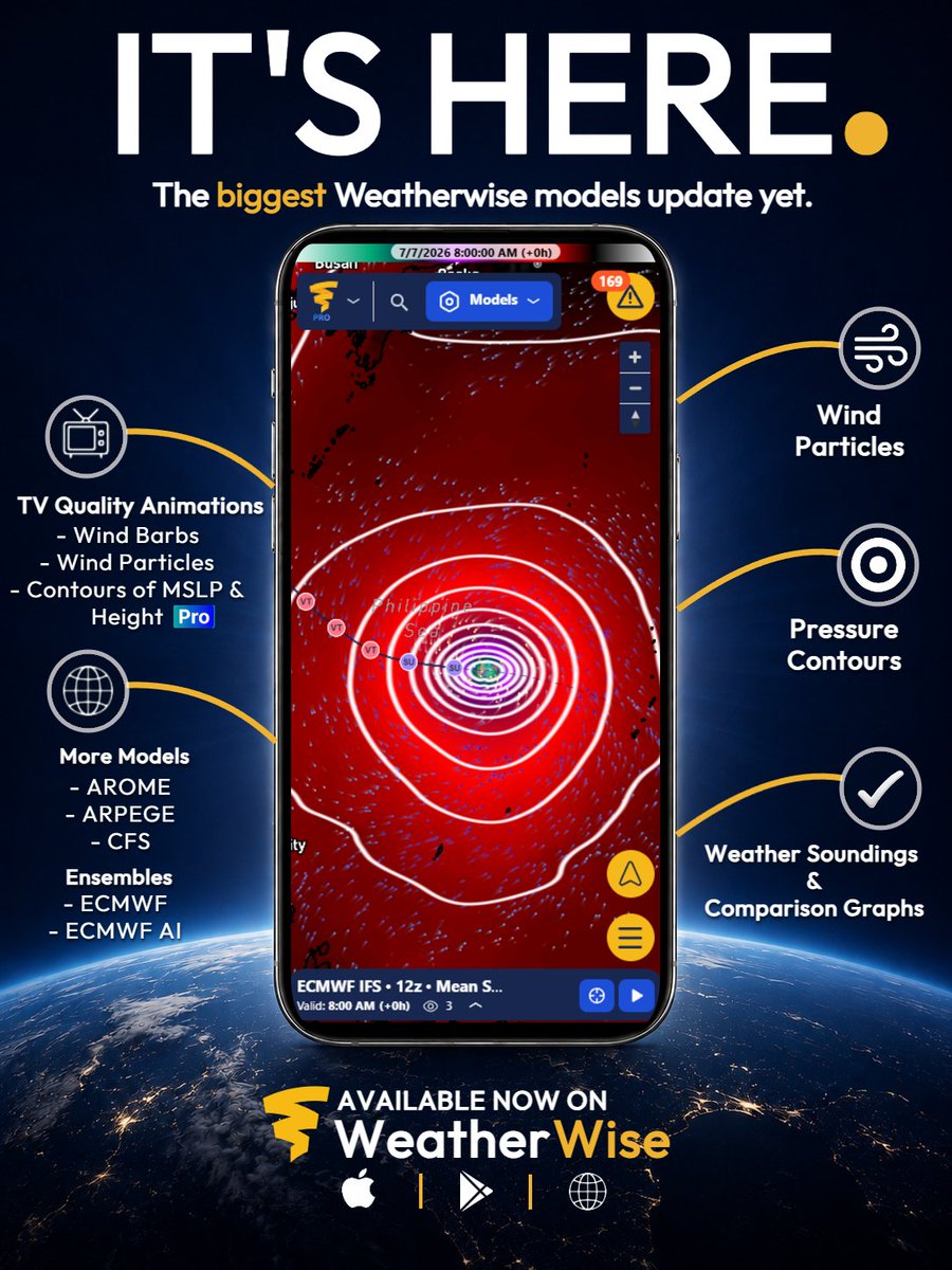
😈 This isn't just an update, it's innovation.
Our biggest models update yet is now live.
Open WeatherWise and explore everything that's new.
🎥 Full walkthrough/tutorial coming by Friday evening.
See thread below!
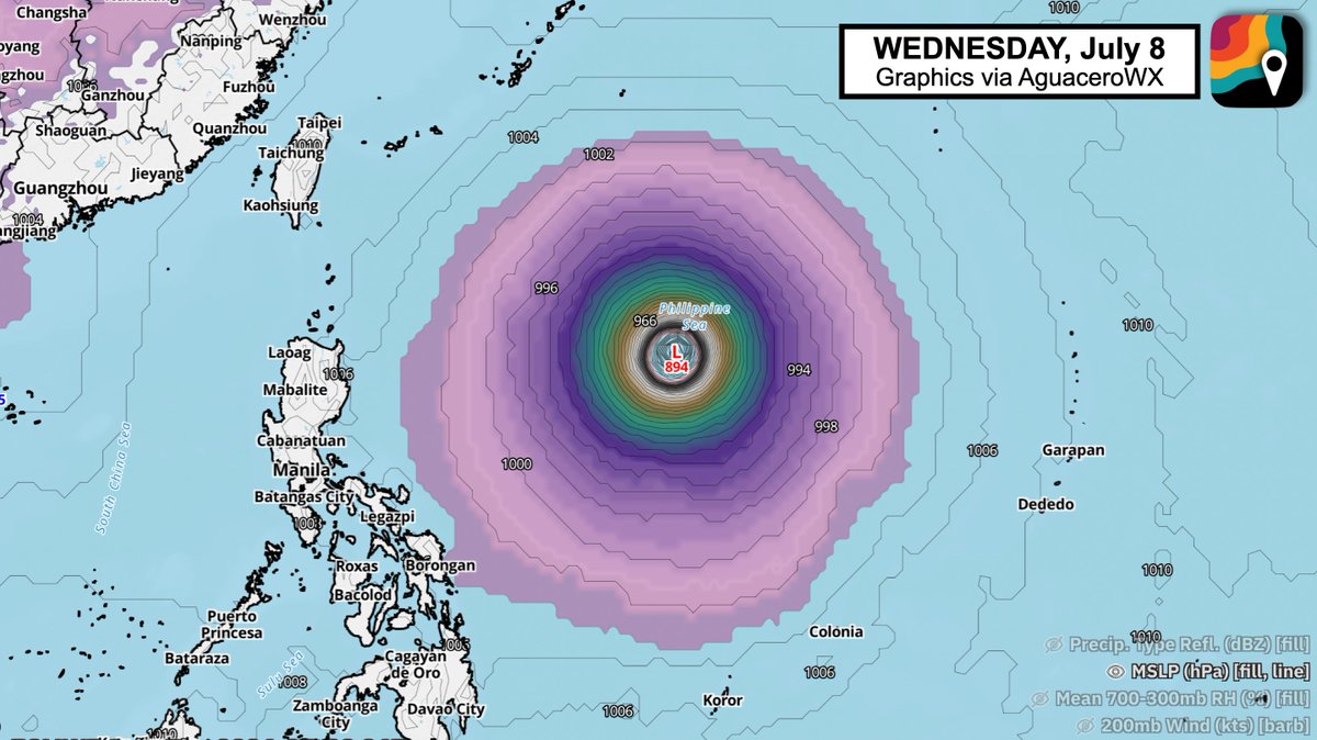
NEW: Bavi is likely to attain Category 5-equivalent status as a supertyphoon in the western Pacific between July 5-8.
The system is about to rapidly intensify. It will pass near or over Guam/Micronesia/the northern Mariana Islands on Monday with Category 3 or 4 impacts. Thereafter, it will continue westward.
It's passing over exceptionally hot water temperatures of 88-90 degrees, which contain extreme oceanic heat content – i.e. fuel.
Winds aloft are fanning away from the system, creating a vacuum of sorts that lifts more heat and moisture from below, strengthening the storm.
And the winds upstairs aren't too strong, meaning there won't be much to disturb or disrupt Bavi's strengthening circulation. Without anything to tear the nascent storm apart, it will likely intensify unimpeded.
In the short term, a bit of dry air being entrained into the system has slowed strengthening. By Friday evening, that will no longer be an issue.
It will probably be a Category 5-equivalent by Monday, July 6 – and perhaps even by Saturday night into Sunday.
If you live in Guam/Micronesia/the northern Mariana Islands, PREPARE for high-end, serious impacts. The potential exists for winds of 120-140+ mph.
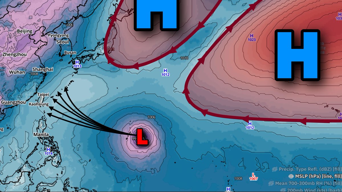
Thereafter, two alrge high pressure systems will act as "forcefields" of sorts, suppressing Bavi's northward progress and steering the storm west.
If you live in Japan, Taiwan or the Philippines, BE AWARE of the forecast and the potential for a high-end super typhoon in the western North Pacific.
After careful consideration, we've decided to draw a small zone from Fargo, N.D. to Bemidji, Minnesota where we believe an isolated EF3+ tornado is conditionally possible this evening.
Ada, Hawley, Mahnomen, Fosston, Bagley, Detroit Lakes and surrounding areas should monitor.
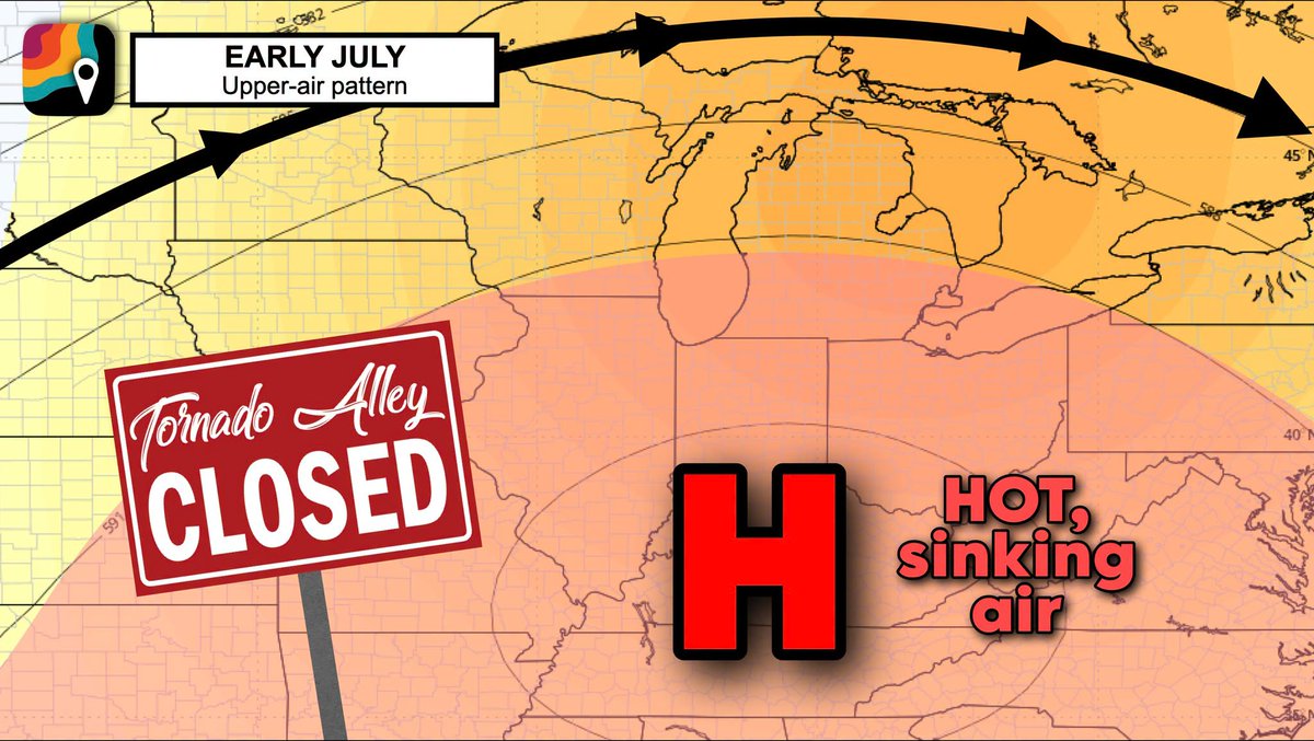
Illinois and Indiana – you are DONE WITH TORNADOES for a while. As far as we can tell, spring tornado season is finally done.
That doesn't preclude isolated, random summertime thunderstorms from a rogue accidental spinup, but there's no indication of any large-scale storm systems or batches of supercells.
Instead, a high pressure heat dome will bring hot, sinking air, and shunt the jet stream north. The Upper Midwest (Minnesota, Wisconsin) may see some severe weather, but it should miss us to the north.
Most inclement weather will likely be deflected around us for a bit.
It's worth noting that there tends to be an uptick in severe weather chances in the fall, with a typical "second season."
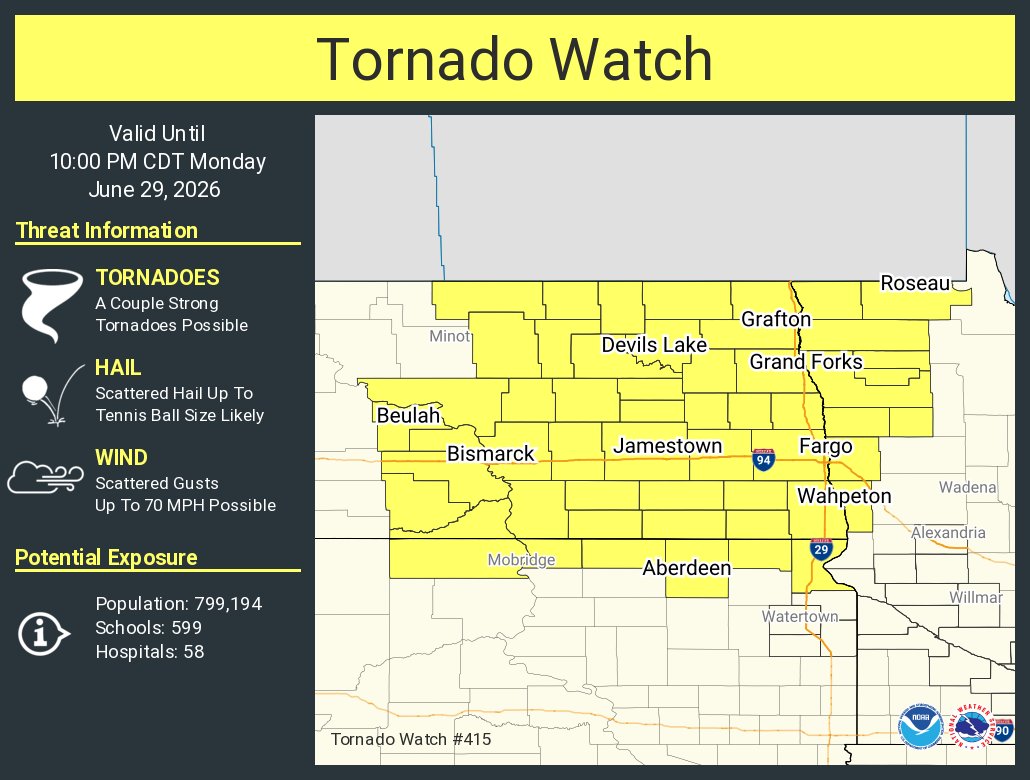
Elevated threat of tornadoes detected for Monday, June 29th, 2026.
See attached map for details.
This forecast initialized on Saturday morning. Follow for future forecast updates.
You wanted more. We delivered.
🟡 FREE METAR Station Plots.
⭐ Storm Highlight + Draggable Popups (Plus).
⚡ And 15+ more improvements/additions.
Check out the graphic, then jump into the app and come back to tell us what you're lovin'!
Oh... and we're already working on the next update. 😉
📲 Find WeatherWise on the Apple App Store, Google Play, or use our web app (link in bio).
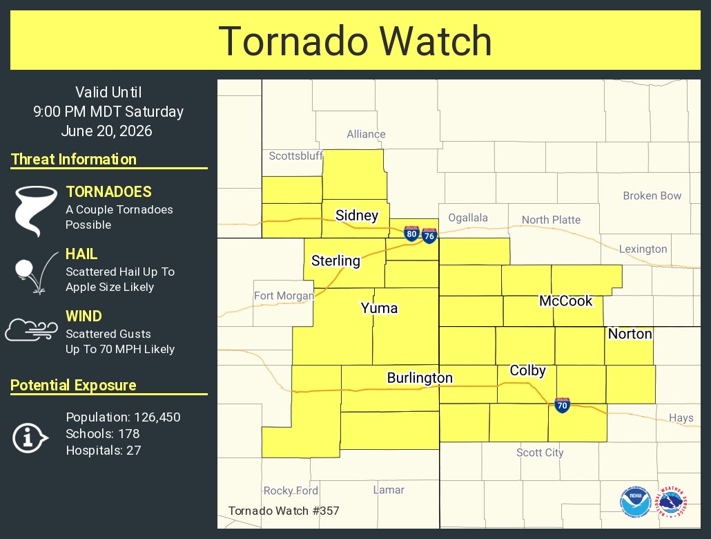
One year ago, a violent tornado near Enderlin, North Dakota threw a train into a field. It earned the first EF5 rating issued nationwide since 2013.
The Enhanced Fujita scale is limited; those limitations have precluded meteorologists from rating ANY EF5 tornadoes for more than a decade. There have undoubtedly been EF5-strength tornadoes since 2013, but no EF5 ratings have been given.
Until June 20, 2025. Last October, the National Weather Service in Grand Forks, North Dakota retroactively assigned an EF5 rating to the Enderlin, N.D. tornado. Doing so required months of scientific inquiry, including simulations, collaboration with wind experts and engineers, etc.
There are 122 National Weather Service offices around the country. While many employ top-notch people, it's unclear how many offices would go to this level to perform the forensic meteorology needed for the classification.
We asked Mindy Beerends, the meteorologist in charge at US National Weather Service Grand Forks North Dakota, about why her office would go through months of extra work to conduct simulations, forensics, etc. and assign an EF5 rating.
"We owed it to the science," she said.
When meteorologists rate a tornado with the Enhanced Fujita scale, they look for "damage indicators" in 28 different categories – hardwood trees, commercial buildings, apartment buildings, etc. But in rural areas, there aren't many damage indicators. And 16 of the 18 damage indicators can't be used to award an EF5 rating; hardwood trees, for example, can only be used to assign ratings up to EF4 strength.
But Mindy's team did something a bit unprecedented – they based a rating off contextual damage and supported it with defensible science. They reviewed the case of a derailed train; one of four empty tankers, weighing 72,000 pounds, was tossed 600 to 1,000 feet away from the track!
"Train" isn't a damage indicator on the Enhanced Fujita scale. Instead, her team collaborated with forensic wind experts, researchers in Canada and engineers. They determined that winds of 230 mph would have been necessary to toss the train car.
The result? A precedent-setting victory for science – a tornado rating the result of months of scientific inquiry. Kudos to Mindy's team for paving the way for future contextual ratings.