LIVE: They are coming home.
Watch as the Artemis II crew returns to Earth, splashing down at around 8:07pm ET (0007 UTC April 11). https://t.co/n3vZE2rcFv
We're going around the Moon. Come watch with us. Artemis II's four-astronaut crew is lifting off from @NASAKennedy on an approximately 10-day mission that will bring us closer to living on the Moon and Mars. The launch window opens at 6:24pm ET (2224 UTC). https://t.co/X27QJejNDt
Tornado Watch, canceled. One last chance for damaging winds with a cold front that moves E across the area 6-10pm. Possible a Severe Thunderstorm Watch gets issued for that. Regardless, it will be gusty with & after the front with temps dropping 20-30 degrees overnight.
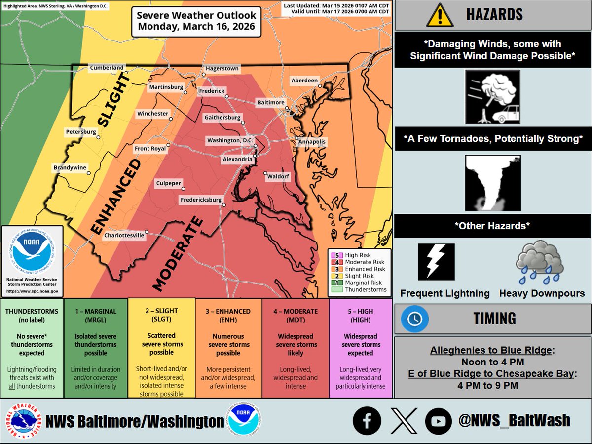
Prepare today for the #severeweather threat Monday. Now at a level 4 out of 5 for all hazards including the possibility of a few strong #tornadoes. Know where to go when a warning is issued whether it's at school, home, or work. Keep the 📱 charged & if you have a wx 📻 use it!
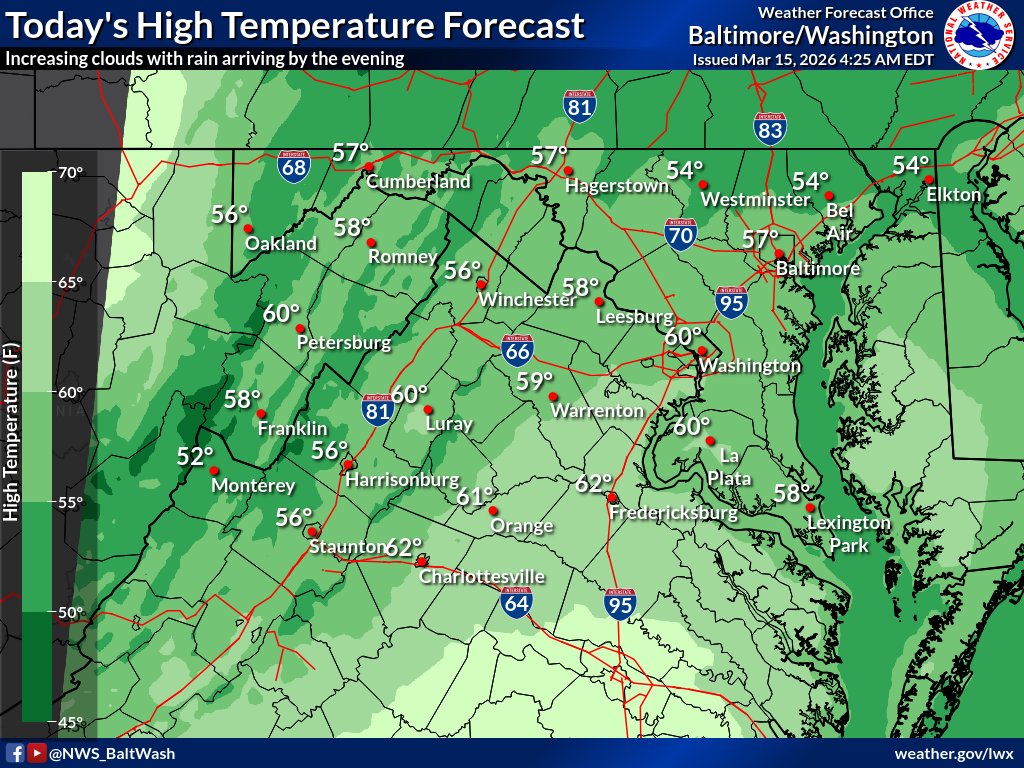
Clouds increase today w/ highs in the 50s-low 60s.
⚠️For Monday, the Storm Prediction Center has upgraded the area to a Moderate Risk of severe t'storms. Damaging winds (some with gusts up to 65-75 mph) and a few tornadoes (locally stronger) are possible. #MDwx#VAwx#DCwx#WVwx
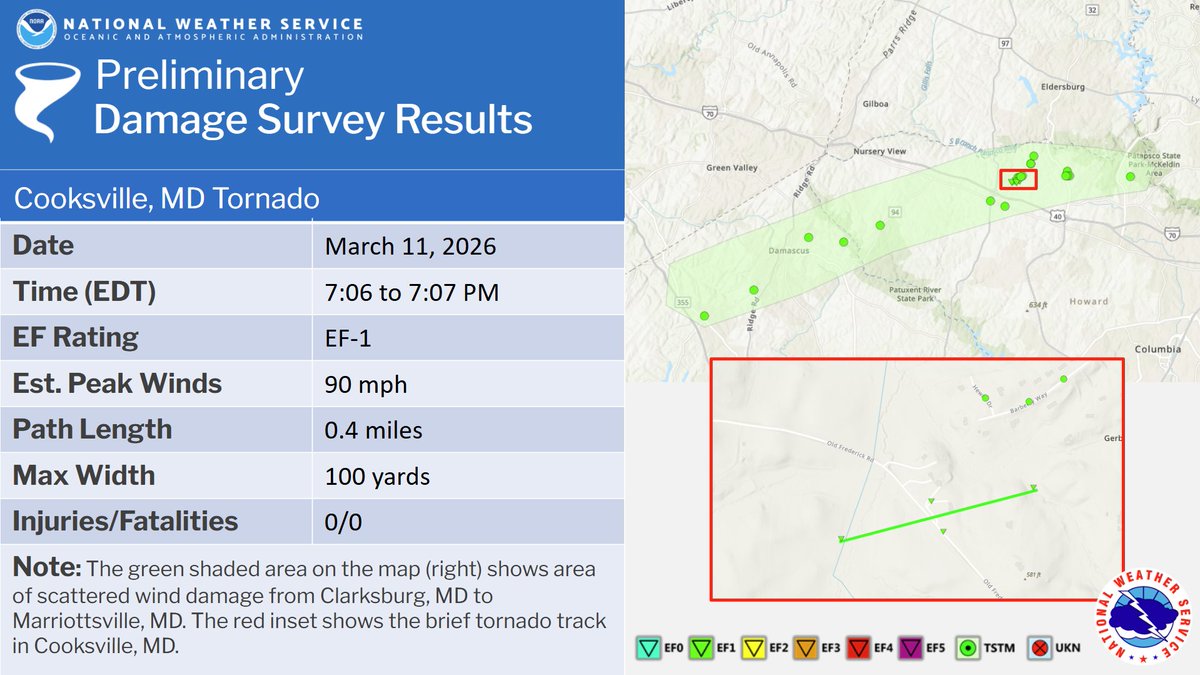
Our storm surveys found a brief EF-1 tornado touched down in Cooksville, MD with severe thunderstorms this past Wednesday (March 11). Additional information can be found here: https://t.co/Ow0Sov6Wc3
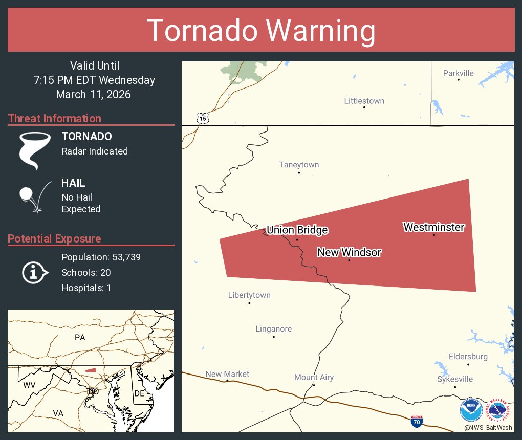
#TornadoWarning until 715pm for @CarrollCoMD. Interior room, bathroom, or basement. Act now! Heads up along MD-140 from Uniontown over to Westminster/Hampstead. #MDwx
Severe Thunderstorm Warning continues for Germantown MD, Gaithersburg MD and Ashburn VA until 7:15 PM EDT. This storm will contain wind gusts to 70 MPH!
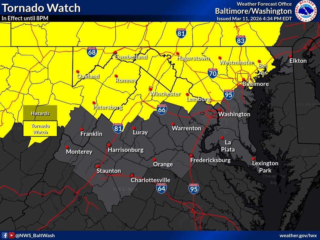
The Tornado Watch was expanded further east to include portions of Northern VA towards the Baltimore metro areas. The Watch remains in effect until 8 PM.
A Tornado Watch is in effect until 8PM tonight for portions of western/central MD, eastern panhandle of WV, and portions of northwestern VA. #MDwx#WVwx#VAwx
@JackRuddenWX High shear and helicity will get things going if the cap breaks. Focus mainly west of I-95 for better forcing. All a wait and see if the clouds break.
Scattered severe thunderstorms are possible this afternoon/evening. Damaging wind gusts, large hail, and a few tornadoes are possible. Pay close attention to warnings, should they be issued, and have multiple ways to receive them. #DCwx#MDwx#VAwx#WVwx
#Snow in #Hawaii? Yes, the Aloha State regularly sees snow fall along its highest peaks during winter.
In this imagery from @NOAA's #GOESWest yesterday, the satellite captured the reflection of white snow on the summits of Mauna Loa and Mauna Kea. #GOES18
While a few showers are possible today, the main story will be the blizzard conditions over the Alleghenies. Several inches of snow and wind gusts up to 40-50 mph are expected across western portions of Grant, Pendleton & Garrett counties. For more info: https://t.co/ZOlvESgJ2H.