HISTORY: The National Weather Service has issued its FIRST EVER tornado watch for the state of Hawaii. #Lowell’s outer bands could bring favorable conditions for rotating cells tonight, specifically to Kauai County.
@stormwx1 This is going to be our biggest severe weather day of the season. Wondering about extreme risk upgrade tomorrow morning but the confidence level might still be lacking at EC. All signals go w/ primary threat being damaging winds, large UH tracks for hail too, We shall see..
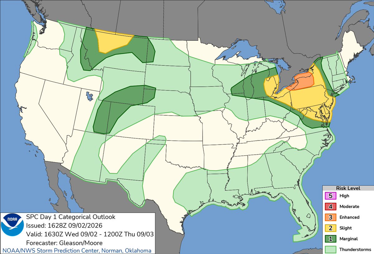
Environment Canada has issued a high risk for severe storms Wed aft-eve for a large portion of SON including the GTHA. Main risk zone has primary threat of wind gusts up to 130km/h along with large hail and tornadoes as secondary threats. #onstorm
@Mike__Gagliardi NHC will initiate advisories on Tropical Storm Dolly (formerly AL96) located in the central Tropical Atlantic, at 1100 AM EDT (1500 UTC).
@flying_steve Depends on if that seniority % is from the top or bottom. In this case you’re sitting 87% overall on the seniority list so higher than the A330?
A ground crew member has been critically injured after tripping and being run over by a Frenchbee A350 during pushback at Montreal-Trudeau.
The incident occurred around 7:00 pm on August 24 as the seven-year-old A350-900, originally scheduled to depart at 6:00 pm, began its pushback. The employee, acting as a wing walker, fell directly in front of the aircraft’s nose gear.
The aircraft, stranded due to prior technical issues, was preparing for a ferry flight. Emergency services responded immediately; the plane remains grounded pending investigation.
@stormwx1 Yeah not great, PCYC is hosting 1000+ sailors for 3 regattas with the first starting tomorrow. Tomorrow might have to be cancelled but awaiting official confirmation.
@stormwx1 Great… this is not good at all, especially considering the continued dry conditions promoting fire growth in N. Ontario and already hot airmass isn’t going to help air quality.
@stormwx1 Update on this, a large area of damage from Fourth Ln southbound to Sandwell Drive. Hydro crews still on site cutting up multiple big trees. Many more old trees down all the way to Guelph Line along Lakeshore.
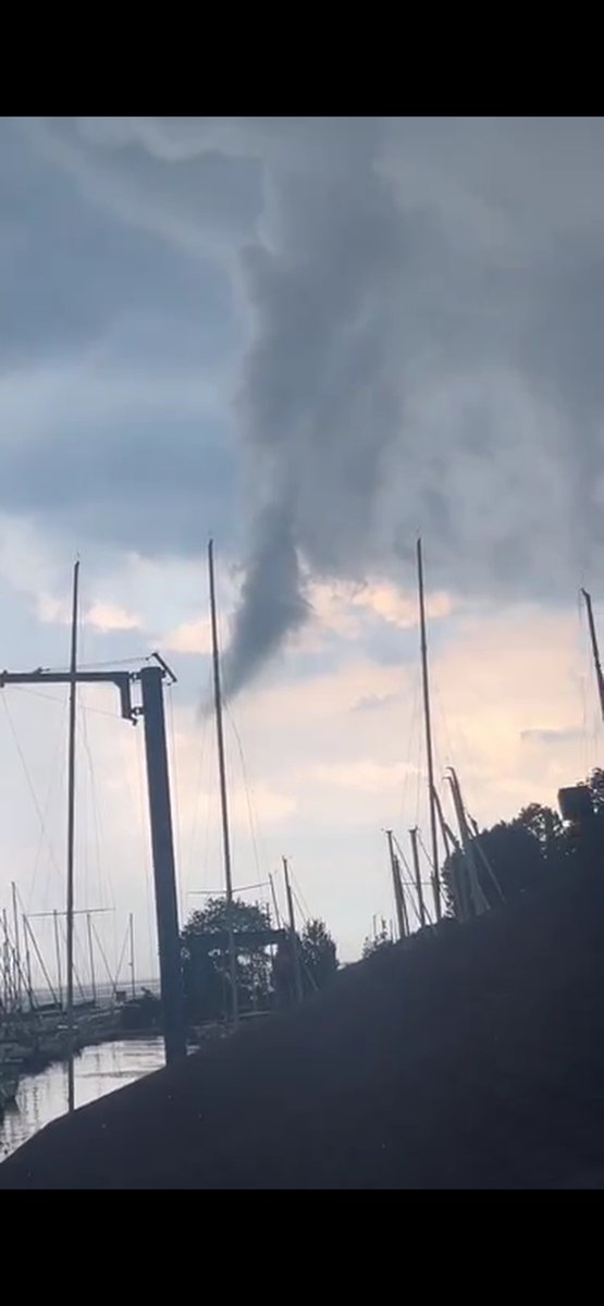
Dangerous thunderstorm moved through Oakville this afternoon. Multiple branches/trees down, sails ripped, patio/BBQ tossed, possible funnel / gustnado / rising scud. Easily orange level warning for straight line winds, 45 knot squall warning was not enough. #onstorm
@stormwx1 Oh it was so bad yesterday, worked outside all day. My weather station had a feels like of 54 degrees around 3pm. Which I thought was overkill until the RBG station about 15 km away reported the same thing.