I'm expecting an average to slightly later than average first frost across the region. The main driver here would be the potential for northwest flow in the end of September and early October. Ensemble guidance varies on the placement of troughing and ridging however, leading to a conservative forecast. More details in a short new video: https://t.co/QECiPD7bKa
Scattered thunderstorms are expected in the area through this evening. A few severe thunderstorms with damaging winds and large hail are likely to occur, mainly west of the yellow dashed line in the graphic. #ILwx#INwx
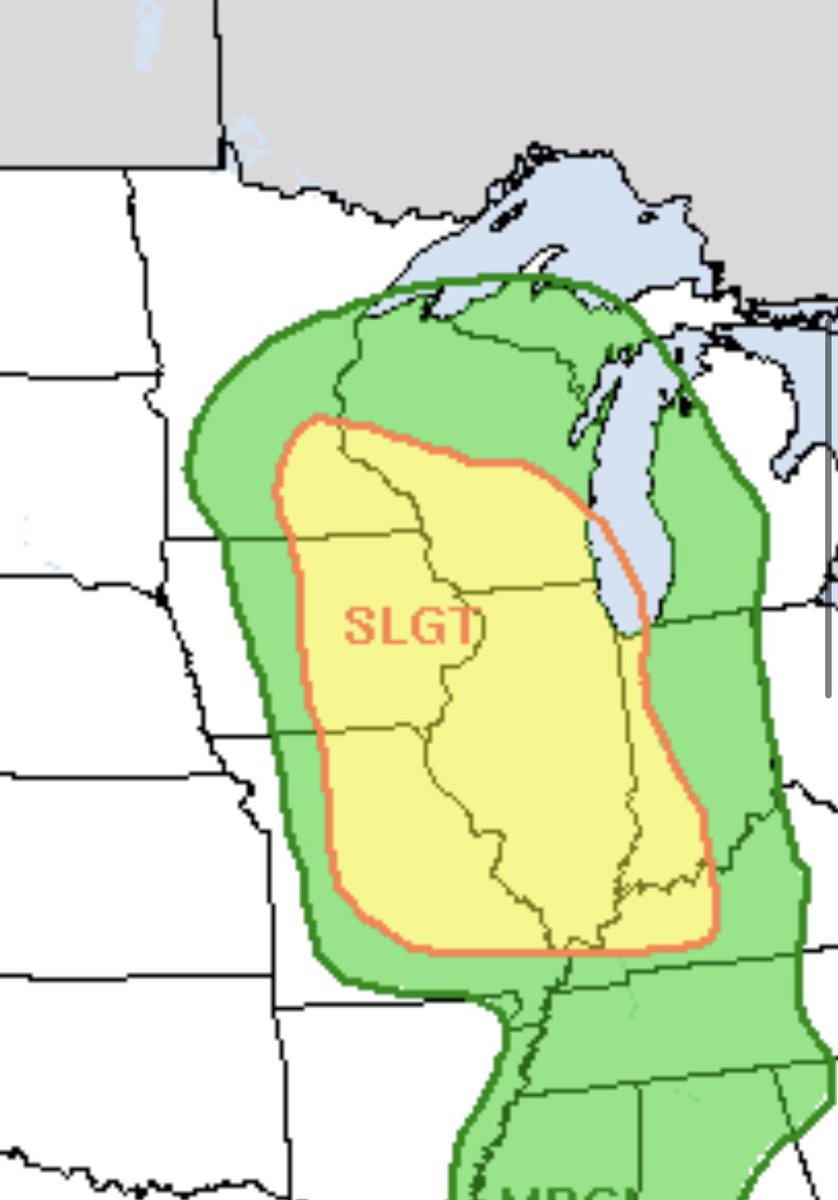
Isolated intense severe thunderstorms will be possible tomorrow afternoon/evening for portions of WI, IL, MN, IA, NE, and KS. Very large hail, damaging wind gusts, and an isolated tornado or two will be possible. Storms will be isolated, likely super cellular however.
Our snowfall maps will be colorful this winter. I plan to be more active on X this winter, the same as on Facebook. I like seeing the salty people on here.
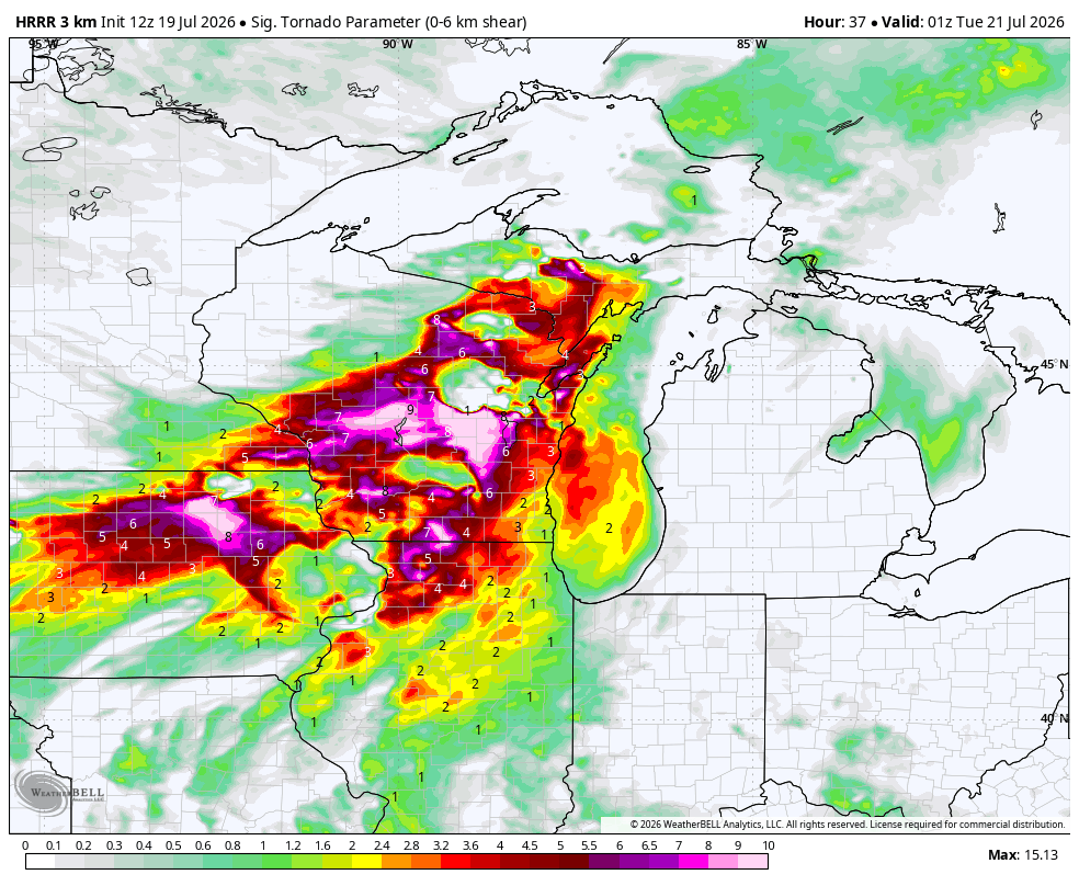
Derecho potential across northern Illinois Tuesday late morning/midday. A complex of storms will develop tonight across the Dakotas and move southeast overnight and into the area tomorrow around midday. Significant wind gusts and embedded tornadoes are possible. This could be a very dangerous storm. #ilwx
A wetter pattern. may evolve as we move into the middle of August for portions of the region. Above average precipitation anomalies would be driven by several rounds of thunderstorms, potentially severe, along the edge of a ridge.
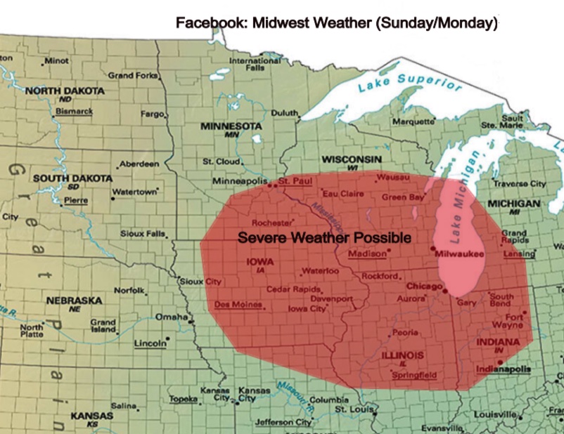
We are several days out, but model guidance continues to come into an agreement on favorable dynamics to be in place for severe weather this weekend and into next week. Sufficient deep-layer/low-level shear from fast-moving shortwaves will likely be in place. On the thermodynamics side, rapid low-level moisture return is likely, which will increase instability, as well as temperatures rising above normal. Greatest corridor as of now appears to be in the red-shaded area, but some changes are possible as we get closer.
Subscribe to our YouTube channel for in-depth discussions: https://t.co/001xexSt8n
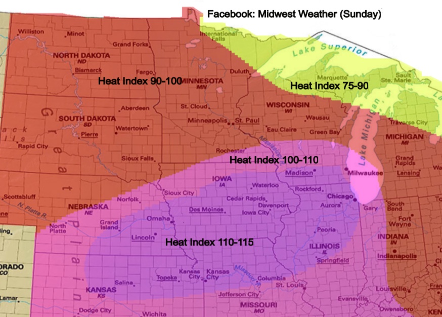
Significant severe weather will be possible Monday and into Monday night for portions of the corn belt. Depending how Sunday evolves, Monday will likely be further south. Extreme instability, moderate deep-layer shear, rich low-level moisture, and likely stronger LLJ compared to Sunday may lead to another fast-moving damaging complex.
A significant severe weather event should materialize tomorrow with all-hazards. There will be a window of enhanced tornado potential early on, then damaging wind threat will dominant.
Conditions will likely be favorable for severe weather late Monday into Monday night over a large part of the Great Lakes and Midwest, including northern Illinois and northwest Indiana. However, confidence in where storms form within the larger favorable environment remains low.
Monday may be the most significant out of the multi-day stretch of severe weather ahead. An arrival of a rather strong embedded shortwave trough will overspread the northern extent of the unstable warm sector. Dew points will pool into the low 70s with moderate instability/deep-layer shear in place. An organized severe weather event is possible, with all-hazards. Damaging wind threat will probably be greatest, but a corridor of enhanced tornado potential seems plausible in any semi-discrete/discrete supercells ahead of the cold front.