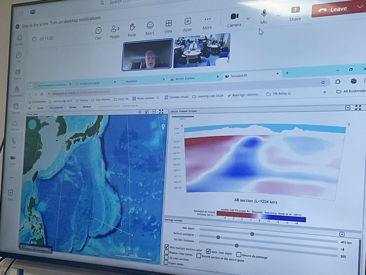
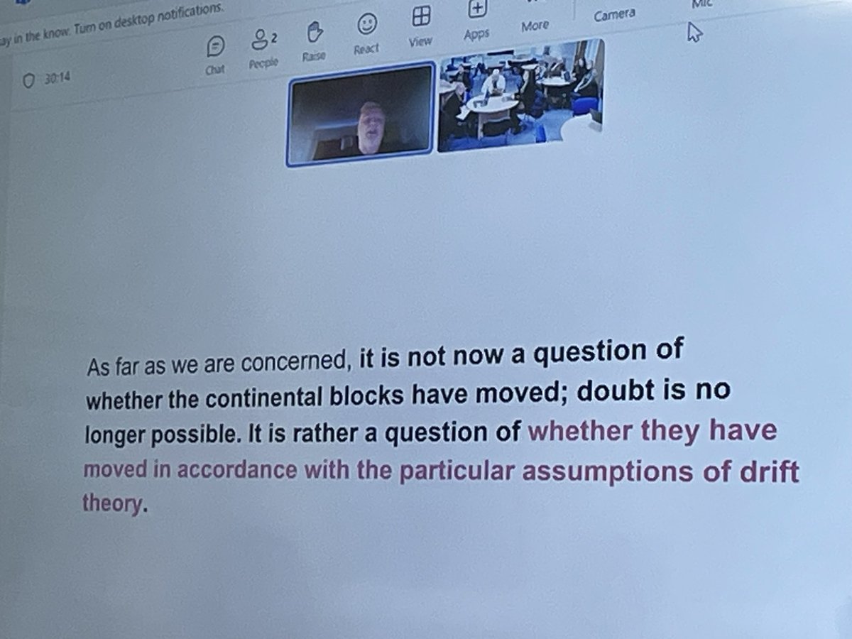
I used to print maps to teach the distribution of earthquakes and volcanoes. Not only did this cost money (colour printing😆) but I never really felt that students grasped what I wanted them to. So after watching videos mainly @lcgeography (thank you!) I now use GIS! 🧵
How do you teach river processes? I find it is so abstract for my pupils. We do a river study for our fieldwork so this does help. However any tips?!! I need ideas. #geography#geographyteacher
20 local geography school teachers from Preston, Lytham, Lancaster, Blackpool and Chorley meeting up to research AQA GCSE geography’s pre-release on the proposed Morecambe Bay Barrage Scheme. Can anyone help us bring the issue to life for our students? @timfarron@CatSmithMP
Today Y7 used GIS to explore the distribution of biomes across Asia. In Y7 we focus on adding layers, interpreting the legend and using the location tool. This helped us to develop our knowledge of latitude from a previous unit. We had some fab descriptions! #GIS
Geography planning shout out 📣 ….. Can anybody help? I need some resources on the challenges/opportunities created by urbanisation in Kenya. Does anyone have anything good?! Thank you in advance #geographyteacher
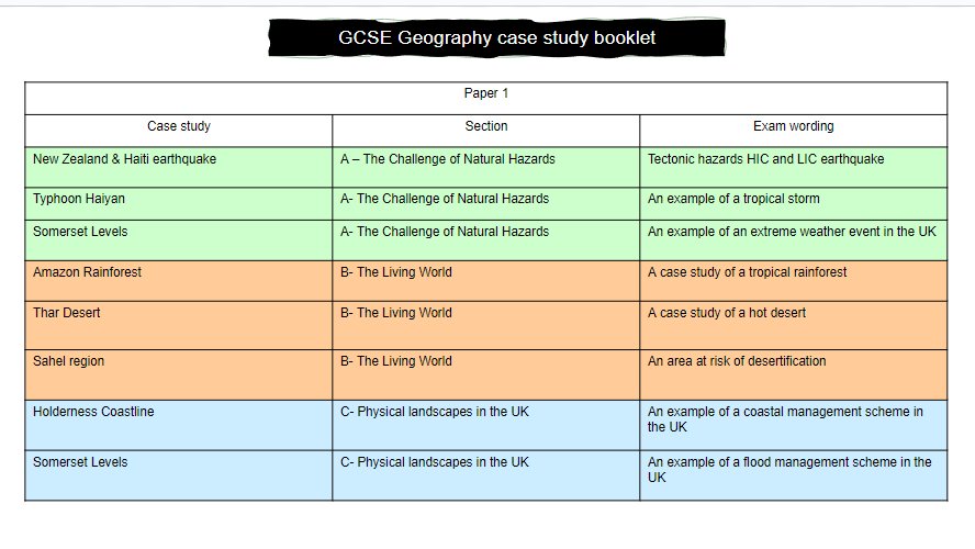
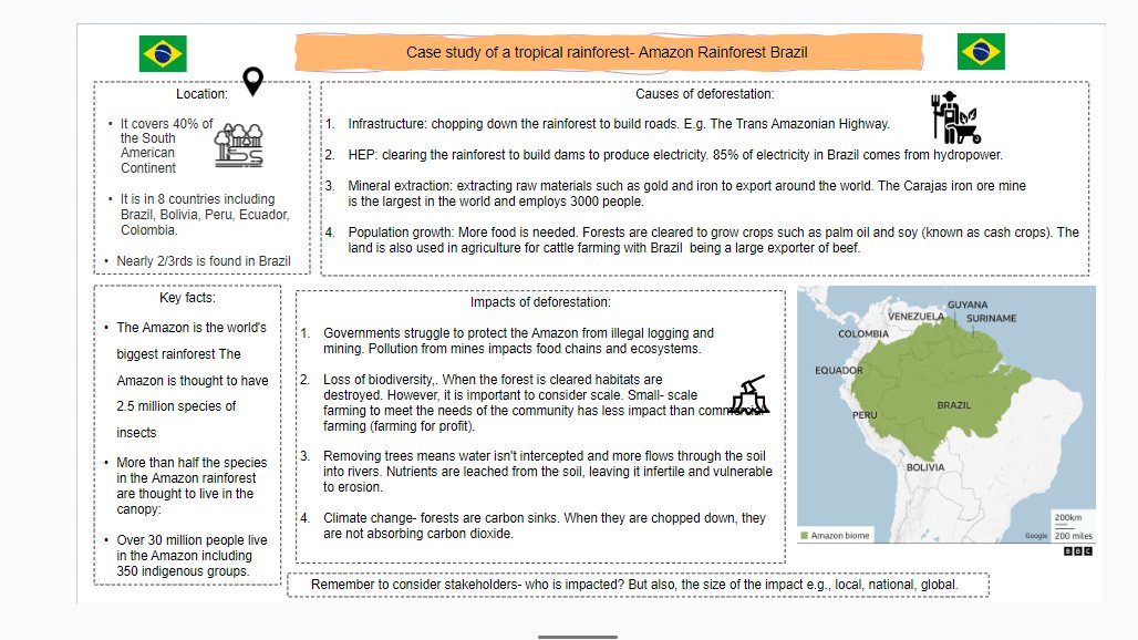
I have put together a case study booklet for our GCSE Geographers to hopefully help with studying for their mock exams. I know these can be a pain to put together! #geography#geographyteacher
https://t.co/m4GuKY6mGA
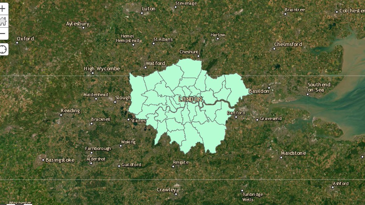
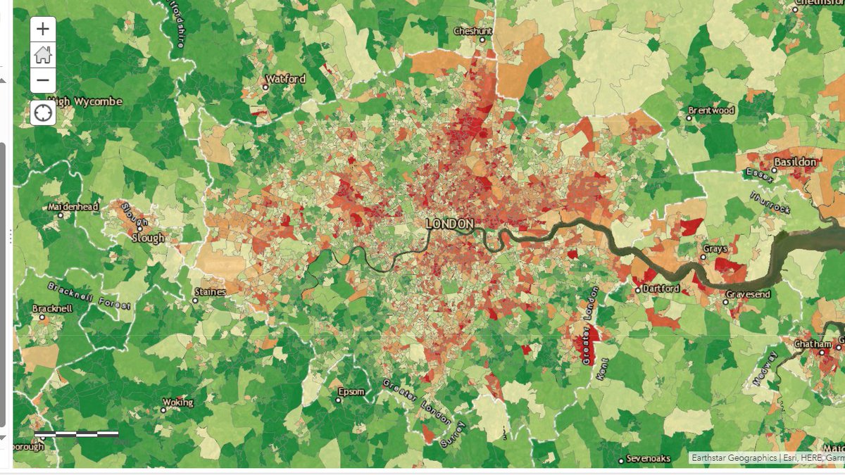
This year I decided to use GIS to teach the challenges in London created by urban change. By flicking between the map of London boroughs and IMD map. We could make comparisons about levels of deprivation between boroughs but also within boroughs.