Old incandescent desk lamps fixed people’s vision better than specialized red-light devices, and the effect lasted two months.
Dr. Glen Jeffery’s team took a windowless university space full of harsh LED lighting and simply placed the lamps around. No special protocol, staff just worked, ate lunch, used the bathroom as usual. Vision was measured before and a couple of weeks later.
The gains were larger than anything they’d seen from targeted single-wavelength red or near-infrared LEDs. Then the improvements held steady until Christmas broke the routine.
Incandescent bulbs put out a continuous infrared spectrum, the closest everyday light we still have to sunlight. Modern LEDs cut most of that out. The study suggests the missing part may matter more than we assumed.
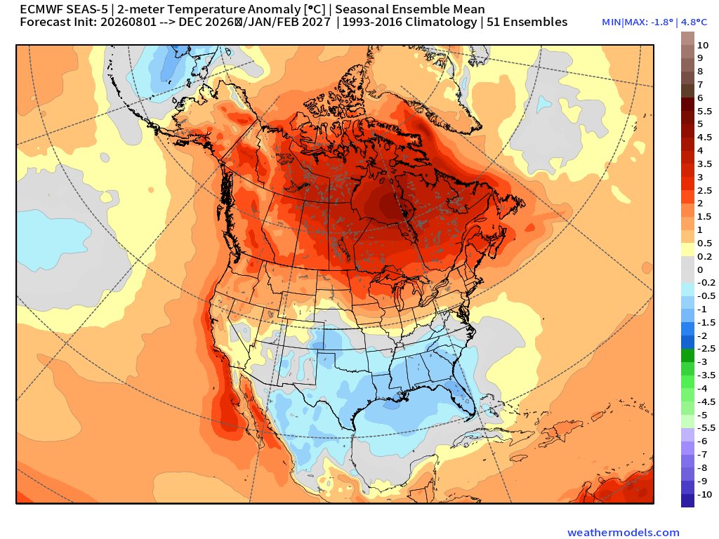
Next week looks relatively wet for most of the US, especially the Southwest (monsoon). The FL peninsula and northern AK lean dry.
Temps: Warmer than normal likely once again. However, the N. Plains to the Northeast lean normal to below normal.
https://t.co/HtSRAT6mRz @NOAA@NWS
WOW 🚨 Airlines in America are using “surveillance pricing” CONFIRMED
One JetBlue customer had the price of their plane ticket double in one day because the data the airline collected showed they were flying for a funeral
“This is one of the biggest scams in American history. Do you think that it would be fine to double or triple the price of an airline ticket for someone flying to a funeral?
There was a disturbing incident that played out on X, that shed some light, I think, on how airlines are using surveillance pricing in real time right in front of us. I think I've got the relevant exchange over my shoulder here. (SEE VIDEO IT’S WILD)
“$230 price increase. They're gonna figure out how they can rip you off one person at a time. They're not gonna charge you the same fare they charge your neighbor. They're not gonna charge you the same fare as the guy sitting next to you in the seat. They're gonna figure out how they can bilk you out of every dime they're willing to pay every time you step on an airline”
“It's gonna be the grocery stores and everybody else until we figure out how to bring transparency, how to bring honesty and some protections for the American consumer”
“This is one of the biggest scams in American history”
I went and found the original post and can confirm JetBlue is trying to hide that they are using surveillance pricing because they deleted their comment. The evidence was deleted
I literally gasped watching this
American bought a cheap phone, hired someone to use it in poor neighborhoods, and visit places acting like they have no money
After a day, apps on that phone had cheaper prices than a normal persons phone
Dynamic pricing is real and we are being robbed blind. Phone are collecting data and using that data to charge people different prices for the exact same services and items
🚨 NEW WILDFIRE IN TOOELE COUNTY 🚨
The Bates Fire is burning east of Stansbury Park in the foothills and is estimated at 30 acres.
Fire officials say no structures are currently threatened, but communication towers are located on the ridge above the fire.
Multiple ground crews and aircraft are responding, with the Utah Task Force en route from Brigham City.
Forecasts for the developing El Niño have become even more impressive. 🤯
The latest European (ECMWF) model now projects El Niño peaking near +4.0°C this December. If that were to happen, it would exceed anything observed in the modern record and would rank among the strongest El Niño events ever forecast.
What does that mean? It has the potential to reshape weather patterns across much of the globe through this winter and into 2027.
Current long-range projections suggest:
Canada could see a much warmer-than-normal winter.
California may be targeted by frequent, moisture-rich atmospheric rivers, increasing the risk for heavy rain, flooding, and mountain snow.
Texas, the Gulf Coast, the Southeast, and Florida could trend wetter and cooler than normal, with an elevated risk of winter storms and ice events.
What about Utah?
It’s still far too early to know exactly how this will affect us.
Historically, strong El Niño winters don’t always translate to a snowy Wasatch Front. Some have been very wet, others have been disappointingly dry in northern Utah. Southern Utah often has a stronger signal toward wetter conditions, but every event is different depending on where the Pacific storm track ultimately sets up. 💦
One thing is certain: a potential El Niño of this magnitude would influence weather patterns around the world, and we’ll be watching closely to see how those global changes translate to Utah as we head toward winter.
I’ll continue tracking the latest forecast trends over the coming months as confidence grows.
WEDNESDAY WX UPDATE: Wildfire smoke will continue to create hazy skies across parts of Utah through at least Friday. Smoke from large fires in the Pacific Northwest will gradually thin across northern Utah, but the Widemouth 2 Fire will continue to produce locally heavy smoke across central Utah. Dangerous heat will also return over the next several days. Many locations will run close to 10 degrees above average, and warm overnight temperatures will provide little relief. A few afternoon thunderstorms are possible each day through the weekend, mainly across the mountains of SW Utah. Most storms will be on the dry side, meaning lightning and strong, sudden wind gusts will be the biggest concerns. By Sunday and early next week, monsoon moisture will increase, leading to more widespread mountain thunderstorms capable of producing heavy rain and localized flash flooding, especially near burn scars, slot canyons, and normally dry washes.
WATCH FIRENADO: A dramatic firenado spins above the massive #Widemouth2 Fire burning in central Utah.
The lightning-caused wildfire has now grown to 84,409 acres and remains 0% contained as firefighters battle hot, dry and windy conditions.
Latest:
84,409 acres
0% contained
Cause: Lightning
Fillmore Ranger District, 6 miles south of Kanosh
The fire is burning in Millard and Sevier counties, with crews continuing efforts to protect nearby communities while facing extreme fire behavior.
#Utah #Wildfire #Widemouth2Fire #firenado
Viewer Video Submitted Via Chime In Syd Keel, Roger Matheny
Here we go again! After a welcome break from the extreme heat, it's making a comeback starting tomorrow.
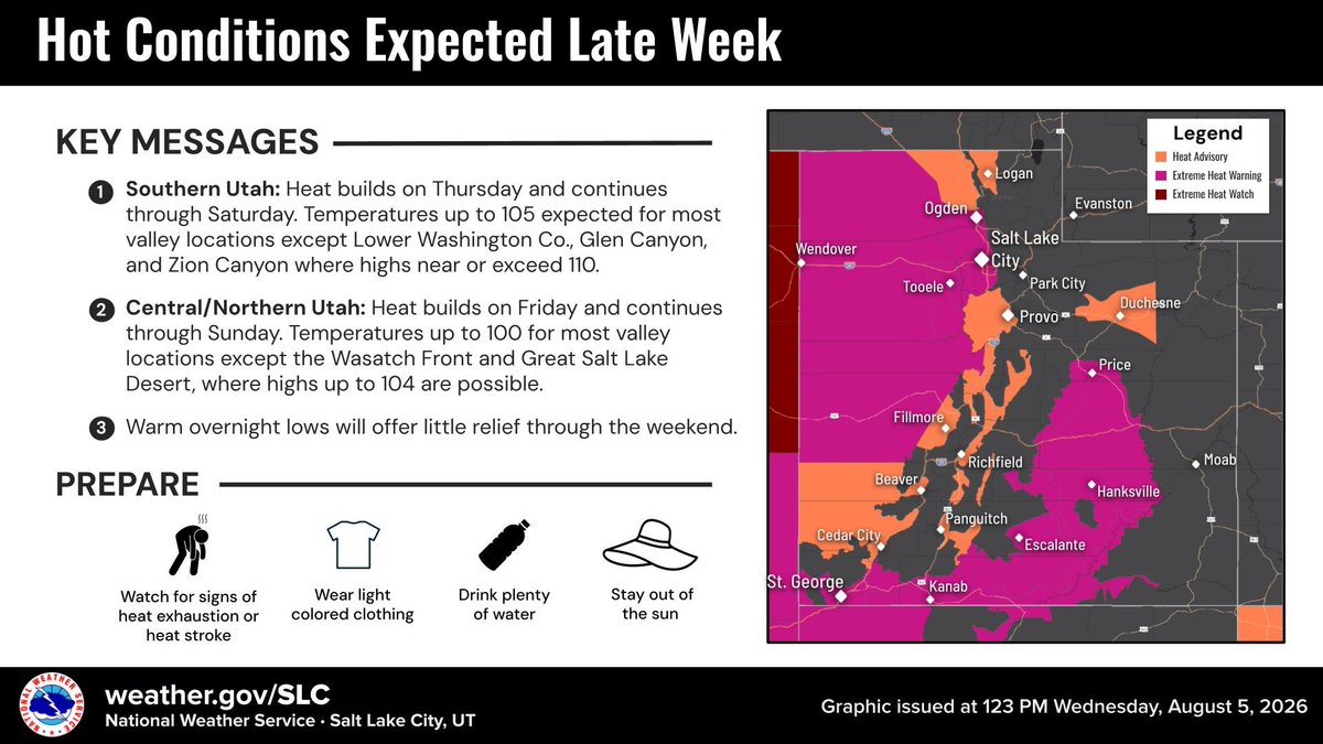
We're likely to break the daily record high on Friday, with temperatures expected to remain above 100° through Sunday. A gradual, modest cooldown is expected to arrive next week.
🌡️Hot temperatures are expected again late this week for most Utah valley locations. Highs will climb around 10 degrees above average Friday and Saturday, with warm overnight lows offering little relief. #utwx
A fire tornado formed above the Widemouth 2 Fire as the uncontained fire continued its spread through Millard County.
📍Kanosh, UT
📹Syd Keel, Roger Matheny via https://t.co/rfXQN8Df2K
#LittleHorseFire update: Located southwest of Fruitland in Duchesne County, the fire laid down overnight, allowing firefighters to make progress. The fire is estimated at 100+ acres, & additional resources are arriving today, including a Type 3 Incident Management Team.
Evacuation orders remain unchanged, including Avintaquin Canyon to the Strawberry River & Morning Star Ranch. Four evacuees remain displaced.
Please avoid the area, follow instructions from local officials, & stay alert for changing conditions & additional updates. (Photo was taken yesterday.) #ffslkmg
Monsoon Update: A More Active Pattern Ahead
Monsoon moisture will slowly begin to increase this weekend, with the weather turning a bit more active as we head into next week.
While moisture remains fairly limited through the rest of this week, isolated afternoon showers and thunderstorms could begin developing as early as Thursday thanks to intense daytime heating. Storm chances will continue each afternoon through the weekend, with the best opportunity across the SOUTHERN MOUNTAINS.
Because the lower levels of the atmosphere remain very dry, the primary hazards with any storms late this week will be:
Dry lightning
Gusty and erratic outflow winds
Looking ahead, a modest surge of monsoon moisture may arrive by Sunday, increasing the potential for more widespread mountain thunderstorms into early next week. If that moisture materializes, there could also be an isolated flash flooding risk, especially near burn scars, slot canyons, and normally dry washes.
The 6-10 day outlook also favors above-normal precipitation, supporting the idea of a more active monsoon pattern next week.
We'll continue to fine-tune the forecast over the coming days, as confidence in the exact amount of moisture that arrives in Utah. Stay tuned!
🚨 Take a look at this… you can see Utah’s wildfires from space.
This satellite image shows thick smoke pouring across central Utah from the state’s largest active wildfires.
🔥 The Widemouth 2 Fire has now grown to more than 84,000 acres, while the Black Canyon Fire has reached 1,150 acres.
The massive smoke plume stretches far beyond the flames, creating hazy skies and really impacting air quality downwind.
Can you see or smell the smoke where you are? Let me know what it’s like in your area.
New 🔥 Start: #LittleHorseFire, located northwest of Fruitland in Duchesne County, is estimated at 10 acres and growing due to gusty winds. The area is under a Red Flag Warning today, contributing to active fire behavior. No structures are currently threatened. The cause remains under investigation. #ffslkmg
🚨 BREAKING: Widemouth 2 Fire explodes in size again
The Widemouth 2 Fire in central Utah has grown to an astounding 68,191 acres, nearly doubling in size since yesterday.
This is now one of Utah’s largest and fastest-growing wildfires of the year. Evacuations remain in place in portions of the affected area, and residents should stay alert for any new emergency notifications.
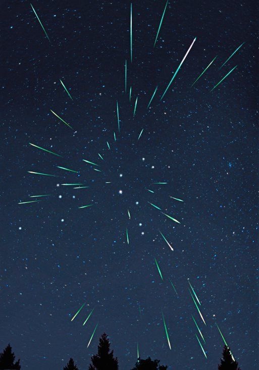
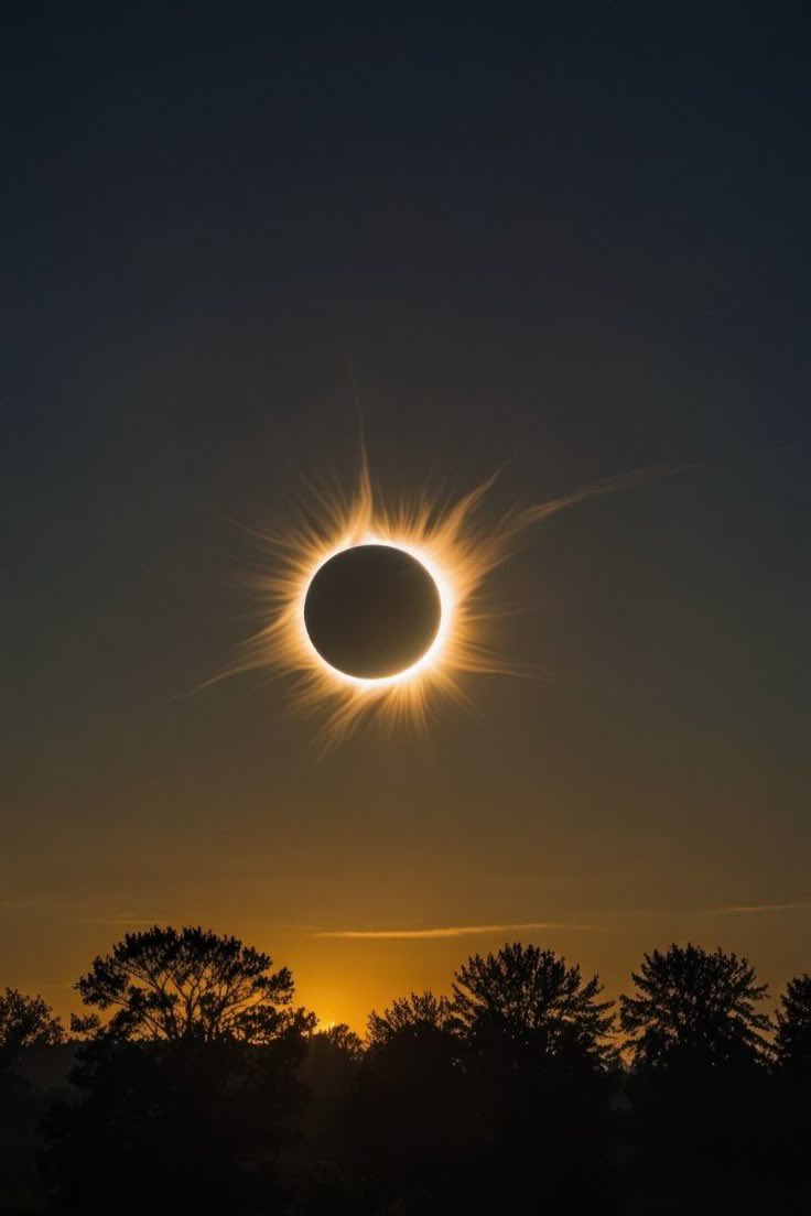
DON’T FORGET TO LOOK UP; on August 12, 2026, there will be a total solar eclipse, along with a peak of the Perseid meteor shower and also a rare alignment of six planets will all occur on the same day.