Imagery can establish that ground has been worked, but cannot establish whether a license exists for it.
Zephyr does not hold that data, and won't pretend to. It makes the join: connects a published licensing register, and the detected polygons are checked against it.
Detection without the register produces an allegation you can't stand behind. The register without detection produces a map of where mining is permitted, and no idea where it is happening.
This is another Zephyr capability.
Join waitlist at https://t.co/ZXRABeL8kJ
→ 16% were already bare in 2020: older workings, tracks, settlement. Correctly detected, but not new.
→ 45% lie within 300 m of surface water, the spatial signature of alluvial rather than hard-rock extraction.
However this is not proof of illegality.
Then we pulled a second scene over the same tile from January 2020 and asked what each of those 91 places looked like five years earlier.
→ 77% were under closed vegetation in 2020. Median NDVI across the detected areas fell from 0.667 to 0.148, canopy to bare ground.
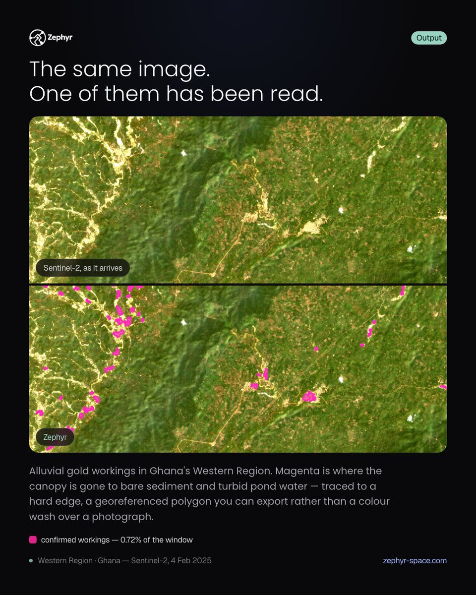
We ran a detection across a 441 km² window in Ghana's Western Region, on a Sentinel-2 scene from 4 February 2025. It returned 91 distinct clusters larger than 1.2 hectares, 317 hectares in total, 0.72% of the window.
Illegal gold mining leaves a colour.
La Pampa, Madre de Dios — one Sentinel-2 scene, nothing else.
Mining strips canopy to bare sediment and leaves turbid ponds. Both separate from rainforest spectrally, detected in one pass.
https://t.co/KhAYzbJuJW
Most useful questions are like that.
You can't see any of it from inside it.
With Zephyr you draw an area, pick a window, and ask. The planner works out which satellites see it and which method answers it.
Join the waitlist🔽
https://t.co/ZXRABeKAvb
#EarthObservation#AI
For decades people assumed this was an impact crater.
It isn't.
The Eye of the Sahara is an eroded geological dome, ~40km across, rings of harder and softer rock weathering at different rates.
At ground level it's just desert. The pattern only resolves from altitude.
An insurer pays a claim on a flood map. A regulator opens a case on a deforestation alert. A shipping company releases a cargo on a vessel detection.
1/🧵
5/ So every analysis Zephyr runs now leaves a receipt anchored on Flare: the imagery lineage and the method, hashed and timestamped by a party with no stake in the answer and checkable afterwards by anyone, with no account, no API key and no permission from us.
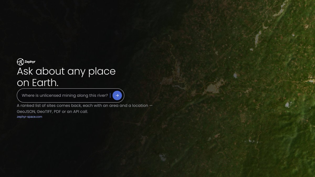
"Where is unlicensed mining along this river?"
That's the whole input. What comes back is 24 discrete sites, each with an area, a centroid and a score.
Not a heat map, a list an inspector can work from.
Underneath: Sentinel-2, a bare-soil and tailing-pond signature, segmentation into connected components, a few foundational model runs and delivery as GeoJSON, GeoTIFF, PDF or a REST API call.
You don't have to know any of that to ask the question.
People assume this is about prettier maps 🌍 . It isn't. It's about which questions get asked at all.
Right now the questions that get asked are the ones someone can afford to answer. Everything else stays unasked. 1/🧵
3/ a map, the numbers behind it, and a record of how it was made or a continuous flow of data for your platform or agent.
Automate data processing and serve it with verifiable computations.