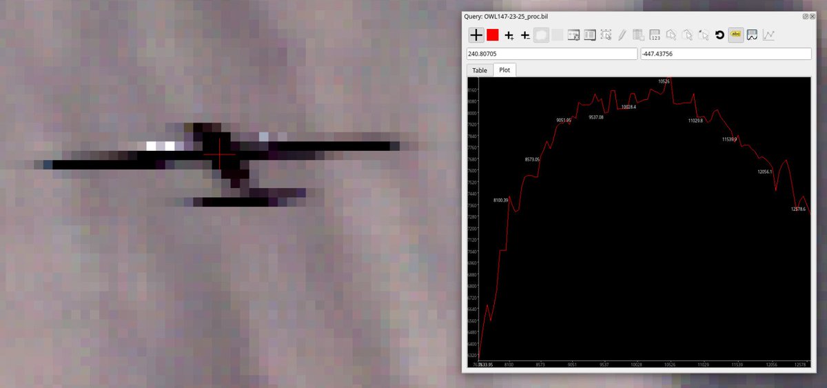
Back in Tuscany on two aircraft @NASA & @esa funded airborne campaign supporting new satellite missions. Both have thermal hyperspectral imagers, and today we unexpectedly imaged one from the other! @kclgeography@NCEOscience @NEODAAS
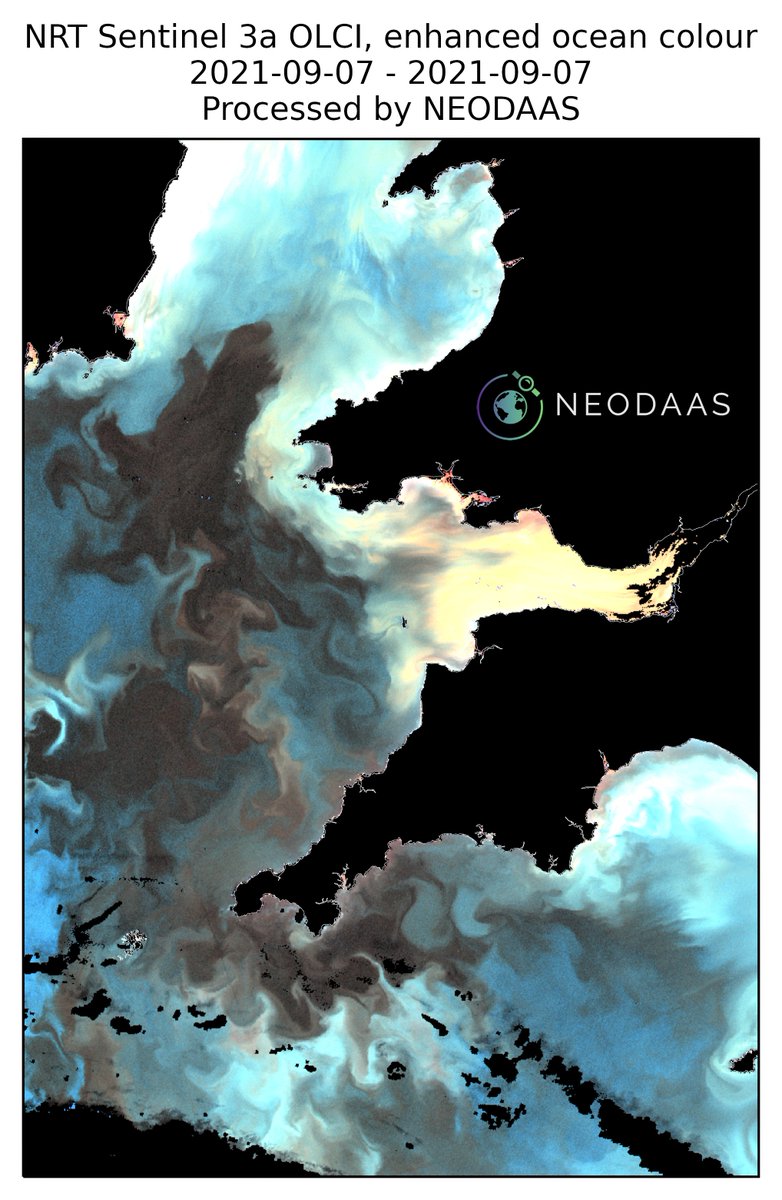
Recent sunny weather has intensified this huge algal bloom which contains the Noctiluca species, so look out for evening bioluminescence at the coasts of S Wales, Cornwall and SE Ireland. Enhanced ocean colour 07 Sep. 2021: it is not really this red in reality.
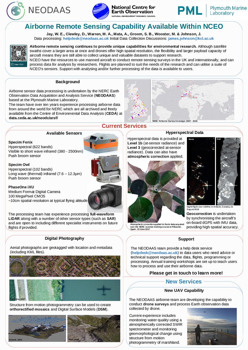
If you want to learn more about the airborne remote sensing capability offered through @NCEOscience and the processing we are continuing to offer through @NEODAAS checkout the poster @_willjay presented at #UKEOConf2019 last month: https://t.co/7lzbq2IO1g
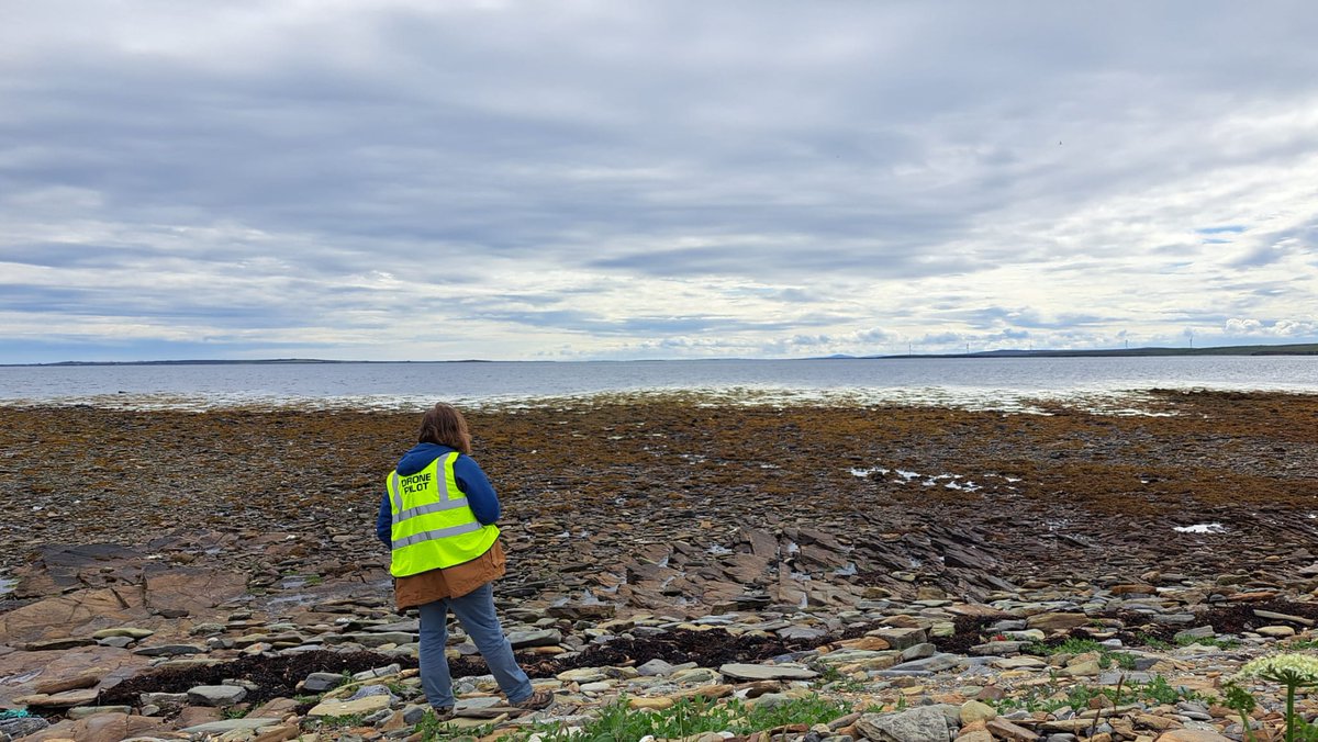
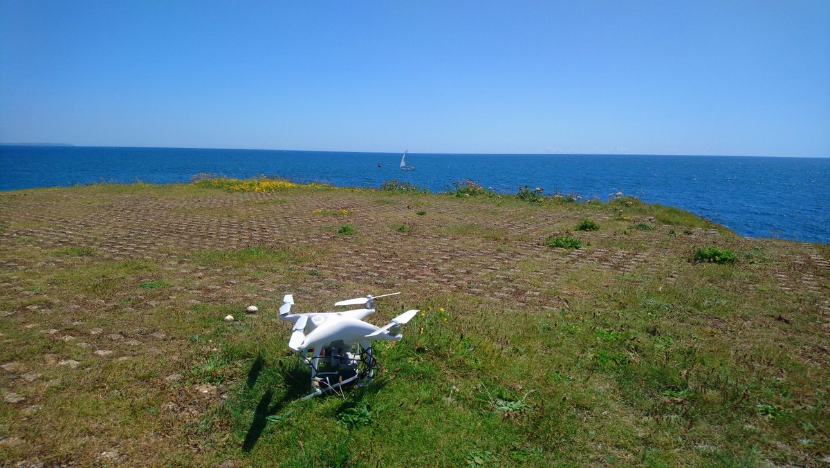
After a week of rain, last Friday was perfect for some field tests and data collection over Penlee Point (Rame Head). A bit too windy but our Phantom 4 managed the challenge! If you look closer to the photo taken with our drone, you will see us there right in the centre.
Do you have a passion for #Python? Our Centre for Geospatial Applications are looking for 2 experienced + competent #programmers who can understand complex issues, design effective solutions and deliver streamlined, well-documented #code that works 🐍💻
https://t.co/F3VE7sdEaO
Interesting find on the shelf of our office - contact prints of 9x9" large format photographs over @PlymouthMarine & the surrounding area!
Taken in 1989 on a Wild RC8 (long replaced with our 100MP PhaseOne iXU-RS 1000).
Can you see what's changed since then?
#aerialphotography