.@FAOSWALIM colleagues have found a hidden🐯Tiger Bush in #BeautifulSomalia
It's not an animal but a patterned vegetation formation: bands of trees/shrubs alternate bare soil/low herbaceous cover, giving the optical impression of a tiger skin!
🤓It can only be seen from the 🛰️
@DavaccTech@konzatech Unfortunately we have had a logistical delay in shipping some of the rockets components. This means we will not be able to launch the rocket tomorrow the 17th. We will communicate the the new date in due time.
Join us this August from 14-17 for the first #STEM Science Technology Engineering Mathematics school holiday camp organized by @DavaccTech & @konzatech for children aged 8-18 to learn 3D printing, Circuits, Sensors, Satellites and witness a #Rocket launch. https://t.co/pBvZoSETMw
The first Sentinel-1 radar data cube for Ghana was explored using a new @ESRI tool. This data will be critical to identifying mining activities and extent in a region with high cloud cover. The advanced analysis ready data #CARD4L was prepared by @NORCEresearch.
Jack D: Now is the time to move your #ArcMap apps to #ArcGISPro! It’s where all of our resources are going. We’re not abandoning ArcMap but this is where we’re going. #EsriEPC@Esri @EsriElectricGas
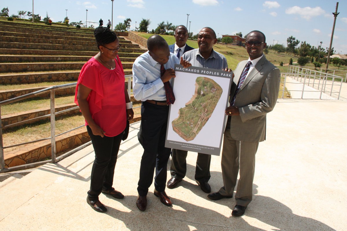
The first of the #DroneDialogueKE series hosted by @machakoscounty today brought stakeholders together to discuss drone status in Kenya. FAO is working with @kwskenya and @KeForestService to adopt drone technology in the surveillance of Kirisia/Leroghi Forest towards #ZeroHunger.
Call for applications now open! GEO and @awscloud are providing free cloud credits that are available for projects to improve understanding of our planet. Click here for more info:
https://t.co/j0AyXTplBK
Wonderful analysis of #geospatial knowledge and it's scalability through cloud platform.
Scaling Up: Why Cloud-Native Geospatial Matters Now via @forbes https://t.co/IpPLXJPjpA
A webinar with Kenya was hosted by the Africa Open Data Network (@networkfordata) and GPSDD (@Data4SDGs) on November 30 to discuss how the Africa Regional Data Cube (ARDC) can help local users. Check out the video: https://t.co/KhdCg0WZHn
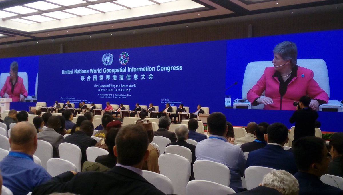
The First United Nations World Geospatial Information Congress (#UNWGIC)
🤗OPENS TODAYS!
Impressive #Zhejiang, Green Cities🌿
@UN@UNGGIM @geoworldmedia @NatGeo
#geospatial is not an option but a necessity, with #GIS#disaster risks and mitigation and post disaster relief becomes much more manageable, inspiring thought from ministerial dialogue #UNWGIC@UNGGIM @geoworldmedia @shimontipaul
To celebrate the ongoing 1st United Nations World Geospatial Information Congress (#UNWGIC) held in #ZhejiangProvince, let's PLAY a game!📸
Click on the link to create photos of you and your beloved ones and WIN airline tickets! 👉https://t.co/Pq2laCpOLO 🛫@UNGGIM @geoworldmedia
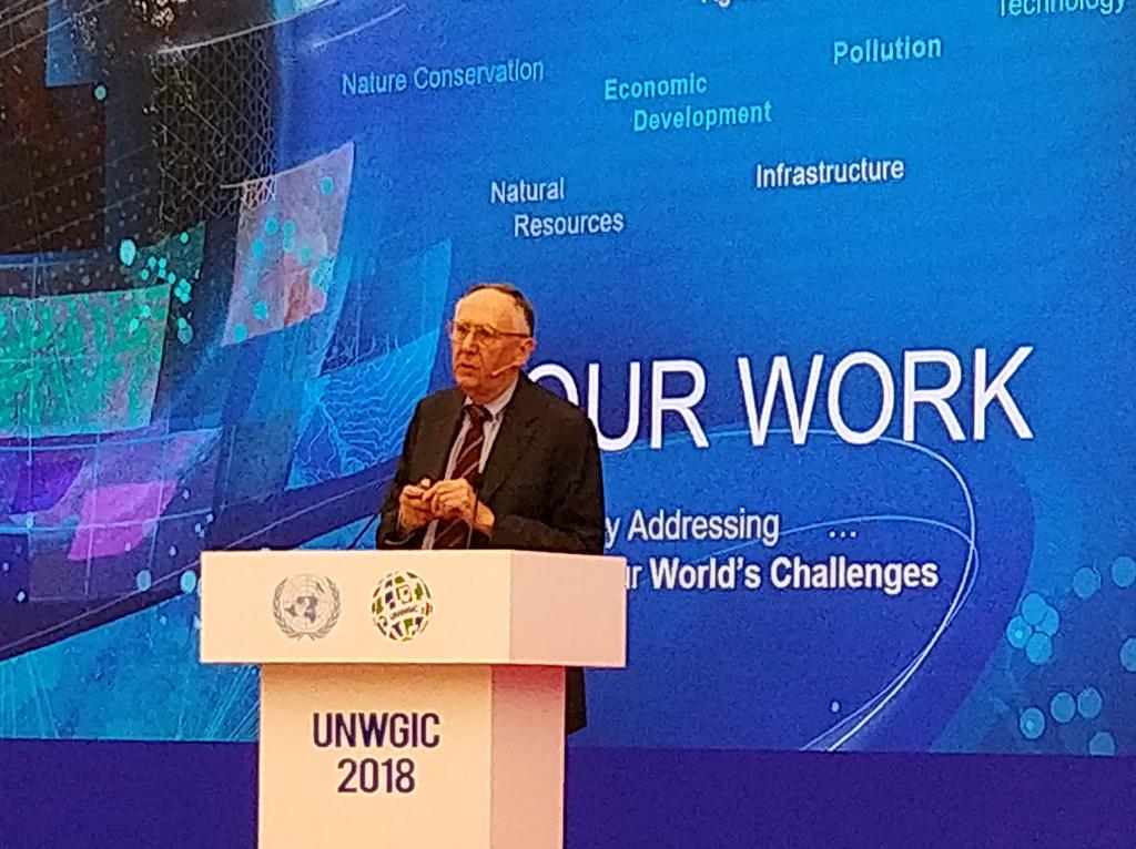
Jack Dangermond President @esri and Chair @WGICouncil delivering global keynote address at #UNWGIC - passionate advocate of geographical community to humankind and it's betterment.
In a consistently changing and challenging world, #geospatial can help better understanding of our natural and human resources and facilitate collaborative and scientific action. Jack #UNWGIC