Is there anyone y’all know that have connected a Eosense single chamber to an Ecotech or Teledyne NOx (or NH3) real time analyzer?👀 i am having some questions with the set up specific for these analyzers
Sudden drops in water temps (<50°F) are leaving turtles lethargic & unresponsive. DO NOT return them to the water! Call for help: 1-866-TURTLE-5 or (361) 749-6793. Your quick action can save a turtle!
More info: https://t.co/an0aUvXzPv #amosrehabilitationkeep#utmsi
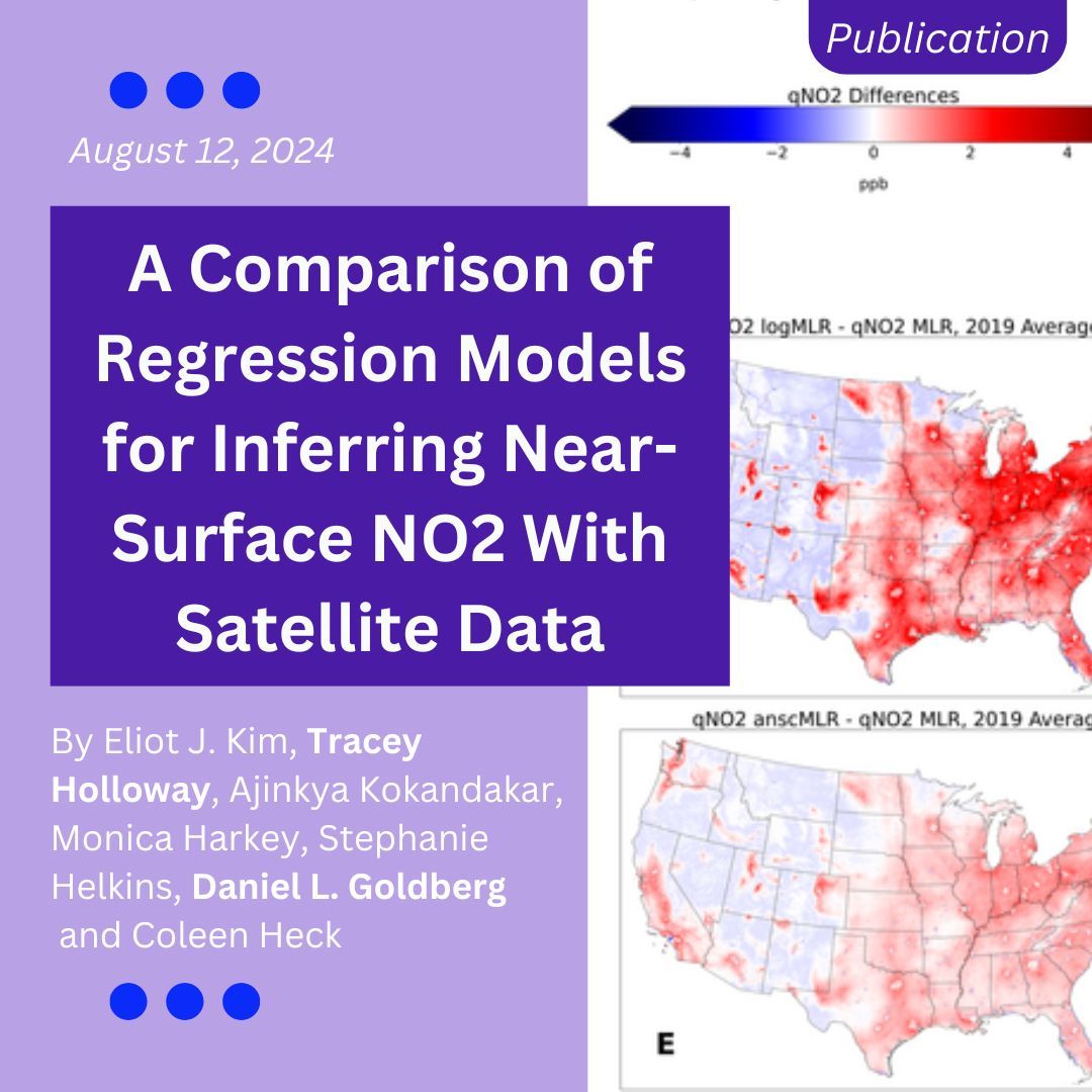
Learn how HAQAST researchers compared regression methods to estimate surface nitrogen dioxide concentrations at 0.01° resolution using satellite and land use data.
https://t.co/D6CNmmZNHR
I love being a PhD student.
it feels like I’m expected to be miserable or overwhelmed.
but as a first-gen student, I’ve had to overcome a lot worse to get here.
to read and write and learn for a living feels like a gift that I hope I never take for granted, inshallah 🙏🏽
Presented my poster at ARONET Science and Application Exchange! Learned a lot about aerosols that I am hoping I can use at our AERONET site. And got to hang out with some of the other members of the NASA IPMSI group. Great two days in Maryland
Really excited to share that the first chapter of my dissertation was published in @ScienceAdvances today! 🎉 It’s available at the link below, and I’m going to share a few key insights here (1/)
Link: https://t.co/FVQRW6BBkJ
How do we know which #wetlands emit the most planet-warming methane? Scientists from our @CoastalCarbon network recently discovered hot, fresh & flood-prone wetlands are the top emitters, while salty wetlands emit barely any. https://t.co/snAz89k3AP @UABBarcelona @UnivOfMaryland
New paper on HCHO in Arctic and boreal regions, led by @TianlangZhao. The main point is that HCHO interannual variability is largely driven by wildfires, except in East Europe. My fav fig is Fig 2, which shows MEGAN does not capture VOC speciation in European boreal forest.
if anyone has any fun and creative ideas of how I can display deposition, ppb difference, and ambient concentration data in maps/figures monthly for 4 watersheds please let me know.
Alternatively, how many maps can one add to a master’s thesis without looking too crazy?
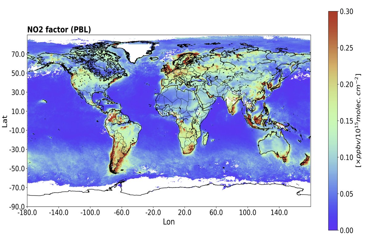
Conversion factors from NASA's model to transform satellite trop NO2 VCD into conc within the PBL. High values are seen over polluted regions (especially coastal ones where the combined shallow PBL + large surface pollution coexist). We're validating this using aircraft spirals.