¿Quieres aprender lo básico de R, pero nunca antes has programado? 👩🏻💻 Te dejo este tutorial que no requiere experiencia previa. No hay excusas! Empieza de cero y aprende lo básico en minutos 🥰 https://t.co/RYta7Pvpsm
#rstats
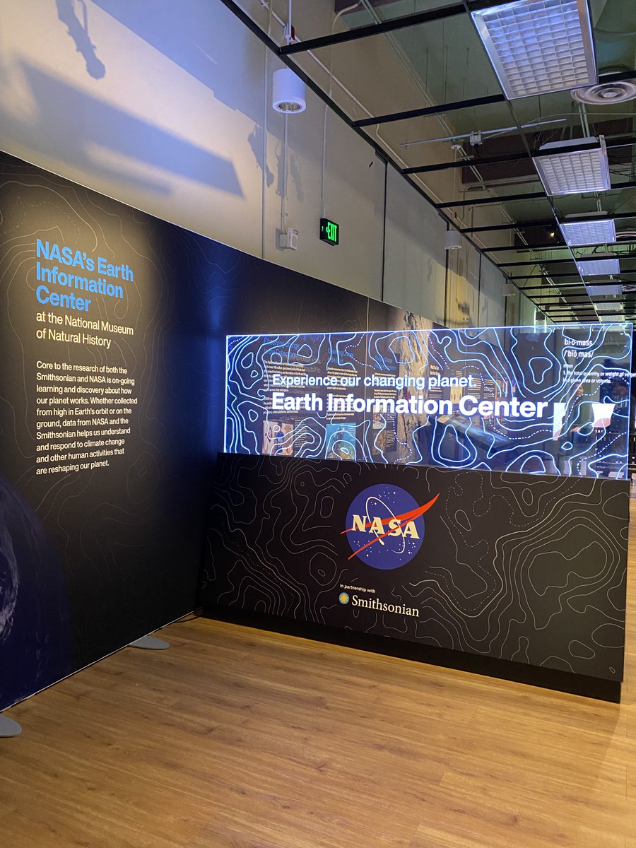
Fancy a day trip to Washington, D.C.? Check out the @NASA Earth Information Center exhibit at the Smithsonian Nat'l Museum of Natural History @NMNH to see #GEDI forest height data visualized on the big screen 😎
@UMDResearch@umdgeography@bsosumd
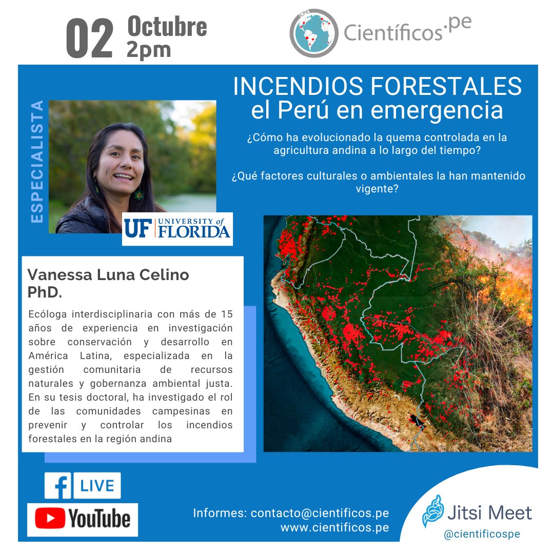
Este miércoles 2 de octubre a las 2 p.m., en vivo por nuestras redes, conversaremos con la Dra. Vanessa Luna @VanessaLunaCel sobre los incendios forestales en los Andes: su origen y su impacto en la agricultura. ¿Podemos hacer algo para prevenirlos? ¡No te lo pierdas!
NASA #LPDAAC's GEDI Version 2 Level 1B Geolocated Waveform, Level 2A Elevation and Height Metrics, and Level 2B Canopy Cover and Vertical Profile Metrics products are now available in the NASA Earthdata Cloud. Basemap: USAID NAIP 2020
Learn more: https://t.co/WEgV71iyjJ
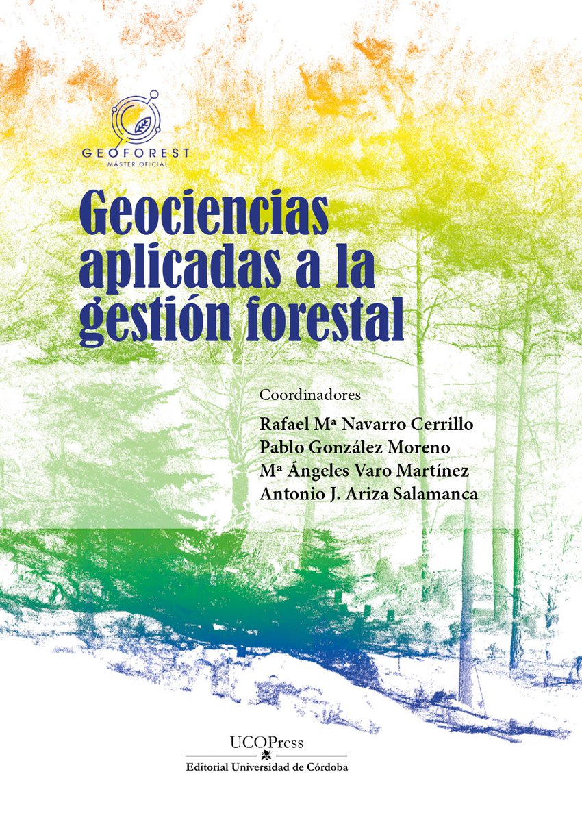
Nuevo Ebook! 'Geociencias aplicadas a la gestión forestal' material docente innovador para másteres especializados en geomática a nivel nacional. Una herramienta para impulsar la formación y la adquisición de competencias digitales en ciencias forestales! https://t.co/lxiqYkgjaP
Una banda de rock está en plena actuación y ven a un chaval con una pancarta pidiendo tocar con ellos. El cantante le pregunta:
- ¿Sabes tocar la guitarra, de verdad?
- Sí.
- ¿Cuál es tu banda favorita?
- Guns N' Roses
Le invitan a subir. Lo que ocurre después es maravilloso
[PAQUETE 📦] - Estas buscando información geográfica? Probá con {geodata}, vas a poder acceder a un compendio de datasets sobre población, elevación, límites geográficos, propiedades del suelo, tiempo de viaje y ➕!
🌐 https://t.co/EHgu4b9jio
✍🏼 gh: rhijmans
#RStatsES#Rtips
@ginaterremoto Hacer un Posgrado (becado) en el extranjero, nos hace pensar si con el CV será suficiente para tener mejores oportunidades en nuestro país de origen, considerando las limitaciones en la evaluación de meritocracia.
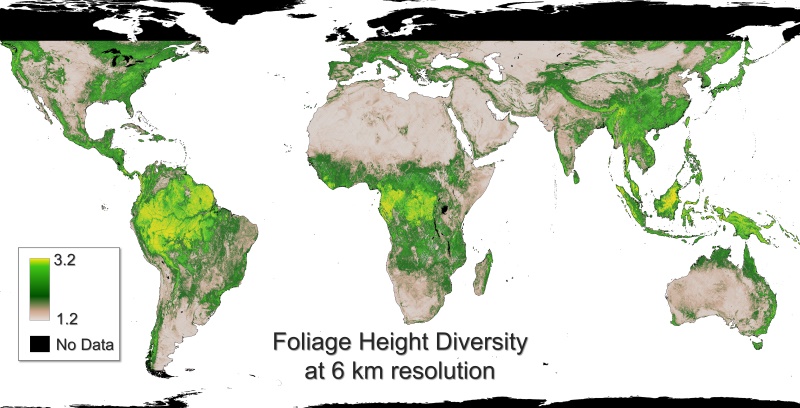
New dataset ➡️ Gridded GEDI Vegetation Structure Metrics and Biomass Density at Multiple Resolutions
Near-global, analysis-ready, multi-res gridded veg structure metrics derived from #GEDI L2 & L4A products associated with 25m diameter lidar footprints!
https://t.co/DVOITOTYgT
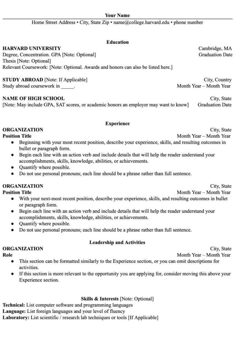
Here’s a CV template created by Harvard.
I have uploaded the word form to a google drive so you don’t have to create from scratch.
You just need to edit and include your detail. Feel free to change the headers when necessary.
Exciting #GEDI news! ✨ The team continues towards instrument reactivation. Robotic maneuvers scheduled for late day (EDT) April 22 and overnight into April 23, will relocate GEDI to its previous site on the ISS. Possible ISS operations may cause delays. Stay tuned for updates!
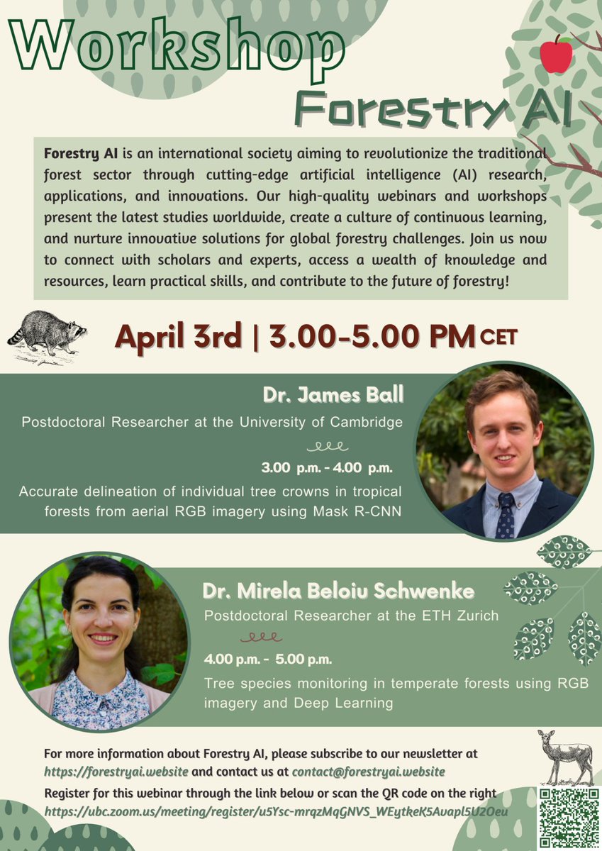
Exploring new horizons: tree species mapping with #deeplearning & #RGB imagery 🌲🌳🌱🌴Future #tree & #biodiversity monitoring methods 🧐
I'll be giving a workshop with @JgcBall at #ForestryAI
If you are interested, join us 👩🏾💻🧑🏽💻👩💻⬇️
Registration: https://t.co/6uZYlmjjM2
New #EarthEngine tutorial from the developer community just published – a workflow on species distribution modeling 🐦🦋🐯🏞️
👉 https://t.co/8YVfJ3tJTz
#python#geemap#habitat
Easily drag all your geodata (Shp, GeoJSON, CSV, etc..) to a map and quickly share using Scribble Maps. Use for free without an account today at https://t.co/nxThoJNtfR #GIS#Geodata#mapping
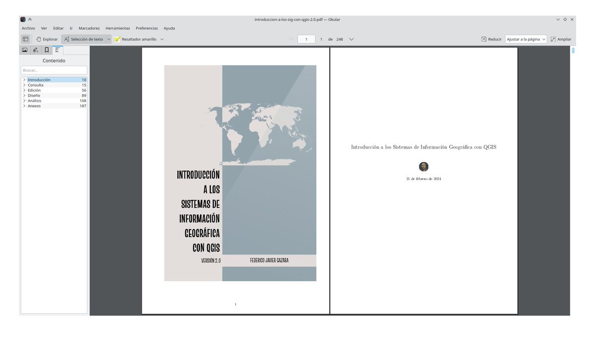
Hola amigos #geoinquietos! Lo prometido es deuda, les traigo la versión 2.0 de mi libro libre "Introducción a los Sistemas de Información Geográfica con QGIS".
Esta versión actualiza los contenidos de la versión anterior a #QGIS 3.34 Prizren.


![estacion_erre's tweet photo. [PAQUETE 📦] - Estas buscando información geográfica? Probá con {geodata}, vas a poder acceder a un compendio de datasets sobre población, elevación, límites geográficos, propiedades del suelo, tiempo de viaje y ➕!
🌐 https://t.co/EHgu4b9jio
✍🏼 gh: rhijmans
#RStatsES #Rtips https://t.co/QCKbY0zJYq](https://pbs.twimg.com/media/GQ6kdOcXoAAmP1T.jpg)
![estacion_erre's tweet photo. [PAQUETE 📦] - Estas buscando información geográfica? Probá con {geodata}, vas a poder acceder a un compendio de datasets sobre población, elevación, límites geográficos, propiedades del suelo, tiempo de viaje y ➕!
🌐 https://t.co/EHgu4b9jio
✍🏼 gh: rhijmans
#RStatsES #Rtips https://t.co/QCKbY0zJYq](https://pbs.twimg.com/media/GQ6kdOcWMAADF6f.jpg)