**Unusually Cold Low pressure to bring periods of isolated showers and even a few Thunderstorms to region tonight-Friday and Mountain snow??**
Strengthening onshore flow this evening ahead of an unusually deep and cold Canadian low that is expected to drop somewhere near the region and kind of hang out tomorrow through as late as Friday. 1st off this will continue to deepen an already very deep marine layer (if we can even call it that) as clouds now are reaching above 8000ft so more like cumulus clouds now. Periods of light rain will develop tonight west of the mountains and will continue at times through Thursday night. As the low makes it's closest approach the strong late May sun and unusually cold air will likely fire off a few Thunderstorms over our foothills and mountains and even costal areas of Santa Baraba and Ventura County. Temperatures will fall to 15-30 degrees below normal with onky 60s west of the mountains and 40s in the mountains.
Now believe it or not... Memorial dat week snow showers are looking more and more likely above 6000-7000ft at times, especially in the LA county mountains during the evening hours Wednesday and Thursday. BIig Bear may see it's 1st late May dusting in over a decade. Winds will also be very strong in our mountains and deserts with blowing sand and gust up to 75mph.
The cold low looks to weaken and shift north and east Friday through the weekend with highs quickly warming back to above normal.
Stay tuned as this weeks forecast is unusually hard to predict and I got a gut feeling we will see more shower and Thunderstorm activity them computers are showing!
#CAwx #Rain #Snow #Winter #Thunderstorms #LosAngeles #BigBear #Sandiego #SoCal
A UCLA-led study by Williams et al. (2022) found 2000–2021 was the driest 22-year period in southwestern North America since at least 800 CE. Since then, the region has seen intense drought, with conditions expected to worsen dramatically this summer. https://t.co/Wi3F82XxVP
Today, we share a breakthrough on the planar unit distance problem, a famous open question first posed by Paul Erdős in 1946.
For nearly 80 years, mathematicians believed the best possible solutions looked roughly like square grids.
An OpenAI model has now disproved that belief, discovering an entirely new family of constructions that performs better.
This marks the first time AI has autonomously solved a prominent open problem central to a field of mathematics.
Lake Powell, the 2nd-largest reservoir in the US, is over 80 feet lower than it was 8 years ago and 170 feet lower than the last time it was nearly full in 1999.
Spring snowmelt inflows are projected at just 13% of normal, the lowest on record. The lake could fall to 3,490 feet as soon as August, roughly 30 feet below the previous all-time low.
3,490 feet is "minimum power pool," the level below which Glen Canyon Dam can no longer generate hydropower for 5 million people across 7 states.
In a desperate move by the Bureau of Reclamation, up to 1 million acre-feet, nearly a third of Flaming Gorge Reservoir in Wyoming, will be released downstream to stabilize Powell.
This water crisis facing the Southwestern US will affect tens of millions of people, and it's not going anywhere.
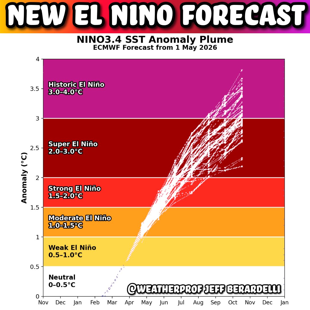
To help us visualize the new European Centre El Niño forecast I added a little color and category.
The average of the ensemble members is ~ +3C sea surface temperature anomaly in the Pacific El Niño region.
That means the average for late 2026 is as high or higher than the any recorded El Niño!
In 2015 the ENSO 3.4 region hit +3.0C (ONI) briefly in November, the highest I know of in my research.
Look at how many members (lines) meet or exceed the historic threshold.
With all this said: it’s not necessarily something to be “scared” of. In fact there’s one big plus… likely less Hurricanes in the Atlantic this summer! However, there are negatives… the extra heat released into the climate system super charges heat waves, floods and droughts. Expect lots of “unprecedented” events as well as the warmest global temperature ever recorded. The plus, science will learn a lot this next year as we may witness climate history.
#ElNino
**Traditional Early May storm will bring Winters last gasp with rain, Big Bear Snow and Record low Temperatures **
Well it looks like Winters last gasp is right on tine this year as a very cold Arctic low for May moves through the region tonight through Tuesday afternoon. Rain amounts should mostly be under .25" but latest computers show potentially up to 1inch in North San Diego county. Snow levels are already at 7000ft and will dip as low as 5000ft Tuesday. San Bernardino mountain communities may see 1-3" of snow above 6000ft to officially wrap up our wet season. Higher totals of 3-6" look possible around Pine Cove and Mt Laguna. May snow in San Diegos mountains is pretty rare but is a normal occurrence for Big Bear. There may even be a Thunderstorm in San Diego county. Highs tomorrow fall to 10-25degrees below normal with record low high and low temperatures in our mountains. Things should dry out Tuesday night . In typical May fashion temperatures will rapidly rise by the weekend with 100s likely in our deserts and jumping from 45 to 80 in Big Bear! Enjoy this unusually cold weather, this will likely be the last winter storm of our wet season til Monsoon season arrives in June Thunderstorm.
#CAwx #Rain #Snow #May #Winter #LosAngeles #BigBear #SanDiego
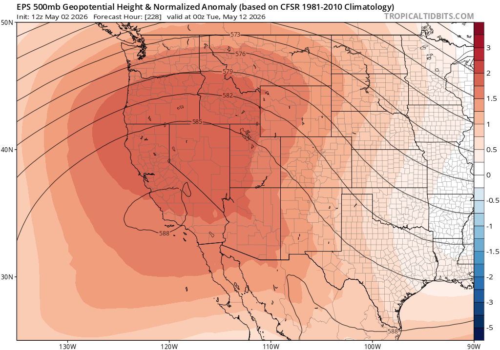
Looking ahead to mid-May, there is now pretty strong inter-ensemble agreement regarding the development of a much more pronounced Western ridge once again, with the potential for a significant heatwave at that time. This would mark a major pattern shift, so stay tuned!