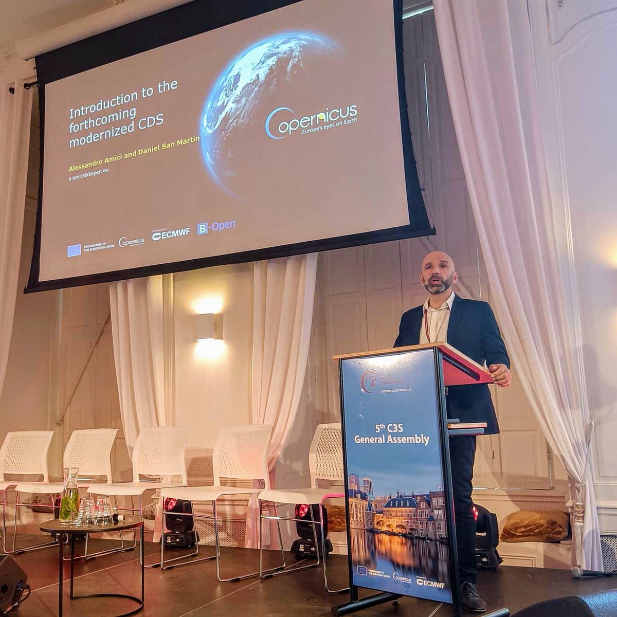
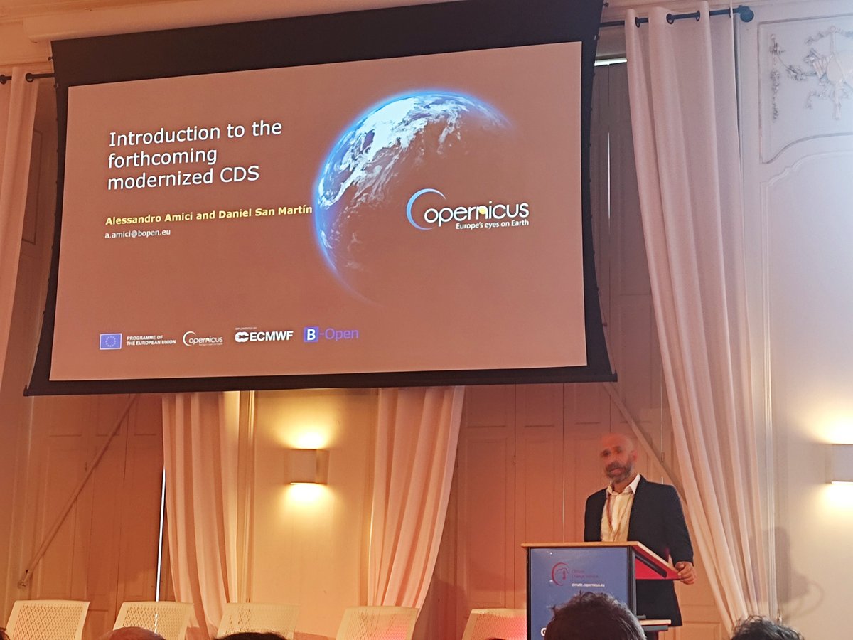
Great to hear so much encouraging and constructive feedback on the existing C3S infrastructure this morning and excited for @alexamici presenting the modernised CDS which we are developing for @CopernicusECMWF
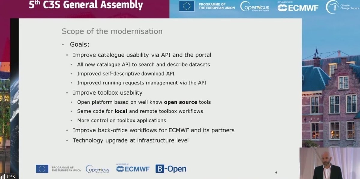
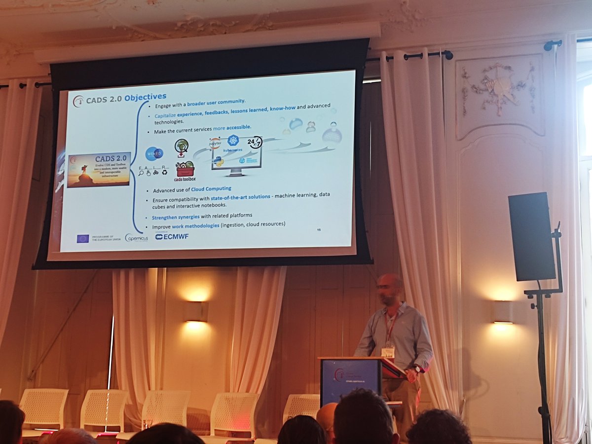
@alexamici from @bopensolutions deep dived into the goals of CADS 2.0 stressing that the most prominent improvements will include the catalogue usability via API & toolbox usability, as well as creating a real open platform to be used everywhere.
CADS available 2023-Q4/2024-Q1
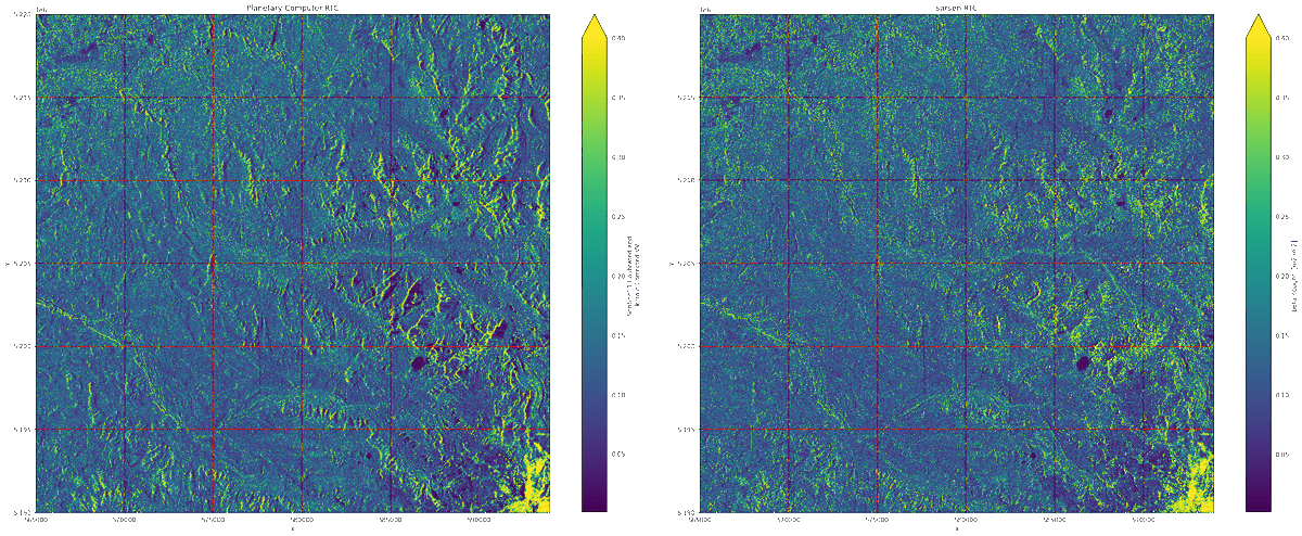
We've just released Sarsen v0.9.2!
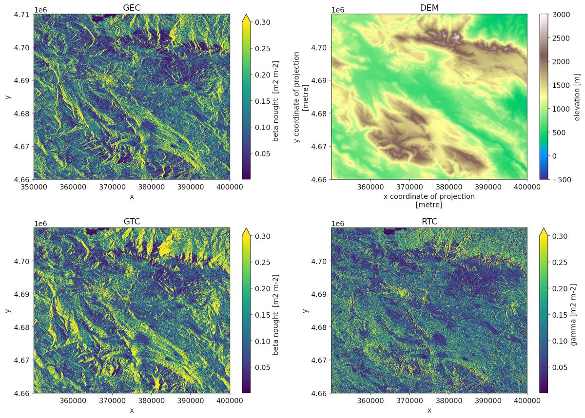
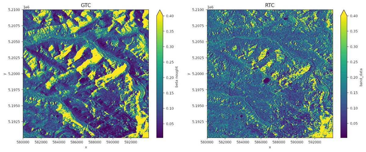
Highlights: massive performance improvements, the ability to terrain correct a full Sentinel-1 SAR product in one go and a detailed correctness analysis.
The aim for the next release is a fully operational tool! Follow me and @bopensolutions
We've just release v2022.06.0!
This release brings a major internal refactor of the indexing functionality (thanks @benbovy, @cziscience), the use of flox in groupby operations, and experimental support for the new Python Array API standard.
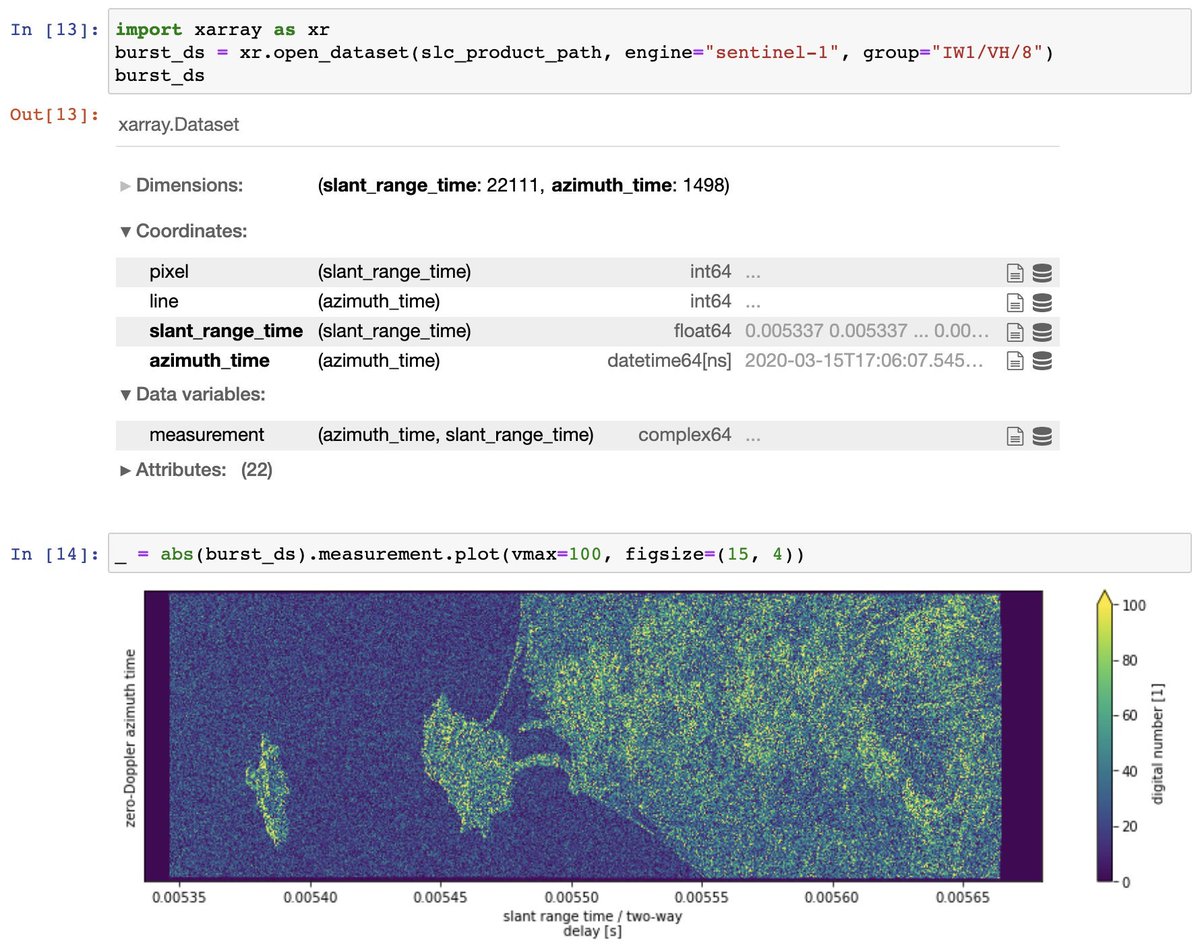
Time to announce the release of xarray-sentinel v0.9.2 to access Sentinel-1 products in Python via xarray! Highlights: full support of remote and compressed data via fsspec and new geospatial attributes. Shameless plug: we are hiring: https://t.co/mRj9EMaKak 🙏 retweet for reach!
Xarray has a new blog! In our first post, @HammanHydro takes a look at what we accomplished with our first @cziscience EOSS grant. (1/n) 🧵
https://t.co/JKomFJv6id
🫴 Improving access to Copernicus climate and environmental data
🔓 Adopting mostly #OpenSource technologies
This is just part of what we're developing together with @bopensolutions and @CopernicusECMWF, to expand #Copernicus services.
👇More details in our blog👇
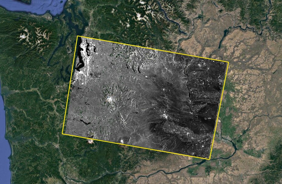
And if you want to make your *own* RTC product from the GRD data, then https://t.co/iQ4qlv7lrY is the place to start. This is a great tutorial from @bopensolutions introducing SAR, geometric & terrain correction, and the new sarsen library.
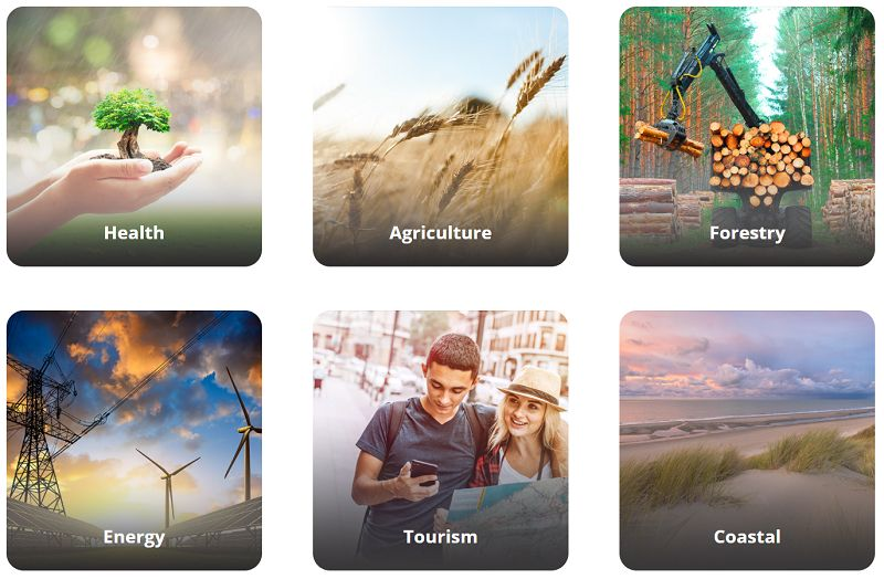
Proud to have been chosen by @CopernicusECMWF and @EUEnvironment to upgrade the European Climate Data Explorer together with @TheClimDatFac. Two years to publish new pan-european climate indicators and visualisations to better support #EUAdaptationStrategy https://t.co/OD445XOHaS
It is my pleasure to announce the first beta release of @bopensolutions flagship Open Source projects: xarray-sentinel and sarsen. Accessing, processing and terrain-correcting Copernicus Sentinel-1 SAR data with Python, @xarray_dev and @condaforge has never been easier 🧵
I'm thrilled to announce the first public release of Sarsen, Open Source algorithms to process SAR satellite data in Python by @bopensolutions. It supports geocoding and gamma flattening Sentinel-1 data on any DEM, partly sponsored by @Microsoft https://t.co/DzjtR94erh 🧵 1/4
I'm please to announce xarray-sentinel v0.4 to access Sentinel-1 SAR data products. This release improves performance and adds helpers for a few metadata related operations like applying radiometric corrections and converting form slant to ground range https://t.co/IWeTSNiNcg
📢 At @bopensolutions we've just released version 0.3 of xarray-sentinel to read @CopernicusEU satellite data in Python, now with full support for Sentinel-1 GRD products 🎊 and calibration metadata. This release was partially sponsored by @Microsoft!
Join our short course on 16 Feb and explore "Analysis Ready Data" with experts from @eumetsat, @meeosrl & @bopensolutions. You'll get an introduction to the "Atmospheric Composition Data Cube" during this two-part event on 16 February 📅. Register at: https://t.co/Sc89475Apx