B.S. in Earth Science (Atmospheric Science Concentration) + Global and Environmental Change. Former intern @StateDeptOES and @CapitalWeather No political slant.
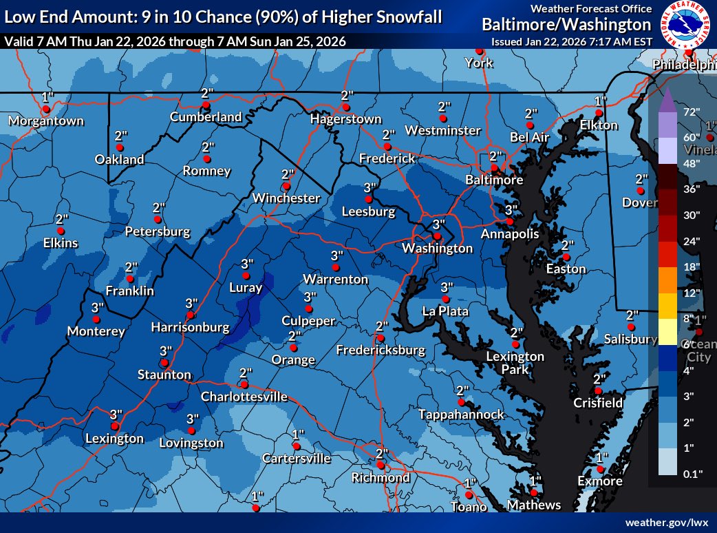
The National Weather Service (NWS) has issued a Winter Storm Watch and released its first maps that cover snowfall only until 7am Sunday.
Maps that include projected snowfall for the whole storm will be out this evening.
Full article: https://t.co/XljAkhGD3I
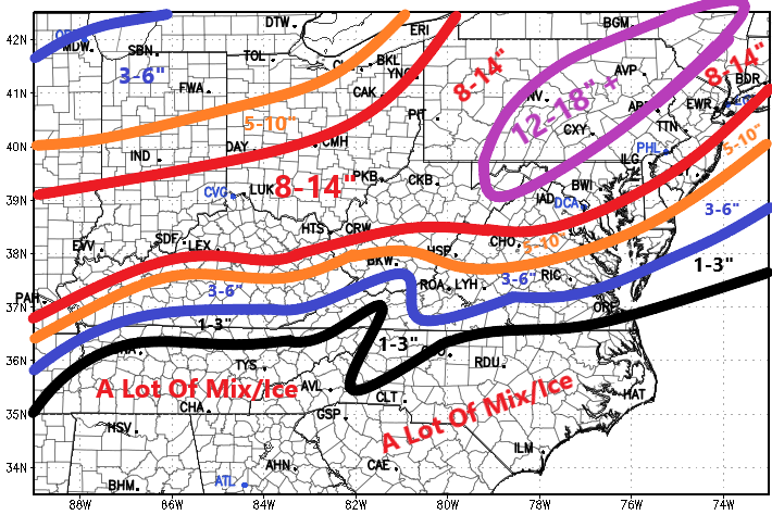
Examining all the morning data...here's my early first thoughts.
Will work with the team at the office and get something official out for Fox 5! But at least for the region and just me sitting through coffee here is what I feel most comfortable with.
South/Central Virginia and Kentucky snow gradients will be absolute hell, so adjustment may be needed there.
Someone will likely do 20"+ with this storm, but I think that zone is likely north or northwest of DC. I liked 8-14" for DCA yesterday, and I still like it today!
More to come later! We'll examine the new data and go from there! ❄️☃️
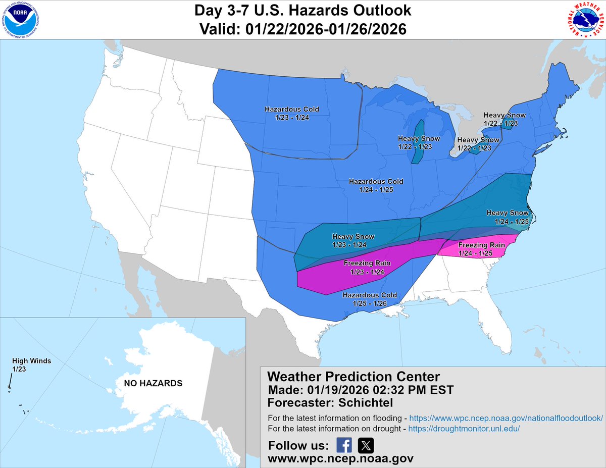
For the second day in a row, a severe thunderstorm watch will be issued for the DC region shortly. ⛈️
WPC has also increased our flash flooding risk to “moderate” this afternoon. Storms could be VERY heavy. Be on guard tonight.
We’re on Fox Local App with more tonight.