#SoldiersAndMaps. A 455th Dental Company (Area Support) @USArmyReserve Soldier shows that a little winter weather is no excuse for avoiding map and compass work.
I just released Battle Staff Tools 1.9!
Added support for multi level orbats, and improved support for Cyrillic 🇺🇦 and long unit names, among other things.
(And self-propelled artillery is back.)
https://t.co/ND2lbS0xcu #ORBATboys
#DYK that the @ArmyGeospatial’s DoD Defense Support of Civil Authorities Automated Support System (#DDASS) is working with our partners to ensure a safe and secure Presidential Inauguration this month by coordinating security efforts between the DoD and other Federal agencies.
#GeospatialHistory. Check out @NGA_GEOINT's great series "NGA Geospatial Pioneers" on YouTube. Meet well-known figures like Thaddeus Lowe and Marie Tharp, as well as lesser know individuals like Floyd Hough and Arthur Lundahl. https://t.co/vKWSrHoGJ6
NGA Geospatial Pioneers
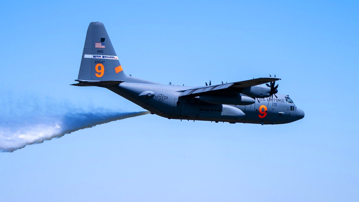
.@ArmyGeospatial's Department of Defense, Defense Support to Civil Authorities, Automated Support System is being used to organize and execute fire suppression support missions in Southern California for @usairforce C-130 systems with Modular Airborne Firefighting Systems.
#FindItHere. The Army Publishing Directorate has everything you need ... Army Doctrine Publications, Army Techniques Publications, Field Manuals, Technical Manuals, and more! Find them all at https://t.co/KEFQMpZh8R
.@ArmyGeospatial's LiDAR sensors conduct high resolution, broad-area collection missions with remarkable accuracy for situational awareness in complex decision-making. Read about it in the 2024-2025 edition of “America’s Engineers." Page 120 at https://t.co/GBghHBqMHn @USACEHQ
#SoldiersAndMaps. @2dCavalryRegt Soldiers train on the Mounted Assured Positioning, Navigation, & Timing System, a cutting-edge system that integrates advanced anti-jamming and anti-spoofing features.
#DYK. Geospatial Engineers in the Army deliver critical support for military operations. They provide Commanders and Staff with an understanding of the physical environment and its impact on operations.
#DYK that the Department of Defense, Defense Support to Civil Authorities, Automated Support System supports DOD response to civilian incidents using aircraft with advanced in-flight medical care. This support was recently used for the New Year's Day fireworks incident in Hawaii.
🚨NEW: Special Counsel Jack Smith's report on his investigation into Trump's attempts to overturn the 2020 election will be released to the public by Attorney General Merrick Garland.
RETWEET if you stand with Jack Smith against Trump!
#DYK that the Department of Defense, Defense Support to Civil Authorities, Automated Support System supports DOD advanced medical response and evacuation capabilities to civilian incidents. This support was recently used for the New Year's Day fireworks incident in Hawaii.
🚨NEW: Liz Cheney on Trump's latest attempt to block the Jack Smith Report: "Trump is already doing what despots do— he is trying to conceal the truth and threatening to jail those who investigated him."
RETWEET if you stand with @Liz_Cheney against Trump!
🚨NEW: New York Judge Ellen Gesmer has blocked Trump's attempt to postpone the Friday sentencing in his hush money case.
RETWEET to thank Judge Gesmer for holding Donald Trump accountable!
In FY25, Releasable Basemap Tiles will be distributed in additional map projections. It is currently available in the Army Standard WGS 84 / World Mercator. We will add the WGS 84 / Pseudo-Mercator and World Geodetic System 1984 in order to support other Army and DoD systems.
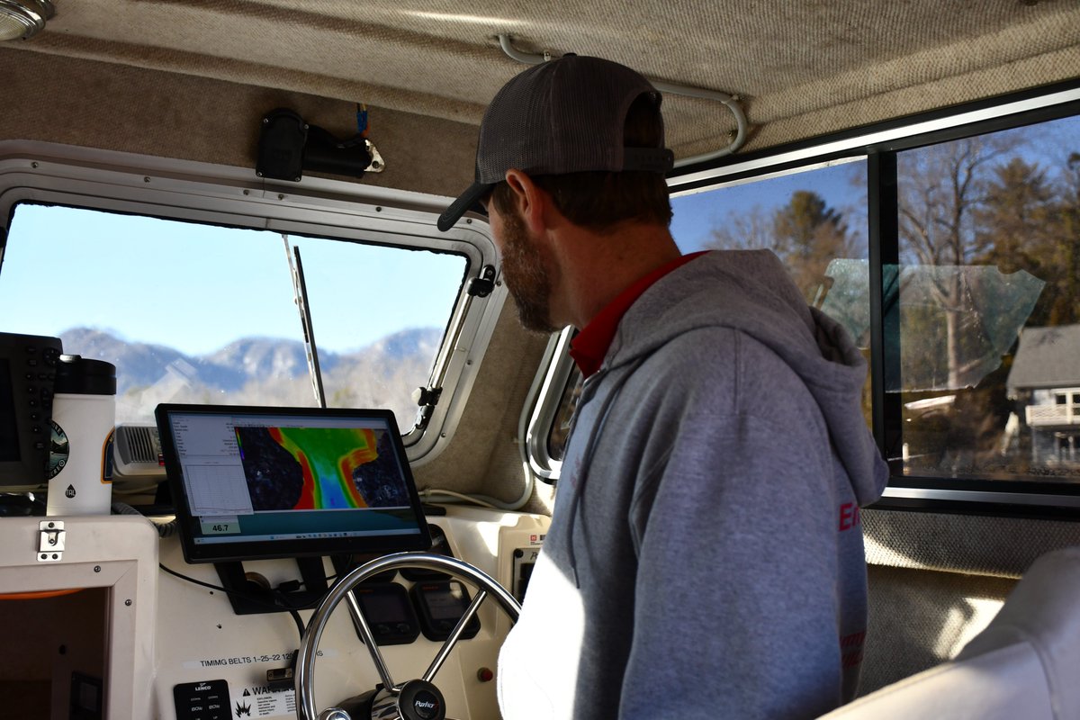
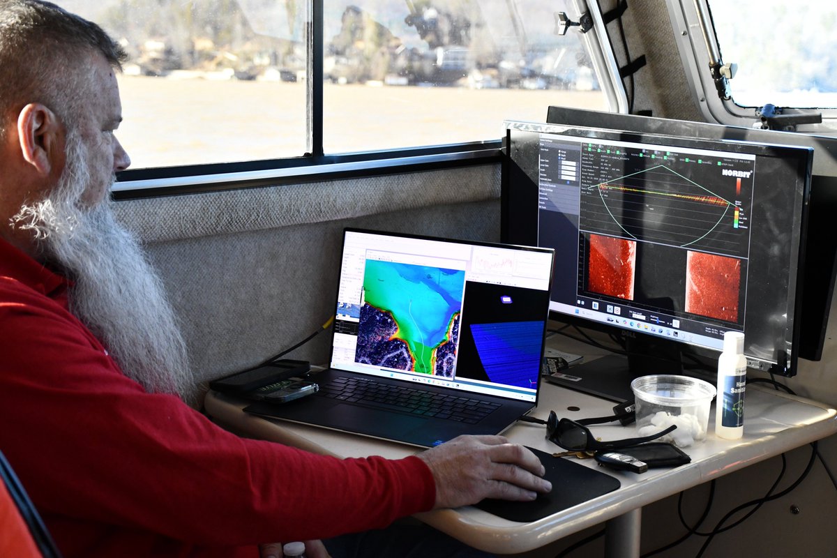
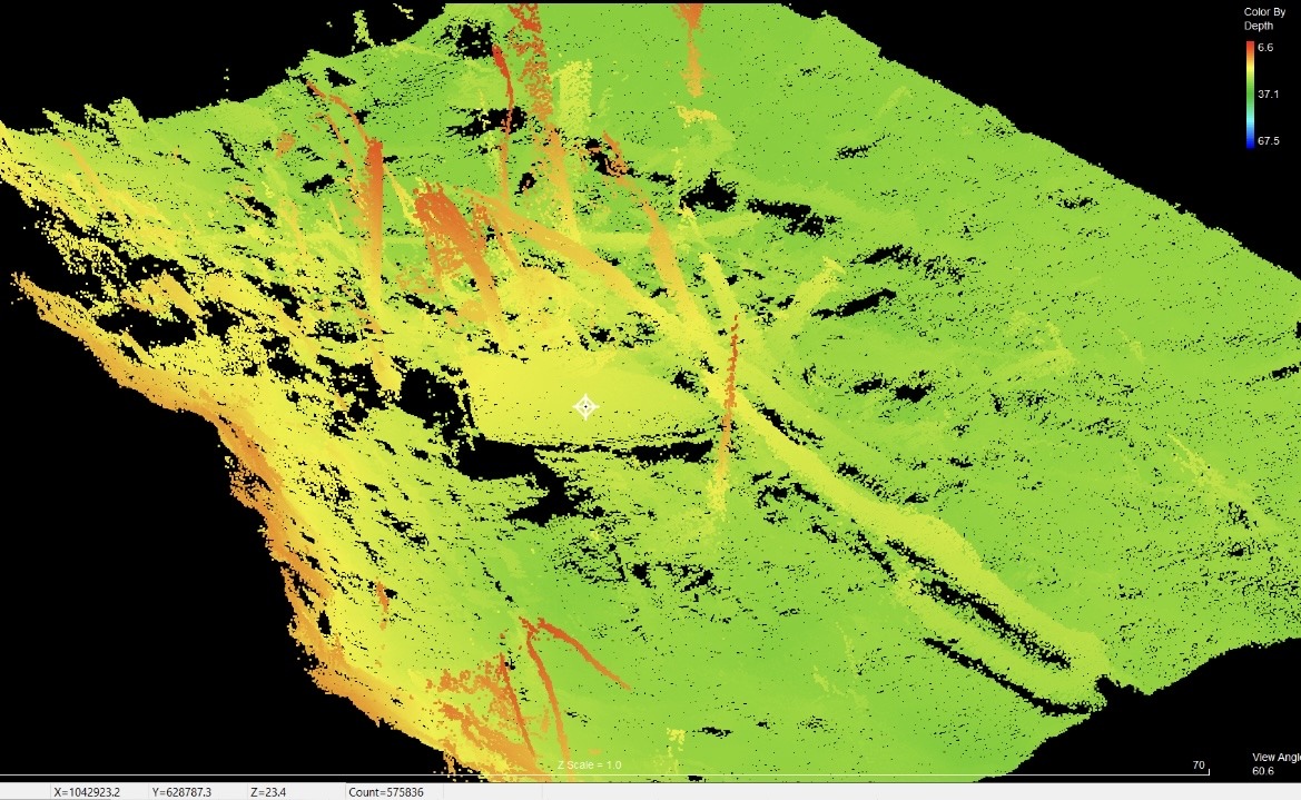
After a week on the water, @USACEWilmington crew finished surveying #LakeLure Jan 4., creating a 3D map of 720 acres of the lake bottom that will help identify Hurricane #Helene debris, like the image shown in green, which might be a dock or a boat. @fema@AtlantaCorps#USACE
ERDC features seven world-class laboratories that work on a wide spectrum of research projects. The labs – located in Illinois, New Hampshire, Virginia, and headquartered in Mississippi – are further supported by additional field sites to enhance and validate research efforts.
.@ArmyGeospatial recently hosted representatives from the North Atlantic Treaty Organization's Geospatial Section. AGC is collaborating with @NATO on a number of efforts intended to support operational resilience in the face of a changing climate.