With Battle Staff Tools you can now produce proper maps with the correct scale and MGRS grids. Online now, and always available for offline use with a license if you want to handle classified information. #BattleStaffTools
@The_Tobias@ak4mannen Du kan exportera det du gör i Battle Staff Tools till KMZ som går att importera till ATAK. Det går även att importera ATAK datapaket med cot meddelanden direkt till Battle Staff Tools, så jag har förberett en hel del för de som använder ATAK.
My conversion of the RBT style from @ArmyGeospatial to @protomaps was missing power infrastructure, but I managed to create my own planetiler profile that extracts the missing data and creates a more complete look.
Then we can create a single mapbundle file with all resources.
@TacticalSust@STACspec You can set all modifiers on units before you place them on the map and they will be displayed. It is mostly limited by how to create a good UI for it.
Next small thinge, lets you connect to a STAC @STACspec service to browse data, or directly create STAC compatible metadata for a local folder with data.
Still experimental, but the goal is to integrate into Battle Staff Tools.
@matt_zaps Day/Night curves, current satellite positioning with one hour trail that also show coverage area based on nadir angle. Lot of things can be configured or filtered by the user.
Just wanted something that looks cool and sort of moves without requiring an internet connection.
@orbatmapper A0? You are thinking too small.
(Also A0 is a stupid size since you can’t print it in landscape on a 44” plotter, and once you go 44” wide your length is almost infinite, or at least 30m.)
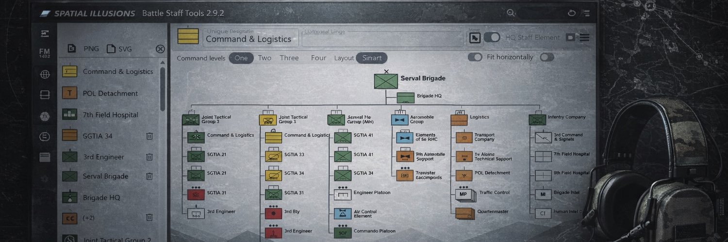
If you create a very, very, very large ORBAT in Battle Staff Tools you might run into that you can’t save it as PNG since it exceeds the maximum canvas size. I have now made a fix that scales it down to fit into 32767x32767 pixels.
Spent the morning doing a change to my download script that packages the worldwide equipment guide. The very large json files are now also stored gzipped and that should make the loading slightly faster over slow network connections.
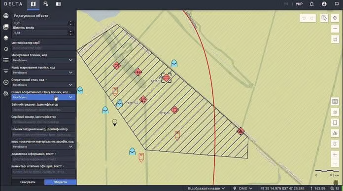
Delta is deeply interconnected now with the country's civilian digital infrastructure. It's all but an intrinsic part of it now.
It's something closer to a national battlefield mesh network than a traditional Western C2 system. This doesn't make it any less an achievement.
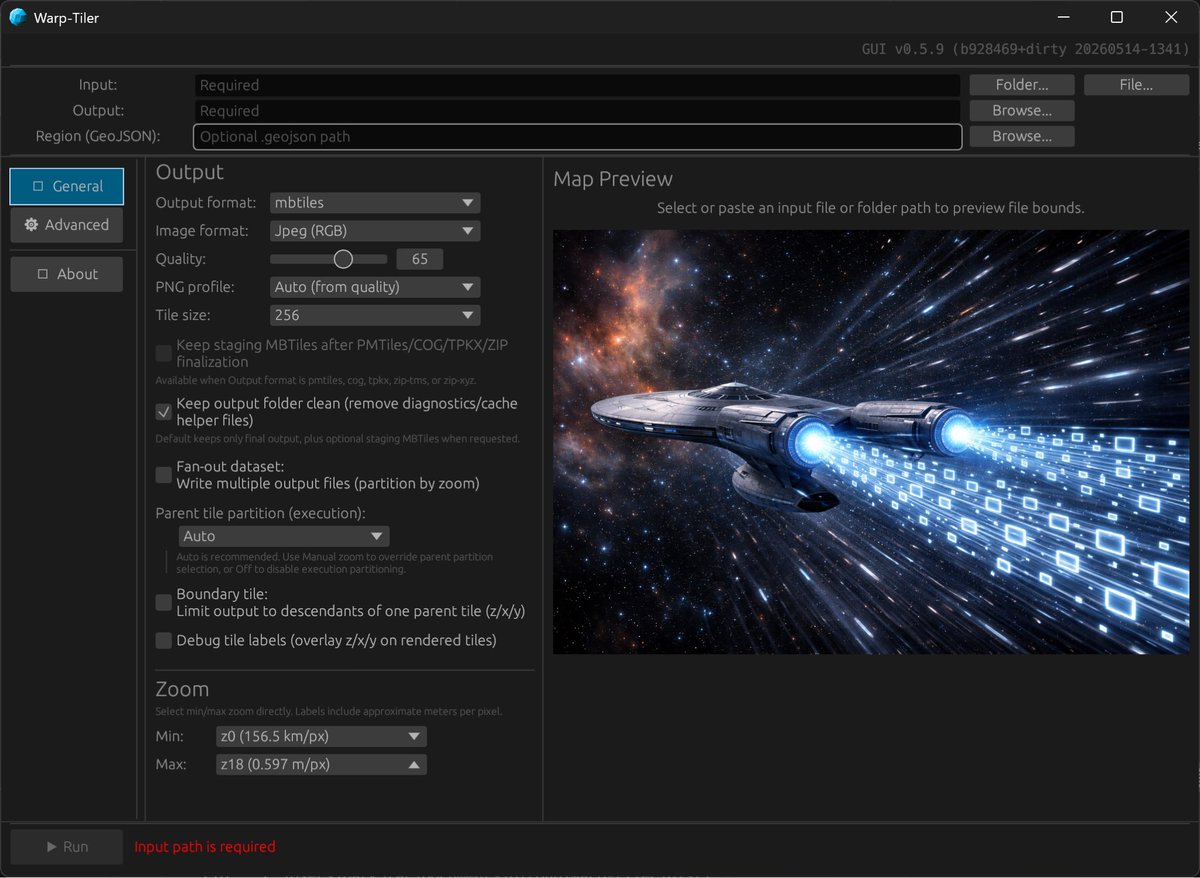
Built a new version of warp-tiler, the fastest way to convert your raster data into tiled formats. Polished the UI and included the latest JPEG2000 improvements that makes conversion at least five times faster.
Ukraine’s DELTA system - there should be a lot of EU/US BMS/C2 system suppliers looking worriedly over their shoulder.
@spatialillusion
https://t.co/1vumNKXrY8