Our next Chipper Days is April 27th. 9-3 across from the Silverado Community Center. Sponsored by the Inter-Canyon League.
Plan for it. Defensible Space Inspections will be in May.
Details to come.
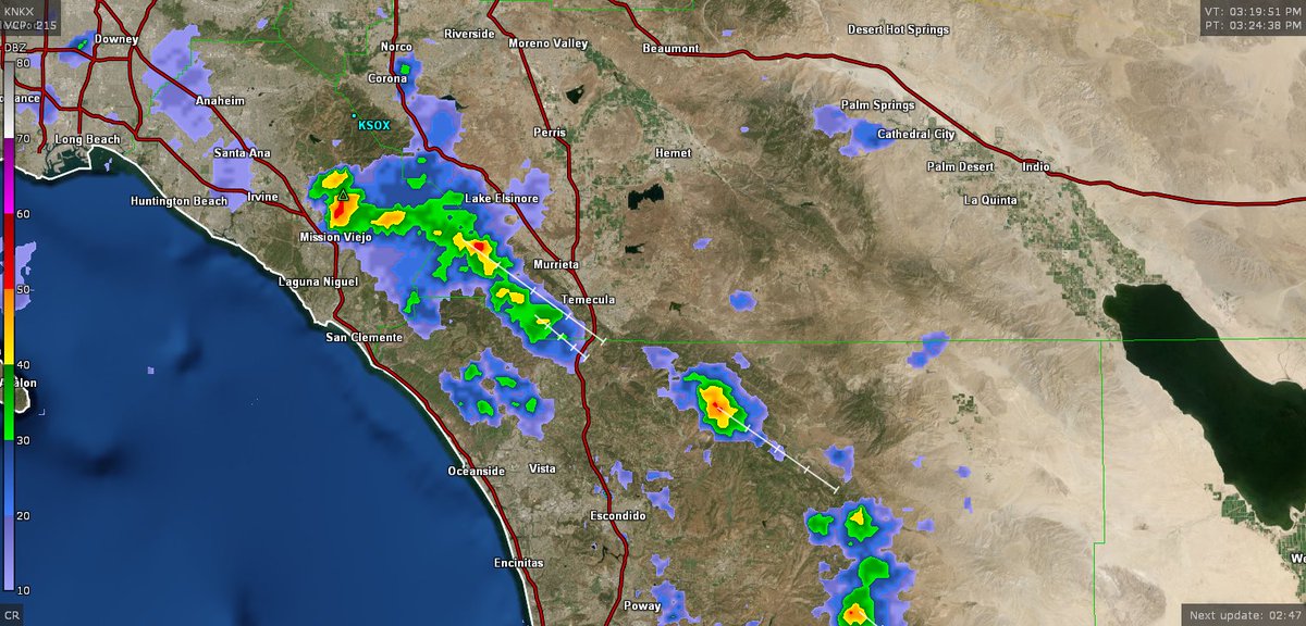
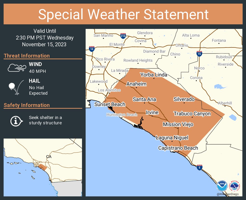
325 pm radar update, isolated showers and thunderstorms with localized heavy rain forming over the Santa Ana mountains and Palomar mountain #cawx#socal with cells moving north to south
My office has allocated $20,000 to establish a Community Emergency Response Team (CERT) program for the canyon community.
Registration is available via the QR code on the attached flyer, or at the following link:
https://t.co/p8EcVExLi3
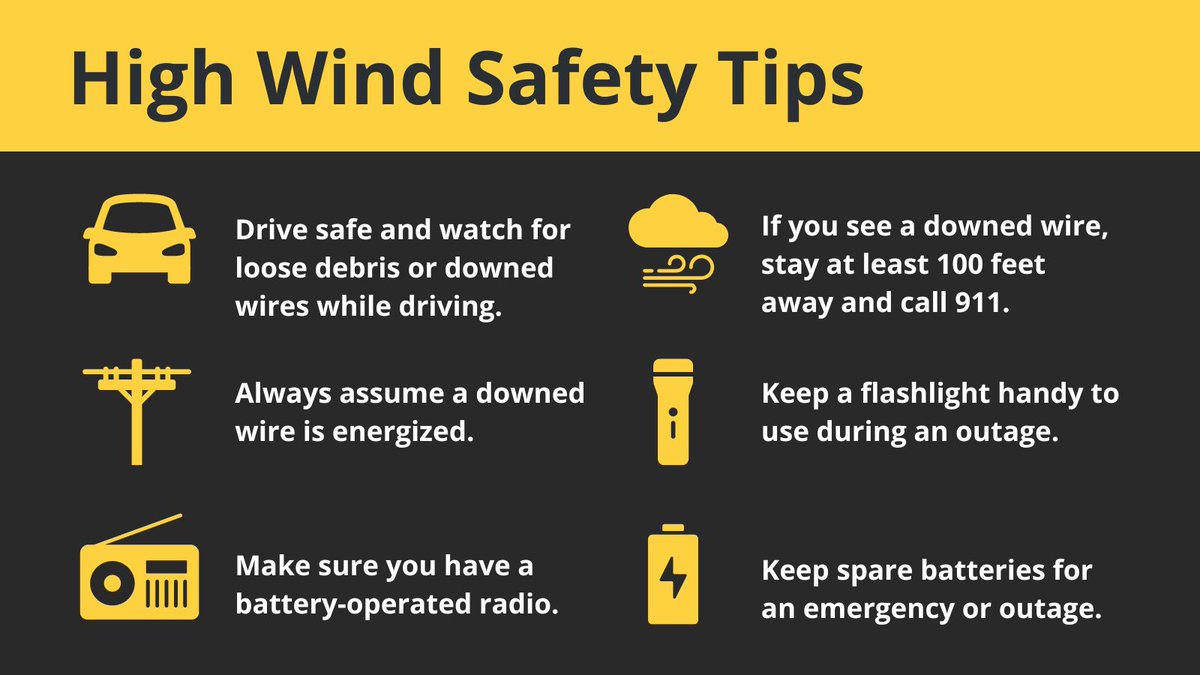
Strong winds are expected in #SoCal. Stay safe by following these wind safety tips. Remember, if you see a downed wire stay at least 100 feet away and immediately call 911. #lawx 💨
Don't let break in the #rain fool you - we're not done. More expected today & continue thru at least tonight. Hillsides are extremely saturated & pose a danger. Creeks & riverbeds have good amount of water flowing thru them. Stay far back as conditions can be life-threatening.
#Rain update: Our crews have been removing rocks and light mud from roads in Silverado, yet no major issues so far. Rain expected to increase this afternoon - we’ll be ready. If you have to drive, please drive slowly.
A look at #Silverado Creek with only a couple inches of #rain - and heavier rain expected this afternoon. Stay far back from creeks & riverbeds during heavy rain as they can be life-threatening. #OrangeCounty
There is an Evacuation Warning (Voluntary) Silverado, Williams, Modjeska and Trabuco Canyons as of February 4 at 7 pm.
For more information, go to https://t.co/V2jfT3joE7 and https://t.co/lHCfZpA0oi.
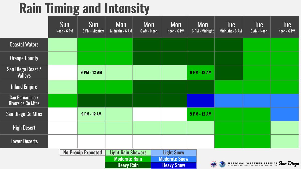
Quick timing update for everyone:
Key points:
🌨️ Focus of heavy rain on Orange County, Inland Empire, and San Bernardino County Mtns Today-Mon
🌨️ Moderate to heavy rain not reaching San Diego County until Mon evening
❄️ Snow levels not falling until Mon evening
#CAwx
#Rain update for #OrangeCounty: 2 inches Thur thru Fri. Up to 0.80-inch per hour possible on Thur. Crews & equipment will be ready to respond to rain-related issues to keep road open. Reminder: Stay out of creeks & riverbeds during storms. Sandbag info at https://t.co/CXG4Yi4iGQ
This shows a simulated *rough estimate* of timing and intensity (simulated radar) for tomorrow's storm. The streamlines are also a simulation of winds tomorrow.
Flood Watches, Wind Advisories, and Winter Storm Warnings remain in effect, see here: https://t.co/UUIe5dbXDT #CAwx
Storm thread time! 🧵🧵🧵
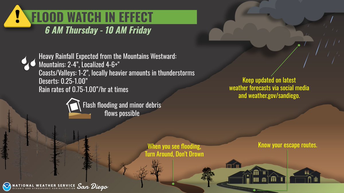
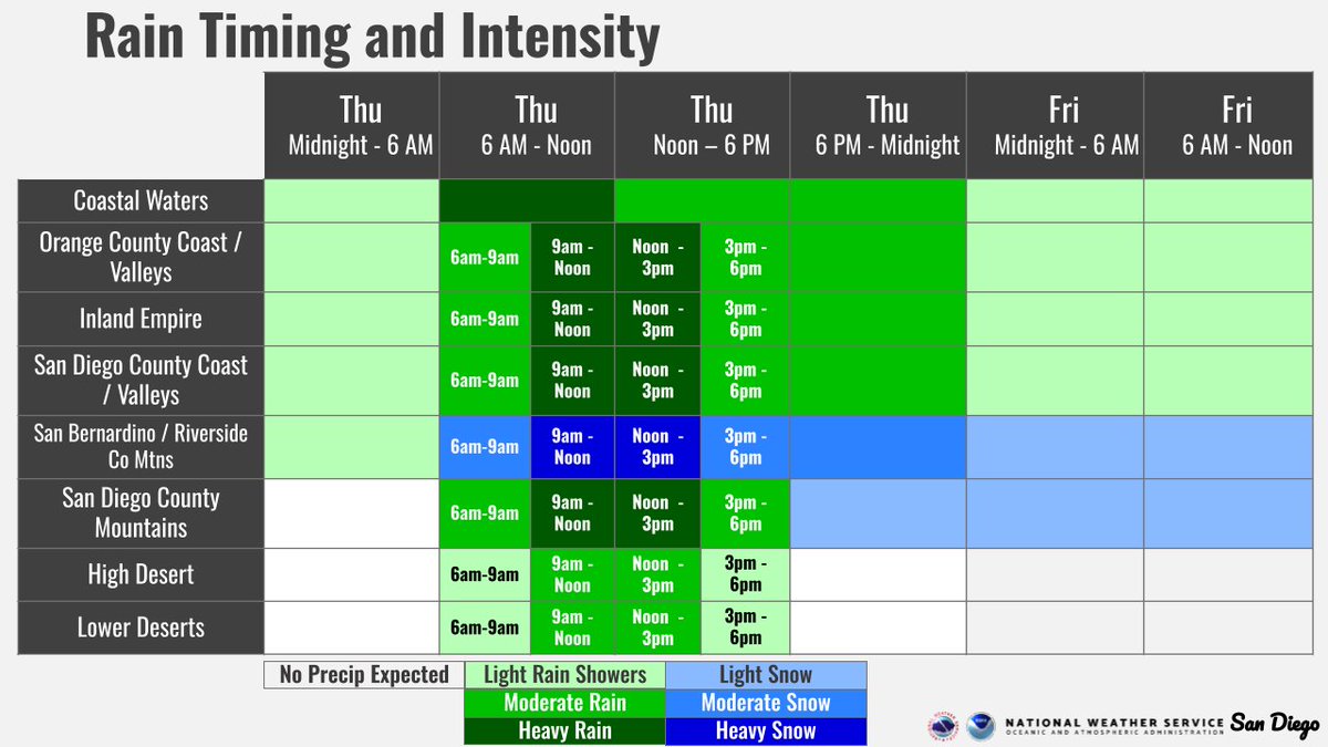
🌧️⛈️ Flood Watch in effect for all areas from the coast to the deserts Thursday morning through Friday morning. The best chances for the heaviest rainfall and thunderstorm activity look to be 9am-3pm Thursday, so plan accordingly!!
#CAwx (1/4)
Time for some Timing! 🕒🤓
Confidence is increasing in the onset of precipitation Thursday morning in the form of lighter rain/lighter mountain snow, and steadily ramping up through the late morning/early afternoon. Prelim totals coming soon as part of a thread👀🌧️❄️
#CAwx
Up to 2 inches of rain expected in #OrangeCounty Sat thru Mon. We’ve had crews & equipment clearing culverts & storm drains – and we’ll be ready to respond to rain-related issues as needed to keep your roadways open.
The Sandbag & Wattle Giveaway for Canyon Residents yesterday was a big success. All of the wattles were given out!
Thanks to @ocwaste, @ocpublicworks, and @ocfireauthority for working with us to make this event possible, & thanks to the Canyon residents who visited!
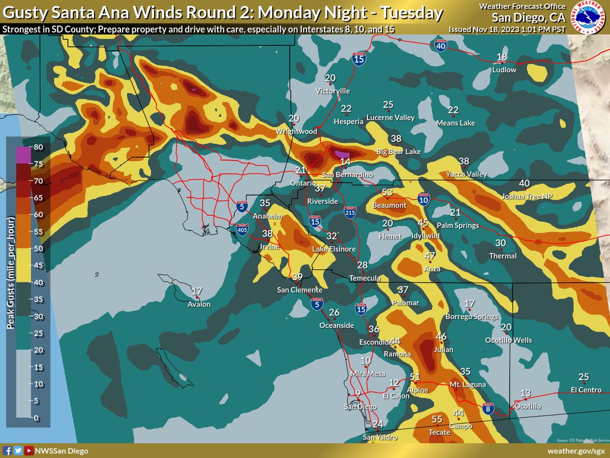
⚠️ Strong Santa Ana Winds Incoming ⚠️
Gusty north and east winds will occur Sunday night through Tuesday. Take a look at our video update from our weather office to see the latest forecast and how you can stay safe: https://t.co/cAhAsI9hiX #CAwx
Weak to moderate Santa Ana winds from the north & northeast will occur across the region Wednesday, with strongest winds below Cajon Pass. Local wind gusts around 55 MPH will occur. Winds will continue (though slightly weaker in some areas) Thursday with very low humidity. #CAwx