Florence NOAA weather radio broadcasting from a frequency of 162.475 MHz is offline due to a phone line issue. Technicians have been contacted to resolve the issue and it will be back online as soon as possible. Luckily, dry and warm but quiet WX is expected on Friday. #HUNwx
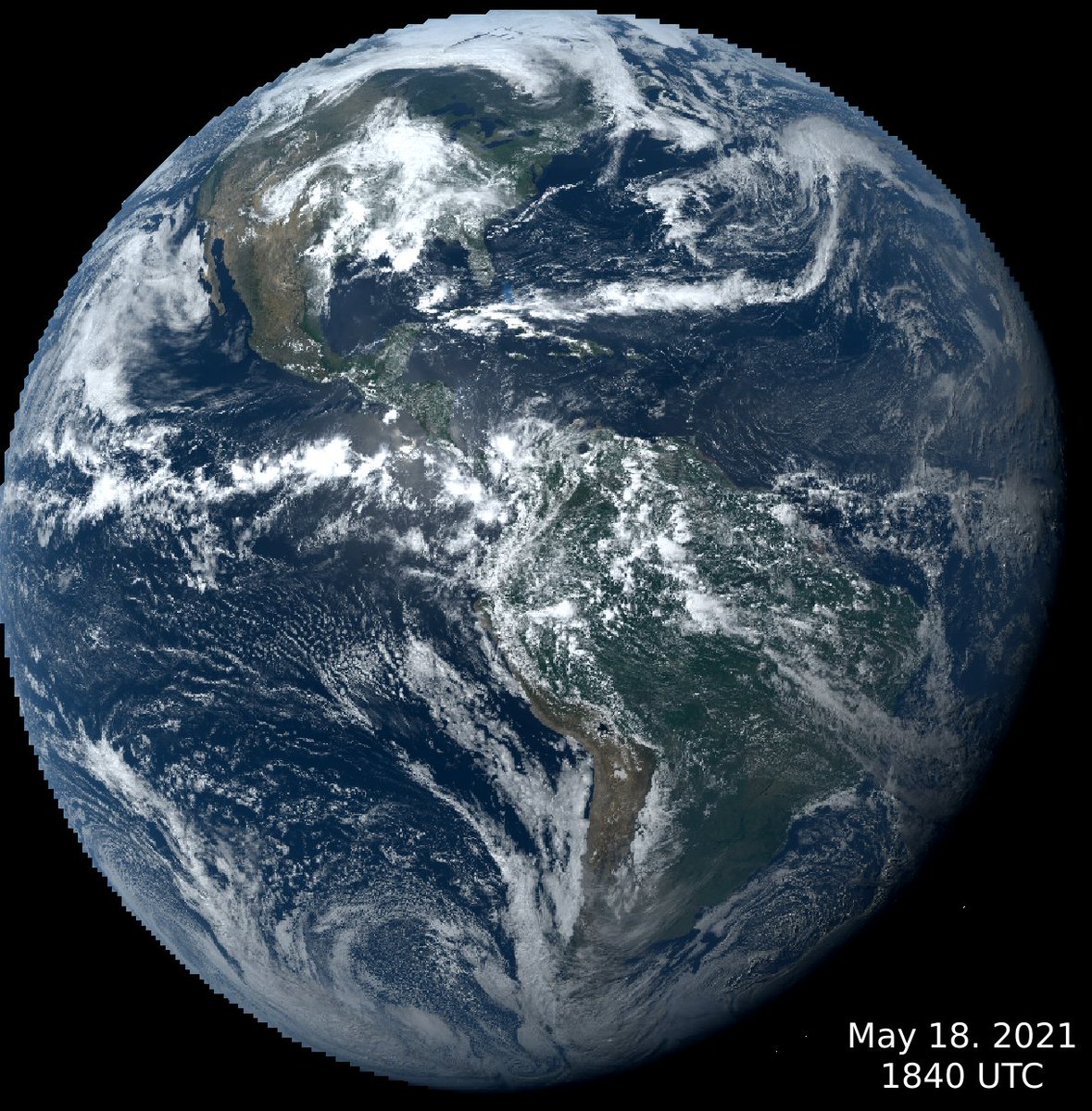
Both of these GOES East images were taken at the same time of day, one on Christmas Day 2020, the other today.
Notice how much more sunlight the Northern Hemisphere is receiving today. The Southern Hemisphere is entering winter.
A green tree that twisted off beside a camper @ Dewayne Hayes Campground. The wind damage occurred from the gusts front ahead of the severe storm in Lowndes County.@NWSJacksonMS@HFitzpatrickWX
8:03 PM - Multiple severe warned storms throughout the WCBI viewing area. Storm track has this coming into Columbus within the next 30 minutes. Straight line winds are a continued big issue within this line of storms #WCBI#mswx#alwx
T-minus 60 minutes. The Falcon 9 countdown continues with no known issues ahead of launch at 2:42am EDT (0642 GMT).
This will be SpaceX’s fourth Falcon 9 launch from Florida in 16 days, and the first time a Falcon booster will launch on its 10th mission.
https://t.co/dndT94Ei7n
If you have any outdoor plans for Mother's Day tomorrow, you may want to have a backup! Showers and thunderstorms will move into the area ahead of an approaching cold front around 3 PM - midnight tomorrow night. Stay tuned for more updates @WCBIWEATHER#mswx#alwx
So far, we've sent 4 gray tails to India, containing 1m Rapid Diagnostic Tests, 545 Oxygen Concentrators, 1,600,300 N95 masks, 457 Oxygen cylinders, 440 regulators, 220 pulse oximeters and 1 Deployable Ox. Concentration System. It's been a heroic effort from all involved.
When evacuations are ordered, folks take it more seriously and take action. A "recommendation" might inspire some to take action, but more choose to take on the risk.
#WordsMatter#EMGTwitter#PIOing
⚠️ 11:41AM SEVERE UPDATE: The southern half of Mississippi has been upgraded to a Level 4 out of 5 severe risk (red) for this afternoon. This upgrade is for a significant threat of damaging winds in excess of 70-80 mph. A few tornadoes and large hail will also be possible.