We're moving. Starting August 1st, we’ll be posting updates on Bluesky instead of X. You can find us at https://t.co/pQBCSfNJ31 [https://t.co/CbsPMRvxIV] Join us there.
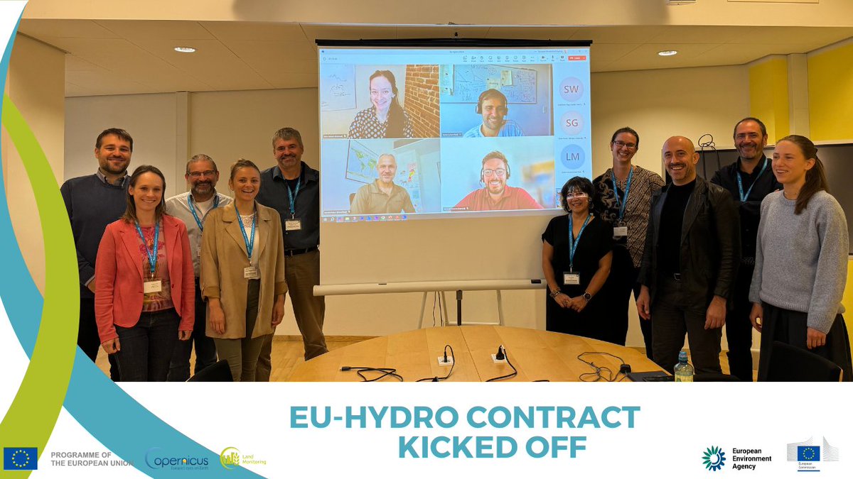
💧 We have kicked off the upgrade of EU-Hydro! 💧
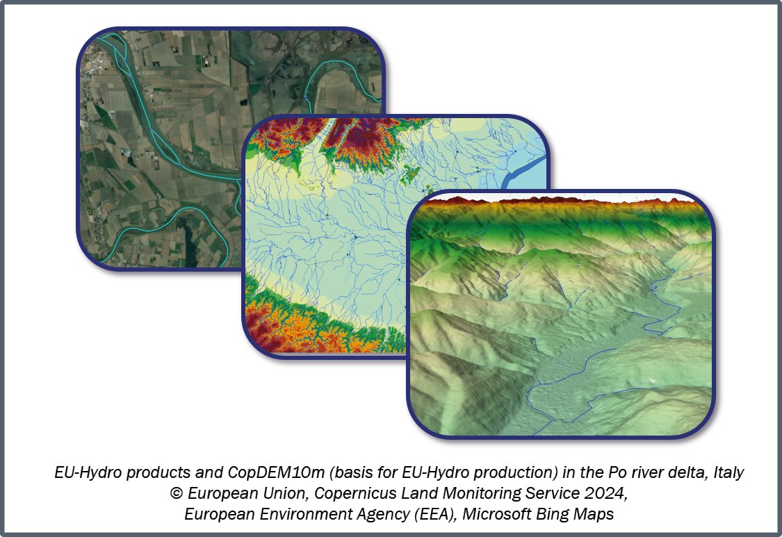
#CLMS users can look forward to a new key reference for hydrological applications, providing physical characteristics & geographical distribution of Europe's water bodies 🏞️
👉 https://t.co/jNCBmAnAW0
Confluvio is part of the consortium assigned to upgrade EU-Hydro, a dataset depicting the river network, water bodies, and river basins of Europe. The new data will support many applications incl. water resource management, environmental protection, & much more. Stay tuned!🌊🛰️
New contract signed to upgrade EU-Hydro, enhancing our #water resource insights! 💧✨
The update will cover all EEA38 river basins, feature new raster layers, and entail much more.
More info here: https://t.co/jNCBmAo8Ly
💧🇪🇺 e-GEOS is part of the consortium assigned by @EUEnvironment for the management of #EU_Hydro, a dataset of European #rivers, intended to provide information on physical characteristics and geographical distribution of #Europe’s water bodies
ℹ️ More 👇🏻
https://t.co/QXOkmia5dC
Join Our Team! If you're passionate about global freshwater conservation, this is a unique chance to work on a diverse portfolio of meaningful conservation projects with clients from leading global conservation NGO's. Apply now at: https://t.co/30Bx4VEkAz
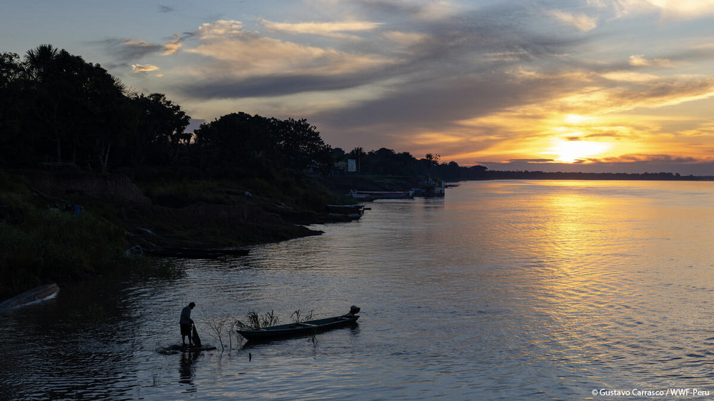
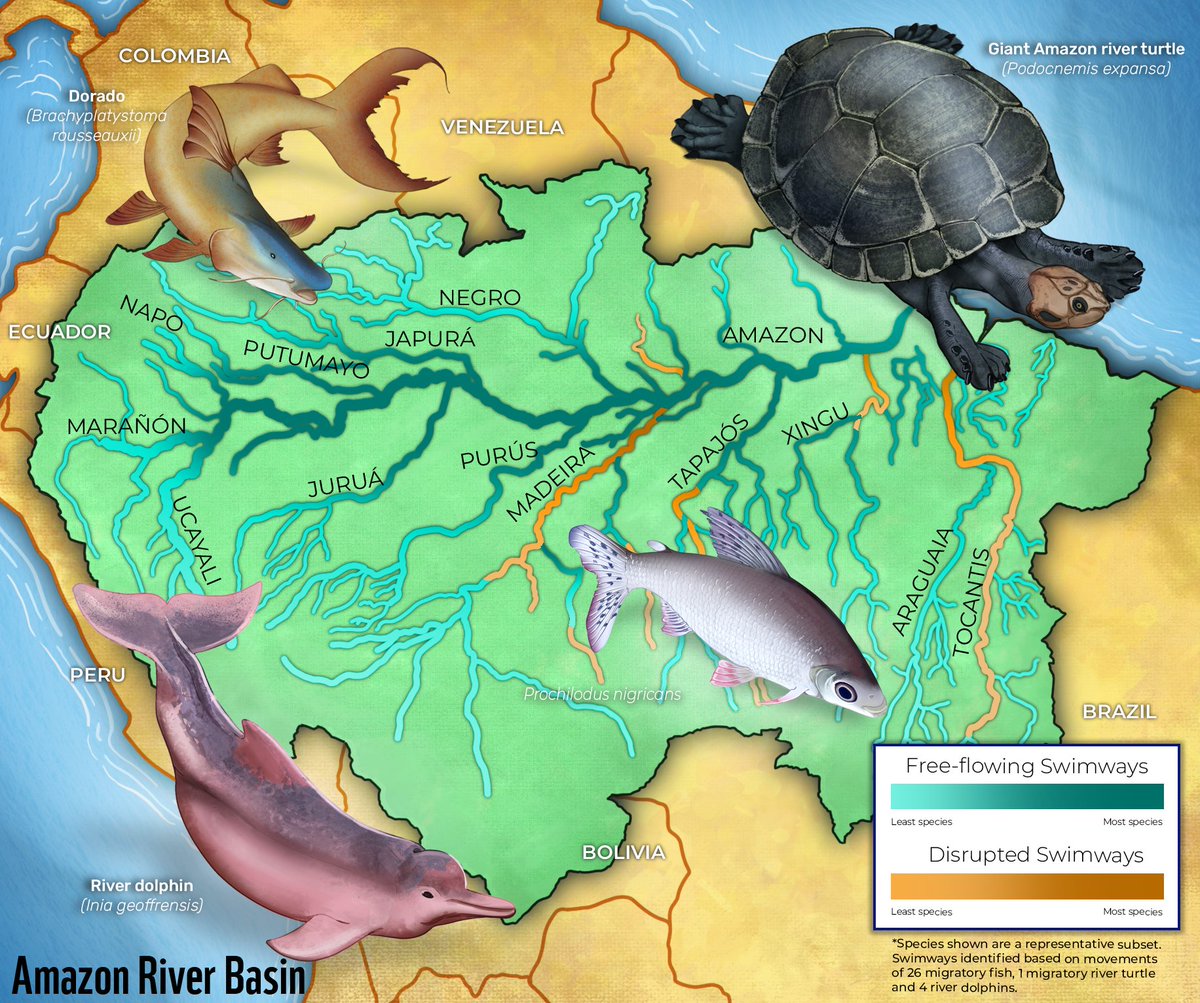
Los ríos conectan la Amazonía 💧🐬🐟
Científicos de varias organizaciones evaluaron el estado de conectividad de 340.000km de #ríosamazónicos, combinando los resultados con la identificación de presencia de #pecesmigratorios, tortugas y delfines de río.
➡️https://t.co/FEVar3pe1r
The Amazon River is like a central highway in South America for animals to find new food sources, mating grounds, or safe spaces away from predators. But proposed dams on Amazon’s tributary rivers would break apart this important network: https://t.co/ZjqXxLFraP.
The Amazon Basin contains a vast network of rivers which act as migratory pathways for freshwater species & support healthy ecosystems. New research shows hydropower development could fragment important rivers, impacting migration and habitats. https://t.co/ZpGuh417sh @WWFscience
The Amazon River is like a central highway in South America for animals to find new food sources, mating grounds, or safe spaces away from predators. But proposed dams on Amazon’s tributary rivers would break apart this important network: https://t.co/kc7dEKajPa
Exciting new dataset of existing and planned renewable power plants in Africa. Thanks to the authors for producing this data. @jjopperman@MicheleThieme@wwfzambia
Africa goes renewable. The Renewable Power Plant database for Africa (RePP Africa) is a spatially explicit database for existing and proposed renewable power plants in Africa. @uni_tue and @Senckenberg
https://t.co/nzy3sSBIic
LakeATLAS is out! Offering more than 50 hydro-environmental characteristics for all lakes worldwide! See https://t.co/NHzglW1t2X for more information. With @messamat, @MaartjeKorver, and @DocSlinky.
HydroSHEDS reinvented! Check out our latest announcements of upcoming global river data at https://t.co/h2DEA739Sf and our new website at https://t.co/r7lmXPbo7d
HydroSHEDS-X is coming! Work in progress to produce updated global river network and catchment delineations from TanDEM-X elevation data. Check out the latest in EOS:https://t.co/cW4aTbHSN5 & https://t.co/wvoekrXqdL @WWFLeadWater@alexisjmorgan@jjopperman@GuentherGrill
HydroSHEDS is the most frequently applied global hydrographic mapping product. A new version will soon offer more capabilities & clearer views of Earth’s rivers, write researchers from @Global_HydroLAB@DLR_en@confluvio + @World_Wildlife.
https://t.co/47MDtbf0UY
@DLR_en@Global_HydroLAB@MicheleThieme We're also excited to share:
🗺️ Extended data for HydroSHEDS v1 (including upstream area & flow length)
🐬🌆🔬Highlighted research & applications from the HydroSHEDS community
And more on the new, improved, and much more beautiful https://t.co/3phoGb0ct9
A Sharper Look at the World’s Rivers and Catchments 🌍🌎🌏
Read our update in Eos today highlighting the vast network of HydroSHEDS users & our work with @DLR_en@Global_HydroLAB@MicheleThieme developing HydroSHEDS v2.0 from 12m satellite imagery 🛰️
https://t.co/pFCLOGl8H7
Wastewater puts pressure on river health worldwide. Congrats to Heloisa Ehalt Macedo for publishing this important dataset. It is linked to HydroSHEDS, HydroRIVERS and HydroROUT, a river routing model, which allows modelling aspects of water quality in rivers worldwide.
HydroWASTE is out! The database includes the location and characteristics of 58 502 WWTPs around the world. It allowed the identification of 1.2 million km of rivers receiving treated wastewater input. https://t.co/GsOyLbDuct