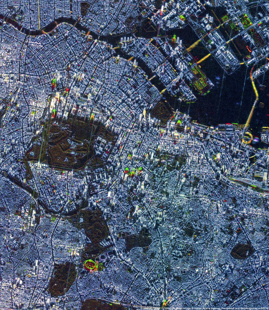
e-GEOS, part of @LDO_Space, and @synspective are proud to announce the signature of a strategic agreement to jointly develop advanced geospatial intelligence solutions.
The collaboration was formally signed today at the Embassy of Italy in Tokyo (@ItalyinJPN) during an institutional ceremony held within the framework of the Italy-Japan Space Dialogues, marking a significant milestone in Italian-Japanese Space cooperation. The signing ceremony took place in the presence of H.E. Mario Vattani, Ambassador of Italy to Japan; H.E. Hikariko Ono, Ambassador of Japan to Italy; C. Milena A. Lerario, CEO of e-GEOS; Motoyuki Arai, Founder and CEO of Synspective; and Marco Brancati, SVP, Technology, Innovation & Systems Architecture of @LDO_Space.
C. Milena A. Lerario, CEO of e-GEOS: “At e-GEOS, we value Synspective’s vision and its innovative approach to SAR technology development, which strongly complements the e-GEOS expertise in advanced value-added geoinformation services. This agreement further strengthens the e-GEOS international positioning as a leading geospatial intelligence provider, fully aligned with @Leonardo_live’s strategic vision for Space and with the commitment to advancing next-generation capabilities through trusted international partnerships.”
Read the Press Release: https://t.co/KXAzvCf2cS
#WeUnlockEarth
@telespazio | @ASI_spazio | @LDO_Space | @GAF_Munich | @LDO_Fondazione
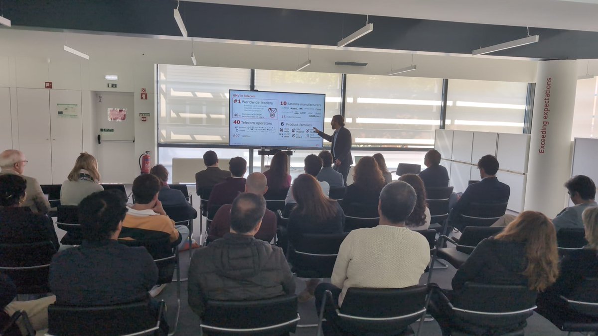
At the @SmallSat Europe 2026 Conference, taking place in Amsterdam from 26 to 28 May, @massimoc_square, Managing Director of #LeonardoSpace, delivered a keynote speech on the impact of Space technologies, infrastructures and services, in the present challenges.
The role of Space technologies in the geopolitical landscape is evolving at an unprecedented pace. The state of technology within the satellite industry is also undergoing rapid transformation, with improvements in launch systems, sensors, electronics and other enabling technologies helping to drive down costs. Established industry leaders must evolve to meet this challenge, maintaining their competitive edge while continuing to play a decisive role in shaping the sector’s future.
In this context, a competitive Space industry and ecosystem are built on shorter product lifecycles and a faster pace of innovation. As Massimo Claudio Comparini stated, "We are seeing increasingly powerful onboard computing capabilities, which are fundamentally transforming the Space sector. At the same time, AI is moving into Space, driving an evolution that is impacting the entire ecosystem across the value chain. The Space industry is becoming more interconnected than ever before.
For many years, we viewed connectivity, Earth observation and navigation as separate domains. Today, those domains are converging and interacting continuously. This is one of the reasons why we decided to invest in and establish a dedicated Space Division within #Leonardo: to capitalize our industrial system and the Space alliance to create a true digital continuum in Space, connecting Space and digital technologies across sectors in the multi domain operations. It is within this context that the Leonardo Space Guardian Earth Observation constellation investment is looking to the future, evolving @Thales_Alenia_S solutions in the Space segment, the @telespazio multi mission ground segment and Space operations, the @e_geos user segment and data analytics application digital platforms and market place powered by our #davinci HPC and AI advanced capabilities.”
#SmallSatEurope
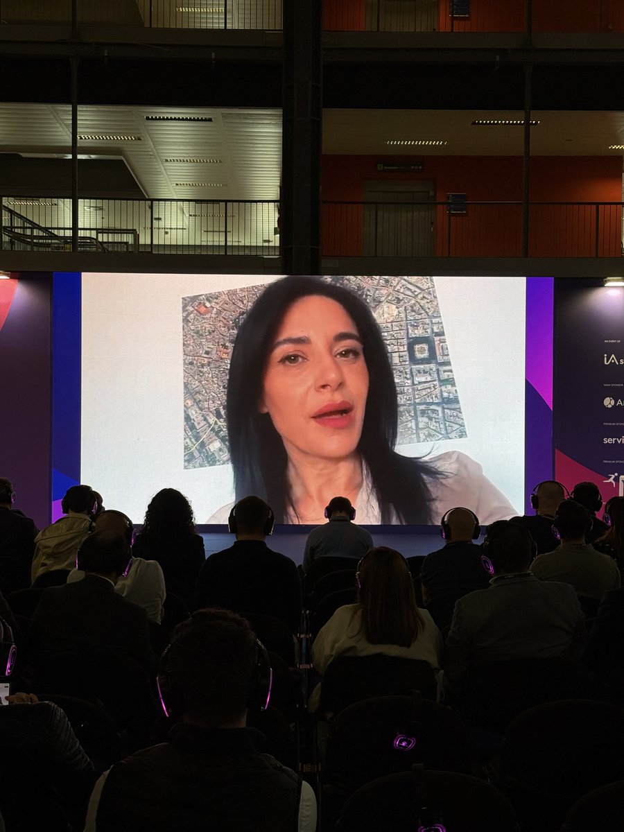
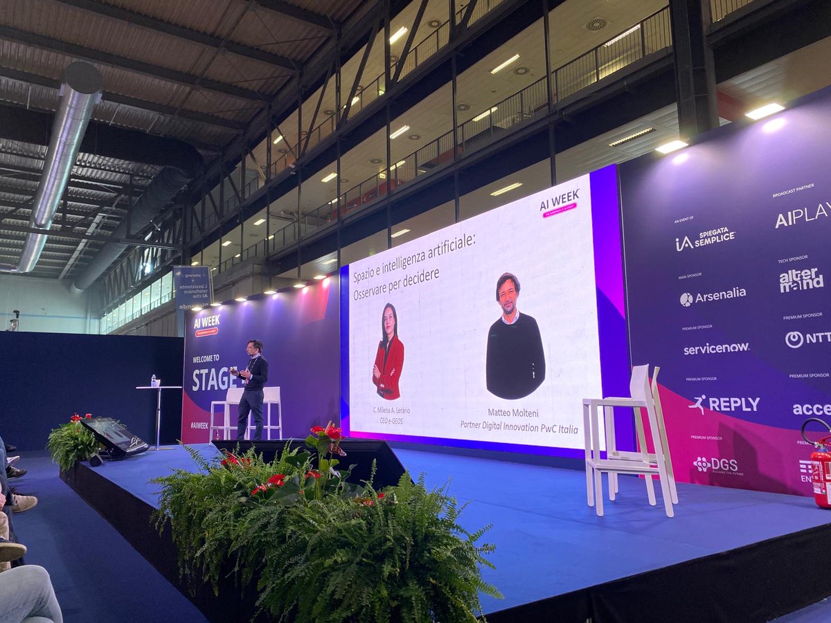
At AI WEEK in Milan, C. Milena A. Lerario, CEO of e-GEOS, part of @LDO_Space, joined Matteo Molteni, Partner Digital Innovation at @PwC_Italia, for a workshop on the transformative role of Artificial Intelligence in the evolution of the Earth Observation sector and the growing business opportunities enabled by AI-driven geospatial applications.
During the session, several e-GEOS services were presented, showcasing how AI algorithms support the development of innovative applications across precision agriculture, deforestation monitoring, maritime surveillance, natural disaster management and sustainable urban development.
These use cases highlighted how Artificial Intelligence is now fully integrated into Geoinformation workflows, enabling the processing of a rapidly increasing volume of satellite and multisource data to extract meaningful insights. AI is driving a shift from simple image-based observation to systems that transform data into actionable knowledge, supporting faster and more reliable decision-making across operational contexts.
#WeUnlockEarth | #PwCItaly #PwCAdvisory
@telespazio | @ASI_spazio | @LDO_Space | @GAF_Munich | @LDO_Fondazione
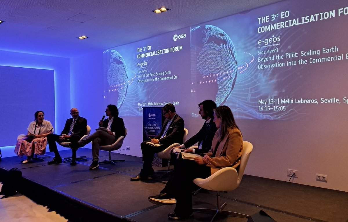
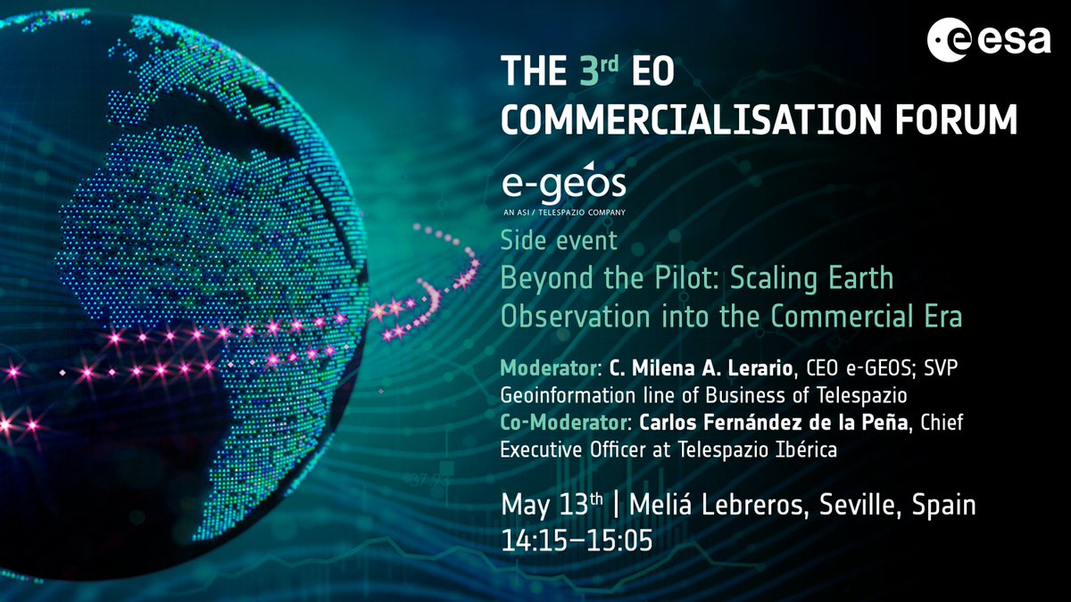
Yesterday e-GEOS, part of @LDO_Space, hosted the side event “Beyond the Pilot: Scaling Earth Observation into the Commercial Era” at the @esa 3rd EO Commercialisation Forum.
The session, focused on the key levers enabling the transition from R&D and innovation programmes to fully operational and scalable Geoinformation services, highlighted the need to strengthen collaboration between institutional programmes, industry and end users to ensure that technological innovation is translated into trusted, operational capabilities.
The discussion, moderated by Domenico Grandoni, Vice President R&D and Innovation at e-GEOS, and co-moderated by Carlos Fernández de la Peña, CEO of @telespazio Ibérica, featured contributions from:
🔸 Rune Floberghagen, Head of Climate Action, Sustainability and Science Department at @esa
🔸Catharina Bamps, Policy Officer at @defis_eu, @EU_Commission
🔸Juan Escalante, Project Manager Copernicus SESA Coordination Team at @eusatcen
🔸Isabel Vera Trallero, Director of the Office for Space and Society at @aee_gob
#WeUnlockEarth | #CommEO #ESAEO @ESA_EO@telespazio | @ASI_spazio | @LDO_Space | @GAF_Munich | @LDO_Fondazione
🌍 As we count down to this week’s e-GEOS side event at the @esa 3rd EO Commercialisation Forum in Seville, we are pleased to announce the distinguished panelists joining the conversation:
🔹 Rune Floberghagen, Head of Climate Action, Sustainability and Science Department - @esa
🔹 Catharina Bamps, Policy Officer - @defis_eu, @EU_Commission
🔹 Juan Escalante, Project Manager Copernicus SESA Coordination Team – @eusatcen
🔹 Isabel Vera Trallero, Director of the Office for Space and Society – @aee_gob
🎤 The session will be moderated by C. Milena A. Lerario, CEO of e-GEOS, part of @LDO_Space, with co-moderation by Carlos Fernandez de la Peña, CEO of @telespazio Ibérica.
📅 13 May | 14:15 – 15:05
📍 Meliá Lebreros, Seville, Spain
𝐒𝐞𝐞 𝐲𝐨𝐮 𝐨𝐧 𝐖𝐞𝐝𝐧𝐞𝐬𝐝𝐚𝐲 𝐢𝐧 𝐒𝐞𝐯𝐢𝐥𝐥𝐞❗
#WeUnlockEarth
@telespazio | @ASI_spazio | @LDO_Space | @GAF_Munich | @LDO_Fondazione
📅 Save the Date❗
🌍 On 13 May, e-GEOS, part of @LDO_Space, will host a side event in Seville as part of the @esa 3rd EO Commercialisation Forum. Titled “Beyond the Pilot: Scaling Earth Observation into the Commercial Era”, the session will explore how Earth Observation is evolving into a service-oriented market.
🛰️ Industry leaders, end-users and institutional stakeholders will discuss what business models are actually working today and how the sector can move from pilot initiatives to sustainable, scalable revenue streams. The discussion will combine market insights, real-world use cases and an interactive exchange on the key enablers of EO commercialisation.
🎤 The session will be moderated by C. Milena A. Lerario, CEO of e-GEOS, with co-moderation by Carlos Fernandez de la Peña, CEO of @telespazio Ibérica.
We look forward to welcoming you to our side event for an engaging discussion❗
📅 13 May | 14:15 – 15:05
📍 Meliá Lebreros, Seville, Spain
#WeUnlockEarth
@telespazio | @ASI_spazio | @LDO_Space | @GAF_Munich | @LDO_Fondazione
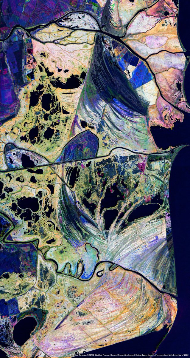
The conference “Space Technology to Protect and Monitor: the Dual COSMO-SkyMed Mission”, jointly organized by the @ItalianAirForce General Staff, Scuola di Aerocooperazione (also known as Italian Joint Air Operations School - Ita-JAOS) and @ASI_spazio as part of the celebrations for the 75th anniversary of the School, highlighted the strategic role of the COSMO-SkyMed satellite constellation in security and environmental monitoring. The event was promoted by e-GEOS, part of @LDO_Space.
During the conference, Alessandro Flamini, Head of Defence & Intelligence and COSMO-SkyMed Commercial and Business Development at e-GEOS, joined the round table “Protecting the Territory: Civil Applications of Satellite Data”, presenting the capabilities of the COSMO-SkyMed mission for the protection of the marine environment.
Specifically, Alessandro Flamini highlighted how, through systematic, wide-scale monitoring of maritime areas including offshore regions, COSMO-SkyMed ensures operational performances that are unaffected by weather conditions or by the lack of sunlight. Particular attention was dedicated to the e-GEOS solutions for the detection of potential oil spills through advanced data analysis algorithms, as well as to the monitoring of marine protected areas to safeguard fragile ecosystems.
#WeUnlockEarth
@telespazio | @ASI_spazio | @LDO_Space | @GAF_Munich | @LDO_Fondazione
The award ceremony for the seventh edition of #T-TeC was held today in Rome, at the headquarters of the Italian Space Agency (@ASI_spazio). The contest is an #OpenInnovation competition organised by #Leonardo and @telespazio to foster technological innovation in the #Space sector among the younger generation of students and researchers from universities around the world. Discover more: https://t.co/fJzTWo66Qh #Leonardo4Innovation
Yesterday, Milena Lerario, CEO of e-GEOS, part of @LDO_Space, joined the workshop “𝐓𝐡𝐞 𝐂𝐡𝐚𝐥𝐥𝐞𝐧𝐠𝐞 𝐨𝐟 𝐄𝐧𝐯𝐢𝐫𝐨𝐧𝐦𝐞𝐧𝐭𝐚𝐥 𝐒𝐞𝐜𝐮𝐫𝐢𝐭𝐲 𝐚𝐧𝐝 𝐂𝐥𝐢𝐦𝐚𝐭𝐞 𝐂𝐡𝐚𝐧𝐠𝐞 𝐢𝐧 𝐭𝐡𝐞 𝐄𝐮𝐫𝐨-𝐌𝐞𝐝𝐢𝐭𝐞𝐫𝐫𝐚𝐧𝐞𝐚𝐧 𝐑𝐞𝐠𝐢𝐨𝐧”, hosted by @medorfoundation.
Her keynote focused on the enabling role of #Geoinformation in advancing the understanding of #land dynamics, supporting a transition from reactive approaches to prevention-oriented and decision-driven models.
Specifically, Milena Lerario highlighted the e-GEOS geospatial solutions for analysing territorial complexity, characterising land morphology and assessing the impacts of natural events. She also underlined how the e-GEOS near real-time services ensure continuous monitoring, delivering timely and reliable information, supporting institutions and civil protection in their operational activities.
#WeUnlockEarth
@telespazio | @ASI_spazio | @LDO_Space | @GAF_Munich | @LDO_Fondazione
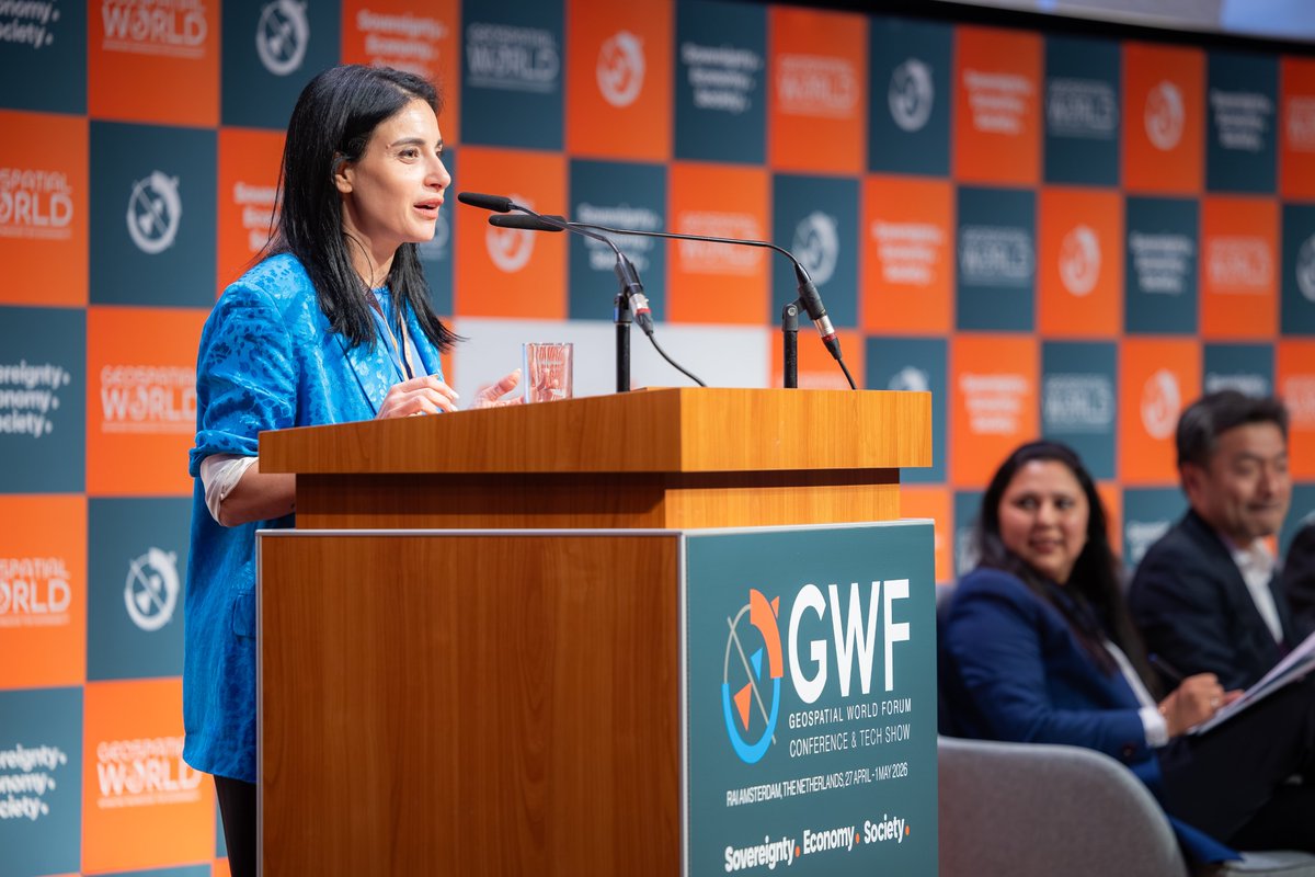
Yesterday, at the Geospatial World Forum 2026, C. Milena A. Lerario, CEO of e-GEOS, part of @LDO_Space, joined the Plenary Session “𝐒𝐩𝐚𝐜𝐞 𝐈𝐧𝐟𝐫𝐚𝐬𝐭𝐫𝐮𝐜𝐭𝐮𝐫𝐞 𝐚𝐬 𝐚 𝐒𝐞𝐫𝐯𝐢𝐜𝐞: 𝐄𝐧𝐫𝐢𝐜𝐡𝐢𝐧𝐠 𝐆𝐞𝐨𝐬𝐩𝐚𝐭𝐢𝐚𝐥 𝐏𝐥𝐚𝐭𝐟𝐨𝐫𝐦𝐬 𝐚𝐧𝐝 𝐒𝐩𝐚𝐭𝐢𝐚𝐥 𝐈𝐧𝐭𝐞𝐥𝐥𝐢𝐠𝐞𝐧𝐜𝐞”.
Here are some main insights from the session:
🔹 A clear direction is emerging: to make #Space increasingly accessible, seamlessly integrated into decision-making workflows and more effective in enabling timely choices.
🔹 At e-GEOS, we support this shift by turning Space-based solutions into an on-demand resource, flexible and scalable, open to a wider user base even without dedicated infrastructure or expertise.
🔹 This transformation is driven by a user-centric vision based on operational needs, enabled by digitalization and automation to deliver value-added products faster and with lower latency.
#WeUnlockEarth | #GWF2026
@telespazio | @ASI_spazio | @LDO_Space | @GAF_Munich | @LDO_Fondazione
🌍 This week e-GEOS, part of @LDO_Space, is in Amsterdam for the Geospatial World Forum 2026!
🛰️ Tomorrow, C. Milena A. Lerario, CEO of e-GEOS, will join the plenary session “𝐒𝐩𝐚𝐜𝐞 𝐈𝐧𝐟𝐫𝐚𝐬𝐭𝐫𝐮𝐜𝐭𝐮𝐫𝐞 𝐚𝐬 𝐚 𝐒𝐞𝐫𝐯𝐢𝐜𝐞: 𝐄𝐧𝐫𝐢𝐜𝐡𝐢𝐧𝐠 𝐆𝐞𝐨𝐬𝐩𝐚𝐭𝐢𝐚𝐥 𝐏𝐥𝐚𝐭𝐟𝐨𝐫𝐦𝐬 𝐚𝐧𝐝 𝐒𝐩𝐚𝐭𝐢𝐚𝐥 𝐈𝐧𝐭𝐞𝐥𝐥𝐢𝐠𝐞𝐧𝐜𝐞”, offering insights into how the shift to on-demand access is redefining the #Space economy, while the real challenge moves to managing and turning #data complexity into decision-ready intelligence.
📅 Tuesday, 28 April
🕒 14:30–15:30
📍 RAI Amsterdam, The Netherlands
#WeUnlockEarth #GWF2026
@telespazio | @ASI_spazio | @LDO_Space | @GAF_Munich | @LDO_Fondazione
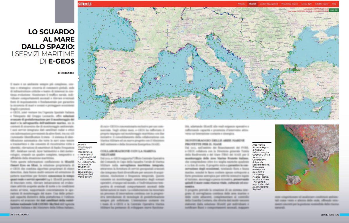
🛰️🌊 La nuova edizione di Spazio 2050, il magazine dell’@ASI_spazio, offre una panoramica sulle soluzioni di e-GEOS, parte di @LDO_Space, per il monitoraggio e la salvaguardia di #mari e oceani.
🌍 In particolare, approfondisce le potenzialità di #SEonSE (Smart Eyes on SEas), la soluzione proprietaria di e-GEOS che consente una conoscenza della situazione marittima in tempo quasi reale: dal tracciamento delle rotte al rilevamento delle imbarcazioni, fino all’individuazione di possibili attività illecite, anche in condizioni notturne o meteo avverse.
📰 Spazio 2050 è disponibile qui nella versione digitale:
https://t.co/7GjCqSmHiG
#WeUnlockEarth
@telespazio | @ASI_spazio | @LDO_Space | @GAF_Munich | @LDO_Fondazione