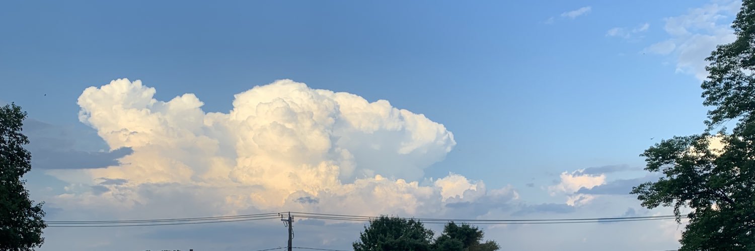
The Mid-Atlantic could see a few tornadoes tomorrow afternoon, with the greatest potential focused across northeastern Pennsylvania and eastern New York.
☀️Early Daytime Hours: The primary severe hazards from storms developing across western New York and central Pennsylvania will be isolated damaging winds and small hail. Although the tornado probability will be substantially low, an isolated tornado cannot be ruled out across central Pennsylvania, particularly just east of the Appalachians, where favorable orographic lift could locally enhance storm development and low-level shear.
🌙 Afternoon/Evening Hours: As storms move into eastern New York and northeastern Pennsylvania, low-level shear is expected to increase to around 30–35 knots by sunset. This will create a localized area where a few rotating updrafts may develop, supporting a low-probability tornado threat, along with hail up to the size of a quarter and damaging wind gusts of up to 70 MPH.
#nywx #pawx
A multi-region severe threat will impact the Plains, Midwest, and South today!
Across the Midwest and Great Lakes, scattered thunderstorms will develop along a cold front this afternoon and push east-southeastward into the early evening, bringing a threat for damaging wind gusts and large hail. A tornado or two cannot be ruled out, especially from northern Indiana into Lower Michigan where wind shear is maximized.
Across the Ozarks and Mid-South, scattered storms will fire late this afternoon in a tropical, unstable airmass, posing a risk for localized damaging downbursts and hail, with an organized cluster potentially pushing southeastward into the Lower Mississippi Valley through tonight.
In the High Plains, supercells developing late this afternoon will be capable of producing very large hail approaching 2 inches in diameter and localized severe wind gusts before clustering this evening.
A live stream is possible today!
** SEVERE WEATHER EXPECTED, THURSDAY, AUGUST 27TH **
An incoming cold front will help to spark off showers and strong/severe thunderstorms Thursday afternoon and evening. The overlap of the highest instability and wind shear will occur across northeastern Pennsylvania, where there will be a risk for locally damaging wind gusts and a threat for a tornado or two. With abundant moisture, there will also be the risk for flash flooding, especially in areas with saturated soils. Remain weather aware if you have plans tomorrow afternoon & evening. Nothing to cancel plans over, but it is good to be mindful of changing weather conditions. The best timing for these storms will most likely occur between 1 and 7 PM, with non-severe showers/storms possibly lingering beforehand and afterwards.
ZONE 2: Scattered (30-50% chance) for strong to severe
thunderstorms Thursday afternoon. The greatest risk will be locally damaging wind gusts of 55 - 65 mph and perhaps some quarter-sized hail. A brief tornado or two cannot be ruled out. This includes Scranton, Williamsport, Allentown, and Reading.
ZONE 1: Isolated (10-30% chance) for strong thunderstorms Thursday afternoon. The greatest risk will be locally strong wind gusts of 45 - 55 mph and perhaps some hail. The tornado risk is much lower, and nearly 0% in this region.
⚠️Stay tuned for updates! Make sure you have a way to receive severe weather alerts and have an indoor shelter to take cover in during a storm during the afternoon and evening hours today! I will try to provide updates as necessary.
#PAwx #Pennsylvania #SevereWeather #Thunderstorm #Scranton #Williamsport #Reading #Allentown
The tsunami-like wave was triggered by an earthquake that caused a large landslide to block a river. As a result, villages were overcome by all the water, resulting in 31 deaths, with many more casualties expected.
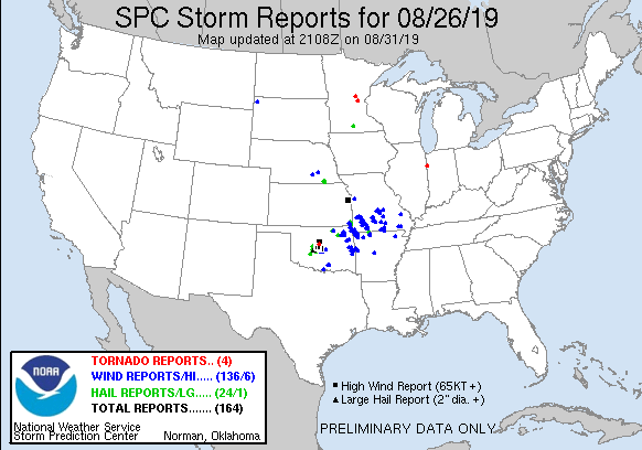
August 26, 2019:
A highly unstable airmass and a cold front produced intense thunderstorms that tore through the Oklahoma City metro. Three weak tornadoes were confirmed, including a high-end EF1 near Seward. Severe wind gusts as high as 87 mph were recorded.
#wxhistory
Posted on the FB page earlier, so I'm sharing this to my X account also... some potential inhibitors here. Take note to paragraph 2 from today's on-call meteorologist:
The Storm Prediction Center has highlighted a large portion of our region away from the coast as level 1 or 2 severe as shown for Thursday. While most of this is a damaging straight-line wind gust threat, a low chance for large hail and isolated tornado cannot be ruled out, especially in Eastern PA and Northern NJ.
This is NOT a slam dunk forecast for severe, as there are some potential convective inhibitors and mitigating factors. Most notably, how quickly the morning warm front clears, and is there enough clearing out in the "warm sector" in the wake of the front. How fast (or slow) the trailing cold front is tomorrow will also play a role.