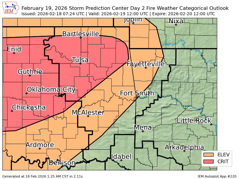
TSA issues Fire Weather Watch valid at Mar 22, 1:00 PM CDT for Creek, Nowata, Okfuskee, Okmulgee, Osage, Pawnee, Rogers, Tulsa, Wagoner, Washington [OK] till Mar 22, 7:00 PM CDT https://t.co/BVfTj9TS5A
WCFD and EOC were monitoring the area on Thursday, February 19th when a large smoke column was detected west / southwest of Bartlesville. https://t.co/XLFbJXp74h
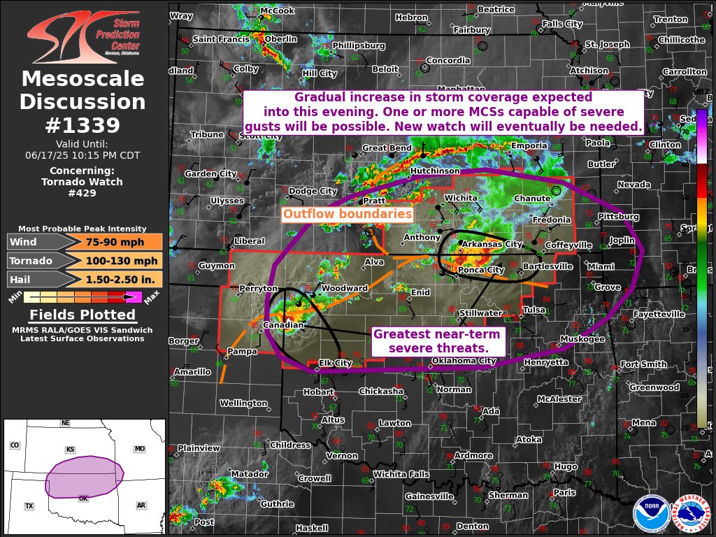
[UPDATE 8:45 pm] DAMAGING WINDS headed for Bartlesville in NE #okwx. Winds in excess of 65 mph likely surging ahead of the main storm. These winds will enter Washington county and Bartlesville between 910 and 920 PM.
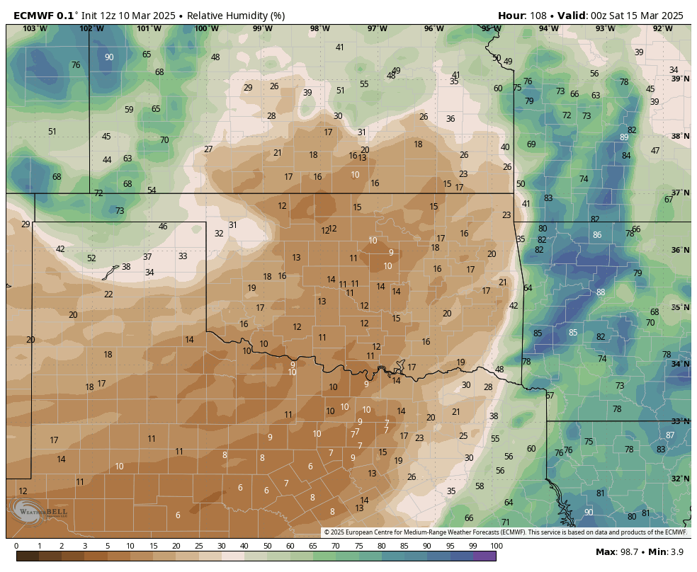
The new 0Z HRRR valid at 1:00 PM Friday has SW winds 45 mph gust 75 mph in Osage, Washington counties in OK. Parts of SE/KS this will create historic wildfires across the area. The relative humidity 10-15%!! #kswx#okwx#okfire#ksfire
This based on 18Z HRRR data... it shows the numbers of hours of high-end fire potential. The gold and orange areas suggest the window for dangeroulsy rapid spread is 8 to 9 hours. If realized, very large fires would occur. This valid from 7am to 7pm Friday.
Getting very concerned about significant fire weather conditions across Oklahoma for Friday. If the Euro model is any indication, very strong wind gusts and low relative humidity values will combine to create potentially extreme fire weather conditions. Stay tuned! #okwx#okfire
Although winter is typically our dry season, most areas have received below average precipitation over the past 90 days. The outlook for meaningful rain remains low over the next 10 days. Therefore, warm and breezy days will bring an increase risk of wildfires. #okwx#texomawx
[9:32 PM 2/17/25] Major winter weather impacts are forecast along much of the Interstate 44 corridor from NE OK into SW MO on Tuesday. Travel should be avoided or plans adjusted.
[2:31 pm - 2/16/25] Winter Storm Watch remains in effect for most of NE #OKwx, NW #ARwx from 6 am Tue to 6 am Wed. Forecast snowfall from 3-8" along, N of Hwy 412, 1-3" south to I-40. Expect travel impacts + blowing and drifting snow. Minor snow and ice into SE OK, W Central AR.
Excellent thread on the upcoming winter storm next week for #Tulsa and northeast Oklahoma. After Tuesday's snow, multiple days of significant winter weather impacts with dangerous cold are expected. Prepare now.









![NWStulsa's tweet photo. [2:31 pm - 2/16/25] Winter Storm Watch remains in effect for most of NE #OKwx, NW #ARwx from 6 am Tue to 6 am Wed. Forecast snowfall from 3-8" along, N of Hwy 412, 1-3" south to I-40. Expect travel impacts + blowing and drifting snow. Minor snow and ice into SE OK, W Central AR. https://t.co/pxf8Hw6bow](https://pbs.twimg.com/media/Gj75oq-aQAAljxA.jpg)
![NWStulsa's tweet photo. [2:31 pm - 2/16/25] Winter Storm Watch remains in effect for most of NE #OKwx, NW #ARwx from 6 am Tue to 6 am Wed. Forecast snowfall from 3-8" along, N of Hwy 412, 1-3" south to I-40. Expect travel impacts + blowing and drifting snow. Minor snow and ice into SE OK, W Central AR. https://t.co/pxf8Hw6bow](https://pbs.twimg.com/media/Gj75lvIbwAAzrYb.jpg)




![iembot_tsa's tweet photo. TSA issues Fire Weather Watch valid at Mar 22, 1:00 PM CDT for Creek, Nowata, Okfuskee, Okmulgee, Osage, Pawnee, Rogers, Tulsa, Wagoner, Washington [OK] till Mar 22, 7:00 PM CDT https://t.co/BVfTj9TS5A https://t.co/0odCgLZrqH](https://pbs.twimg.com/media/HD3kweaWQAAcFR-.png)




![NWStulsa's tweet photo. [9:32 PM 2/17/25] Major winter weather impacts are forecast along much of the Interstate 44 corridor from NE OK into SW MO on Tuesday. Travel should be avoided or plans adjusted. https://t.co/cUTgpAb8ek](https://pbs.twimg.com/media/GkCkDSoaAAIyIbG.png)


