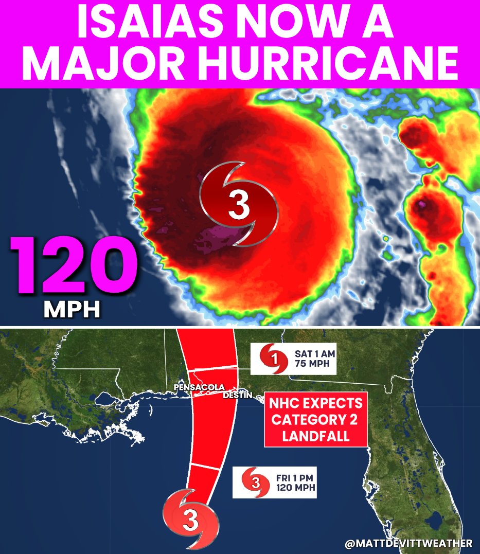
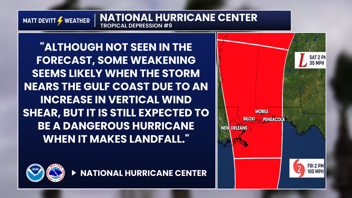
#BREAKING: Isaias has strengthened to a Category 3, Major Hurricane in the Gulf with winds of 120 mph. 1st Major Hurricane of the 2026 Atlantic Hurricane Season. Some weakening is expected at landfall tonight along the Florida Panhandle, but the NHC is still currently calling for a Category 2 landfall with hurricane-force gusts, 5 - 7 feet of storm surge, flooding, power outages and isolated tornadoes. Hurricane preps need to be completed this morning. If told to evacuate, please do so. I'll be with you every step of the way with no hype, just the facts 24/7. - Matt
Miss Terry said flowers were delivered to their house today. Who from? Jalen Hurts. She just read the card.
“Coach Saban, thank you for the opportunity to be a part of your story. … I’m honored to share a small moment with you and Miss Terry. Congratulations on your premiere.”
HURRICANE ISAIAS: New hour-by-hour model showing the landfall between Mobile Bay (AL) and Navarre Beach (FL), especially near the state line Friday evening into early Saturday morning. A peak of Category 2 or 3 is possible in the Gulf, with some weakening towards landfall. It will not be a weak storm though. It’ll still be impactful with heavy rain, storm surge up to 5-7 feet, hurricane-force gusts over (at least) 75+ mph and tornadoes. If you're in the path with impacts expected, hurricane prep needs to be completed no later than Friday morning. I'll continue to keep you updated 24/7. #Isaias
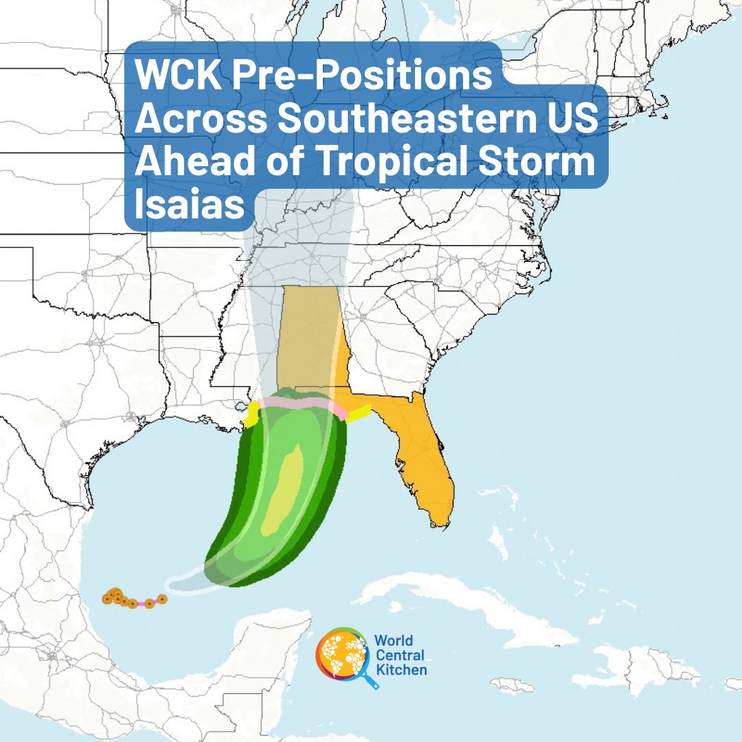
WCK is pre-positioning teams in Alabama and Florida ahead of Tropical Storm Isaias’ landfall, which is projected to hit communities on the gulf coast this Friday. The storm is expected to be a Category 1 or 2 hurricane, with winds reaching up to 100 miles per hour. By working with communities and local partners before the storm hits, our teams will be in place and ready to act as quickly as possible the moment it passes—ensuring no time is lost getting meals to the people who need them most. #ChefsForFlorida #ChefsForAlabama
Read More: https://t.co/ugrSehlcLn
Forget the spaghetti models. Forget the forecast cones. Floridians know there’s only one hurricane forecast that really matters…
What’s Waffle House doing? 👀😂
Full menu? We’re fine.
Limited menu? Might wanna charge your phone.
Waffle House CLOSED?
BABY, PACK THE CAR. WE’RE LEAVING. 😂🌀
Future #Isaias will likely be one of the most significant storms of the 2026 Atlantic Hurricane Season with a landfall in the United States. Yet in the first forecast cone, the general public has very little indication of what intensity the storm is actually forecast to be at landfall.
I'm already seeing considerable confusion, with people assuming the storm will make landfall with 100 mph wind...and I understand why when they are looking only at the cone.
What they see is a 100 mph Category 2 hurricane at 96 hours in the Gulf, followed by a tropical depression well inland across northern Alabama and Mississippi at 120 hours. What they don't see is the forecast intensity at the coastline between those two points.
It isn't until the third paragraph of the forecast discussion that the NHC explains that the expected landfall intensity is not explicitly “seen in the forecast,” other than noting that “some weakening” is anticipated.
So what is the current expectation at landfall? A 75 mph hurricane? 85 mph? 95 mph?
That difference matters. According to NOAA, “small increases in wind strength can dramatically increase damage.” NOAA's hurricane damage potential scale indicates that a 95 mph hurricane has roughly 6.6 times the wind damage potential of a 75 mph hurricane.
I have tremendous respect for the National Hurricane Center and the work they do, but I hope this is something they consider addressing during the offseason: adding a special forecast landfall annotation when the official track crosses the coastline.
I actually raised this same issue just a few weeks ago. There are certainly potential drawbacks, including added clutter with multiple landfalls and the risk of conveying too much precision. But overall, I believe the benefits outweigh those concerns.
This isn't about criticizing the forecast. It's about improving how the forecast is communicated.
At the end of the day, the goal should be to give the public the clearest possible understanding of what is currently forecast so people can make better-informed decisions. If a hurricane is forecast to make landfall between two forecast points, I believe the expected intensity at the coastline deserves to be clearly shown.
The Sun shines on Biloxi
Air is filled with vapors from the sea
The boy will dig a pool beside the ocean
He sees creatures from his dreams underwater
And the Sun will set from off towards New Orleans
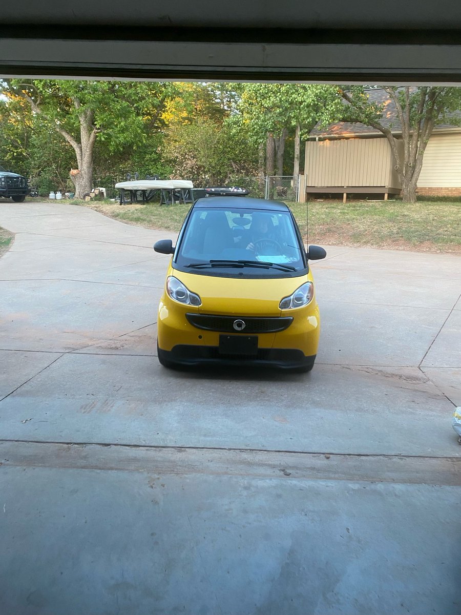
Alabama tight end Josh Ford (6-6, 266) once drove this tiny yellow Smart car.
He even took his now fiancée out on their first few dates in that car.
“I’m thankful that we did that because she’s not dating me for the truck or anything,” Ford said. “She dated me for me.”
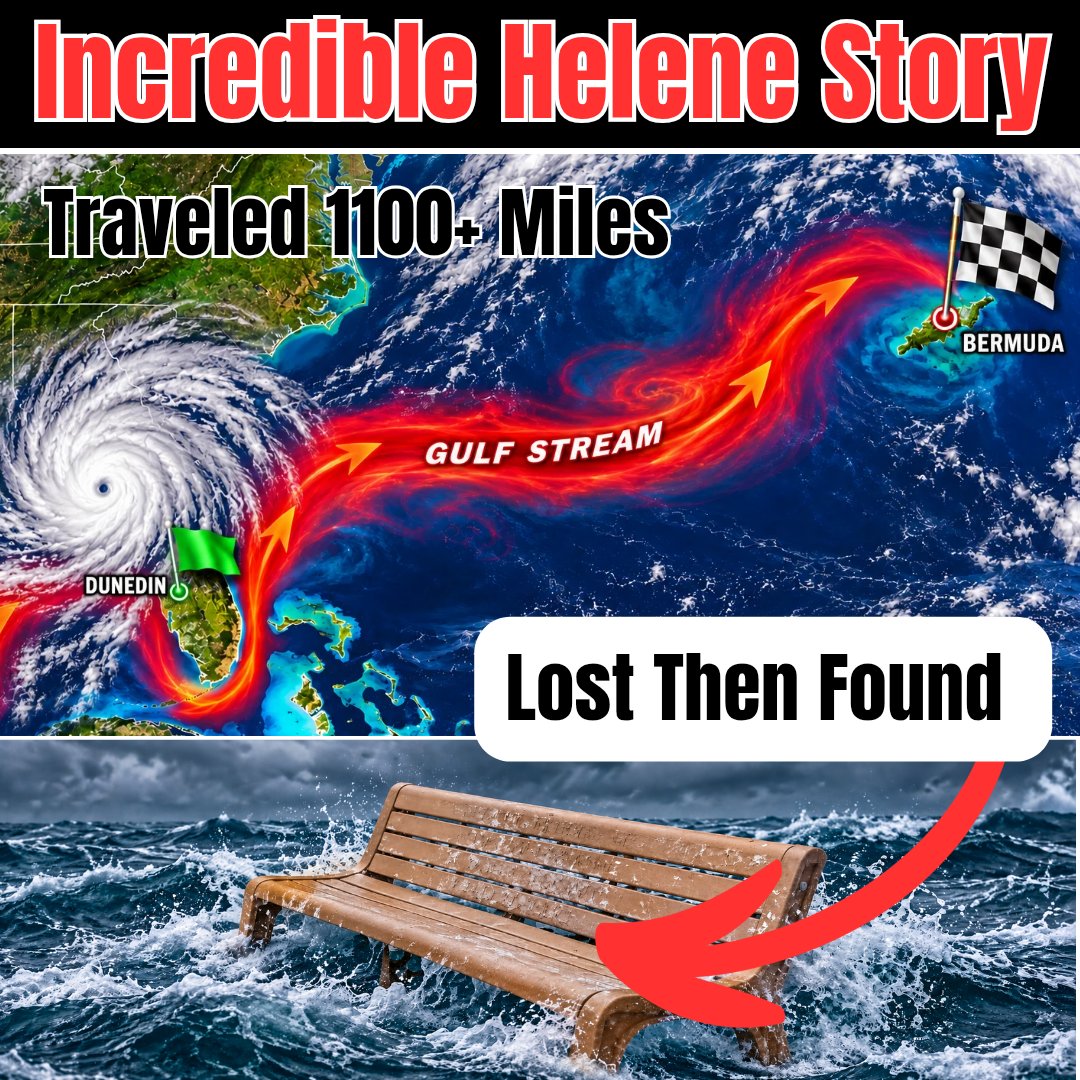
An incredible story from Dunedin, Florida. Storm Surge from Hurricane Helene took away a Memorial bench from the Dunedin Causeway back in 2024. It was recently found in Bermuda, which is over 1100+ miles away, likely due to the strong currents of the Gulf Stream. The bench honored Medhat 'Mike' Sadiku and the family was notified from the lady that found it. Just amazing!!! Read more: https://t.co/diI2IQQnqa