Friends in the Northeast and MidAtlantic! @americanrivers is hiring a Regional Directors for the Northeast and MidAtlantic. Come save rivers with me :) https://t.co/ihFYLmErGO
We are happy California has a break in the rain. Here's🎥 from early in week showing Fremont Weir, Cache Creek Outlet Weir, & the Yolo Bypass doing exactly what they were designed to do & help manage #flood. Weirs are passive systems & move water when it reaches a specific height
When you see an article so full of egregious beaver slander that you have to break twitter sabbatical just to tag @EmilyFairfax and @ben_a_goldfarb. No surprise, they're already on it... #beaverbeliever
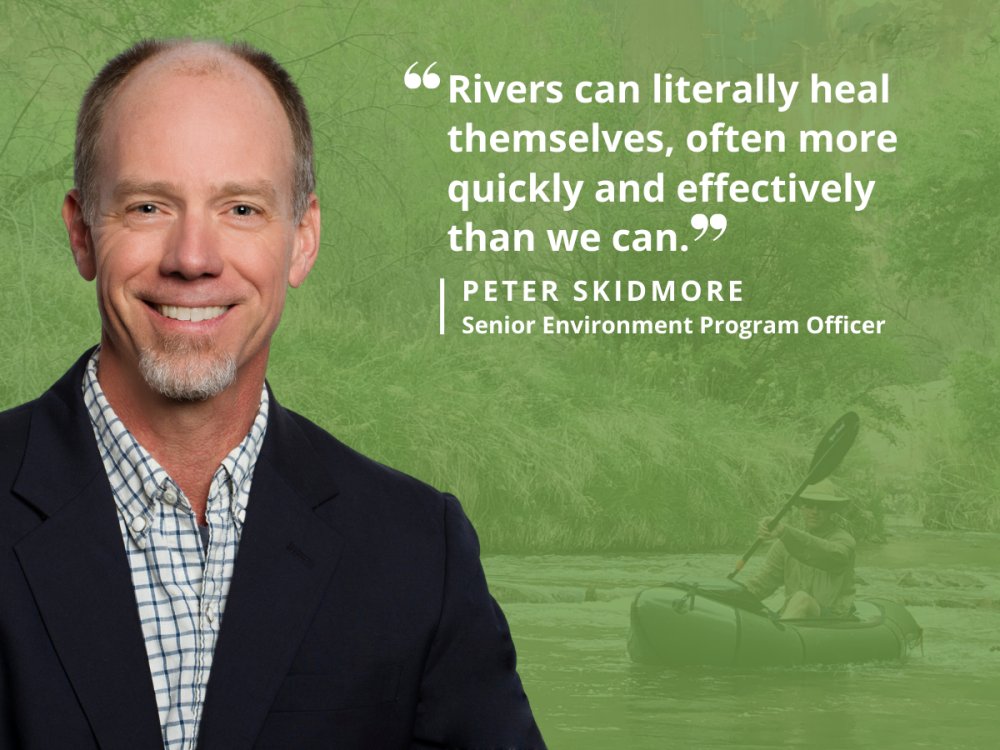
Healthier rivers lead to healthier communities and a healthier planet. By giving rivers the space and freedom they need to thrive, we can build climate resiliency and battle #climatechange through natural processes. #ClimateWeekNYC https://t.co/cOiywPicO7
Today we're launching a new climate website to help communities build resilience, with:
💻 Real-time dashboard of extreme weather
🔎 Interactive maps of future climate impacts for each area
🧰 Tools to develop resilience plans & access federal funding
https://t.co/YLoObiAyzY
River sediment is changing globally, impacting the stability of river systems and the ecological and economic systems that rely on them. New #SciencePerspective shows the current state of knowledge… https://t.co/NGLTvXZY89
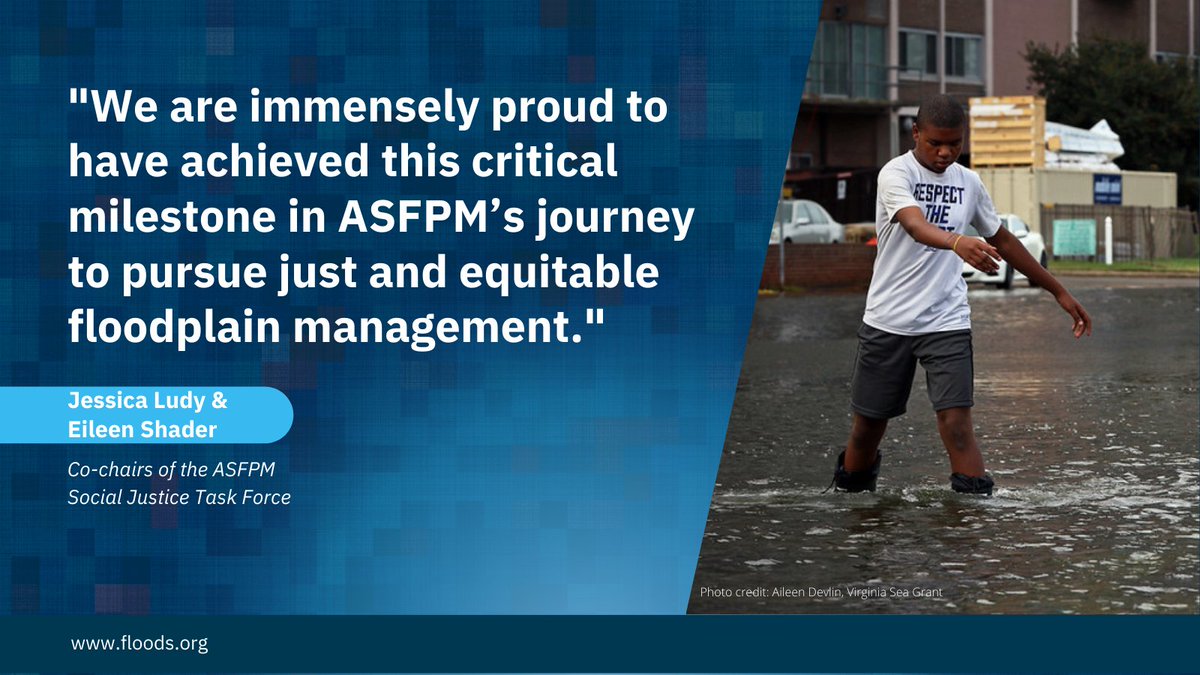
As leaders in floodplain management, ASFPM will actively promote and support inclusive, equitable, and just
floodplain management policies and practices... Read more about our social justice policy statement, which was unanimously approved by the board:
https://t.co/58pJJMUbUp
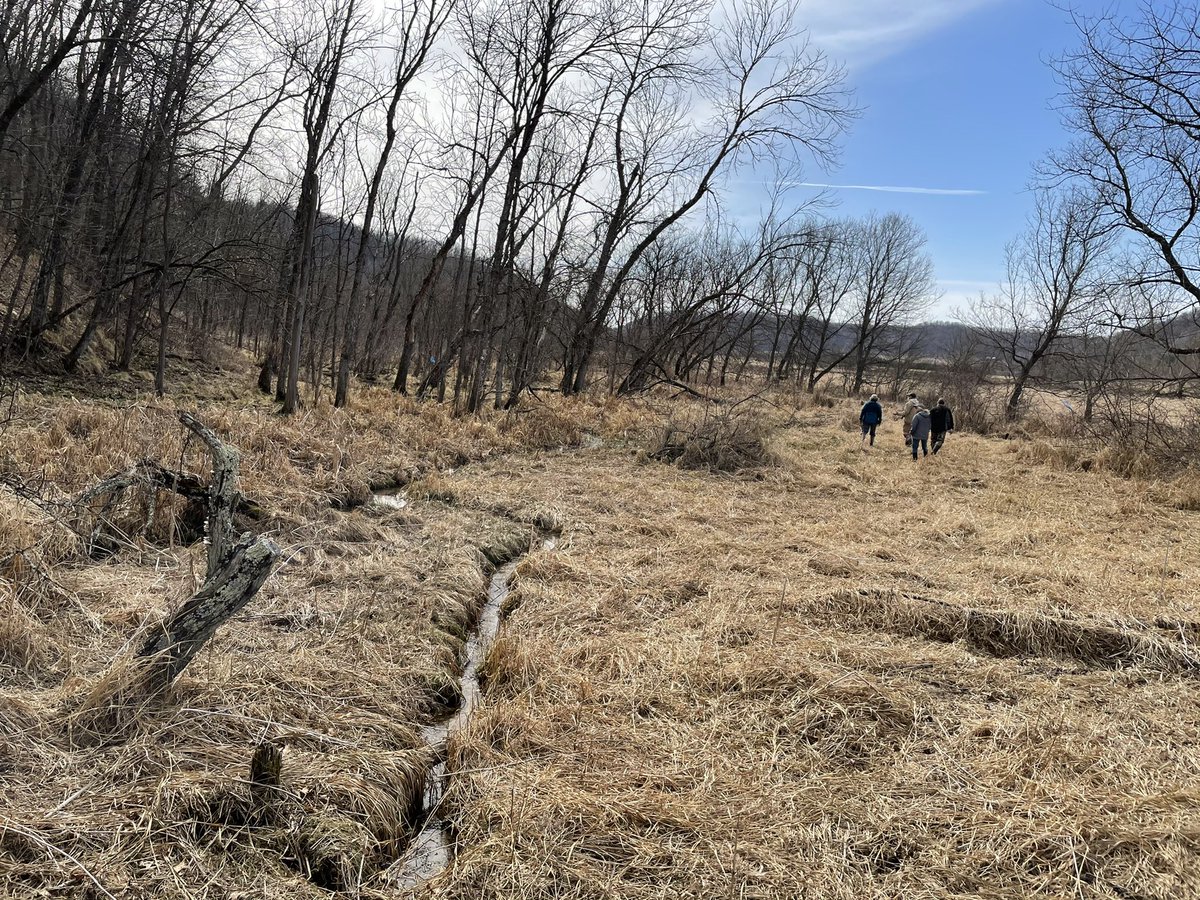
It was a Sunday Funday exploring floodplain wetlands of the West Fork of the Kickapoo with the Valley Stewardship Network. Many sedge meadows at risk to erosion-induced drainage.
1/ Flooding is a rising threat across the United States, with homeowners facing as much as $19 billion in damages every year.
What puts a neighborhood at high risk? Geography is key, but new data reveal another factor, too: race.
Read the report: https://t.co/GrF0DDplkc
Fingers crossed: what's the best estimate of national floodplain disconnection due to linear infrastructure? I'm seeking a very specific figure, if it exists—the total percentage of American floodplain that has lost functionality because of roads, railroads, dikes, etc. Thanks!