From the City of Gulf Shores
𝗚𝗢𝗩𝗘𝗥𝗡𝗢𝗥 𝗞𝗔𝗬 𝗜𝗩𝗘𝗬 𝗜𝗦𝗦𝗨𝗘𝗦 𝗠𝗔𝗡𝗗𝗔𝗧𝗢𝗥𝗬 𝗩𝗜𝗦𝗜𝗧𝗢𝗥 𝗘𝗩𝗔𝗖𝗨𝗔𝗧𝗜𝗢𝗡
Alabama Governor Kay Ivey has issued an executive proclamation declaring a mandatory evacuation for all non-residents, tourists, and visitors in Alabama coastal areas, effective immediately as of 2:30 p.m. CDT today, October 8, 2026, due to the threat of Hurricane Isaias.
𝗪𝗵𝗼 𝗶𝘁 𝗮𝗳𝗳𝗲𝗰𝘁𝘀: All non-residents, visitors, and tourists.
𝗔𝗳𝗳𝗲𝗰𝘁𝗲𝗱 𝗔𝗿𝗲𝗮𝘀: All Baldwin County areas south of the Intracoastal Waterway, including the City of Gulf Shores and the City of Orange Beach.
𝗗𝘂𝗿𝗮𝘁𝗶𝗼𝗻: In effect until the state of emergency expires or is modified.
All visitors currently staying south of the Intracoastal Waterway, including the City of Gulf Shores and the City of Orange Beach, should make immediate preparations to safely evacuate the area.
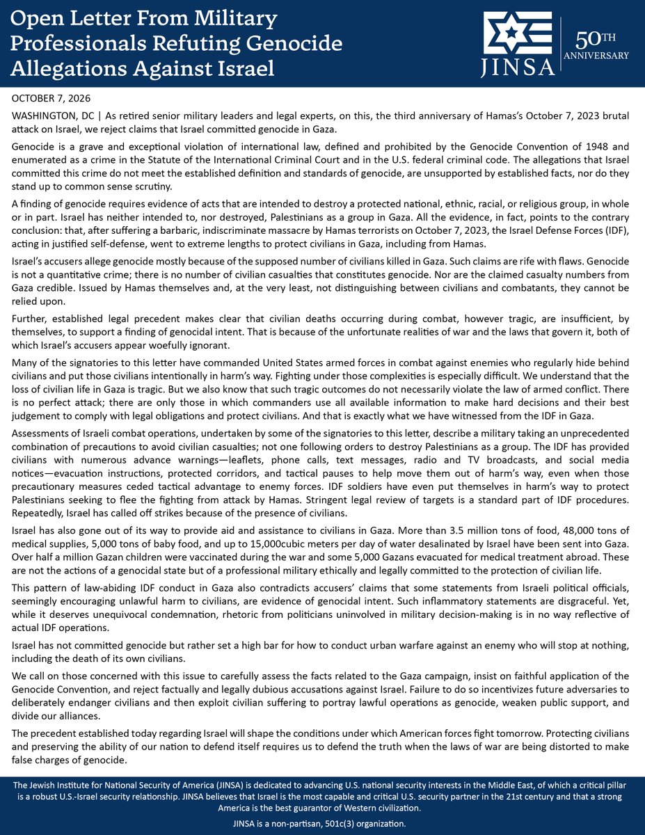
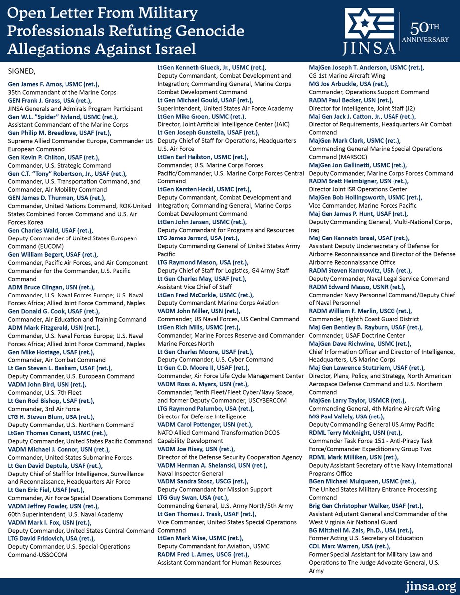
Over 75 senior retired 🇺🇸U.S. generals, admirals, and military lawyers have signed a new open letter rejecting claims that Israel committed genocide in Gaza.
The signatories include those who have commanded U.S. armed forces in combat, applying the laws of armed conflict.
Their conclusion: based on the facts and applicable legal standard, the conduct of Israel’s war against Hamas does not constitute genocide.
As the letter states, “Civilian deaths occurring during combat, however tragic, are insufficient, by themselves, to support a finding of genocidal intent.”
The standards used to judge military conduct matter precisely because war is tragic and imperfect.
“The precedent established today regarding Israel will shape the conditions under which American forces fight tomorrow. Protecting civilians and preserving the ability of our nation to defend itself requires us to defend the truth when the laws of war are being distorted to make false charges of genocide.”
This is not an argument for minimizing the suffering of civilians. It is an argument for applying the law faithfully and maintaining the distinctions that matter: between the tragic consequences of war, violations of the laws of armed conflict, and the specific crime of genocide.
Read the full open letter here: https://t.co/kZ60lnqGCw
HOLY SH*T
@City_of_Ottumwa in Iowa opened up their most recent city council meeting with a prayer to SATAN.
"Let us pray. Dear dark father... HAIL SATAN"
WTF is wrong with these people???
At 6:29 a.m. on October 7, 2023, Palestinian Hamas terrorists invaded Israel.
They stormed communities, murdered families in their homes, raped, burned and kidnapped.
Three years on, Israel remembers the victims and the barbarity of Palestinian jihadist terrorism.
We will never forget.
#UNFORGO7TEN
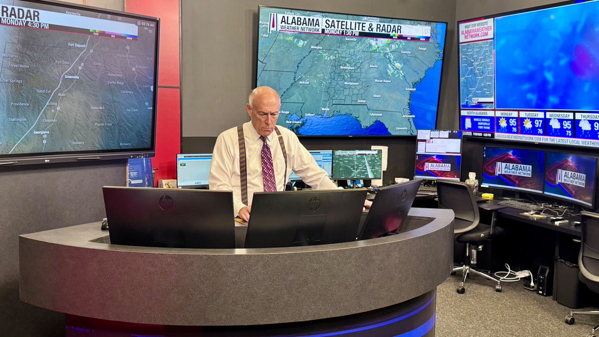
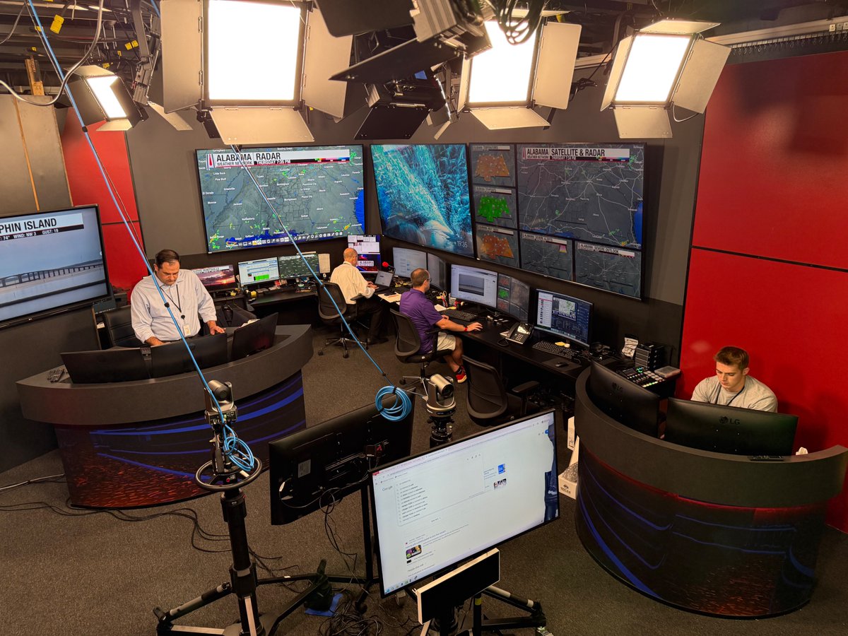
AWN! Now is the time to be sure you have the Alabama Weather Network app on your phone, tablet, and TV. If you can't find it on your TV, simply watch our live coverage using the YouTube app.
We have the latest weather staff in the state, and the most resources.
AWN will be live before, during, and after the landfall of Hurricane Isaias. I expect we will be live for at least 24 consecutive hours; possibly longer. We have the largest SKYCAM network, and teams in the field second to none with live drones and dashcams.
In addition to wind, flooding, and storm surge issues on the coast, we will have the risk of isolated tornadoes statewide Saturday. We will be there for you; we cover all 67 Alabama counties. It doesn't matter when TV market you are in or which NWS office issues your warnings.
We understand Alabama people, culture, geography, and microclimates. It is an honor to serve, and we will be there for you during the storm. The coverage will be visually interesting; you will get critical information you need to keep your family safe.
Thanks in advance for trusting us.
EYES ON THE GULF: Getting many, many questions about the weather situation Friday and Saturday. Here are the key messages tonight...
*Tropical Depression 9 will likely be Hurricane Isaias when it moves into the Central Gulf Coast late Friday night or early Saturday morning.
*NHC forecasts the hurricane to be at category two strength with 100 mph winds about 6 hours before landfall. Some weakening is possible as it moves onshore due to strong winds aloft/shear, but it still is expected to be a dangerous hurricane with major impact.
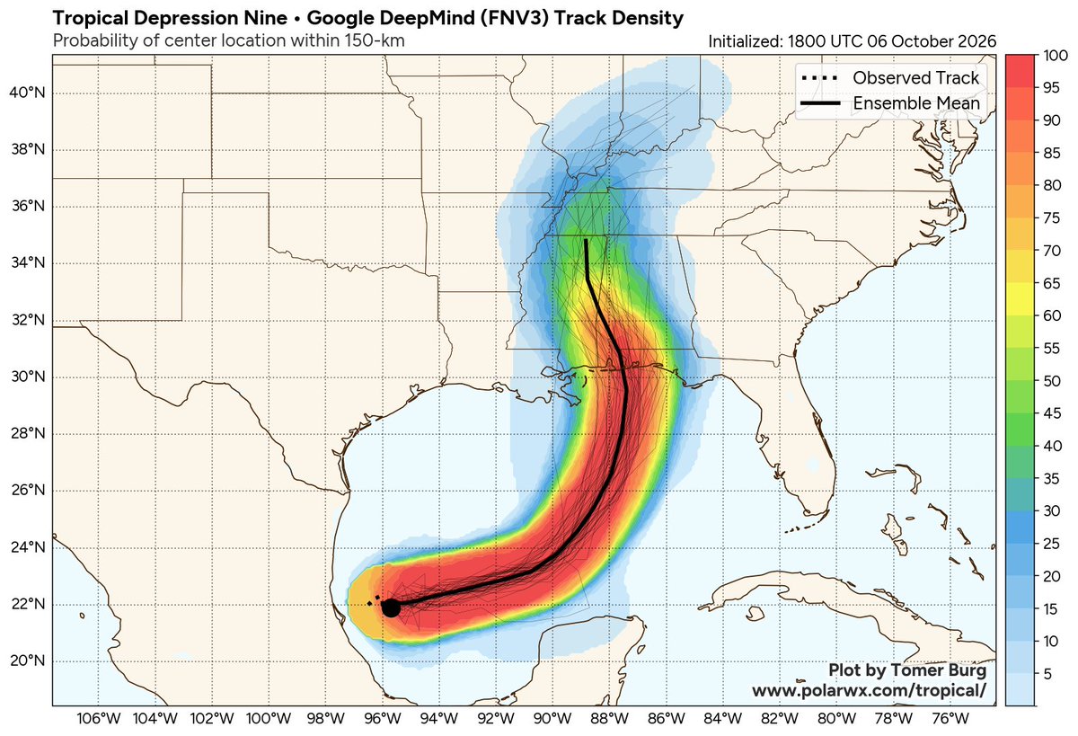
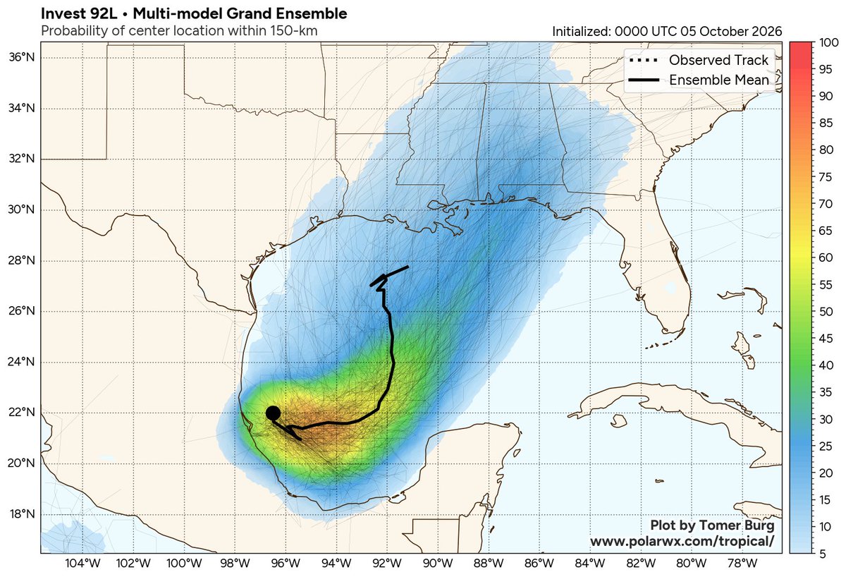
*Attached is the output from the Google DeepMind FNV3 model, which has performed well. The mean of the ensemble members takes the hurricane right into Orange Beach/Perdido Key. But please remember a hurricane is not a dot or a skinny line; the impact will extend far from the center, especially to the east.
*We will get a first look at storm surge potential tomorrow. Remember, the storm surge issues will be along and to the east of where the center makes landfall.
*Although the storm is expected to be compact for the next few days, it will likely grow significantly in size, particularly on the eastern side, when it reaches the northern Gulf Coast. Therefore, based on the forecast uncertainty and expected larger size, don't focus too much on the forecast points.
*The system is expected to produce rainfall amounts of 3 to 6 inches along the Gulf Coast Friday and Saturday, with localized totals up to 10 inches. Flash and urban flooding, along with isolated river flooding, will be possible.
*Rain amounts Saturday across inland parts of Alabama will be generally in the 1-3 inch range, with some flooding possible.
*Gradient winds will be highest on the coast, of course; gusts to 80/90 mph are possible there. For inland Alabama, gusts to 30/40 mph are possible Saturday, mainly over the western half of the state.
*Isolated tornadoes are possible across Alabama Saturday. Tropical tornadoes are typically short lived, low topped, and under the radar. They can touch down with little to no warning.
*The weather improves Sunday as the tropical low moves well to the north of Alabama. Most of the Gulf Coast will be dry Sunday and through all of next week.
*With any tropical system, forecasts can and probably will change. Be watching for updates.
I will have a new video briefing here by 5:15a CT tomorrow...
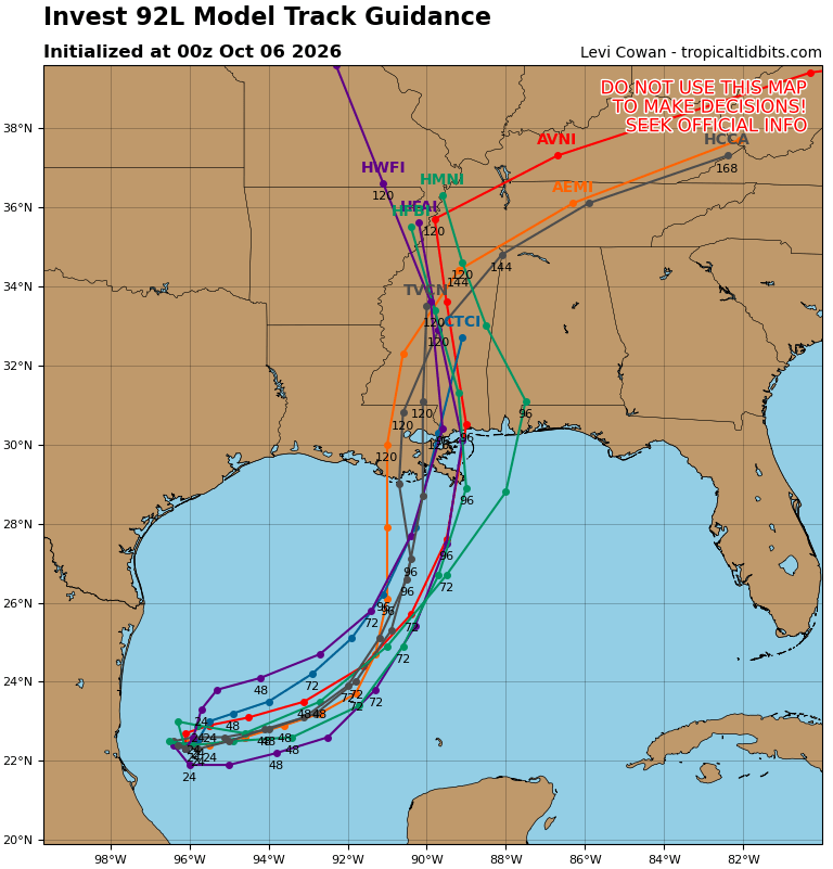
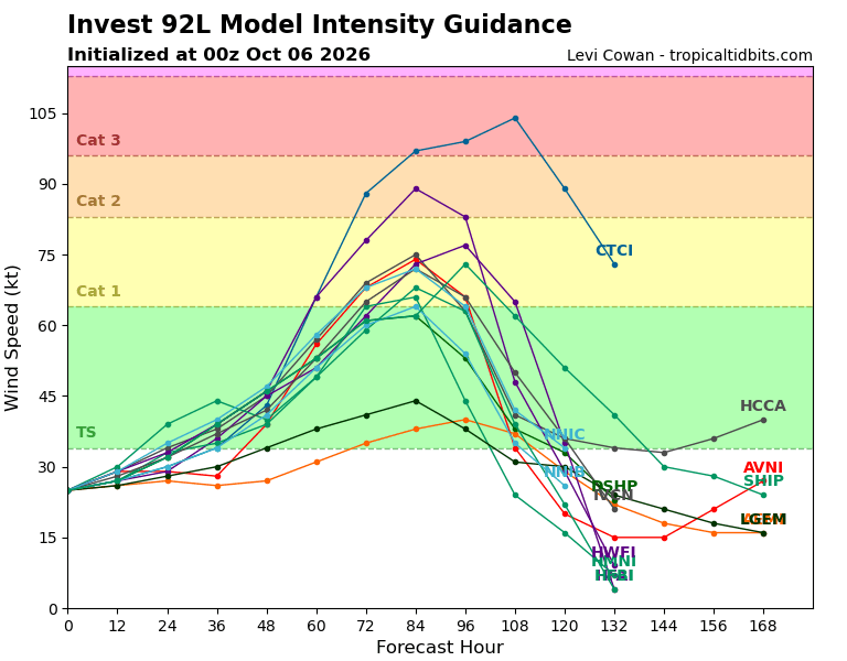
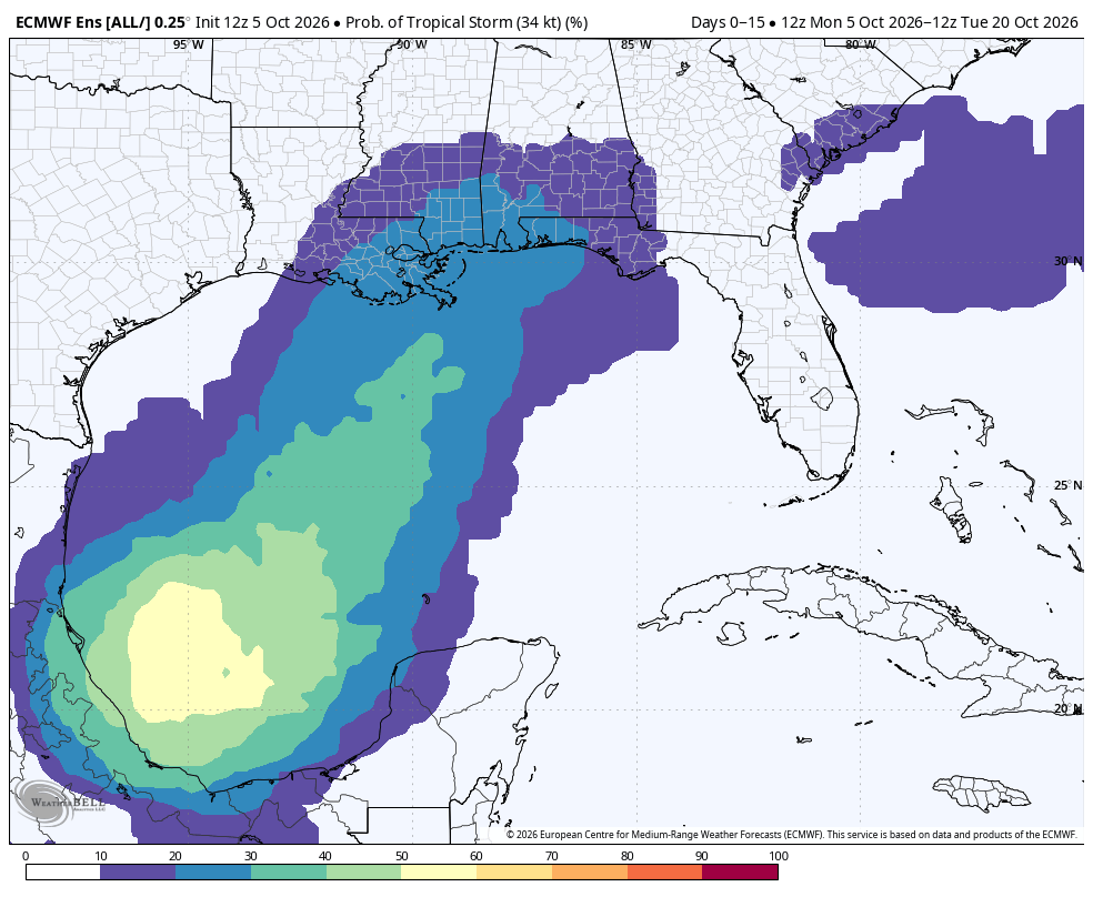
LATE NIGHT LOOK: 00Z guidance is rolling in tonight; eyes are on Invest 92L in the Southwest Gulf.
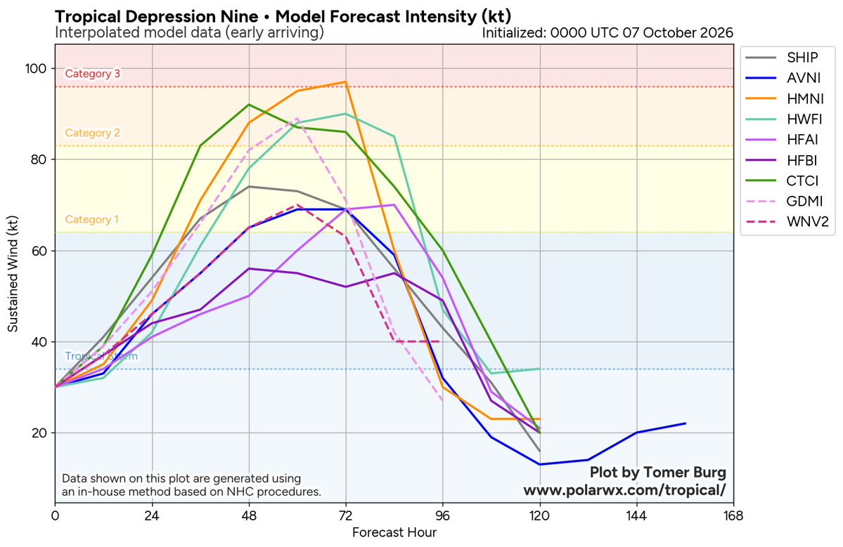
Intensity guidance is more aggressive, suggesting potential for this feature to become a hurricane before landfall Friday night or Saturday. The name will be Isaias.
Most models are clustered around SE Louisiana and the Mississippi coast; this solution would put Alabama on the east side, with potential for heavy rain, gusty winds, and maybe a few isolated tornadoes.
Still too early for a specific impact forecast. Be watching for the next video briefing here early tomorrow morning.
SATURDAY: There are big football games, concerts, and festivals across Alabama and along the Gulf Coast this weekend. With a tropical system coming up from the south, there are many questions.
This is what I can tell you now.
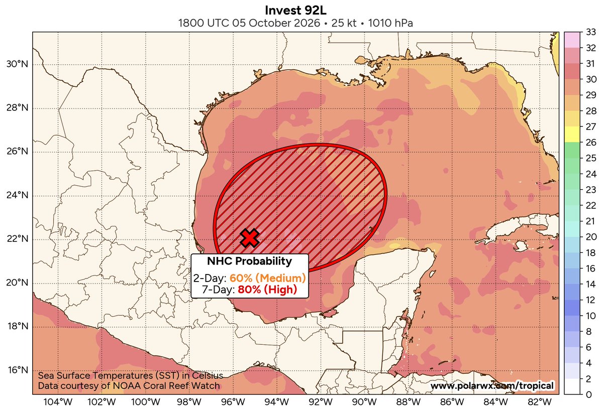
*NHC has raised the chance of the disturbance in the Gulf becoming a depression or storm to 80 percent. Odds of this becoming a minimal hurricane are low, but it can't be ruled out.
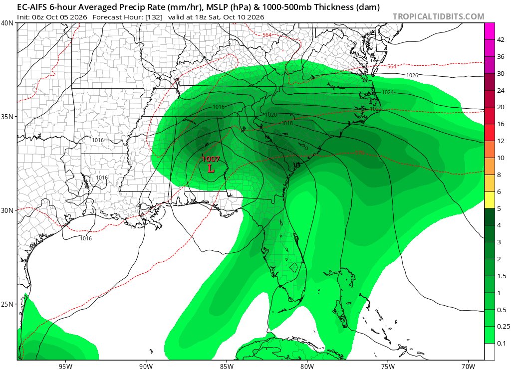
*Still believe the main impact from this (whether a broad low, depression, or storm) will be a huge rain mass across the Deep South over the weekend. Some flooding is possible, especially over the southern half of Alabama and near the coast where the ground is saturated.
*Until the system becomes better organized, and we get dropsonde data from hurricane hunter aircraft, there will still be considerable uncertainty in the timing and placement of the heaviest rain. Forecast confidence will be much higher by Wednesday.
*For now, rain looks likely Saturday and Saturday night. Perhaps lingering into Sunday. It could be a steady, soaking type rain. And, if the tropical system deepens before landfall, wind could be an issue. Winds could gust to 30/40 mph at times at some point over the weekend.
*Rain will likely begin on the Gulf Coast Friday night, then spreading northward Saturday.
It is important to remember any or all of this could change in the coming days. It is just too early to be really specific. When we get to Wednesday I will be very detailed. Keep an eye on updates.
THE GULF: Needless to say there are many, many questions about the weather for the Gulf Coast, and for Alabama this weekend.
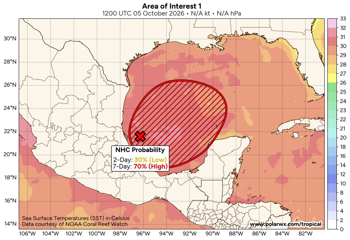
NHC now gives the disturbance in the far southwest Gulf a 70% chance of developing into a depression or storm. And almost all of the reliable guidance brings the system northward in the direction of the central Gulf Coast. 
Inevitably, this will mean lots of rain this weekend for parts of the coast and the Deep South. But a word of caution… It is still simply too early to know how much rain will fall in any given location, and when the rain starts and stops.
Once the system becomes better organized, and we gather data from hurricane hunters, forecast confidence becomes much higher. Stay tuned for updates… 
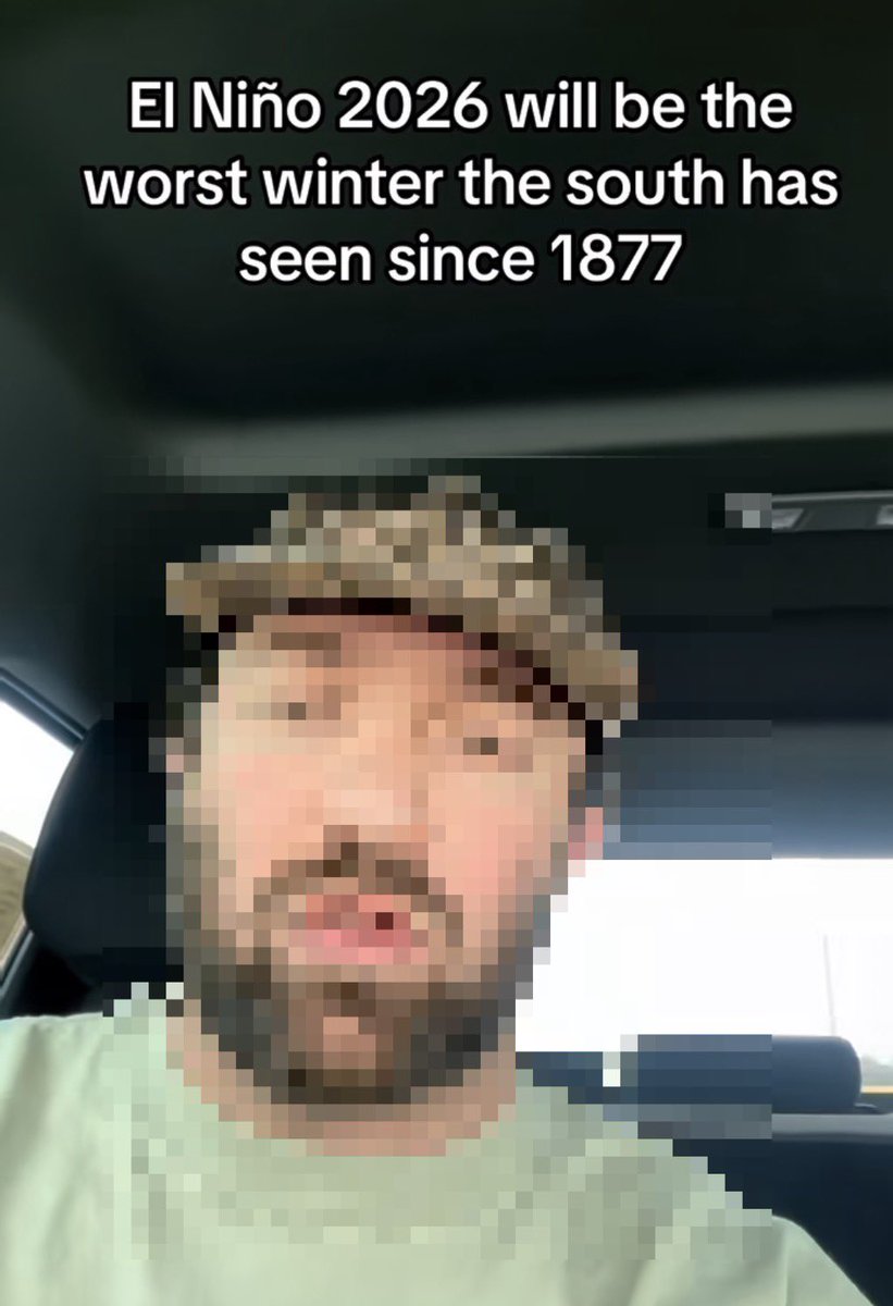
I have been bombarded by questions from people seeing this viral video on social platforms.
This is a great example of taking a legitimate weather signal and turning it into a forecast that the science does not support.
Yes, the developing El Niño is unusually strong, and it absolutely deserves attention.
But there is no scientific basis for saying “this will be the worst winter the South has seen since 1877.” El Niño changes the odds of certain weather patterns; it does not dictate the weather for an entire season.
Very strong El Niño events do not guarantee the expected impacts everywhere.
Don’t turn a seasonal climate signal into a 100% certain winter forecast. That’s not how meteorology works.
For Alabama, the most reliable signal is toward a wetter-than-average winter with a more active southern storm track. That can mean more opportunities for heavy rain, flooding, thunderstorms and severe weather. It can also occasionally produce winter storm threats when cold air happens to be in place.
But El Niño does not tell us how many tornadoes Alabama will have, how much snow we will get, or whether we will have some kind of historic winter. Those things depend on the individual weather patterns that develop week by week.
A strong El Niño changes the odds. It does not write the forecast. So yes — this winter deserves close attention. But anybody telling you in September that they already know this will be the worst Southern winter in 149 years is selling certainty that the atmosphere hasn't given us.
As always, please think before you share social media nonsense.